End of US highway 138 |
 |
Summa
|
|
|
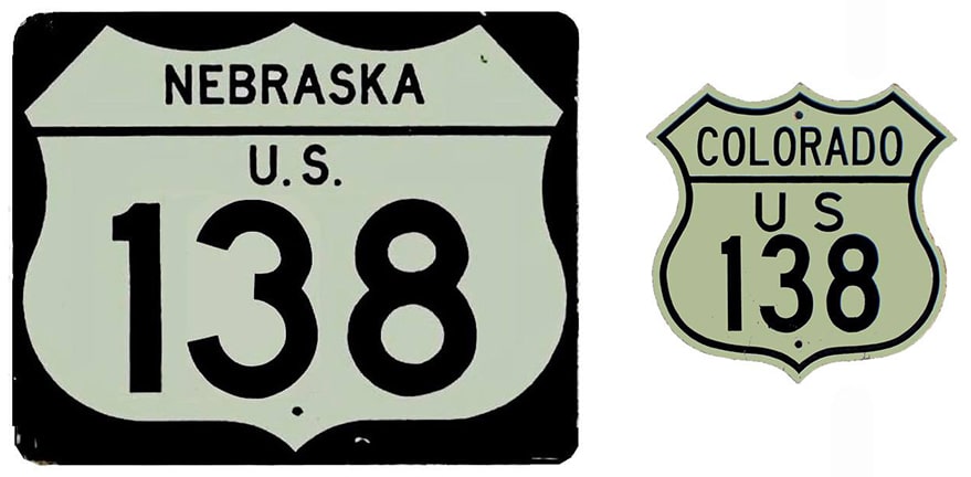
US 138 is something of an anomaly among the US routes. One might question how this road got its number, considering that there is no US 38. Well, historically there was a US 38. Originally US 6 was not a coast-to-coast route. From approximately 1925 to 1932, it went only as far west as Erie PA. Today's portion of US 6 from Chicago to Council Bluffs was US 32; and modern US 6 from Omaha through Sterling to Greeley was US 38. So at that time, it made sense for this short segment connecting US 38 in Sterling to US 30 in Big Springs to be designated "US 138". In 1932, when US 38 (and US 32) were assimilated by a westward extension of US 6, perhaps US 138 should have been renumbered as well. Maybe US 306? (since there was already a US 106 and US 206 at the time):
|
c. 1929, CDoT
|
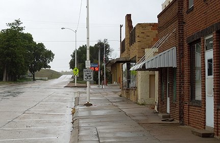
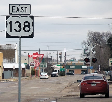
Drivers reaching the east terminus of US 138 are actually heading north. The Lincoln Highway (as well as the original US 30) went right through town via 3rd and Pine Streets (instead of bypassing it to the north, as US 30 does today). So the original junction with US 138 was right in Big Springs; these photos were taken looking west on 3rd:
Sanderson, Sep. 2014
|
Sanderson, Sep. 2014
|
|
That was westbound on the Lincoln Highway, and later the original alignment of US 30, which continued by turning right (north on Pine). To the left (south) was the original east beginning of US 138.
Here, we are looking north on Pine, where US 138 originally ended. Ahead on Pine was westbound US 30, while eastbound US 30 was to the right on 3rd: |
Sanderson, Sep. 2014
|
|
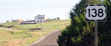
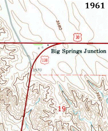
Several decades ago, US 30 was changed to follow its present alignment, which runs a couple miles north of Big Springs. At that time, the US 138 designation was extended ahead (north on Pine, along former US 30). The last trailblazer was posted where the highway begins to climb the breaks that line the edge of the South Platte valley:
|
Sanderson, Jun. 2020
|
|
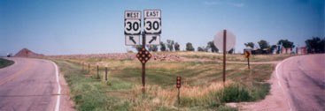
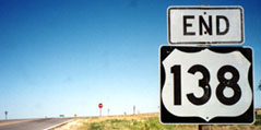
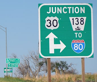
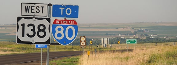
About a mile ahead is US 138's terminus at its junction with the modern US 30. Until about 1999, the road forked just before reaching US 30, and drivers were presented with the option to head east or west on that route:
|
Sanderson, July 1998
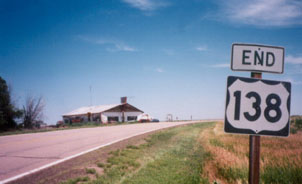
Travelers choosing the east fork were greeted by this "End" assembly:
|
Sanderson, July 1998
|
|
For drivers who chose the west fork, there was no "End" sign. But that fork aligned with "Day Road" (a paved county road that heads north from US 30 to connect with US 26 and NE hwy. 92, providing the quickest access to the upstream end of Lake McConaughy). Travelers following the Mormon Trail auto route are directed by signs to use Day Rd.
(For reasons unknown to me, the Mormons did not follow the North Platte west from its mouth. Instead, they followed the South Platte to a point near Big Springs, and then ascended what came to be known as "California Hill". They then dropped down into the North Platte valley via "Windlass Hill", which is preserved today as a part of Ash Hollow State Park. Reportedly one can still see the deep ruts left there by all the wagons.) By August 2000, the intersection with US 30 had been reconfigured. There is no longer a "Y"-shaped fork at the junction; it is more of a standard four-way intersection now. The new alignment goes right through the forks of the historic Y-junction, and north of US 30 traffic on Day Road must veer west a bit before reaching its original alignment: |
|
|
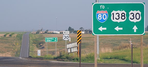
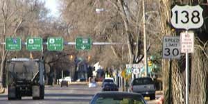
Approaching the east end of US 138, there was a junction diagram (which seems like overkill, but is a common practice in Nebraska)...
|

Sanderson, Aug. 2005
|
|
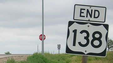
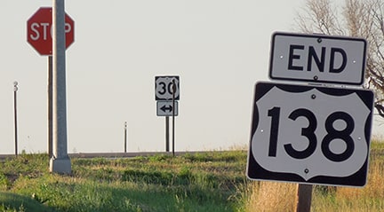
...and just beyond that, near the stop sign, was an "End" assembly:
Sanderson, Aug. 2000
|
Morrison, Aug. 2016
|
Sanderson, Jun. 2020
|
|
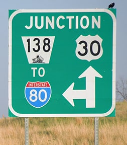
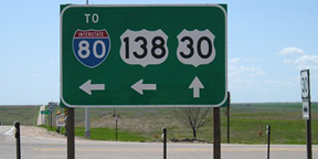
Next are some perspectives of the east beginning of US 138 as seen from both eastbound and westbound US 30. The junction diagrams had erroneous "NE 138" highway markers...
|
Sanderson, Jun. 2020
|
Sanderson, Jun. 2020
|
|
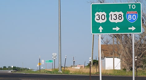
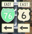
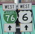
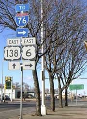
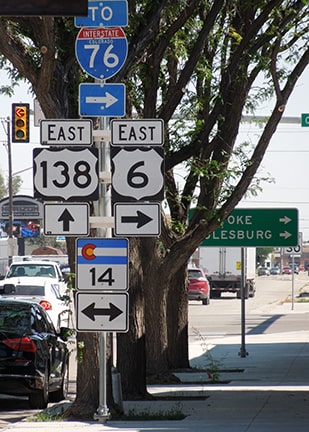
...but signage at the actual junction correctly used US highway shields:
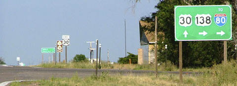
Sanderson, Aug. 2005
|
Sanderson, Jun. 2020
|
Summa, 1987
|
Morrison, May 2009
|
Sanderson, Jun. 2020
|
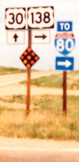
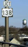
Travelers who take that turn to the south are immediately greeted with the first westbound confirming marker, as well as a panoramic vista of the South Platte River valley:
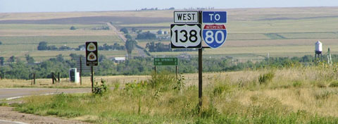
Sanderson, Aug. 2005
|
Sanderson, Jun. 2020
|
|
The town of Big Springs is about two miles down the hill -- the water tower visible at far right marks its location.
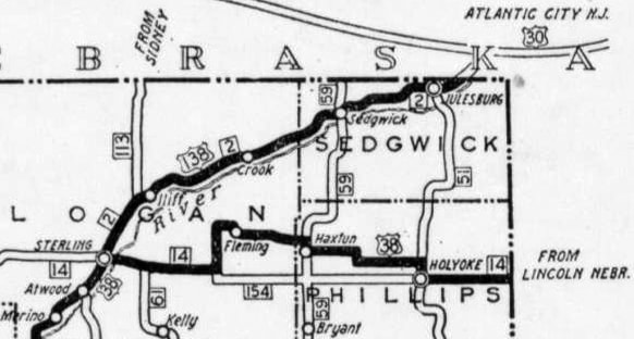
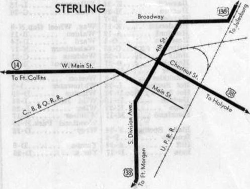
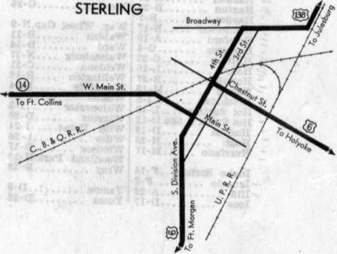
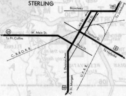
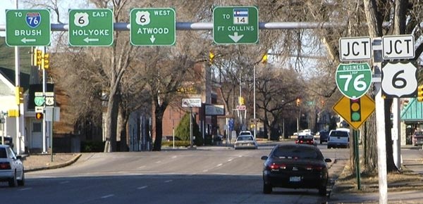
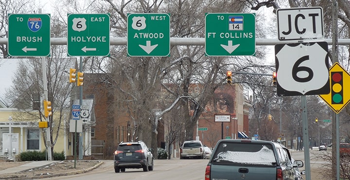
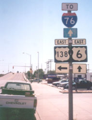
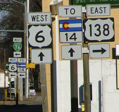
US 138 follows the north bank of the Platte upstream for a mere 71 miles to its western terminus in Sterling. There, it originally had a junction with its parent route, US 38...
|
c. 1931, CDoT
|
|
...but already by 1932 that had been replaced by US 6. And by 1934, Sterling's one-way couplet of 3rd/4th Streets had been established, giving US 138 a split terminus downtown:
|
c. 1932, CDoT
|
c. 1934, CDoT
|
Originally, 4th Street carried both directions of US 138, but from about 1933 until 2020 only southwestbound traffic used 4th. Also note the "C. B. & Q. RR" line: that was abandoned long ago, and in late 2020 its old right-of-way was repurposed so that highway alignments through downtown Sterling could be reconfigured. The historic railroad corridor now carries a new road that directly connects US 6 and CO 14. That project also resulted in a new endpoint for US 138 (more on that later).
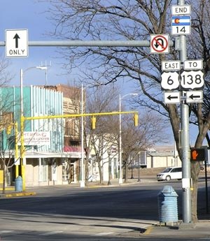
For 94 years both US 6 and US 138 were directed along one-way couplets, but that is no longer the case. The new endpoint of US 138 is on 3rd at Chestnut (same as its begin point). However, US 138 no longer terminates at an "elbow" in US 6, because US 6 no longer uses 3rd and 4th. Rather, it runs both directions along Chestnut, uses a new alignment to connect with Main Street (CO 14), and then continues south via Division to reconnect with its original alignment.
For 94 years both US 6 and US 138 were directed along one-way couplets, but that is no longer the case. The new endpoint of US 138 is on 3rd at Chestnut (same as its begin point). However, US 138 no longer terminates at an "elbow" in US 6, because US 6 no longer uses 3rd and 4th. Rather, it runs both directions along Chestnut, uses a new alignment to connect with Main Street (CO 14), and then continues south via Division to reconnect with its original alignment.
|
These photos show what was historically the last westbound marker on 4th and, a few blocks ahead, the sign bridge at the route's west terminus:
Sanderson, Mar. 2006
|
Sanderson, Mar. 2006
|
Sanderson, Mar. 2019
|
Sanderson, Mar. 2019 (all gone as of 2020)
|
|
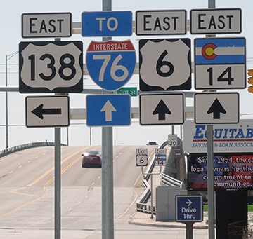
(Note that the I-76 control point used there is "Brush" -- more on that below.) The light ahead was at Chestnut Street. There, US 138 ended at its junction with what was US 38 for a few years, but then US 6 for several decades. There was no "End" assembly, but signage on the signal masts on both sides of 4th made it pretty clear that travelers began following new numbers there:
|
Sanderson, Mar. 2006
|
Sanderson, Mar. 2006
|
(Note also that several of these photos show references to so-called "Business Loop" I-76, which is dual-signed for 50 miles along a predominantly rural segment of US 6 between Sterling and Ft. Morgan. It is a gross mis-application of the concept. By 2007 all references to BL 76 had been removed in Sterling, but as of 2020 it appears that BL 76 was still signed everywhere south of Sterling. But I digress.)
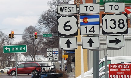
Eastbound US 6 was to the left on Chestnut, while westbound was straight ahead on 4th. The junction with CO hwy. 14 was two blocks ahead (at Main Street), although today CO 14 has been rerouted such that it now uses that segment of Chestnut (as we will discuss more below).
Eastbound US 6 was to the left on Chestnut, while westbound was straight ahead on 4th. The junction with CO hwy. 14 was two blocks ahead (at Main Street), although today CO 14 has been rerouted such that it now uses that segment of Chestnut (as we will discuss more below).
|
Historically, highway traffic heading the opposite direction (north on Division) was directed northeast on 3rd (which was the other half of the one-way couplet with 4th). Upon reaching Chestnut, US 6 traffic continued to the right, whereas straight ahead on 3rd was the west beginning of US 138:
|
Sanderson, Mar. 2019
|
|
Straight ahead still is the west beginning of US 138, but since 2020, 3rd carries both directions of US 138 (not just eastbound). Also since then, the segment of 3rd south of Chestnut is no longer a state-maintained highway, but the highway sign assembly still remains there, and in fact it was enhanced with the addition of a CO 14 marker. However, it was not updated to indicate that US 6 now runs both directions along Chestnut (not just to the right):
|
Sanderson, Jul. 2021
|
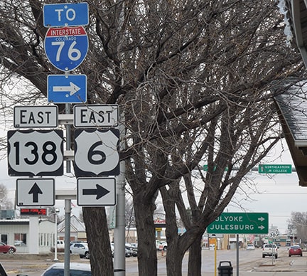
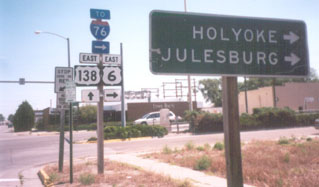
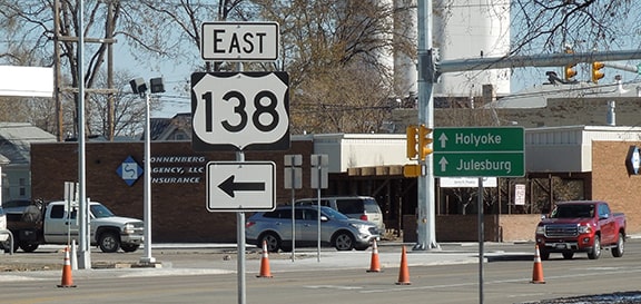
Regarding the green sign in the distance, it is interesting that there were no control destinations pointing straight ahead; only Holyoke and Julesburg to the right. It should be noted that Julesburg is also served by US 138 (straight ahead), but granted, one can get there more quickly by using I-76. So I think a control point of Iliff should have been used for eastbound US 138.
...but as of 2020 there was no reassurance until five blocks later, where 3rd curves to become Broadway:
|
Sanderson, Jul. 2021
|
|
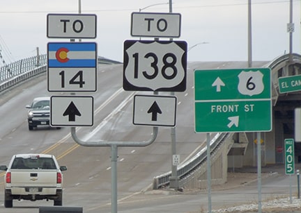
Heading east on Main, historically CO 14 traffic continued along the diagonal segment of Main. That designation ended at its junction with eastbound US 6, and signs there informed drivers how to get to US 138:
|
Sanderson, Mar. 2006
|
Sanderson, Mar. 2019 (gone as of 2020)
|
|
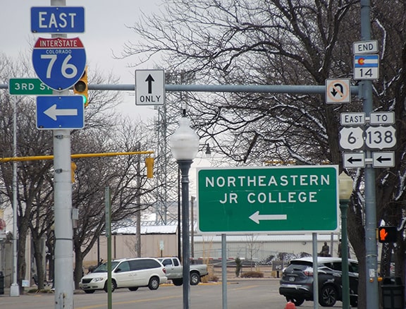
Turning left from there, in two blocks one encountered the west beginning of US 138 at the Chestnut intersection, where US 6 traffic was directed to turn right. Now that the S-Curve project is completed, CO 14 has a direct connection to US 138, so no "TO" signage is required (as we will see below). But now US 6 traffic stays on Division (instead of 3rd and 4th). At the intersection with CO 14, US 6 traffic must turn, and drivers there are also given directions to US 138:
|
Sanderson, Jul. 2021
|
|
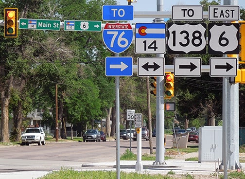
The street blades shown above indicate that CO 14 uses Main to the left, but to the right CO 14 no longer follows the diagonal segment of Main. Instead traffic is routed along a former RR right-of-way. As of 2021 this road had no name; it was simply referred to by its highway numbers (14 and 6). Heading east from Division on that road, drivers encounter a new US 138 sign and a new directional sign... but again, no "Iliff" (or any other control point) for traffic turning left on US 138:
|
Sanderson, Nov. 2020
|
|
About a block further ahead, at 3rd, drivers come to the junction that has long marked the west beginning of US 138. Here are some older scenes from that perspective:
|
Sanderson, July 1998
|
Sanderson, Mar. 2006
|
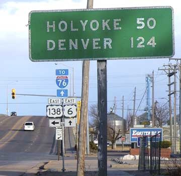
That neat old button copy sign has since been removed. That scene is a little ironic, since it is westbound US 6 that leads to Denver (not eastbound), although of course I-76 does provide quicker access. Following are some more recent photos, one before the 2020 "S-Curve" project, and one after:
Sanderson, Mar. 2019
|
Sanderson, Jul. 2021
|
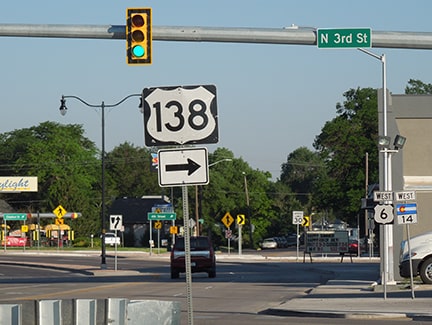
Ahead, the Chestnut Street viaduct spans the railyards. Then US 6 crosses the South Platte River, and in about two miles reaches I-76 at interchange 125. Travelers coming into Sterling from the opposite direction (west on US 6) see a few references to the upcoming junction with US 138:
Sanderson, Mar. 2019
|
Sanderson, Mar. 2006
|
After that, they were bombarded with an array of information, culminating with the signs visible in this scene:
Sanderson, Mar. 2006
|
(detail)
|
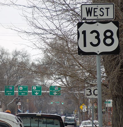
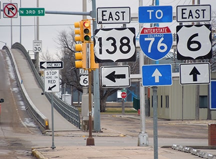
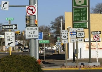
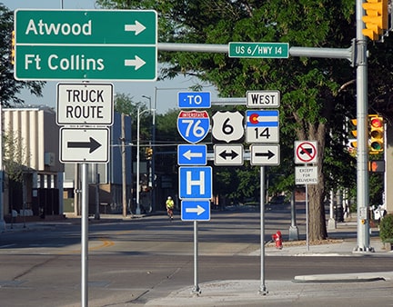
The green sign right about in the center of that photo said "Brush", and it indicated that drivers should turn left (south) at the next block ahead. But remember the reference to "Brush" above? That was the same intersection where southbound traffic was directed to turn east! So what is the recommended route to Brush? I-76 or US 6? (Brush is about 35 miles away. Drivers who have time and who enjoy scenic two-laners can certainly use US 6 to get there. But it is much faster to use I-76. "Atwood" is a more appropriate control point for southwestbound US 6 traffic.) Anyway: the west beginning of US 138 is to the right on 3rd:
|
Sanderson, Mar. 2019
|
Sanderson, Jul. 2021
|
Now that US 6 traffic doesn't have to turn right for another few blocks, signage at the intersection with 3rd is more minimal. The next block in the distance is 4th. Until the early 1930s (before these streets were converted to one-ways) US 38 took a left turn there, and the west beginning of US 138 was to the right on 4th. Now that 4th runs both ways again, traffic can once again turn north there, although 4th is no longer on the state highway system.
|
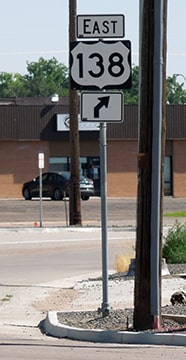
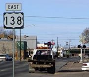
The one perspective we have not yet viewed is southbound on 3rd, along the new westernmost segment of US 138. This photo shows the last westbound trailblazer, which was posted just after the intersection with Sidney Avenue:
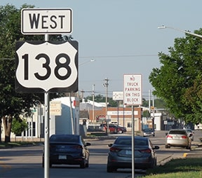
Sanderson, Jul. 2021
|
From the 1930s until 2020, this road was one-way the opposite direction. Ahead, at Chestnut, these signs are posted at the new west terminus of US 138:
Sanderson, Jul. 2021
|
Research and/or photo credits: David Backlin; Nathan Edgars; Jeff Morrison; Troy Newcombe; Dale Sanderson; Michael Summa
Page originally created 1998;
last updated Nov. 24, 2021.
last updated Nov. 24, 2021.
