End of historic US highway 156
|
Summa
|
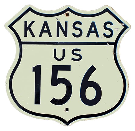
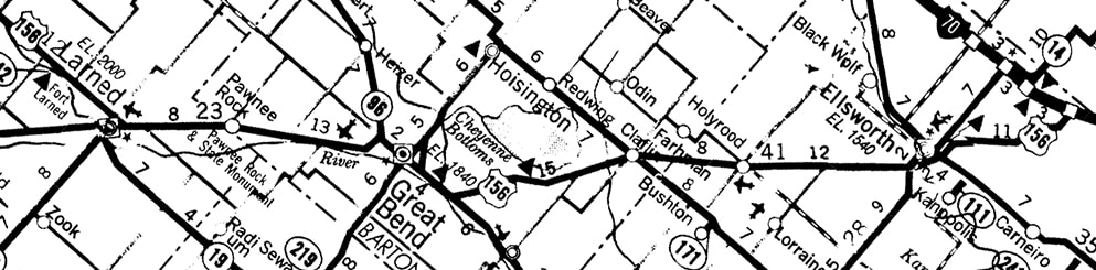
US 156 was commissioned in 1956 as part of the solution to eliminate the US 50-N / US 50-S split in Kansas. At that time, most of US 50-N became US 56. But at Larned, US 56 continued southwesterly through Dodge City. What had been the remainder of US 50-N from Larned to Garden City became US 156:

c. 1957, KS DoT
|
US 156 was decommissioned at AASHTO's Oct. 1979 meeting (although reportedly KDoT did not remove signage until 1982); since then the road has been designated KS hwy. 156. The current west terminus of K-156 in Garden City is the same as the historic terminus of US 156:
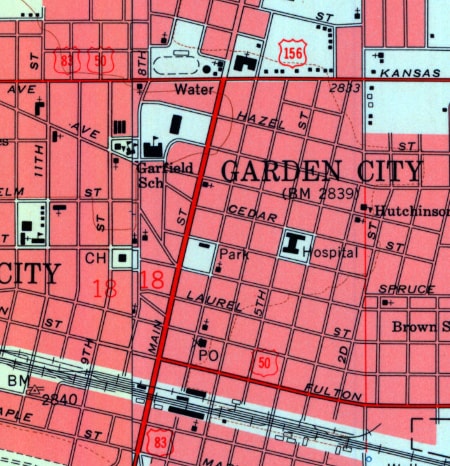
c. 1960, USGS
|
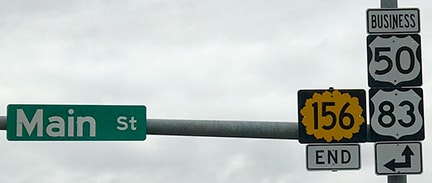
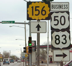
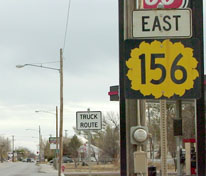
These photos were taken looking west on Kansas Avenue at Main Street. The signage was a bit misleading, because the junction is actually with Business 50 and Business 83. On the other hand, they do illustrate the historic junction well, because when US 156 was here, drivers on mainline US 50 and US 83 were still directed along what is now the business route through town:

Sanderson, Nov. 2001
Sanderson, Mar. 2018
|
|
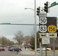
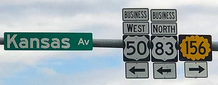
These shots were looking the opposite direction (east on Kansas), from the perspective of a driver heading east on historic US 50 and south on historic US 83. Those routes turned right on Main, while US 156 began straight ahead:
|
Sanderson, Nov. 2001
|
Sanderson, Nov. 2001
|
|
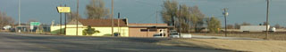
These photos were looking north on Main; they show the historic west beginning of US 156 as viewed from what was then westbound US 50/northbound US 83:
|
Sanderson, Nov. 2001
|
Sanderson, Mar. 2018
|
|
The original east terminus of US 156 was at its junction with US 56 in Larned. This photo was looking east on 14th Street, which is now both US 56 and K-156:
|
Sanderson, Nov. 2001
|
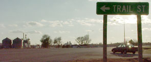
The semi in the background at far right was heading southwest on Trail Street, which formerly carried US 56 traffic. So originally, US 156 probably went due east from that vantage point (past the right side of the yellow building) and ended at Trail. It may have been later on that the more rounded-off alignment (to the left of the building) was constructed, in which case US 156 would have ended at far left.
|
This photo shows another perspective: looking southwest on US 56/K-156. Today both routes curve to the right here, west onto 14th. But originally US 56 went straight ahead here, continuing southwest along the railroad on Trail. So when US 156 was around, it began here, to the right:
|
Sanderson, Nov. 2001
|
|
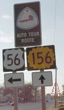
Today to the right, both US 56 and K-156 continue west on 14th. In about a half-mile, at Broadway, US 56 goes left (south), while K-156 continues straight ahead on 14th towards Garden City:
|
Sanderson, Nov. 2001
|
US 56 goes down Broadway for a few blocks to the railroad, where it rejoins its former alignment southwesterly on Trail.
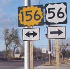
This shot was looking north on Broadway (eastbound US 56) where it intersects K-156 at 14th: |
Sanderson, Nov. 2001
|
It was during the 1960s that the diagonal highway between Larned and Ellsworth was completed. This road was initially designated K-45, and some locals still refer to it as "the 45 highway" (either for that reason, and/or because conventional wisdom held that K-45 was surveyed along a 45-degree angle. Study of a detailed map reveals that is not exactly true, but it is pretty close). At the time, I-70 was not yet completed in that area, and there was no Ellsworth bypass, so K-45 ended right in Ellsworth. The 1965 map was the first to show I-70 open to traffic north of Ellsworth. In 1966 AASHO approved an extension of the US 156 designation along the former K-45 north and east from Larned, as well as the Ellsworth bypass, ending at I-70's interchange 225 northeast of Ellsworth. The 1967 map was the first to show this:
c. 1967, KS DoT
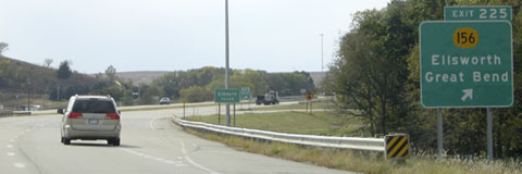
These photos, looking north at interchange 225 with I-70/US 40, show the final east end of US 156, which since 1982 has been the end of K-156:
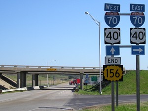
Morrison, May 2009
|
Ivy/Nitzman, Oct. 2021
|
|
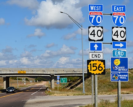
This perspective from westbound I-70 shows the east beginning of K-156, as well as the historic east beginning of US 156:
|
Field/Nitzman, Oct. 2004 (similar signage on westbound I-70)
|
Research and/or photo credits: Andy Field; Brent Ivy; Jeff Morrison; Alex Nitzman; Dale Sanderson; Michael Summa; Clinton Walker
Page originally created 2001;
last updated Dec. 9, 2023.
last updated Dec. 9, 2023.
