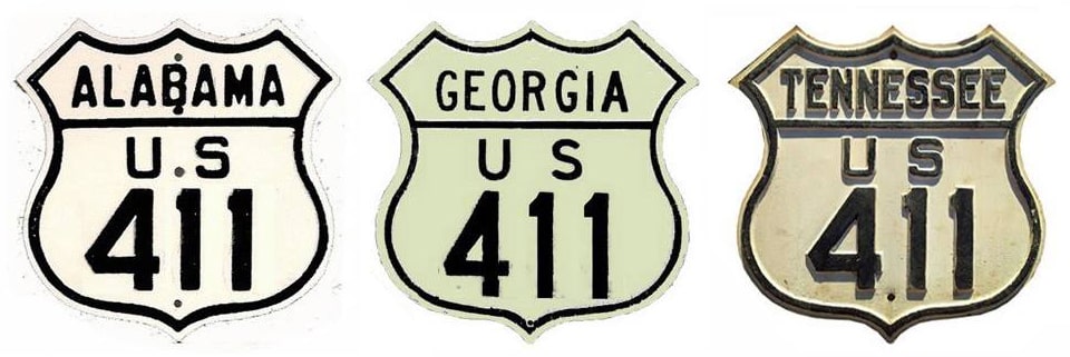
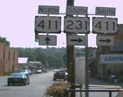
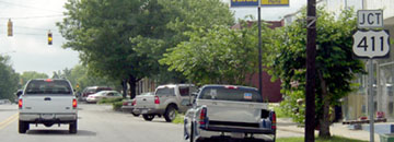
End of US highway 411 |
 |
|
Note: this page is about the current US 411, which is actually the third route to carry that designation. There are separate pages for the original US 411 and the second US 411.
|
Summa
|
|
1934-1940
|
1940-1944
|
1944-1950
|
1950-1952
|
1952-1956
|
|
1956-1958
|
1958-1967
|
1967-1976
|
1976-1984
|
1984-present
|
Mileage: in 1989 AASHTO listed a figure of 341 miles for US 411... but that was assuming an endpoint in Greeneville. The route has been truncated to Newport, and our own 2020 measurement yielded 310.1 miles. Historically, when it went to Bristol, US 411 was 394.9 miles long.
|
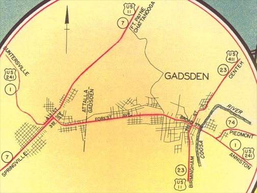
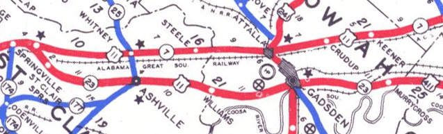
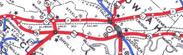
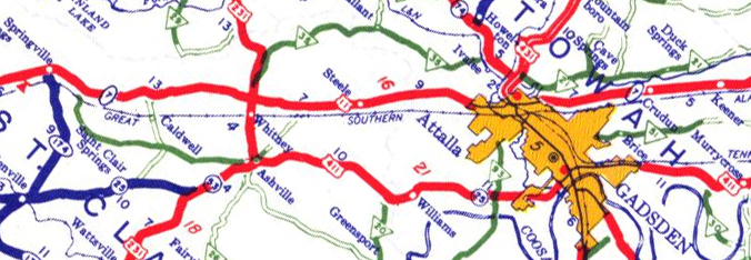
Originally the south end of US 411 was in Gadsden, on 3rd Street at Broad Street (which carried US 11 and US 241 at the time):
c. 1939, AL DoT
|
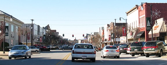
This image was looking west on Broad; at the traffic signal northbound US 11 came from the left and continued straight ahead:
Bajek, Dec. 2008
To the right on 3rd was the south beginning of US 411. If a driver turns that direction, they will soon come to the modern functional equivalent of this historic junction, because today highway traffic is routed over a newer bridge along Meighan Boulevard, a couple blocks north of Broad.
|
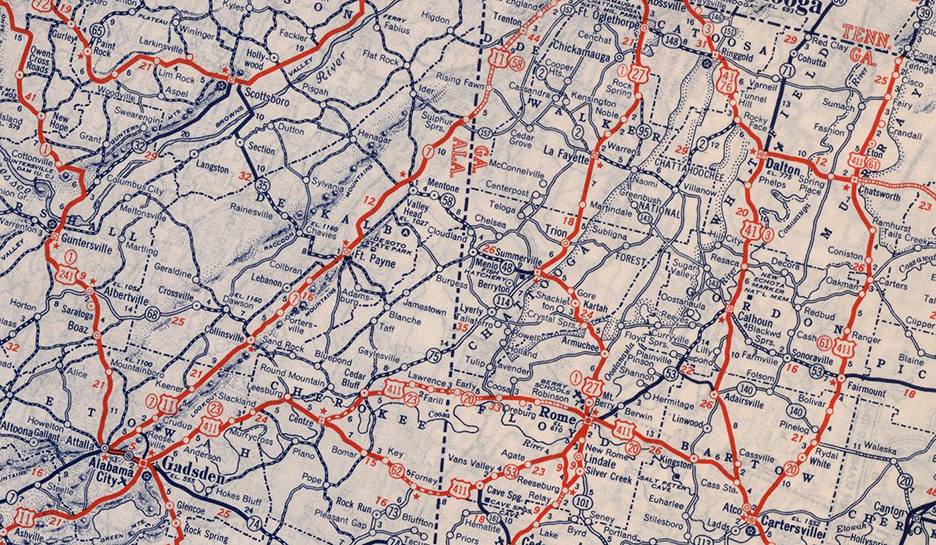
From the time US 411 was commissioned in 1934, it was envisioned to go north all the way to Bristol. Perhaps the road through Tennessee was not yet up to standards; for some reason the designation was not immediately signed in that state. From Gadsden, US 411 ran through northwest Georgia (as it does yet today), but its north end was "on hold" at the stateline for about five years (near the aptly-named community of Tennga), waiting for Tennessee to pick it up...
 c. 1940, Rand McNally
|
...which they did in 1940, but not yet all the way to Bristol: initially the US 411 designation was extended to Maryville. US 411 junctioned with US 129 about four miles southwest of Maryville, and USGS topos from that timeframe indicate that the two routes were overlapped into town. US 411 ended at the intersection shown here -- this photo was taken looking northeast on Broadway Avenue at Washington Street:
|
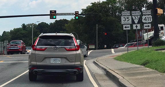
Sanderson, Aug. 2018
|
|
US 411 terminated there, but US 129 continued ahead on Broadway. Also ahead was TN hwy. 73, which also ran to the right on Washington.
This next photo was looking northwest on Washington, which today carries US 411, but historically this was TN hwy. 73, which continued to the right on Broadway: |
Sanderson, Aug. 2018
|
|
At the time, US 129 ran both right and left on Broadway, and to the left was also the north beginning of US 411.
It was about 1944 that the US 411 designation was extended north (right) from that junction; from Newport it continued along modern US 321, to end at its junction with US 11E in Greeneville: |
c. 1951, TN DoT
|
|
At the time, there was no US 11 bypass -- instead traffic was routed along what is signed as Business 11 today. That comes into town via Summer Street, and turns north on Main Street. Today Main is US 321; to the right was once the north beginning of US 411:
|
Nelson, July 2006
|
Finally in about 1950, the US 411 designation was extended to its intended north terminus (more info and photos on the Bristol page).
|
|
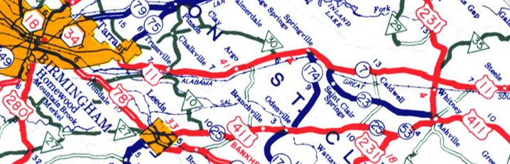
In 1952 the south end of US 411 was also extended. Until that time, mainline US 11 went through Gadsden and Ashville, whereas the parallel highway to the west was designated Alternate US 11...
|
c. 1952, AL DoT
|
|
...but then US 11 was changed to follow its current alignment, while the US 411 designation was extended southward along the former US 11, ending at its junction with US 11 in Springville:
|
c. 1953, AL DoT
|
|
This photo was taken from the northeast edge of Springville, looking north on US 11. Originally US 11 traffic was directed to the right here, while straight ahead was Alt. US 11. But in 1952 US 11 was changed to follow its current routing to the left, while to the right was the south beginning of US 411:
|
Lintz, Jun. 2020
|
|
This photo was taken from AL hwy. 23 at its southbound terminus. For a few years this was the south end of US 411:
|
Google Maps Street View, Apr. 2013
|
|
Then in 1956 the US 411 designation was truncated to US 231 at Ashville (most likely in anticipation of the extension that would occur two years later):
|
c. 1957, AL DoT
|
|
This photo was looking southbound on US 231; for a couple years the south beginning of US 411 was straight ahead:
|
Nelson, Aug. 2005
|
Here is a perspective from the former endpoint; historically US 411 ended at the light ahead...
|

Nelson, Aug. 2005
|
|
...but by 1958 it was extended to the left with US 231, and US 411 continued all the way to its current terminus at US 78 in Leeds:
|
c. 1959, AL DoT
|
|
This photo was looking south on 9th Street; US 411's interchange with I-20 is about two miles behind the camera. There was no "End" sign, but this is its terminus, at the Bankhead Highway, which is known locally as Parkway Drive:
|

Wilson, Feb. 2002
|
|
These shots were approaching the south beginning of US 411 from westbound US 78:
|
Patriarca, June 2003
|
Patriarca, June 2003
|
|
Signage for US 411's beginning as seen from eastbound US 78 is also among the trees; the route begins to the left on 9th:
|
Patriarca, June 2003
|
c. 1969, TNDoT
|
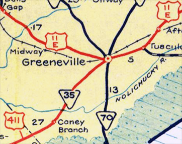
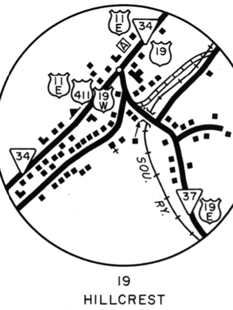
Back to the north end: US 411 was truncated out of Bristol in about 1967, when TN DoT removed the US 411 signs north of Bluff City. That was illustrated on the preceding 1969 map (Hillcrest was the name of the community situated where US 19 split into US 19E and 19W, now within Bluff City limits.). At the time, today's US 19, 19E, and 19W had not yet been built. US 11E-19W-411 came from the southwest via what is now TN hwy. 44 (Bluff City Highway). This interactive image is looking north on that road:
US 19E came in from the southeast (right) via Elizabethton Highway. At that junction, US 19E-19W-411 all ended. Straight ahead was only US 11E-19.
|
|
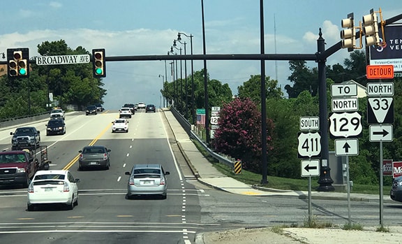
The minutes of AASHTO's 1976 meeting noted that approval had been granted to further truncate the route, this time between Greeneville and Hillcrest. In Greeneville, it is possible that US 411 ended at its former location (see above), although by this time that was Business US 11. Otherwise US 411 may have gone as far as the modern US 11 bypass (Andrew Johnson Highway). This photo was looking south on US 11-321:
|
Nelson, July 2006
|
|
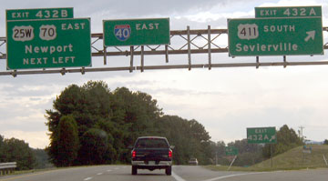
It is possible that US 411 began to the left, down Main via what is now Business 321. AASHTO records still indicate US 411 begins there. But already by 1984, Tennessee had truncated US 411 again, this time to I-40's interchange 432, on the outskirts of Newport. US 25W-70 parallels I-40 in this part of the state, so most maps are not at a large enough scale to show whether US 411 ends at its junction with the US route or with the interstate. But the sign shown in this photo indicated that it overlapped to the interstate:
|
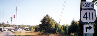
Sanderson, Oct. 2000
|
By 2014 that sign had been removed, and by November 2015 traffic along that northernmost segment of US 411 had been redirected along a new alignment running about a half-mile to the west (more on that below). At the former junction with US 25W-70, old US 411 was vacated. The photo below shows how the road now veers slightly to the left, but the original alignment is marked by the shadows of the overhead powerlines. A small green Newport city limits sign still stands, but it is now sitting incongruously in the middle of the newly-seeded grassy area:
Backlin, Sep. 2017
|
From that intersection, US 411 traffic was directed to turn right along with US 25W-70. Today, a half-mile to the west, traffic on the new US 411 is not directed to turn right to I-40, but neither is there an "End US 411" sign:
|
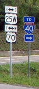
Backlin, Sep. 2017
|
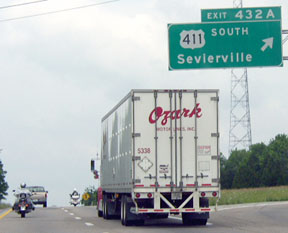
Historically US 411 did continue to the interstate, and officially it probably still does continue along that short segment to the east. This photo shows that interchange:

Sanderson, Oct. 2000
|
|
That was on north US 411/east US 70/south US 25W. On I-40, the green signs that direct traffic back this direction (away from Newport) mention only US 411; they do not reference US 25W-70 at all... although that may be simply because, since that road closely parallels I-40 for the next ten miles or so, it is relatively low-usage:
|
Patriarca, summer 2003
|
Patriarca, summer 2003
|
|
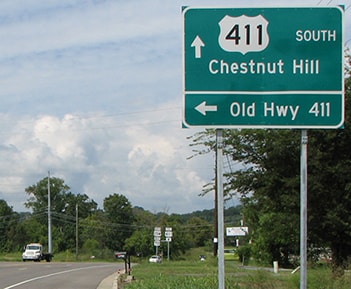
Heading west from I-40 along US 25W-70-411, the turnoff to the historic road is now marked "Old Hwy 411":
Backlin, Sep. 2017
|
Now US 411 splits off from 25W-70 a little ways ahead, but these photos show the first confirming signs to the left along the original highway:
|


Research and/or photo credits: David Backlin; Mark Bajek; Nathan Edgars; Adam Froehlig; Karin and Martin Karner; Josh Lintz; Steven Nelson; Chris Patriarca; Nathan Perry; Mike Roberson; Dale Sanderson; Michael Summa; Ed Wilson
Page originally created 2000;
last updated Dec. 11, 2023.
last updated Dec. 11, 2023.
