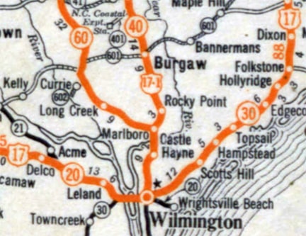
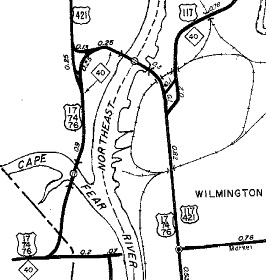
Current and historic US highway endpoints in Wilmington, NC
|
1927-present
|
 |
c. 1931, Gousha
|
When the US routes were originally commissioned, there were no automobile bridges over the Cape Fear or Northeast Cape Fear rivers in the Wilmington area. Instead, US 17 traffic used a ferry at the foot of Market Street. US 17-1 began by heading north from Market, probably via 4th Street initially.
|
|
But in 1929 the first bridge was built: the Parsley Street Bridge was located in essentially the same place as the current Isabel Holmes Bridge. US 17 traffic was directed to use the new bridge (instead of the ferry), and by 1930 3rd Street (instead of 4th) had become the main highway route between downtown and the bridge. At that time, US 17-1 could have been truncated to its junction with US 17 on North 3rd, but the designation was likely overlapped with US 17 south on 3rd, ending at Market. This photo was looking north on 3rd:
|
Nitzman, June 2005
|
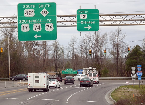
Today that is northbound Business 17, which continues to the right on Market (although that directional sign has been gone for years). Originally, that was the path of mainline US 17, and straight ahead was the south beginning of US 17-1. But that designation had a short life: it was decommissioned in 1932. Its Wilson-Wilmington segment was renumbered as US 117. But at first, US 117 did not end in Wilmington; rather it continued further south, ending in South Carolina. However, that same year a different US route was extended to a Wilmington endpoint: US 421 joined with US 117 at Castle Hayne, and the two routes overlapped down to the bridge junction in Wilmington. US 117 split off there, but US 421 continued south on 3rd, ending at the same intersection where US 17-1 had previously ended. Following are a couple more perspectives of that junction -- first looking south on 3rd, and then looking west on Market:
Sanderson, Jun. 2019
|
Sanderson, Jun. 2019
|
|
Then in 1934, US 17 was changed to its current route, eliminating the segment of US 117 that continued into South Carolina. So US 117 was truncated at the bridge junction, and instead extended south on 3rd to end at Market. Also in 1934 the US 74 designation was extended east from Chadbourn, ending in Wilmington (also at 3rd and Market). However, neither US 74 nor US 117 ever shared that endpoint with US 421, because that was the same year that US 421 was extended south from Wilmington. But that was the southern terminus of US 74 until 1938, and the south end of US 117 until 1969:
|
c. 1957, NC DoT (linked to source)
|
|
In 1969 US 421 was moved to its current route, which avoids downtown Wilmington by running along the opposite side of the river. At that time, US 117 was changed such that it crossed the Parsley Street Bridge (and later the Isabel Holmes Bridge), ending at its junction with US 421:
|
Storey, 1999
|
|
The road configuration in that area has changed since the 1970s; please see vahighways.com for more details about exactly how US 117 was routed through there. Here is how that same junction was signed as of 2017:
|
Sanderson, Mar. 2017
|
|
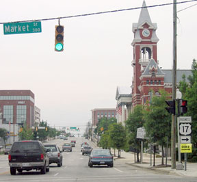
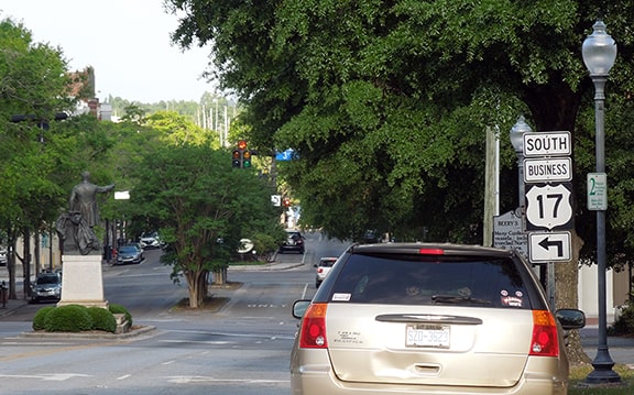
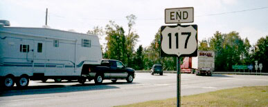
The "End" sign shown above is gone now, and of US 117 no longer runs through that junction, because its south end was rerouted in 2002; the old route is now signed simply as NC hwy 133. Instead, US 117 is now extended southeast from Castle Hayne via NC hwy. 132 (College Road). At Shipyard Boulevard the designation heads west. The last southbound marker is just past the junction with US 421 (Carolina Beach Road):
|
Sanderson, Mar. 2017 (gone as of 2019)
|
|
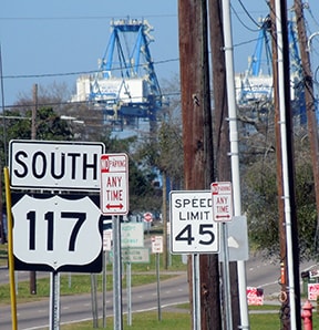
US 117 continues about a mile ahead, and then ends at a secured entrance to the State Port:
|
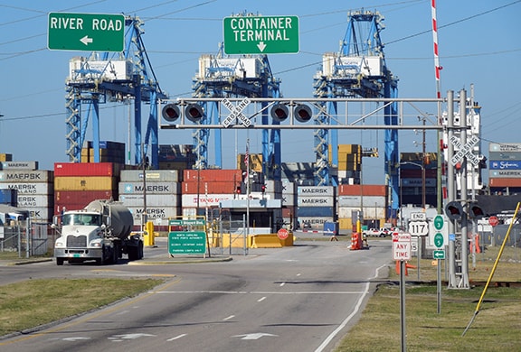
Sanderson, Mar. 2017
|
|
At lower right an "End" assembly is visible; it is shown close-up in these photos:
|
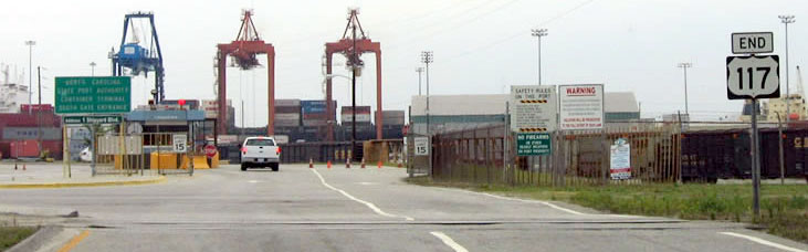
Field, May 2005
|
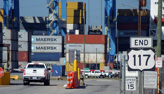
Sanderson, Mar. 2017 (117 shield gone as of 2019)
|
|
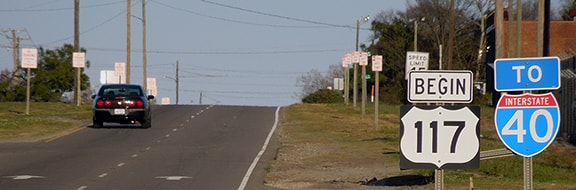
Across the road, there was a "Begin" assembly for traffic heading the opposite direction:
|
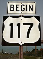
Karners, Apr. 2014
|
Sanderson, Mar. 2017 (117 shield gone as of 2019)
|
|
Just under a mile ahead from there, US 117 has a junction with US 421, and that is where the first northbound marker is posted:
|
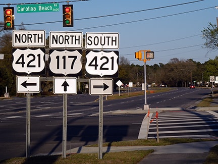
Sanderson, Mar. 2017
|
Research and/or photo credits: Andy Field; Karin and Martin Karner; Alex Nitzman; Mike Roberson; Dale Sanderson; Jimmy Storey
Page originally created 1999;
last updated Dec. 17, 2023.
last updated Dec. 17, 2023.
