End of historic US highway 650 |
 |
|
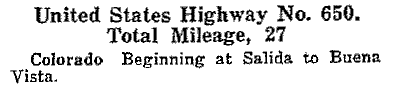
This excerpt is from AASHO's Apr. 1927 route log:
|

|
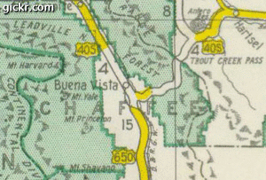
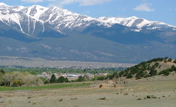
US 650 was one of the original US routes, but it was decommissioned after less than a decade, in about 1934 (although apparently not quite soon enough to result in a change to the 1935 issue of Colorado's state highway map). Until that time, some US highway routes in Colorado were numbered differently than they are now. US 285 went north from Denver, to Laramie WY, along what is now US 287. Present-day 285 from Denver southwest to Antero Junction was not on the US highway system (it was designated CO hwy. 8). There was no US 24 in Colorado. Instead, it was US 40-S that was signed along US 24's present route from Limon through Colorado Springs, over Ute and Wilkerson passes to Antero Jct, then over Trout Creek Pass to Johnson Village, and north through Buena Vista to points beyond. Just shy of Buena Vista, near present-day Johnson Village, US 650 headed south from US 40-S along the Arkansas River to its junction with US 50 in Salida. The entirety of US 650 is shown on this map, which covers just a small area of central Colorado:
|
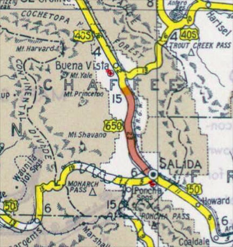
c. 1935, CDoT
|
|
Note also the curvy railroad line to the west of Salida. The actual rail line was not that curvy. Rather, the cartographer drew in the highway lines first, and then added the RR lines later, simply for the purpose of helping drivers navigate, by indicating which side of the highway the railroad was on. That concept figures into the historical analysis that will follow. This photo was looking north on US 285, approaching Buena Vista:
|
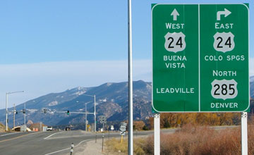
Sanderson, May 2008
|
|
Today's US 24 runs along the corridor of historic US 40-S, so this junction is the modern functional equivalent of the historic north end of US 650. However, the road alignments were a bit different back when US 650 ended there. For one thing, the current bridge over the Arkansas was not built until 1937. So where was the bridge before then? Historic CDoT maps offer a clue. This image is switching back and forth between the 1932 and 1934 issues. Notice the railroad just south of Buena Vista changed from west of the highway (1932) to east of the highway (1934):
|
c. 1932 and 1934, CDoT
|
It is very unlikely that the actual alignment of the railroad changed like that. So why was the RR line changed on the 1934 map? Most likely it was because the highway was realigned to the opposite side of the tracks. One could therefore conclude that, until 1932, US 650 used what is now Chaffee County Road 301 to cross the river and the railroad before reaching its junction with US 40-S. Then in 1933 or '34, US 650 was changed to a new alignment (which is essentially the same as today's US 285).
|
This photo was taken from US 24-285, just east of Johnson Village, from approximately the point where the historic alignment of US 40-S crosses the modern highway. Westbound US 40-S continued ahead towards Buena Vista (visible in the background) and crossed the Arkansas near the Reformatory via a bridge that no longer exists. I have seen an old map that labeled it "Star Highway Bridge", and I have also read an account that referred to it as the "Free Gold Bridge". US 650 came in from the lower left via today's CR 301, ending at its junction with US 40-S, which may have been near the hay bales in the middleground:
|
Sanderson, May 2008
|
|
This next photo was taken from CR 301, near those hay bales, looking back the opposite direction. The paved road on the left is modern US 24-285. The gravel road on the right is historic US 40-S (further off in the distance, it has a couple concrete bridges dated 1922). That road may have come right toward the camera on its way to Buena Vista:
|
Sanderson, May 2008
|
|
To the right on 301 is what was probably the north beginning of US 650; this photo was looking that direction. A few miles ahead, near Nathrop, this road has a bridge across the Arkansas. The current bridge was built in 1990, but it replaced an older bridge in the same location. That bridge is what US 650 may have used to cross the river before joining the current alignment southward into Salida:
|
Sanderson, May 2008
|
|
Today, southbound US 285 leaves the Arkansas River about eight miles northwest of Salida, and instead travels through Poncha Springs before climbing over Poncha Pass. The road that continues along the river to US 50 in Salida is now CO hwy. 291. But historically, US 650 followed what is now County Road 193 and CO 291 into Salida.
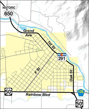
This map shows the current highway configuration in Salida. Note that "F" Street and County Road 105 are highlighted. That's because apparently US 50 and/or US 650 were routed along these roads for at least some stretch of time during their existence: |
Sanderson
|
|
If US 650 followed modern CO 291 all the way through town, then its south end was where the photo below was taken. This was on southbound Oak Street, at the junction with US 50. Incidentally, part of the Sangre de Cristo Range is visible in the background:
|
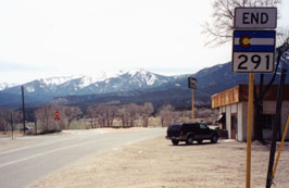
Sanderson, Apr. 2000
|
|
This photo was at the same junction, looking west on US 50 at what may have been the south beginning of US 650 (part of the Sawatch Range is visible in the background):
|
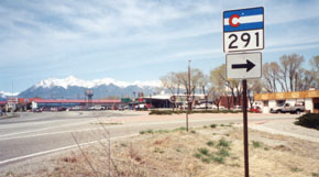
Sanderson, Apr. 2000
|
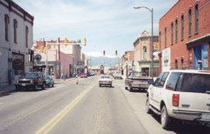
Beginning in 1934, reportedly CDoT agreed to direct US 50 traffic through downtown Salida: along modern 291 (north on Oak and First), and then down "F", back to Rainbow Boulevard. If so, then US 650 may have had a different south end during its final year or so. This photo was looking southeast on First; the signal is at "F":
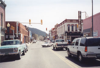
Sanderson, Apr. 2000
|
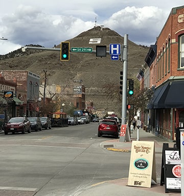
There, the white pickup had just reached what would have been the south end of US 650. Eastbound US 50 was straight ahead, and westbound was to the right on F. Here is a more recent photo from the same perspective:
|
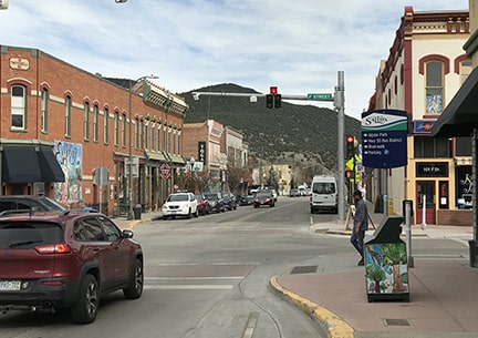
Sanderson, May 2021
|
|
This next photo shows the same intersection from the opposite direction (northwest on First, which is north on modern CO 291, and west on historic US 50). Westbound US 50 would have taken a left at the light, while straight ahead was the south beginning of US 650:
|
Sanderson, Apr. 2000
|
|
And finally, one more perspective: this was looking northeast on "F", or historic eastbound US 50, which continued to the right on First. To the left on First may have briefly been the historic south beginning of US 650:
|
Sanderson, May 2021
|
Research and/or photo credits: Alvin Edlund; Dale Sanderson; Michael Summa
Page originally created 2000;
last updated Dec. 10, 2023.
last updated Dec. 10, 2023.
