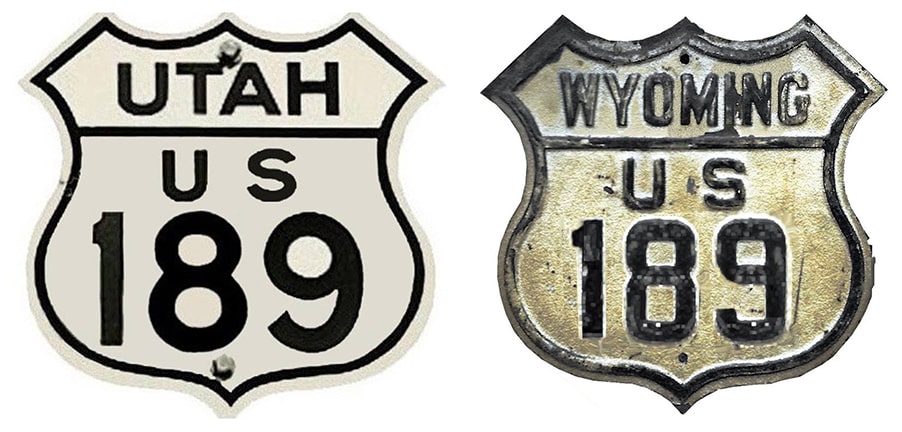
End of US highway 189 |
 |
Summa
|
|
Mileage: in 1989 AASHTO listed a figure of 322 miles for US 189. That is reasonably close to our own 2020 measurement, which yielded 312.1 miles (including the unsigned segment between Silver Creek Jct. and the Wyoming line; reroutings and realignments likely explain the difference).
 c. 1939, UDoT c. 1939, UDoT
|
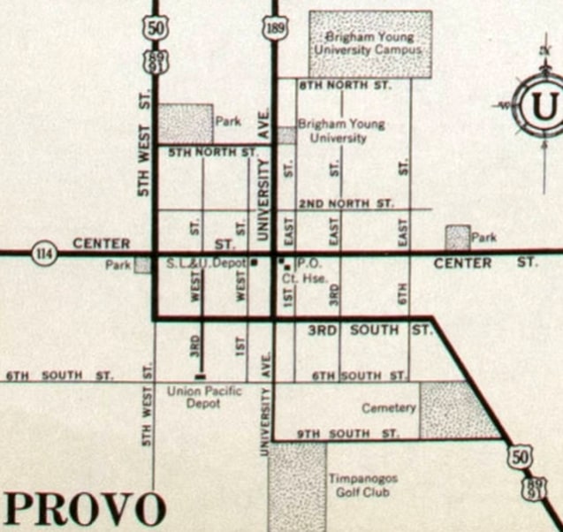
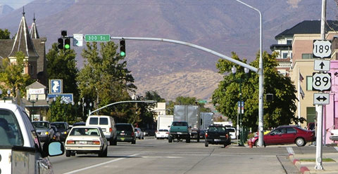
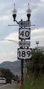
Before today's US 189 was commissioned, there was a different US 189 in Utah. That route was assigned a state highway number in 1938, and the US 189 designation was changed to the current route. However -- while the south end of modern US 189 has always been in Provo -- before I-15 was built, its terminus was at its junction with US 89, right in town, as shown on the preceding map. The photo below was taken looking east on 300 South, which is also southbound US 89:
Sanderson, Oct. 2005
|
|
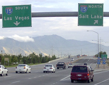
University Avenue is the crossroad; originally US 189 began to the left. But today if a driver turns right and goes about a mile-and-a-half, they will come to the modern south end of US 189, which is at its interchange with I-15:
|
Stewart, Aug. 2003
|
|
In the distance is Loafer Mountain. It was not mandatory to take one of those I-15 exits; drivers had the option to continue straight ahead, which took them to the intersection with 1860 South, where a right or left turn was required:
|
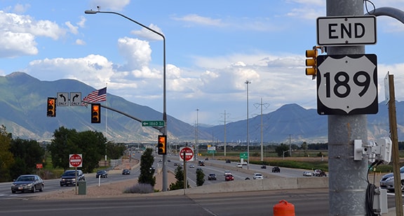
Nitzman, July 2016
|
|
That "End" assembly was added sometime between 2009-2012; straight ahead is the offramp from northbound I-15. Signage for traffic heading that direction formerly looked like this:
|
Sanderson, Oct. 2005
|
Morrison, Jun. 2023
|
|
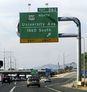
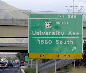
Note that is exit 263; UDoT renumbered their interchanges shortly before that photo was taken. The old number is shown in the first of these two photos, which were both taken from southbound I-15:
|
Stewart, Aug. 2003
|
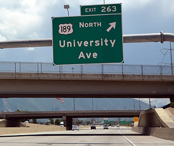
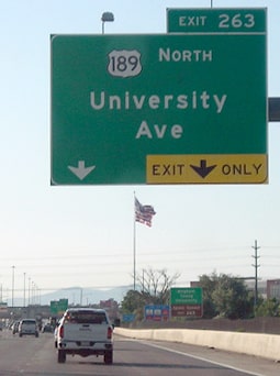
Nitzman, July 2016
|
|
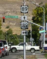
Part of Spanish Fork Peak is visible in the background. As of 2016 that interchange was being reconfigured, but at the time, drivers exiting to the right would loop around and go over the second bridge. They would then be on 1860 South, and would have to make a left turn to get on US 189 (University). Not far past that intersection, the first northbound confirming marker was posted:
|
Sanderson, Oct. 2005
|
Nitzman, July 2016
|
|
Heading that direction affords spectacular views of Mount Timpanogos. Continuing that way we soon come to the historic south beginning of US 189 at 300 South:
|
Sanderson, Oct. 2005
|
|
According to AASHO's route logs, the north end of US 189 has always been in Jackson, and accordingly it was shown that way on most commercial maps (and also note that initially there was no US 89 bridge at Hoback Junction):
|
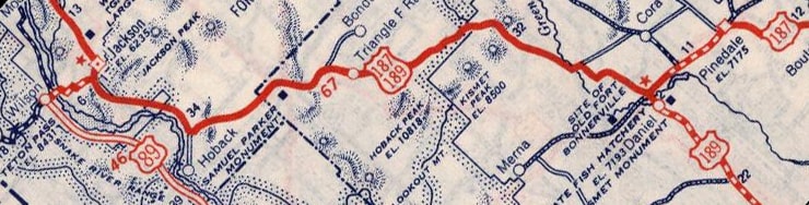
c. 1940, Rand McNally
|
|
But in reality, Wyoming did not signpost US 189 north of Daniel Junction, so that was the de facto north end for about 15 years. This photo was taken from northbound US 191:
|
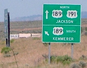
Sanderson, Jun. 2006
|
|
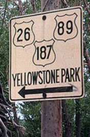
Historically that would have been northbound US 187, which continued straight ahead to Jackson, while the north beginning of US 189 was to the left. In 1953 Wyoming decided to signpost US 189 in accordance with the route log, so that is when US 189 was extended to Jackson. Today US 26-89 joins with US 189-191 at Hoback Jct, and the four routes are overlapped along the single highway heading north into Jackson (Wyoming has no aversion to route concurrencies). All four routes are shown on this sign, approaching Jackson:
|
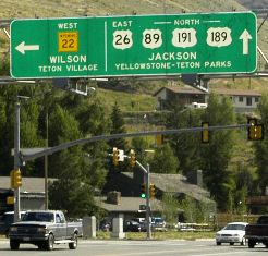
Grier, Aug. 2006
|
|
US 189 has an unusual terminus, in that it does not terminate at a junction with another highway. Rather, it continues for another mile, carrying travelers into downtown Jackson, and then ends (while the three other routes turn left and continue on):
|
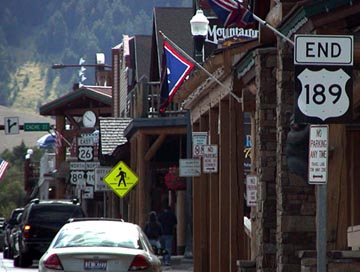
Cooper, July 2005
|
Dienhart, Aug. 2018
|
|
Although the main highway is ultimately a north/south road that leads to Grand Teton and Yellowstone National Parks, for a short distance through Jackson traffic is routed onto Broadway, which is an east/west street. Those photos were taken there; the sign was posted in the block between Millward and Glenwood streets. The intersection after that is Cache Street, onto which highways US 26-89-191 turn left, as noted on the assembly in the distance. Prior to 1982 it was US 187 (instead of US 191) that made that turn...
|
c. 1963, attribution unknown
|
|
...but US 189 has never continued to the left there, and has never continued any further north than downtown Jackson. This next photo was taken looking south on Cache:
|

Grier, Aug. 2006
|
|
Snow King Mountain dominates the view in that direction, and one of the ski runs is visible in that photo. US 26-89-191 continues to the right, and US 189 begins that way. If a traveler takes that turn, they will soon see the confirming assembly shown here:
|

Grier, Aug. 2006
|
|
It should be noted that, for about 25 years, US 189 had a signage gap in Utah. Internally, the Utah Dept. of Transportation defines US 189 as being concurrent with US 40 north of Heber City, and ending at the same place US 40 does: at I-80 near Park City. The past several issues of their official state highway maps have indicated this:
|
c. 2014, UDoT
|
|
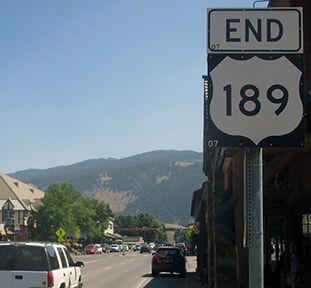
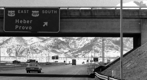
However, there are a few problems with that. First, UDoT is ignoring the segment of US 189 in Wyoming: travelers must use I-80 to get there. Furthermore, for about 25 years, the signage UDoT actually posted for US 189 did not match its own route definition. US 189 was not signed anywhere between Heber City and Silver Creek Jct; that entire segment was posted only as US 40. And not only that, but there was an "End US 189" assembly posted in Heber from the early 1990s until 2017:
|
Stober, late 1990s
|
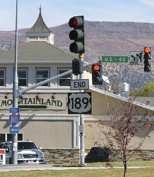
Sanderson, Oct. 2005
|
|
That particular "End" assembly was gone as of July 2010, but another one was added (on the opposite side of the road) in 2012, and it remained until 2017. But here is the assembly that was posted after that time:
|
Rand, Aug. 2018
|
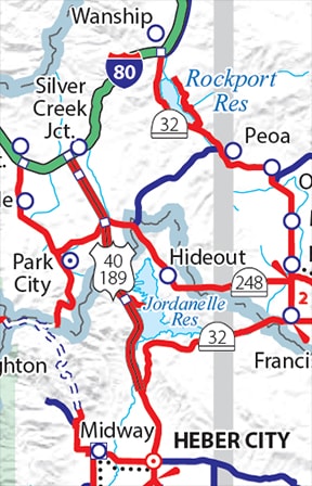
Historically, US 189 turned left there for an overlap with US 40 through Heber City, and then split away to route through Kamas and Peoa (essentially along what is now U-32, most of which is visible on the map above). That meets I-80 at Wanship, and from there US 189 was concurrent with it to the Wyoming state line, through Evanston, and then up north to Jackson. But when the Jordanelle Reservoir was constructed (see map above), part of old US 189 had to be rerouted to higher ground. When that happened, it seems that UDoT took the opportunity to reroute US 189 such that it heads north with US 40 to Silver Creek Jct, and they renumbered the segment of old US 189 between Heber and Wanship as U-32. But for some reason, instead of signing US 189 as it had been redefined, UDoT instead posted that junction in Heber as the north end of US 189. Apparently UDoT never obtained AASHTO's approval to do any of this -- and if they would have tried, AASHTO probably would have rejected the request, because UDoT's action resulted in two disconnected segments of US 189 (one in Utah and one in Wyoming).
|
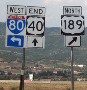
Regardless, that all changed in late 2017: UDoT finally added US 189 trailblazers along the segment of US 40 north of Heber...
|
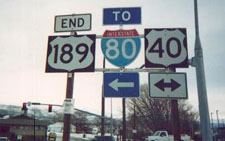
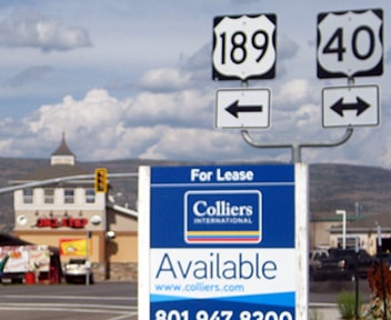
...and now when northbound travelers reach I-80 at Silver Creek Jct. a sign instructs northbound US 189 traffic to continue via eastbound I-80:
Rand, Aug. 2018
|
|
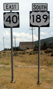
Historically US 189 was signed along with US 40 from the I-80 interchange at Silver Creek Jct...
|
c. 1975, UDoT
|
...and US 189 was also dual-signed with I-80 from there to Wyoming...
|
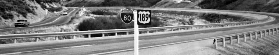
c. 1960s (attribution unknown)
|
...but that changed in the 1990s, and as of 2018, US 189 was still not signed from I-80 at the US 40 exit. Nor was US 189 dual-signed along its I-80 overlap (although that is not uncommon; see Utah's neighbor, Colorado). In contrast, another of Utah's neighbors, Wyoming, still does an excellent job of posting US routes where they are concurrent with interstates, and US 189 shields appear along I-80 as soon as drivers cross the state line:
|

Sanderson, Mar. 2001
|
Research and/or photo credits: Casey Cooper; Paul Dienhart; Chris Elbert; Tom Grier; Jeff Morrison; Alex Nitzman; Charles Rand; Dale Sanderson; Michael Stewart; Dan Stober; Michael Summa
Page originally created 1999;
last updated Dec. 10, 2023.
last updated Dec. 10, 2023.
