End of US highway 80 |
 |
Summa
|
Summa
|
|
1926-1928
|
1928-1966
|
1966-1977
|
|
1977-1989
|
1989-1991
|
1991-present
|
|
Mileage: when US 80 went all the way to California, it was 2538.4 miles long, and at that time its midpoint was at Roscoe TX. By 1993, more than half of US 80 had been decommissioned. As of 2020, US 80 measured 1030.4 miles. Its midway point is almost exactly on the state line just west of Cuba AL.
|
|
|
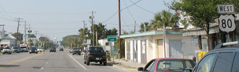
US 80 was among the original 1926 routes; at the time its east end was in Savannah. Then in 1928 the US 80 designation was extended about ten miles further east, to its current terminus: a little seaside community then known as Savannah Beach, but now more commonly referred to as Tybee Island. The east end of US 80 is not the easternmost point on the highway. That actually occurs about a mile north of the terminus, where US 80 reaches the Atlantic Ocean near the mouth of the Savannah River on Tybee Island. At that point, the highway takes a sharp turn and begins heading mostly south (but also slightly back west) along the shoreline, on Butler Avenue. This photo shows the last eastbound trailblazer:
|
Karners, Apr. 2014
|
|
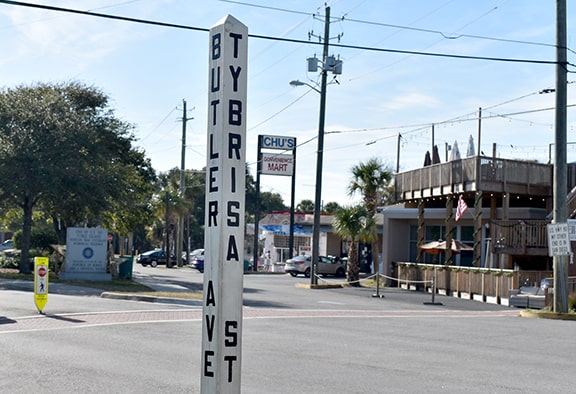
A little ways ahead is a five-way intersection with Inlet Avenue and Tybrisa Street (aka 16th Street) where the US 80 designation currently ends. This photo was looking south on Butler at the east end of US 80:
|
Taylor, 2001
|
|
Inlet goes off into the right background (behind the white truck). Between the red car and the Arby's sign was an "End" assembly, shown close-up here:
|

Taylor, 2001
|
|
Unfortunately, not long after that photo was taken, that assembly disappeared. But by 2007, it had been sort of replaced:
Field/Nitzman, May 2007
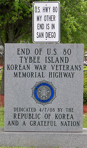
Of course it had actually been about 40 years since US 80 went all the way to San Diego, but it was still a good sentiment. By 2009 that one was gone, too, replaced with a monument, and just behind that was a newer version of the sign:
|
Karners, Apr. 2014
|
|
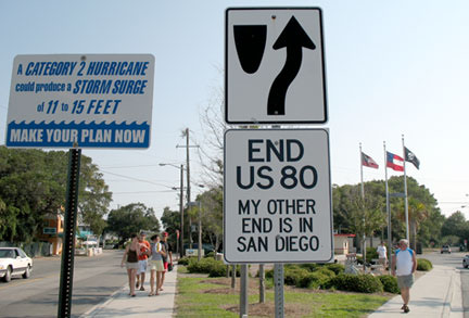
This next photo is a more recent overview of the intersection. In the left background the Korean War Veterans sign is visible, and at far right it can be seen that the San Diego sign has been moved to a new location:
|
|
|
Butler continues off the left edge of the photo as a local road for another quarter-mile or so... and until roughly 1985, the US 80 designation also continued further south, all the way to the point where Butler ends at 19th Street. This was shown on historical GDoT maps of Chatham County, and corroborated on USGS topo maps (an example is shown here):
|
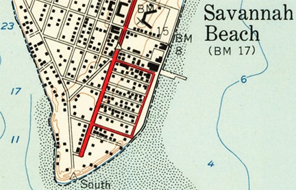
c. 1957, USGS
|
|
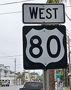
Heading the opposite direction on Butler, these photos show the first westbound US 80 sign:
|
Field/Nitzman, May 2007
|
Karners, Apr. 2014
|
The green sign ahead says "Historic Tybee Lighthouse Causeway". Way off on the horizon a white watertower is just visible. US 80 heads north and actually slightly east to about that point, before turning west towards the mainland.
As noted above, originally the west end of US 80 was in San Diego. This map showing the original extent of US 80 was included in a 1929 US Dept. of Agriculture Office of Information press release, issued shortly after the US routes were commissioned:
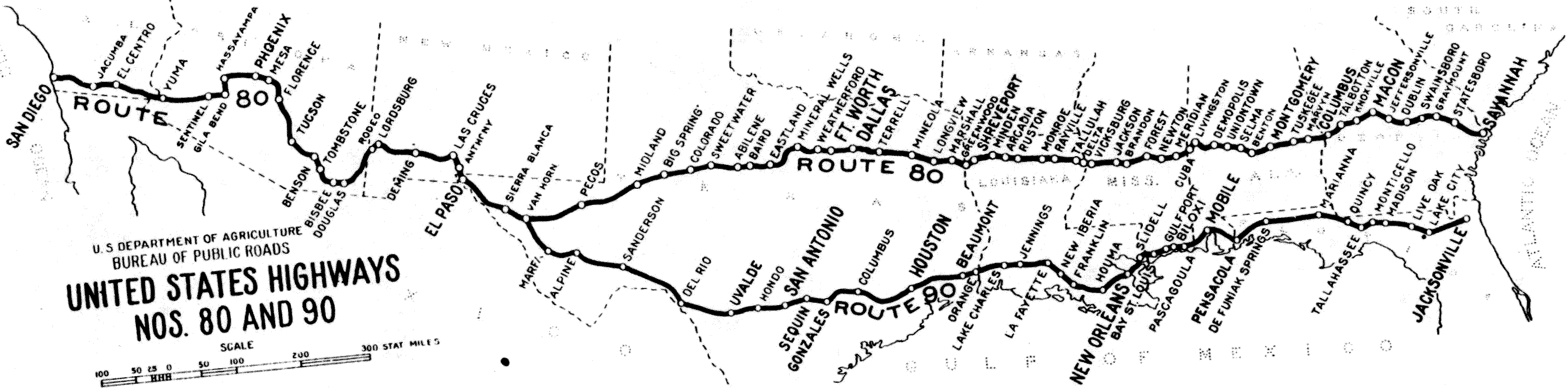
c. 1927, US Government Printing Office
|
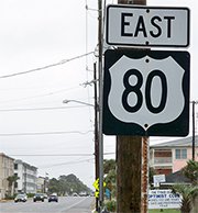
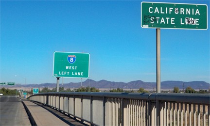
For about 40 years US 80 was a grand coast-to-coast route, over 2700 miles in length. But the end of the road's glory days came in about 1966, when the designation was eliminated in California. This photo is looking north on 4th Street in Yuma AZ (westbound Business I-8/historic US 80) at the CA state line. When CalTrans decommissioned US 80 in their state, this was where the route ended:
|
Karners, Dec. 2011
|
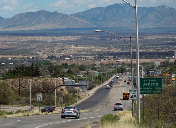
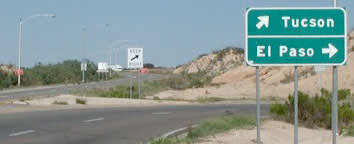
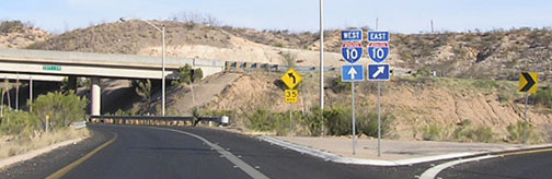
In Oct. 1977, AASHTO approved the removal of US 80 from most of Arizona as well; all that remained was the segment that came in from New Mexico down to Douglas and then back up to Benson. Here is where that segment began, at its exit from I-10:
|
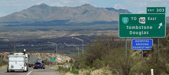
Sanderson, Mar. 2016
|
|
Visible in the distance are the Little Dragoon Mountains. Today old US 80 is designated AZ hwy. 80. The road veers slightly to the right, and as it straightens out for the final approach into Benson, the view has shifted such that the main Dragoon Mountains loom in the distance, on the far side of the San Pedro Valley:
|
Sanderson, Mar. 2016
|
|
For about a decade, that was the westernmost stretch of US 80. This shot shows the west end of 4th -- a driver's only option here is to veer right to a "Y" that serves east or west I-10 at interchange 303:
|
Hamilton
|
|
The road visible at far left once carried US 80, but now it serves as the offramp for eastbound I-10. Upon taking that curve to the right, the signage shown here comes into view, marking the point where US 80 ended for about 10 years:
|
Elbert, Apr. 2008
|
|
That segment of US 80 formed a 150-mile loop that connected to I-10 on both ends, so in 1989, Arizona and New Mexico had it reclassified as a state highway. Once that happened, there were no independent segments in either state, so US 80 was cut back to the NM/TX state line. Then in 1991, AASHTO approved Texas' request to decommission the stretch between Anthony (near El Paso) and its current terminus in Dallas (although reportedly it took until 1993 before all the signs were removed between those two points. And remarkably, one set of US 80 signs survived for another three decades). This photo shows the last westbound trailblazer:
|
Sanderson, Feb. 2021 (unchanged since at least 2012)
|
|
That is in Mesquite, approaching the Dallas city limits, about a half-mile before the route's terminus at its junction with I-30:
|
Karners, Jan. 2012
|
|
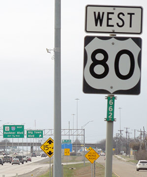
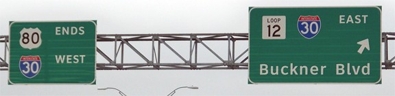
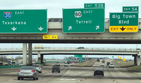
These shots were taken while approaching the west beginning of US 80 on I-30:
Field/Nitzman, Oct. 2003
|
Sanderson, Feb. 2021
|
|
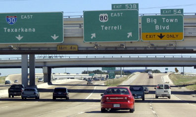
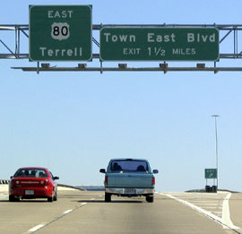
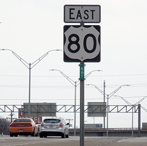
Obscured behind the second overpass is the first eastbound confirming sign, which is shown close-up here, as well as the first standalone trailblazer:
|
Field/Nitzman, Oct. 2003 (same as of 2021)
|
Sanderson, Feb. 2021
|
Research and/or photo credits: Chris Elbert; Andy Field; Alan Hamilton; Karin and Martin Karner; J.P. Nasiatka; Alex Nitzman; Mike Roberson; Dale Sanderson; Michael Summa; Brian Taylor
Page originally created 2001;
last updated Jan. 7, 2023.
last updated Jan. 7, 2023.
