End of US highway 90 |
 |
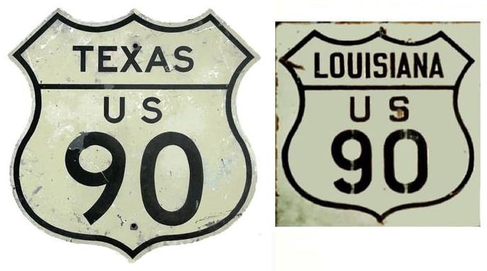
Summa
|
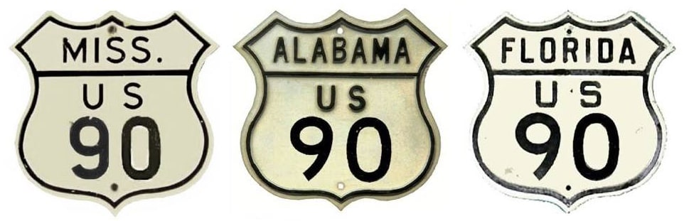
Summa
|
|
1926-1939
|
1939-1940
|
1940-1950
|
1950-present
|
|
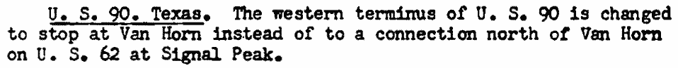
Mileage: in 1989 AASHTO listed a figure of 1850 miles for US 90... however, that included the mileage of US 90's associated business/bypass/alternate routes. According to the state subtotals on AASHTO's 1989 spreadsheet, mainline US 90's actual end-to-end total at the time was 1633 miles.
|
That is reasonably close to our own 2020 measurement, which yielded 1621.4 miles (reroutings and realignments likely explain the difference).
|
|
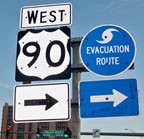
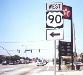
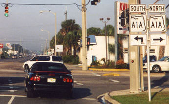
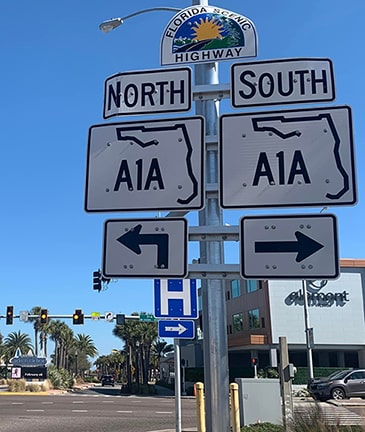
US 90 was among the original 1926 routes; at the time its east end was in Jacksonville. In 1950 the designation was extended to its current terminus at Jacksonville Beach. This photo shows the signage for the east beginning of US 90 from southbound FL A1A...
|
Karners, Dec. 2009
|
...and this shot was from the opposite direction:
|
Allen, 2000
|
|
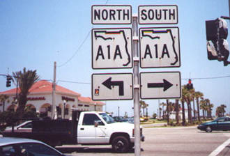
Those were taken from Third Street, at Beach Boulevard. For drivers approaching this intersection from the right on Beach (which is not a designated highway), there are signs for A1A but not for US 90 (which begins straight ahead):
|
Sanderson, Oct. 2003
|
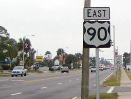
However, the first confirming marker is just visible in the distance; it is shown close-up here:
|
Sanderson, Oct. 2003
|
|
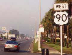
Heading the opposite direction, the last eastbound marker was on Beach, several blocks before the terminus:
Bryant, Dec. 2005 (unchanged as of 2009)
|
Ahead, there was no "End" sign for US 90, but these photos show the signage that does exist at the terminus at Third:
Allen, 2000
Straight ahead about two more blocks is the Atlantic Ocean.
|
Converse, Jan. 2022
|
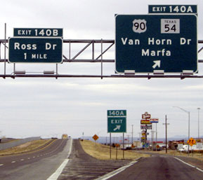
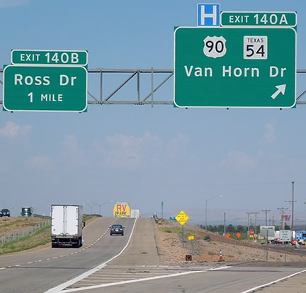
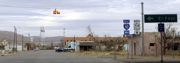
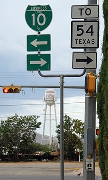
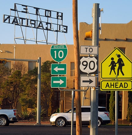
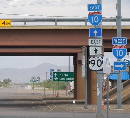
The west end of US 90 has always been at Van Horn TX (except for a one-year extension; details follow). Of course there was not always an Interstate 10 running through Van Horn, so the historic endpoint of US 90 was at its intersection with US 80. That route is no longer in commission west of Dallas, but historically it ran through Van Horn on its way to El Paso and San Diego. In Van Horn that road is known as Broadway, and today it is signed as Business Loop I-10 through town. I-10 parallels Broadway, running about four blocks to the south. Modern signage leaves some doubt as to whether the US 90 designation still ends at Broadway, or whether it now ends at I-10. We will start with these photos, which were taken from westbound I-10 at Van Horn's central interchange. The sign assembly at the end of the offramp indicates US 90 begins to the south on Van Horn Drive, whereas to the north is TX 54:
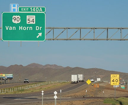
Sanderson, Jul. 2022
|
Sanderson, Jul. 2022
|
|
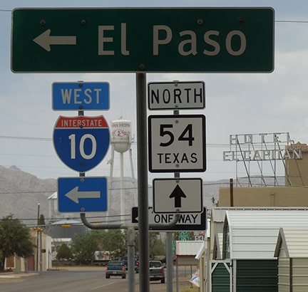
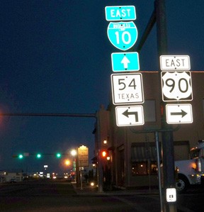
These photos were taken heading the opposite direction on I-10:
Nitzman, Jan. 2006
|
Sanderson, Jul. 2022
|
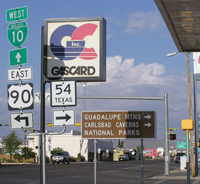
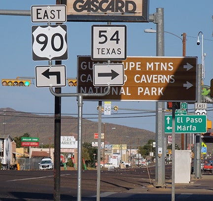
That matches the TXDoT definition for TX 54, which was officially extended to I-10 in 1976. However, I have not seen a minute order truncating US 90 to I-10, and most TXDoT info shows that US 90 still technically extends to the north for a few blocks, concurrent with TX 54:
|
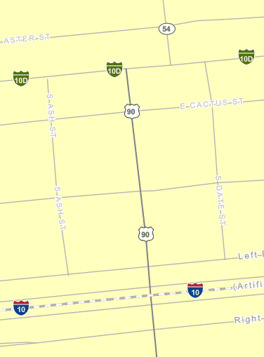
TXDoT data viewer, accessed Mar. 2019
|

|
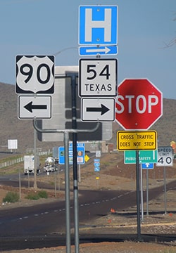
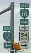
Next we will approach this intersection by heading north on Van Horn Drive. No "End US 90" sign was posted at the interstate...
|
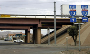
Nitzman, Jan. 2006
|
Sanderson, Jul. 2022
|
|
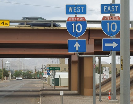
...but neither were there any more references to US 90 at all, so there was not much in the way of interesting signage at the end of US 90's 1600-mile journey across the country:
Nitzman, Jan. 2006
|
Sanderson, Jul. 2022
|
Sanderson, Jul. 2022
|
Nitzman, Jan. 2006
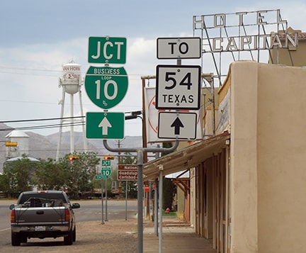
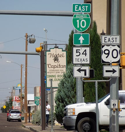
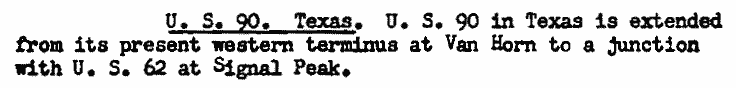
Despite the lack of references to US 90, if we continue another block or two ahead to Broadway, we reach what I believe is still the official west end of US 90, at the junction with historic US 80 (now Business 10):
|
Sanderson, Jul. 2022
|
Drivers wanting TX 54 turn right there, and then must make an almost immediate left turn on La Caverna Street. There is no signage marking that left turn (and there is hardly enough space), but if we back up just a bit, there is a sign on eastbound Broadway just before Van Horn:
|
Karners, Dec. 2011
|
Sanderson, Jul. 2022
|
That is the first of a few signs indicating that US 90 actually begins at Business 10 (not I-10). We will see more of those below, but first, a diversion: for a very brief timeframe starting in 1939, the US 90 designation was extended to the left (north along TX 54) to a terminus at US 62 near Guadalupe Pass:
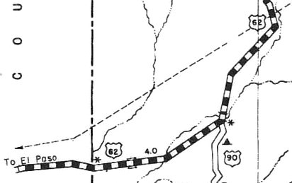
c. 1940, TXDoT
|
|
That map shows US 90 as an "unimproved road". This photo was taken looking east at that junction...
|
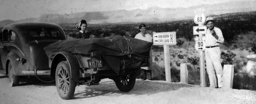
unknown attribution, from aaroads.com
|
|
...which was about a mile south of the modern junction of US 62-180 and TX 54. At the time, US 62 came from the west on a road that has long since been vacated and sold into private ownership (US 180 was not extended through this area until 1944). At today's TX 54, US 62 veered to the north:
|
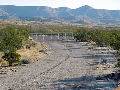
Sanderson, Apr. 2014
|
|
Some of the same mountains are visible in both of those photos. Pavement on the old road has held up pretty well, but while evidence of the centerline stripe is still visible, it is fading fast. That was the north arm of the old wye-junction; off to the right of that photo was the south arm, which led to what is now southbound TX 54, but was once the west beginning of US 90. However, according to official records that designation was truncated back to Van Horn less than a year later. Here is a shot from the modern junction:
|

Elbert, Mar. 2006
|
Today that is the north end of TX 54. About five miles ahead is the entrance to Guadalupe Mountains National Park (which preserves several interesting geological features, including Guadalupe Peak: at 8749 feet, the highest point in Texas. The mountain visible in the distance is El Capitan, which is a shoulder of Guadalupe). For a very brief time eastbound US 90 ended about a mile behind the camera. Historic AASHO documentation suggests the reason Texas extended US 90 to that point was because they ultimately wanted to extend US 90 further west (all the way to California!), beginning with an overlap on US 62 to El Paso. But when AASHO rejected that idea, it appears Texas did not want US 90 ending with a northbound trajectory, so they truncated it back to Van Horn the very next year:
AASHO meeting minutes, 1939
AASHO meeting minutes, 1940
|
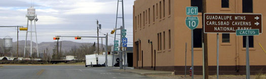
...although remarkably, in 1968 Texas asked AASHO for permission to extend US 90 back up to that same junction (the request was denied). Anyway, back to Van Horn: in these next photos, we are looking south on La Caverna (TX 54), where it reaches Broadway (Bus. I-10):

Karners, Dec. 2011
|
Sanderson, Jul. 2022
|
|
In 1976 the TX 54 designation was extended to the right (and then left to I-10), but signage at that junction refers to that movement only as "TO US 90". Same thing heading west on Broadway:
|
Elbert, Mar. 2006 (unchanged as of Dec. 2011)
|
Sanderson, Jul. 2022
|
To the right on La Caverna is northbound TX 54. Since 1976 that route technically also continues ahead, making a left turn in a half-block (onto Van Horn Drive). Historically that left turn marked the west beginning of US 90...
attribution unknown; from an old postcard
|
...and it is still signed that way. Based on that, and on the other evidence presented above, I suspect US 90 still technically begins there (rather than a few blocks to the left, at I-10):
Hamilton, 2002 (unchanged as of Dec. 2011)
|
Sanderson, Jul. 2022
|
|
Drivers who take that left turn onto Van Horn soon come to the I-10 interchange:
Nitzman, Jan. 2006 (unchanged as of Dec. 2011)
|
Sanderson, Jul. 2022
|
|
The signage on the other side of the overpasses should prompt drivers to check their fuel gauge before leaving town...
Nitzman, Jan. 2006
|
Sanderson, Jul. 2022
|
|
...and lastly here is a photo of the first eastbound trailblazer. These westernmost miles of US 90 are in a starkly dry region -- quite a contrast to the climate at the east end of the route:
|
Sanderson, Jul. 2022
|
Research and/or photo credits: James Allen; Cullan Bryant; Eric Bryant; Jeff Converse; Nathan Edgars; Chris Elbert; Alan Hamilton; Karin and Martin Karner; Alex Nitzman; Mike Roberson; Dale Sanderson; Michael Summa
Page originally created 2000;
last updated Aug. 3, 2022.
last updated Aug. 3, 2022.
