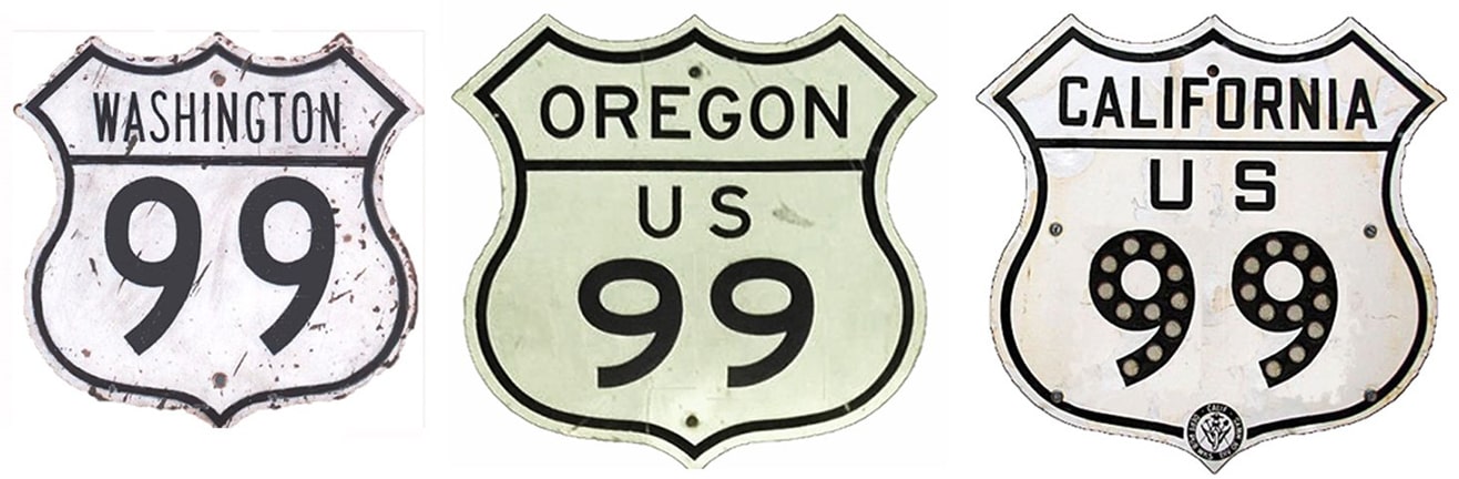
End of historic US highway 99 |
 |
|
1926-1932
|
1932-1963
|
1963-1965
|
1965-1969
|
1969-1971
|
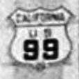
Summa
|
|
From an official standpoint Route 99 fits into the same category as Route 66: it does not exist anymore. Historically US 99 was one of the country's main north-south highways, serving several of the major cities in California, Oregon, and Washington. This map showing the original extent of US 99 was included in a 1928 US Dept. of Agriculture Office of Information press release, issued shortly after the US routes were commissioned:
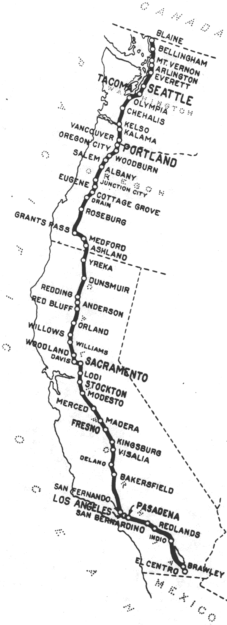
c. 1927, US Government Printing Office
|
|
|
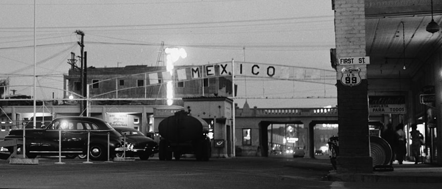
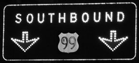
However, US 80 traffic did not use Adams to the east (right). Instead, westbound US 80 came in from the right on Main Street (a couple blocks behind the camera), then north on Imperial to this point, and then continued via Adams to the left. For a brief time, US 99 began straight ahead, on what is now designated CA hwy. 86. This next photo shows historic signage that was once posted in that same location:
|
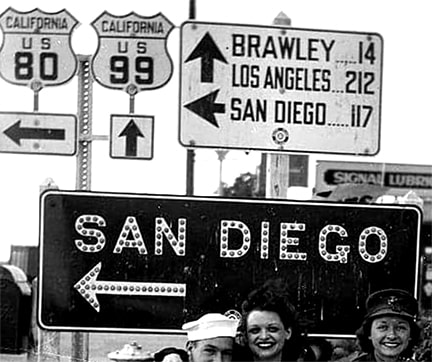
c. 1945 (attribution unknown)
|
|
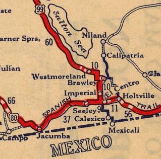
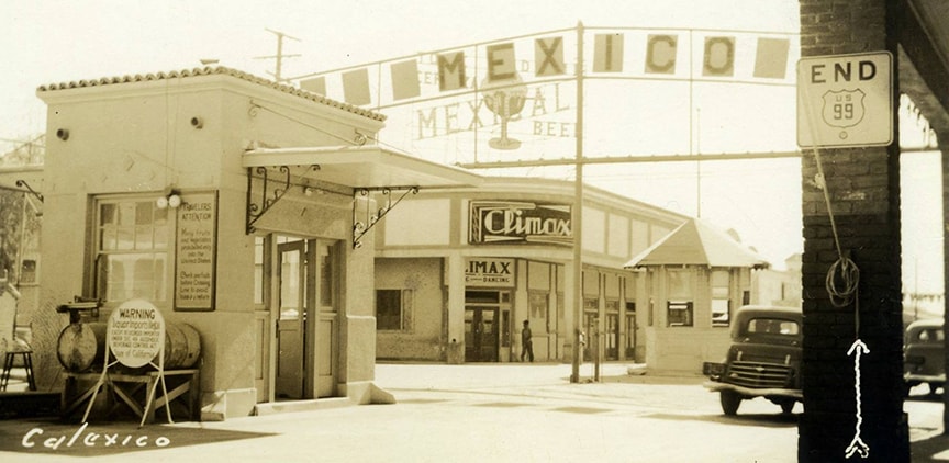
The south end of US 99 was extended to the international border at Calexico in 1932, so at the time of that photo El Centro was no longer the south beginning of US 99. This map was roughly contemporary with the photo:
|
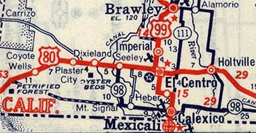
c. 1939, Rand McNally
|
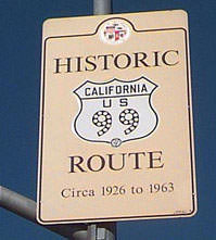
US 99 essentially followed what is now CA hwy. 111 southward into Calexico... but just shy of the modern border crossing, US 99 went east on 3rd Street. That is no longer permitted, so the Historic US 99 signage shown here has been posted on 2nd for several years now:
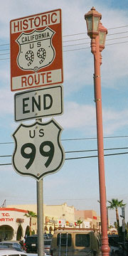
Salek, Jan. 2006
|
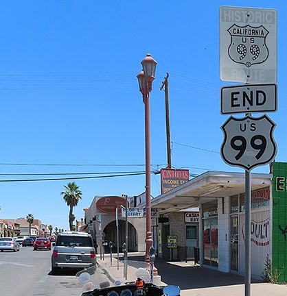
Friedman, May 2020
|
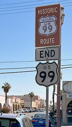
Sanderson, Oct. 2023
|
|
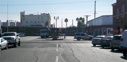
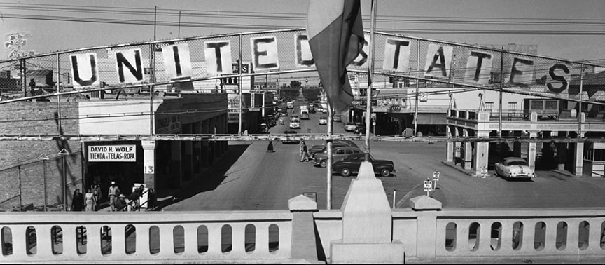
The placement of that particular "End" assembly is a bit odd, but it was decided that the "End" assembly should be placed in a highly-visible location. There are another two "Historic 99" signs ahead on 2nd (here and here), because US 99 actually continued ahead another three blocks, and upon reaching Heffernan Avenue, traffic was directed south for two more blocks, ending at the historic border crossing:
|
Karners, Dec. 2011
|
|
Not much to look at today, as that crossing has since been closed in favor of the modern port of entry, just to the west (right). But some great historical images have been digitized; these first ones were taken looking that same direction. Not only was there a trailblazer posted within one block of the US 99's endpoint...
|
c. 1950, Los Angeles Times (linked to source)
|
|
...but just a little further ahead was an "End" sign:
|
c. late 1940s, Michael Semas Collection
|
|
Facing the opposite direction (north on Heffernan), this was a view of the south beginning of US 99:
|
c. 1950, Los Angeles Times (linked to source)
|
|
On the right side of that photo, two US 99 shields are visible, enlarged here:
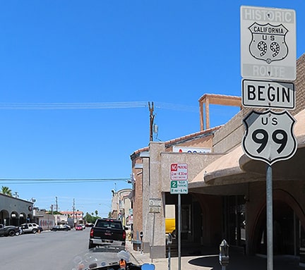
That second one was located just past 1st Street, in the same place where the retro "Begin" assembly is posted today:
|

Salek, Jan. 2006
|
Friedman, May 2020
|
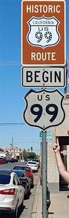
Ballard, Mar. 2021
|
That was heading north on Heffernan from the old crossing. Nice signs, but unfortunately there were no further signs directing US 99 pilgrims.
In 1963, the south end of US 99 was temporarily truncated to Los Angeles, because I-10 had been completed east of there, and south of Indio US 99 was redesignated as CA 86.
|
|
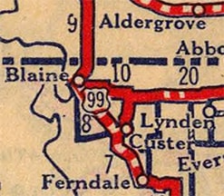
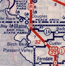
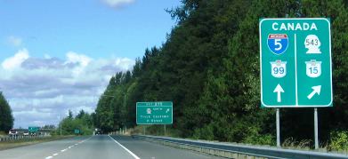
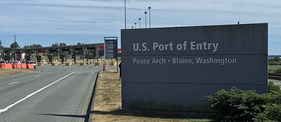
We begin with a photo from northbound I-5 approaching Blaine. The upcoming exit (to WA hwy. 543, which heads due north to connect with British Columbia highway 15) leads to what is known as "Truck Customs". Commercial traffic cannot use the I-5/B.C. 99 ("Peace Arch") border crossing:
|
Field/Nitzman, Aug. 2006
|
|
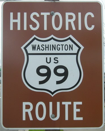
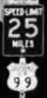
Historically, today's WA 543 carried US 99 traffic in Blaine. This shot was looking north on WA 543, approaching the end of old US 99:
|
Jensen, 2001
|
|
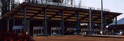
Ahead at customs one would see the sign shown here (or, more accurately, a similar sign in the same location), at the original terminus on the Canada border:
|
Jensen, 2001
|
|
This next photo was looking the other direction, and it shows the north beginning of WA 543 (which was the north beginning of original US 99) from Canada:
|
Jensen, 2001
|
|
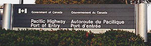
The Peace Arch border crossing was opened in the 1940s, and at some point the US 99 designation was routed onto the new road leading to it (which is now I-5). Heading south from Canada, drivers who look closely at the Peace Arch might notice the inscription shown here:
|

Field/Nitzman, Aug. 2006
|
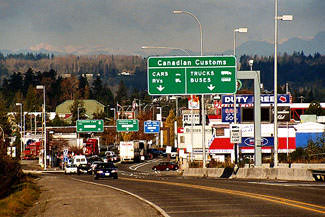
These photos were taken heading south from the Arch, approaching the north beginning of I-5 (and the former north beginning of US 99) at US Customs...
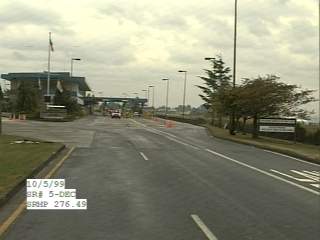
c. 1999, WSDoT SRWeb
|
Sanderson, Jul. 2021
|
...and these shots show northbound I-5 at the Canada border; the obelisk shown in this first photo is one of several in the area marking the international boundary:
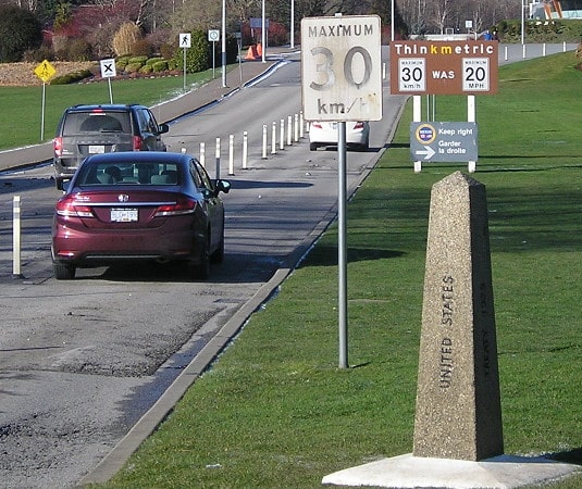
Morrison, Feb. 2019
|
Sanderson, Jul. 2021
|
|
That was the northern terminus of US 99 at the time of its decommissioning. Ironically, one of the last remaining reminders of US 99's existence is in Canada: straight ahead is British Columbia hwy. 99. The Peace Arch, for which this border crossing is named, is visible on the left side of the preceding photo, and here is a side-view:
|

Bozanich, Oct. 2001
|
As of 2003, that marker had been temporarily removed -- or perhaps permanently -- for political reasons.
|
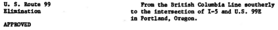
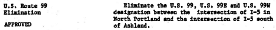
In 1963, US 99 was temporarily truncated to Los Angeles, before the remainder of the US 99 designation in California was decommissioned in 1965. Washington was the next state to eliminate US 99; below is the agenda item from AASHO's June 1969 meeting minutes:
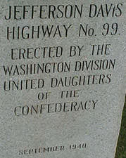
That left only an orphaned segment of US 99 in Oregon, and that was formally decommissioned in Dec. 1971:
|
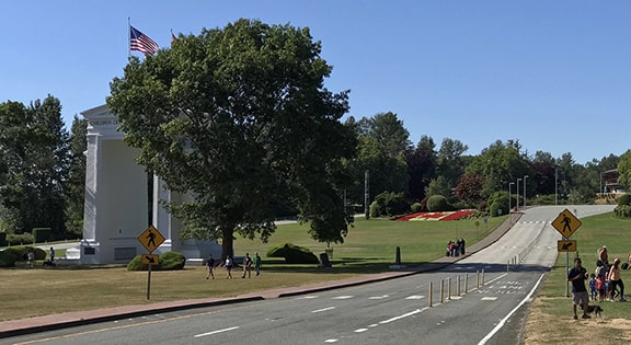
Even though US 99 has been gone for decades, there are still a few relics posted on the road. One was in Seattle, at 1st Avenue and Columbia Street, above the onramp to the Alaskan Way Viaduct; this lasted until 2019:
|
Charpy
|
Research and/or photo credits: Michael Ballard; Mark Bozanich; "Charpy"; Tom Fearer; Andy Field; Jeff Jensen; Karin and Martin Karner; Jeff Morrison; Alex Nitzman; Matt Salek; Dale Sanderson; Michael Semas; Michael Summa; Mike Wiley
Page originally created 1999;
last updated Oct. 24, 2023.
last updated Oct. 24, 2023.
