End of US highway 38 |
 |
Summa
|
1926-1931
|
|
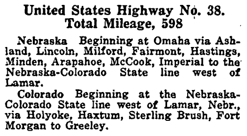
US 38 was among the original US routes commissioned in Nov. 1926. This description of the route is from AASHO's Apr. 1927 route log:
US 38 was actually signposted in Nebraska in June 1926, a few months before AASHO officially approved it later that November:
|
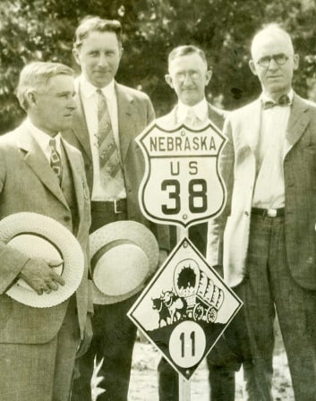
Dedication of the first uniform highway markers in Nebraska, Jun. 1926, NDoR
|
|
This map shows the easternmost mileage of the short-lived US 38:
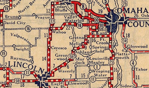
c. 1927, Rand McNally
|
This photo was taken looking to the north on 27th Street in Lincoln NE, approaching the intersection with "O" Street:
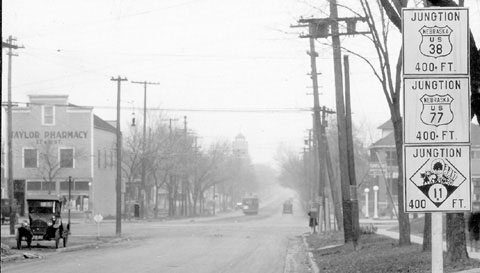
c. 1927, NDoR
|
US 38 continued north and east of Lincoln; it ended in Omaha, as shown on these maps, which agree that US 38 came in from the west on Center Street, then turned north on 36th Street...
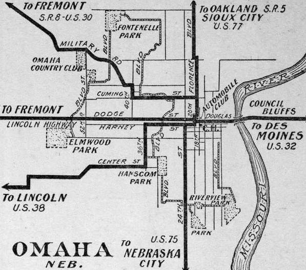
c. 1927, National Map Co.
|

c. 1931, Clason
|
...but beyond that the details differ (and maybe the routings actually did change between 1927 and 1931). But we can be certain that US 38 did not end on 36th at its junction with US 30. The routings shown on the 1931 map seem to have been quite accurate, based on multiple historic photos in the Durham Museum archive dated 1928-1930 which show US route signs at the intersections of both 24th/Farnam and 18th/Douglas. None of them are crystal clear, but they are legible, and following are the best examples I have found:
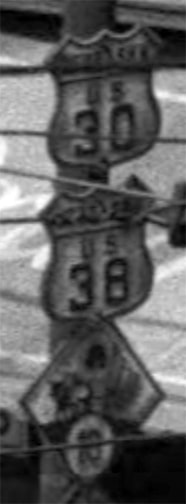
c. Jul. 1928 (linked to source)
|
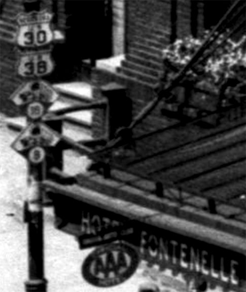
c. Apr. 1929 (linked to source)
|
Based on those maps and photos, I suspect US 38 ended on Douglas at 18th. Given the timeframe, it would have been typical for the US 38 designation to be signposted to a point at or near the courthouse. This was located on 18th and Farnam, but I have not found any photos from that intersection that show US 38 signs. However, we do know from the above that US 38 was signed to at least 18th/Douglas, and since that was a highway junction, it seems quite likely that intersection would have marked the terminus of US 38.
Today US 30 does not serve Omaha. US 6 does, but traffic is not routed along Farnam (and not much of Douglas, either). Today Dodge Street is Omaha's east-west "Main Street" all the way through the city (and the maps above illustrate how highway traffic eventually jogged up to Dodge even back then). US 38 apparently followed Center west to 132nd Street, then south to Millard. It probably used today's Millard Avenue to get to Q Street, which it then followed west -- probably to 204th, and then south to the town of Gretna.
From there, US 38 continued west essentially along what is now US 6: through Lincoln, Hastings, Holdredge, and McCook. Then into Colorado, serving Holyoke and Sterling (which explains the seemingly-misnumbered US 138). From Sterling, US 38 continued along the South Platte River, through Brush and Ft. Morgan. At Wiggins, instead of following the "Denver Cutoff", US 38 traffic was directed to continue alongside the Platte to Greeley, on the road that is now US 34.
From there, US 38 continued west essentially along what is now US 6: through Lincoln, Hastings, Holdredge, and McCook. Then into Colorado, serving Holyoke and Sterling (which explains the seemingly-misnumbered US 138). From Sterling, US 38 continued along the South Platte River, through Brush and Ft. Morgan. At Wiggins, instead of following the "Denver Cutoff", US 38 traffic was directed to continue alongside the Platte to Greeley, on the road that is now US 34.
Research and/or photo credits: Dan Drackley; Dale Sanderson; Michael Summa
Page originally created 2000;
last updated Sep. 10, 2023.
last updated Sep. 10, 2023.
