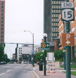
End of US highway 15 |
 |
Summa
|
Summa
|
|
1926-1927
|
1927-1934
|
1934-1935
|
|
1935-1950, 1951-1974
|
1950-1951
|
1974-present
|
Mileage: in 1989 AASHTO listed a figure of 854 miles for US 15... however, that included the mileage of US 15's associated business/bypass/alternate routes. According to the state subtotals on AASHTO's 1989 spreadsheet, mainline US 15's actual end-to-end total at the time was 794 miles. That closely matches our own 2020 measurement, which yielded 793.4 miles. Historically, when it went to Rochester, US 15 was 881.5 miles long.
|
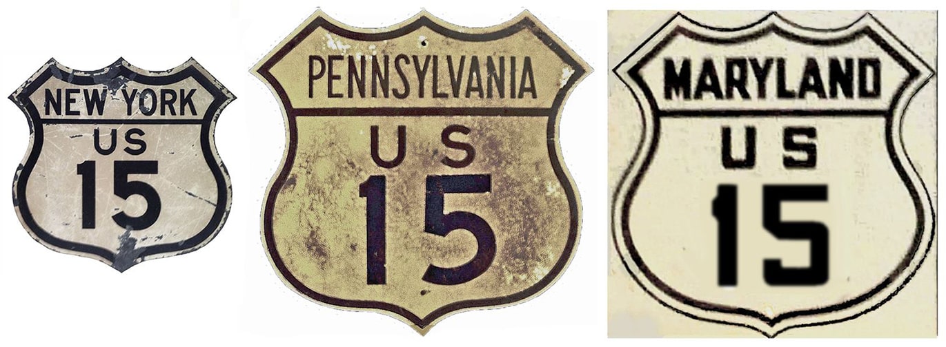
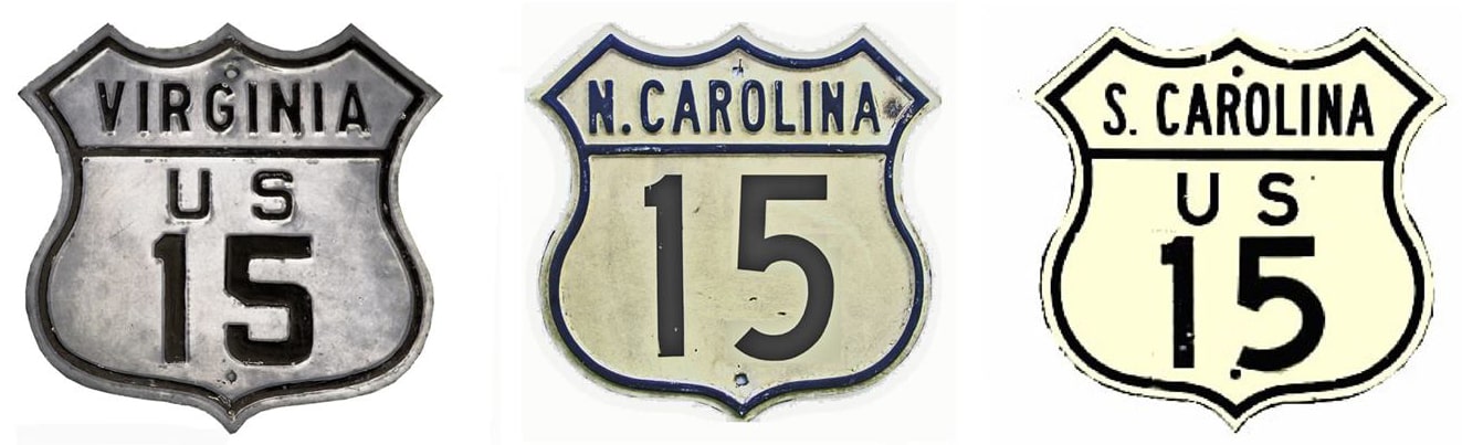
US 15 was an original 1926 route, commissioned to run between Rockingham and Harrisburg. In 1934 US 15 was rerouted such that the south end extended to Walterboro (more info on those pages). In 1935 the north end of US 15 was approved to Rochester. In Pennsylvania that extension replaced the northernmost section of US 111; New York may not have signposted their segment until 1939:
|
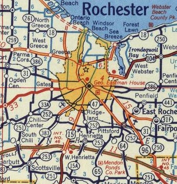
c. 1956, Gousha
|
|
The old road is still drivable (the northern segment is now signed NY hwy. 15), but it is no longer heavily used, thanks to I-390 and the Southern Tier Expressway (I-86/NY 17). This photo was taken heading south on South Avenue at Court Street:
|

Wiley, 2000
|
Nitzman, Jan. 2017
|
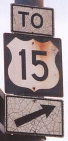
|
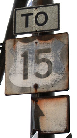
Note the old US 15 sign: a relic from the past. That entire sign bridge shown there was gone as of 2008, as was another old US 15 sign posted about a block further south, shown here:
|
Nitzman, 2000
|
Nitzman, 2000
|
|
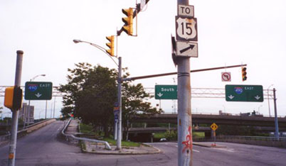
Those shots were taken from what was historically the north beginning of US 15. Since that road is one-way southbound, the historic north end was about a block away. This photo shows that spot, on Clinton Avenue at Woodbury Boulevard (or NY hwy. 31), just north of I-490:
|
Nitzman, 2000
|
|
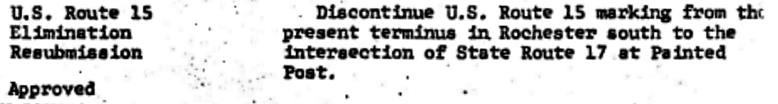
US 15 ended there until 1974, when its north end was truncated to its present terminus. Here is that agenda item from the minutes of AASHTO's meeting in June of that year:
|
|
|
Travel between Painted Post and Rochester would soon be accomplished via I-390 and the Southern Tier Expwy, which was already complete in the Corning area by the time the US 15 designation was truncated. So US 15 never ended at the historic junction of Hamilton and High Streets in Painted Post. Rather, it ended at an interesting interchange with NY 17:
|
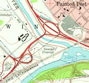
c. 1976, USGS
|
|
These photos were taken just west of Corning, heading east on the Southern Tier Expressway. Note the changes to route designations that have taken place:
|
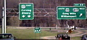
Nitzman, 1994
|
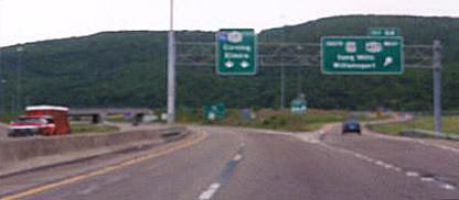
Nitzman, 2000
|
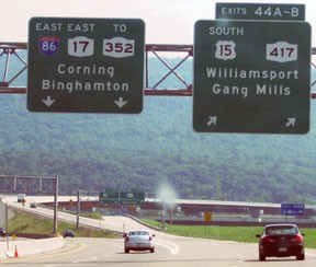
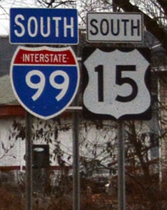
In 1994 there was just US 15, NY 17, and 417. The 2000 photo showed that the I-86 designation had been added to the NY 17 corridor. A few years later, construction was underway to replace this diamond interchange with a tri-level stack interchange, in order to accommodate a new limited-access freeway for US 15 traffic (which would later become an extension of I-99). These photos show the temporary signage there, as well as the replacement sign bridge:
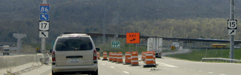
Nitzman, May 2005
|
Bender, July 2010
|
|
By 2010 the panel included a NY 352 sign, and the control point "Elmira" was changed to "Binghamton". An I-99 shield was added to these overhead signs in about 2014, but initially those replaced the US 15 shields, which were not added back until about 2016. Here is a more current photo of the same sign bridge:
|
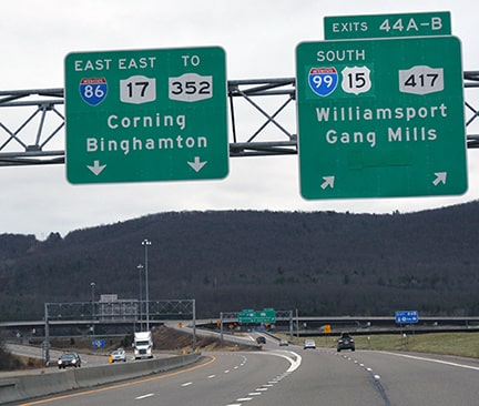
Nitzman, Jan. 2017
|
|
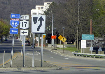
This next series of shots shows signage heading the opposite direction on NY 17, before and after I-86 and I-99 had been designated:
|
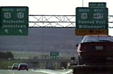
Nitzman, 1994
|

Nitzman, July 2005
|
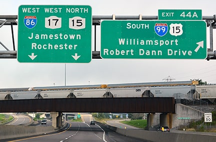
Nitzman, Aug. 2021
|
|
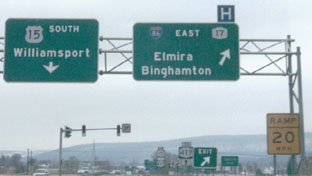
After taking that exit, these photos show the first southbound sign over the years:
|
Nitzman, Aug. 2021
|
|
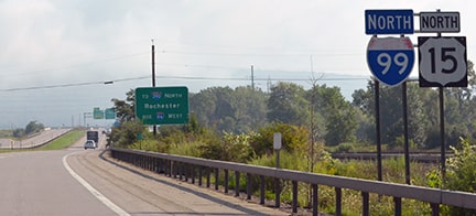
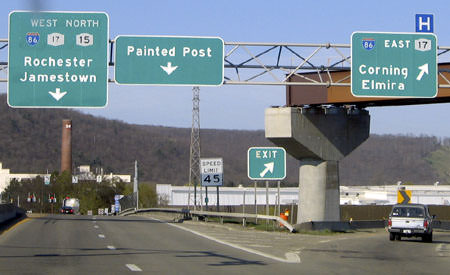
These next shots were taken while approaching the north end of US 15, at its interchange with I-86. This is the last northbound US 15 sign:
|
Nitzman, Aug. 2021
|
|
For a time, an "End" sign was posted just prior to the point where US 15 merges with westbound I-86...
|
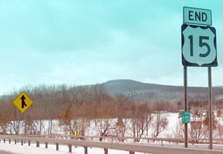
Osbaldeston, Mar. 2010
|
|
...but unfortunately that has since been removed, and now instead there are twin "End I-99" assemblies near that location. They are visible in the background of this photo:
|

Nitzman, Aug. 2021
|
|
That is the north end of US 15. Prior to the completion of the modern interchange, the north terminus looked like this:
|
Nitzman, May 2005
|
|
At the time, the flyover ramps were under construction, and the true end of US 15 was technically at the stoplight ahead; here is a shot from there:
|
Nitzman, May 2005
|
The road straight ahead used to be US 15, back when the designation continued up to Rochester. Now that the interchange with I-86 has been reconfigured, US 15 traffic can no longer get to that intersection (at least not directly).
|
This was the beginning of US 15 as seen from the opposite direction (on Hamilton Street, heading south out of Painted Post), but now traffic coming from this direction no longer has direct access to US 15:
|
Kerr, Mar. 2001
|
Research and/or photo credits: Jesse Bender; George Bourey; Doug Kerr; Alex Nitzman; Greg Osbaldeston; Dale Sanderson; Michael Summa; Mike Wiley
Page originally created 2000;
last updated Dec. 29, 2023.
last updated Dec. 29, 2023.
