Current and historic US highway endpoints in Apalachicola, FL
|
1933-present
|
 |
|
In 1933, Florida managed to get two new intra-state US routes approved, both of them terminating in Apalachicola. From that city, US 98 went west, ending in Pensacola. US 319 went the opposite direction, gradually curving to the north, ending in Tallahassee (the US 19 designation had been extended south from Tallahassee in 1930, so it made sense to number the road to Apalachicola as a branch of US 19). Initially US 319 included a ferry segment between Apalachicola and Eastpoint:
|
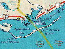
c. 1935, Gousha
|
|
However, since the original Gorrie Bridge opened in 1935, it certainly was at least in the planning stage (if not already under construction) when these two US routes were commissioned... making it likely that the new bridge was one of the primary factors prompting Florida to seek a US route designation to Apalachicola.
|
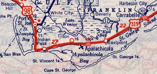
c. 1939, Rand McNally
|
|
So why wasn't the entire corridor (Tallahassee-Pensacola) simply given a single US route number (rather than two different designations sharing a common terminus in Apalachicola)? Possibly because of the signed direction of travel. Obviously US 98 between Pensacola and Apalachicola is east-west. But, even though one could argue that US 319 between Apalachicola and today's US 98-319 junction east of Carrabelle could also be signed east-west, US 319 from that junction up to Tallahassee has a strong north-south bearing.
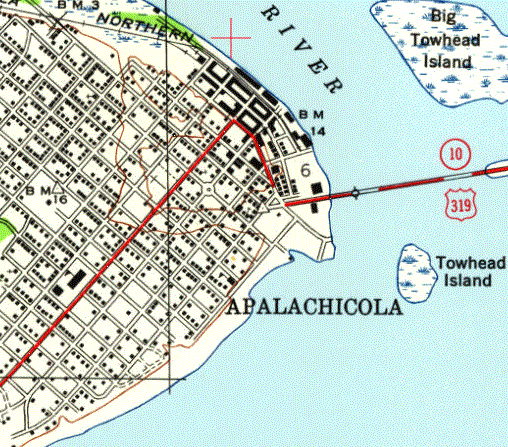
So when US 98 and US 319 both ended in Apalachicola, where exactly did they terminate? The earliest map I have seen is this 1940s topo, shown here alternating with a modern basemap, in order to compare the alignment of the original bridge to the modern bridge approach: |
|
|
It is not clear where the original transition point between US 98 and US 319 was located, but one possibility is the Franklin County courthouse on Market Street.
In 1952, the US 98 designation was extended east and south to its current terminus in Palm Beach. To get there, it overlapped US 319 for over 30 miles to the east, so a case could be made that US 319 should have been truncated to the junction where it separates from US 98 (between Carrabelle and Sopchoppy).
In 1988 the current bridge opened; heading westbound the final approach into Apalachicola is along a slightly different alignment than the original bridge. This photo (taken a few years later) shows both alignments, although the first bridge (on the left) was in the process of being dismantled: |
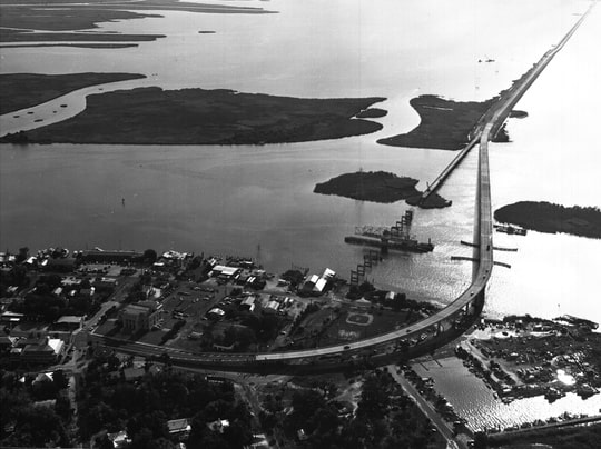
c. 1991, Florida State Archives (linked to source)
|
|
The point where the two alignments diverge is about a mile east of town, on a small unnamed island just south of Big Towhead Island... and that point of divergence is exactly where an "End" assembly is posted for US 319:
|
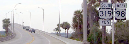
Cozart, Dec. 2003
|
|
The original bridge went straight ahead, but that sign is posted right where the current bridge makes a slight curve to the left. That is an absurd location for a highway designation to end... and in fact I suspect Florida did not intentionally place the terminus there. Around this time FDoT appears to have been reasonably meticulous about asking AASHTO for permission to make changes to any of its US routes, submitting applications for other projects in both 1986 and 1988. But I do not see where they have ever sought approval to move the terminus of US 319 away from its former location in Apalachicola. And why would they? As I said, it makes no sense whatsoever to have US 319 ride along with US 98 for 30 miles, only to have it terminate at a nondescript location at the foot of a bridge.
So how did an "End" sign get placed there? I wonder if, when the bridge was under construction, someone working on the project misinterpreted a work instruction and thought that US 98 was the only highway carried by the new bridge, so they put up an "End" sign right there at the project limits: |
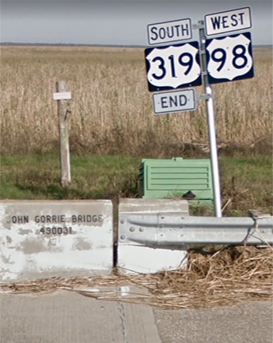
Nov. 2018, Google Maps Street View
|
|
Both in that photo and in this next one, it can be plainly seen that the assembly is posted exactly where the asphalt of the original alignment meets the concrete of the new bridge alignment:
|
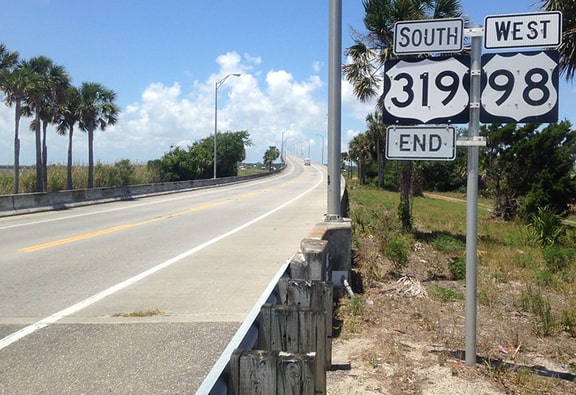
Fearer, May 2017
|
|
Directly across the road is a "Begin" sign for traffic heading the opposite direction:
|

Cozart, Dec. 2003
|
Eastpoint is about four miles ahead (within about one year, the vegetation shown in those photos was severely reduced, thanks to Hurricane Ivan).
|
Research and/or photo credits: Justin Cozart; Tom Fearer; Larry McDonald; Dale Sanderson
Page originally created 1999;
last updated Jan. 4, 2020.
last updated Jan. 4, 2020.
