End of US highway 165 |
 |
|
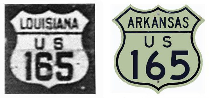
1926-1938
|
1938-1981
|
1981-present
|
Summa
|
Mileage: in 1989 AASHTO listed a figure of 430 miles for US 165... however, that included the mileage of US 165's associated business routes. According to the state subtotals on AASHTO's 1989 spreadsheet, mainline US 165's actual end-to-end total at the time was 412 miles. Our own 2020 measurement yielded 403 miles (reroutings and realignments likely explain the difference).
|
|
US 165 has been around since the beginning in 1926. Its south end has always been in the town of Iowa, Louisiana, although originally traffic came in from the north along Thompson Avenue (which is now LA hwy. 383). As shown on this map, after passing through Iowa, US 165 ended at its junction with US 90:
|

Karners, Jan. 2015
|
|
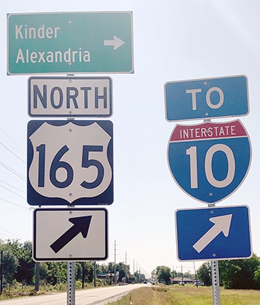
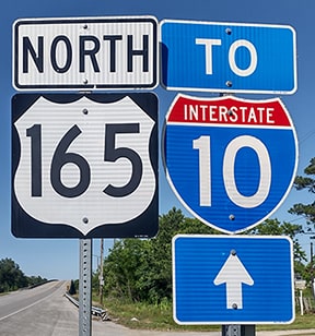
The current US 165 roadway was built in 1937; the last southbound marker is just past I-10 and LA 3258:
|
Karners, Jan. 2015
|
|
The junction with US 90 is just east of town. No "End" sign was posted there:
|
Allen, 2000
|
Karners, Dec. 2009 (unchanged as of 2015)
|
Turner, Apr. 2023
|
|
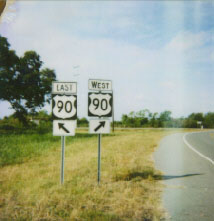
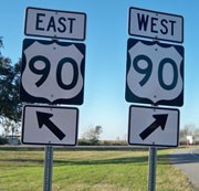
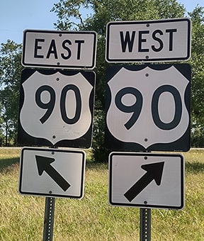
US 165 ends at a "Y" intersection with US 90, which is just visible running across the background of those last photos. The interchange with I-10 is about a mile behind the camera. These shots show the signs on US 90 at the south beginning of US 165 (from both eastbound and westbound, respectively):
|
Karners, Jan. 2015
|
Allen, 2000
|
Karners, Jan. 2015
|
Turner, Apr. 2023
|
|
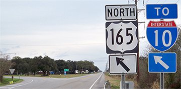
For drivers who make that turn to the north, formerly the first confirming assembly looked like this...
|
Karners, Dec. 2009
|
...but that was posted on the east branch of the "Y", so traffic coming from eastbound US 90 (and therefore using the west branch of the "Y") never saw that sign.
|
|
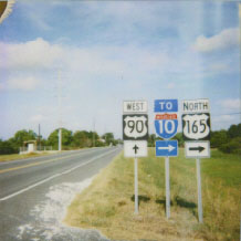
The next reference to US 165 was about a mile ahead, just shy of the I-10 interchange...
|
Karners, Jan. 2015
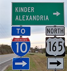
...but by 2023 another assembly had been installed closer to the terminus:
|
Turner, Apr. 2023
|
|
Originally the north end of US 165 was at its junction with US 65 in McGehee, although today's US 65 across the north and east edges of town had not yet been built. Instead, US 65 went through the business district on 1st Street, and then left town via what is now AR hwy. 4, or Crooked Bayou Drive:
|
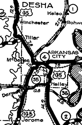
c. 1930, AHTD
|
|
This next photo was looking north on what is now Owl Street where it ends at Crooked Bayou. Today US 65 runs just to the west (left) of Owl. But at the time of this photo, US 65 ran along Crooked Bayou, so this photo showed the perspective of a driver at the north end of US 165:
|
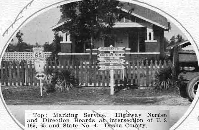
from the 1929-1930 Biennial Report of the State Highway Commission
|
|
That lasted until 1938, when modern US 65 was built. That partially followed what had been US 165, so the US 165 designation was truncated to a junction about four miles south of McGehee, or about three miles northeast of Dermott:
|
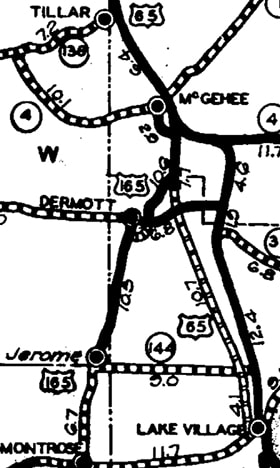
c. 1940, AHTD
|
|
This photo shows modern signage at that intersection -- today US 165 continues north with US 65, but until 1981 it ended here:
|

Nelson, Jan. 2006
|
In this photo we are looking south on US 65. Formerly the north beginning of US 165 was to the right:
|
Nelson, Jan. 2006
|
|
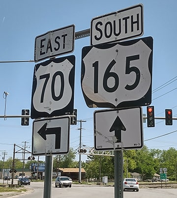
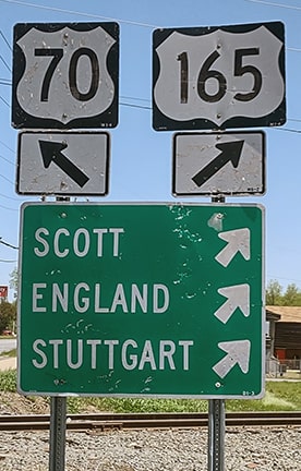
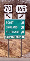
In more recent times, Arkansas has applied for and received several of what could be considered frivolous US highway extensions... and US 165 is one of them. At their Oct. 1981 meeting, AASHTO approved an extension of US 165 north through McGehee to Dumas, via a 24-mile overlap with US 65. From there, US 165 splits off again, runs through DeWitt, Stuttgart, and England, and then to its current terminus at US 70 in North Little Rock:
|
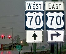
Karners, Apr. 2014 (posted after 2008)
|
Turner, Apr. 2023
|
|
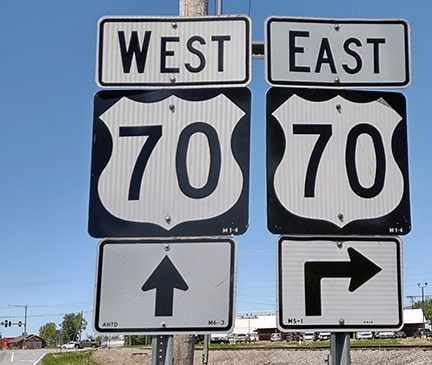
Westbound US 70 comes in from the right and then continues ahead. This photo shows the signage from that perspective (west on US 70, or Broadway):
|
Nelson, Oct. 2003
|
Turner, Apr. 2023
|
|
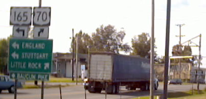
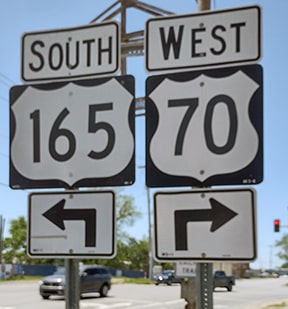
US 165 begins to the left on Baucum Pike or England Road. This perspective was looking the opposite direction: east on US 70, which curves to the left here:
|
Turner, Apr. 2023
|
|
In the distance at lower right is another assembly; that is shown in more detail in the following photos, where US 165 begins to the right:
|
Turner, Apr. 2023
|

|
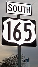
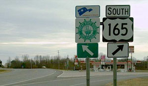
Travelers who take that fork to the right will soon encounter the first southbound US 165 marker:
|
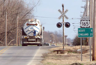
Backlin, Jan. 2008 (replaced as of 2014, but content is the same)
|
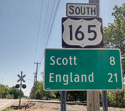
Turner, Apr. 2023
|
Research and/or photo credits: James Allen; David Backlin; Nathan Edgars; Karin and Martin Karner; Steven Nelson; Mike Roberson; Dale Sanderson; Michael Summa; Charles Turner
Page originally created 2000;
last updated Dec. 9, 2023.
last updated Dec. 9, 2023.
