End of US highway 61 |
 |
Summa
|
Summa
|
|
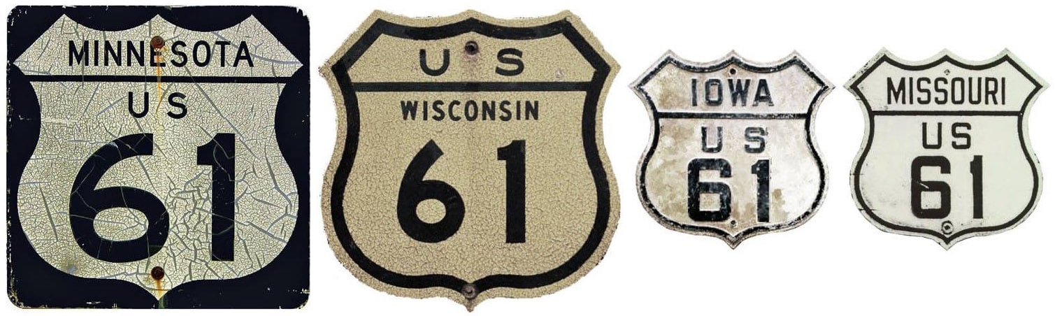
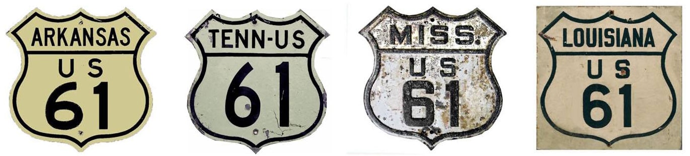
1926-1963?
|
1963?-1990
|
1990-present
|
|
Mileage: in 1989 AASHTO listed a figure of 1712 miles for US 61... however, that included the mileage of US 61's associated business routes. According to the state subtotals on AASHTO's 1989 spreadsheet, mainline US 61's actual end-to-end total was 1673 miles... but at the time, US 61 still ended at Grand Portage. Since then it has been truncated to Wyoming, and our own 2020 measurement yielded 1400.5 miles.
|
|
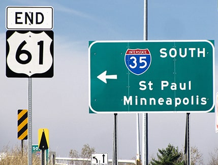
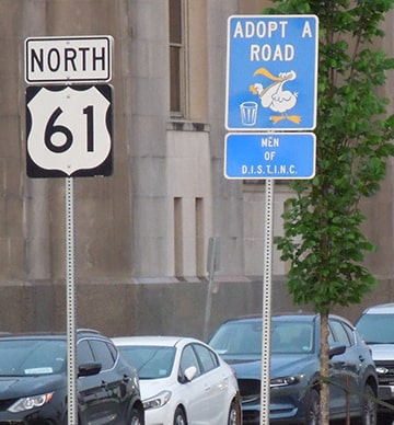
Currently, the north end of US 61 is in Wyoming MN, at a somewhat disappointing and inconspicuous interchange with I-35. Historically an "End" sign was posted as drivers approached the interchange, but in 2019 or later it was moved to the far side of the interchange:

Osbaldeston, Sep. 2002 (removed sometime between 2011-2015)
|
Castleman, Sep. 2018
|
Lilja, Jun. 2023
|
|
From Forest Lake, US 61 heads north on Forest Boulevard into Wyoming. Historically it continued north from there, but now the designation is routed west on Viking Boulevard, and US 61 ends at I-35's exit 135. This next shot shows the exit from northbound I-35:
|
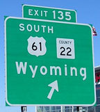
Morrison, Mar. 2007
|
|
If one were to exit there and turn right, the first southbound assembly would soon come into view:
|
Morrison, Mar. 2007
|
|
That is actually heading east, but the signal ahead is original US 61, and there traffic is directed to the south (right). More photos and commentary on Jeff Morrison's US 61 page.
Formerly US 61 continued north from Wyoming (along present-day state highways and county roads) through Duluth, and then along the scenic North Shore of Lake Superior, all the way to the Canada border: first to Pigeon River, and later to Grand Portage. Some segments of the historic route are now signposted as "Old US 61", complete with old-style cutout shields: |
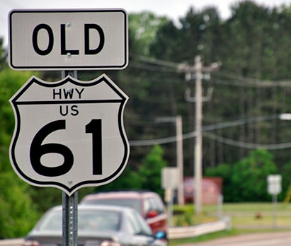
Kasprzyk, summer 2016
|
|
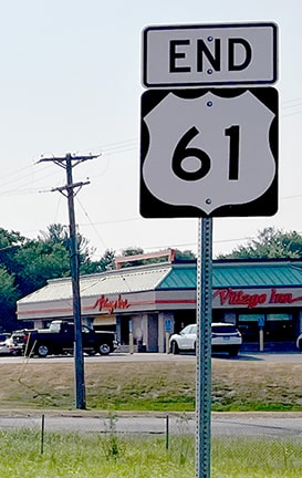
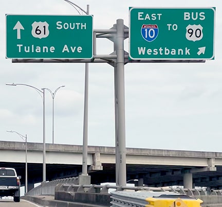
The south end of US 61 has always been in downtown New Orleans, although the exact terminus has changed (more details on the New Orleans page). At the time of my 2023 visit, the last reference to US 61 was on Airline Highway at its I-10 interchange:
|
Sanderson, Mar. 2023
|
|
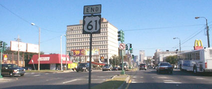
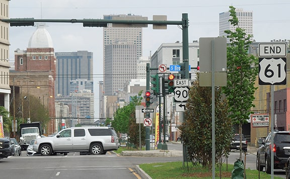
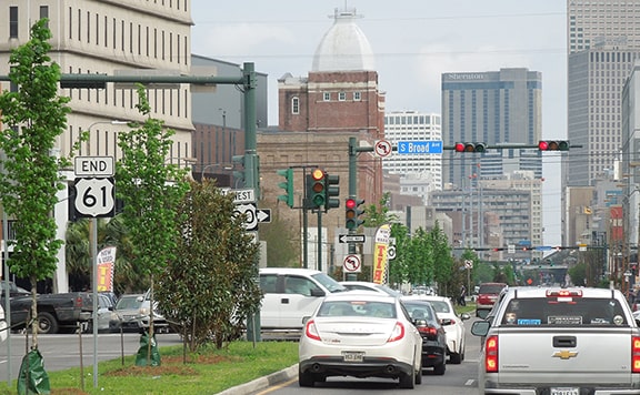
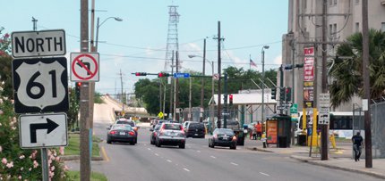
Ahead Airline becomes Tulane Avenue, and since the 1950s, US 61 ends about 1.5 miles ahead, on Tulane at Broad Street (four blocks southwest of the historic terminus). This photo was looking down Tulane:
|
Field/Ivy/Nitzman, Nov. 2008
|
|
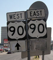
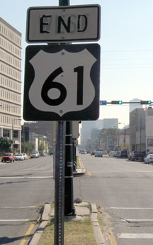
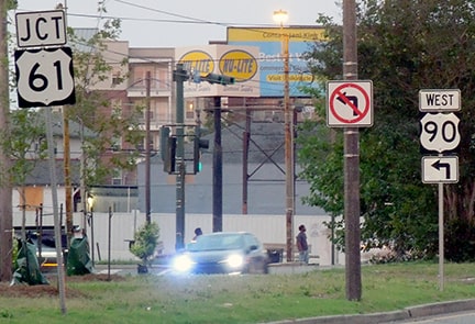
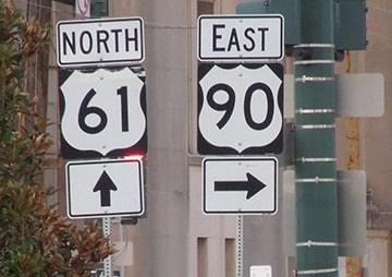
Straight ahead on Tulane is westbound US 90. Eastbound is actually to the left on Broad, but left turns are not permitted at that intersection, so traffic is supposed to turn right on Broad and then turn around. The right turn arrow was so faded it was almost illegible... but that was par for the course in terms of approach signage at this intersection. Behind that assembly was a hurricane evacuation sign, the front side of which we will see below. Just ahead an "End" sign was posted:
|
Nitzman, 1999
|

Karner, Jun. 2013
|
A closer look reveals that the old "End" tab was formerly a "West" tab:
Field/Ivy/Nitzman, Nov. 2008
|
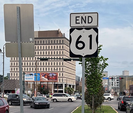
That sign had not changed in many years. It was removed in 2016, and then replaced in 2019. References to US 90 were also added at that time:
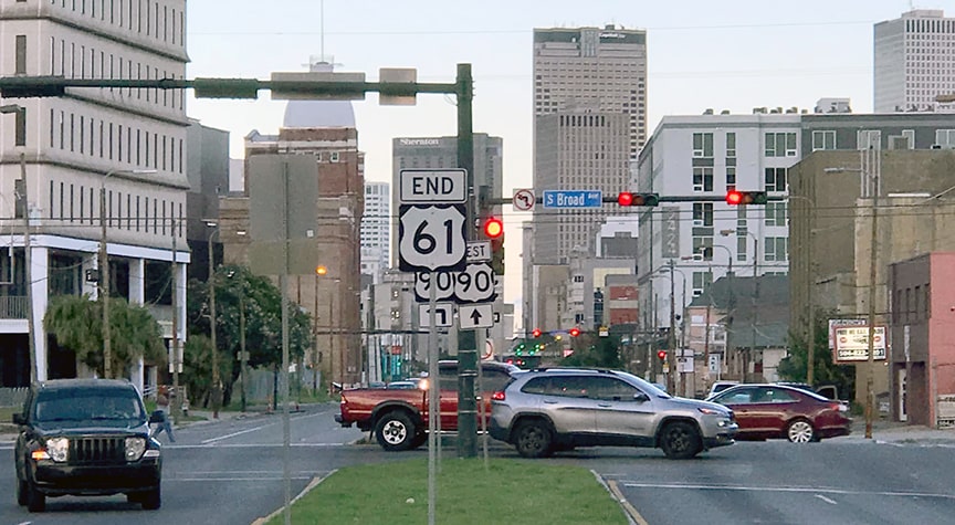
Mortell, Jul. 2022
Westbound US 90 is straight ahead (even though that direction is southeast), and eastbound US 90 is to the left on Broad (although one cannot make that movement here). Shortly before my 2023 visit, the City had planted trees all down the median in the middle of Tulane, so it is more difficult to see/photograph those signs now:
Sanderson, Mar. 2023
|
Sanderson, Mar. 2023
|
Sanderson, Mar. 2023
|
The next photo shows a sign assembly that was formerly posted heading southwest on Broad, at the right-hand turn marking the south beginning of US 61:
|
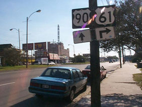
Nitzman, 1999
|
|
Westbound US 90 actually continues to the left on Tulane, but left turns are not allowed, so traffic was directed straight ahead, where it makes a u-turn on the far side of Tulane. That sign was later replaced with the one shown here...
|
Karner, Jun. 2013
|
|
...and that has since been replaced yet again. Now drivers are not informed which way to turn for US 61, and they are told to turn left to continue on US 90, even though they are not permitted to make that movement at Tulane:
|
Sanderson, Mar. 2023
|
|
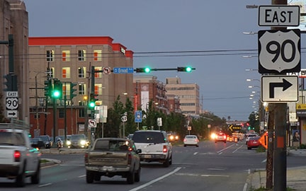
Heading up Tulane on eastbound US 90, there is a junction sign...

Field/Ivy/Nitzman, Nov. 2008
...and then directions to turn right on Broad in order to continue east on US 90 are posted on the right-hand side of the road, as well as in the median:
|
Sanderson, Mar. 2023
|
Google Maps Street View, Nov. 2021
|
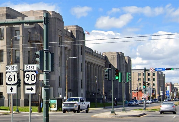
The signage in the median additionally indicates that straight ahead on Tulane is the beginning of US 61:
Sanderson, Mar. 2023
|
|
If one does continue straight on Tulane, the first northbound US 61 marker is posted in the median. The one shown here has since been replaced, but this photo also shows the front side of the hurricane evacuation sign mentioned above:
|
Sanderson, Mar. 2023
|

Research and/or photo credits: Monte Castleman; Andy Field; Brent Ivy; Martin Karner; Bruce Kasprzyk; Patrick Lilja; Jeff Morrison; Robert Mortell; Alex Nitzman; Greg Osbaldeston; Dale Sanderson; Michael Summa
Page originally created 1999;
last updated Dec. 17, 2023.
last updated Dec. 17, 2023.
