End of US highway 48 |
 |
|
2002-present
|
|
|
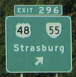
Note: the current US 48 is not to be confused with US 48 [i], which served California during the 1920s and '30s; nor US 48 [ii], which served Maryland and West Virginia in the 1970s and '80s. Interestingly, all three routes carrying the US 48 designation have been less than 150 miles in length. Therefore one could argue that none of them deserved to be US routes, and/or designated with a two-digit number (which generally implies a major route). This photo shows signage at the east end of US 48, at its interchange with I-81 near Strasburg:
|
Nitzman, Aug. 2021
|
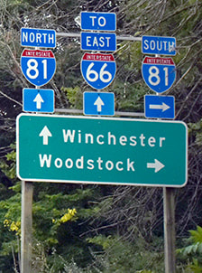
This image shows signage for the east beginning of US 48 as seen from northbound I-81 (the signs for southbound traffic are similar):
Nitzman, July 2004
|
|
At the end of the northbound offramp, a sign indicates US 48 begins to the left:
|
Nitzman, Jul. 2004
|
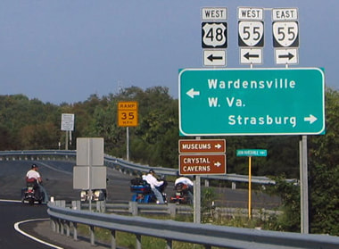
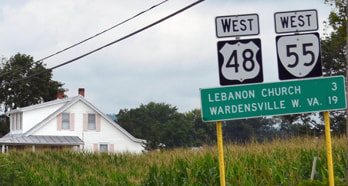
Turning that direction (west), a US 48 marker is posted for the benefit of traffic on westbound VA hwy. 55 (the Strasburg water tower is visible in the background):
|
Rosenberger, Apr. 2003
|
|
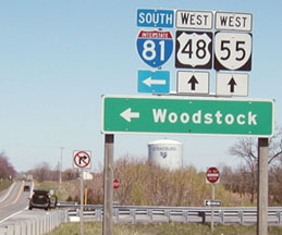
A little beyond there is the first US 48 confirming marker. The route is coincident with VA 55 to the West Virginia state line (which is about 15 miles west of Strasburg):
|
Nitzman, Aug. 2013
|
Behind the camera is the east terminus of US 48, but VA 55 continues east to US 11 in Strasburg, and then for another 50 miles to US 29 in Gainesville VA.
|
US 48 is the designation given to Corridor H of the Appalachian Development Highway System, and as part of that system it is supposed to be a high-speed four-lane highway. West Virginia has, despite great controversy, committed to making this happen; however Virginia currently has no intention of expanding the meandering two-lane road for the 15 miles between I-81 and the West Virginia state line. Thus, at least for the foreseeable future, US 48 will not be the major artery connecting I-81 and I-79 that was envisioned (contributing to the controversy in West Virginia and earning the project the nickname "Highway to Nowhere").
|
As of June 2006, there was no mention of US 48 anywhere along the road in WV, with the exception of this sign:
|
Cinquegrana, June 2006
|
|
Around that time, a WV DoT official remarked that the road would not be signed as US 48 until improvements were complete along most of the corridor. However, they appear to have re-thought that: by 2012, the 33-mile segment heading west from the VA line had been signed as US 48. As of June, signage instructed traffic to take the Patterson Creek Road exit (northwest of Moorefield), and upon reaching the bottom of the offramp, an "End" sign was posted:
|

Mortell, June 2012
|
|
However, the road was essentially complete a bit further west (to Knobley Road), and that segment was also signed as US 48:
|
Mortell, June 2012
|
Over the next few years, US 48 signage was extended incrementally further west as new segments of the road were completed and/or improved. Then in 2017, even though the new highway was still not built between Davis and Kerens, US 48 signs were added at the designation's ultimate terminus at an interchange with I-79 near Weston.
|
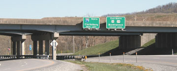
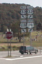
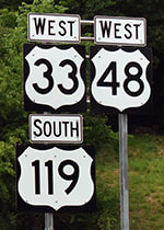
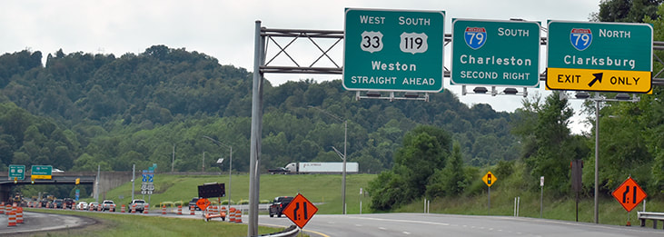
Some of the images in the following series were taken prior to the addition of US 48 signage. This first picture faces east at the western terminus of US 48. The route begins at the intersection of I-79 (which runs along the overpass in the picture) and US 33-119, with which it is coincident until Buckhannon WV (where US 119 splits off to the north). US 33-119 continues west (behind the camera) as a two-lane road, connecting with US 19 in Weston:
|
|
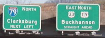
|
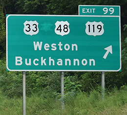
The next photo was from southbound I-79:
Moraseski, Apr. 2003
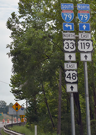
The west beginning of US 48 is to the right with US 33-119; that designation has now been added to that overhead sign:
|
Lintz, Nov. 2017
|
|
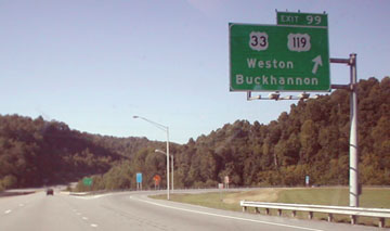
If a driver takes that exit, they loop around and come to a "Y" in the road:
Moraseski, Apr. 2003
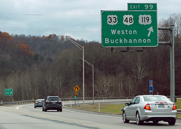
Weston is to the left via US 33-119, and US 48 begins to the right: overlapped with those routes, heading towards Buckhannon. Now a US 48 shield has been added to that assembly:
|
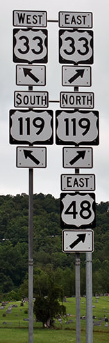
Nitzman, Aug. 2021
|
|
|
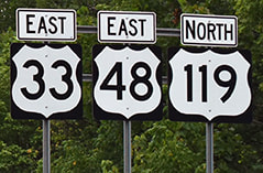
Heading the opposite direction (west), this is the last US 48 trailblazer:
Nitzman, Aug. 2021
Continuing ahead and approaching the terminus, an "End" sign has been posted:
|
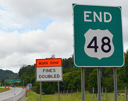
Nitzman, Aug. 2021
|
|
In the distance an overhead sign bridge is visible; that is shown close-up in the next photo. The actual west endpoint of US 48 is at the I-79 overpass ahead:
|
Nitzman, Aug. 2021
|
Research and/or photo credits: Robert Brooks; Rich Cinquegrana; Josh Lintz; Dan Moraseski; Robert Mortell; Alex Nitzman; Eric Rosenberger; Dale Sanderson
Page originally created 2003;
last updated Sep. 10, 2021.
last updated Sep. 10, 2021.
