Historic US highway endpoints in Cortez, CO
|
1927-1970
|
 |
|
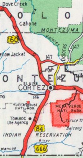
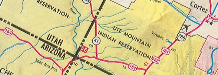
When the US highways were first commissioned in 1926, the direct route between Cortez and Dove Creek (today's US 491) had not yet been built, so westbound US 450 continued by turning north on what is now CO hwy. 145. It skirted the town of Dolores and then followed a stairstep path over to Dove Creek. Meanwhile, US 666 began at that turn in US 450, went through downtown Cortez, and then down to Shiprock NM:
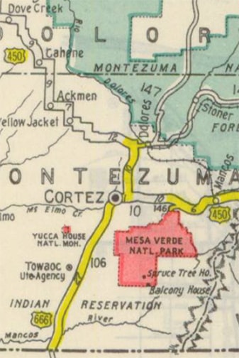
c. 1931, CDoT
|
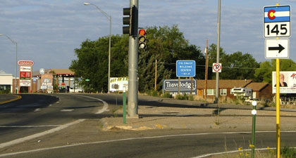
This first photo was taken heading west on US 160:
Sanderson, July 2004
Originally that would have been west on US 450, which continued to the right, while straight ahead was the north beginning of US 666. This shot is from the opposite direction (east on US 160):
Sanderson, July 2004
|
That was northbound US 666, and the intersection ahead (where the RV is) was where the route terminated. Eastbound US 450 was straight ahead, and westbound was to the left on today's CO 145. One more perspective; this was looking south on CO 145:
Sanderson, July 2004
Originally that was eastbound US 450, which continued to the left at the light. To the right was the north beginning of US 666. The North Rim of Mesa Verde is prominent in the background. By 1934, US 450 had been replaced by US 160, but back then 160 still went northwest out of Cortez (through Dove Creek), instead of southwest (as it does today). Then in about 1938, today's more direct route between Cortez and Dove Creek was built:
|
c. 1939, CDoT
|
So the north end of US 666 shifted about two miles west, to the three-way junction just west of downtown Cortez. This shot was looking north on US 491/east on US 160:
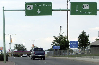
Sanderson, July 2004
|
|
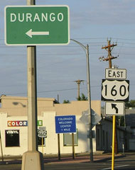
That was formerly the north end of US 666. The gentle curve to the right was eastbound US 160, and the left turn led to westbound US 160. The signage in the median is shown close-up here, both before and after US 666 was renumbered:
|
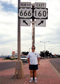
Voss, 1998
|
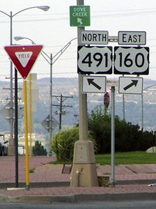
Sanderson, July 2004
|
|
The map above also shows that in 1938 (coincidentally), the US 84 designation was extended westward through New Mexico. For just a few years, it was overlapped with US 666 north from Shiprock, and it ended here at the same junction (CDoT maps between 1939-1941 show this, but it is unclear whether US 84 was ever actually signposted along that route).
|
|
|
And then,1966 was the year that the highway through the Navajo Reservation in northeast Arizona (today's US 160) was commissioned as a US route. It was originally assigned as US 164, and it ran from Flagstaff to Cortez:
|
c. 1970, CDoT
|
|
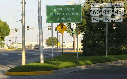
So the junction in Cortez also marked the east end of US 164 from 1966-1970. Here we are looking the opposite direction (south on US 491):
|
Sanderson, July 2004
|
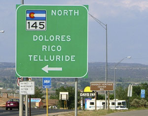
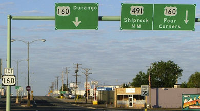
Ahead, eastbound US 160 is directed to the left on Pinon Drive, but straight ahead at various times has been the north beginning of US 666, the west beginning of US 84, and the east beginning of US 164. The signage at the turn is shown close-up here:
|
Sanderson, July 2004
|
|
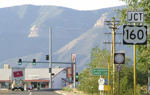
Although that was signed as US 160, it is technically "Spur US 491". Pinon is kind of a strange road: it keeps bending more to the east, but at Linden Street it turns back due south to a stop sign at Main Street (US 160). There was no guide signage whatsoever for US 160 traffic. And that intersection was not signalized, even though traffic on Main can be really heavy, especially during tourist season (the entrance to Mesa Verde is just 10 miles up the road). This photo is looking west on Main, approaching Linden:
|
Sanderson, July 2004
|
Pinon (to the right) is actually "Spur 491"; it connects with mainline 491 after about three blocks. It is one-way from here to Linden; traffic coming the opposite direction stays on Linden, which is the intersection behind the pedestrian sign. But it was formerly US 160 that went right; straight ahead (and then bending to the left) was the west beginning of US 84 from 1938-1940, the north beginning of US 666 from 1938 to 1970, and the east beginning of US 164 from 1966 to 1970.
If US 84 was ever signed to Cortez, it was only until about 1940. In 1970, US 160 was redefined to follow its current route southwest out of Cortez and through the Navajo lands. That eliminated the need for US 164. US 666 was then extended northward out of Cortez along the former route of US 160, so since then no US routes terminate in Cortez. US 666 was renumbered to US 491 in 2003.
If US 84 was ever signed to Cortez, it was only until about 1940. In 1970, US 160 was redefined to follow its current route southwest out of Cortez and through the Navajo lands. That eliminated the need for US 164. US 666 was then extended northward out of Cortez along the former route of US 160, so since then no US routes terminate in Cortez. US 666 was renumbered to US 491 in 2003.
Research and/or photo credits: Dale Sanderson; Oscar Voss
Page originally created 2004;
last updated May 8, 2016.
last updated May 8, 2016.
