End of US highway 202 |
 |
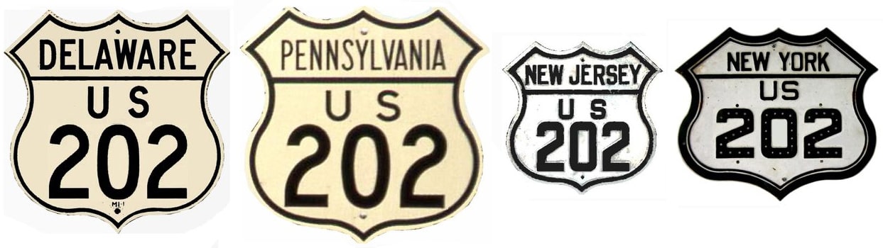
Summa
|
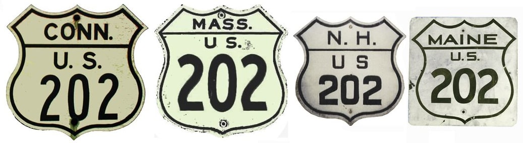
Summa
|
|
1934-1958
|
1958-1984
|
1984-present
|
|
Mileage: in 1989 AASHTO listed a figure of 627 miles for US 202. That closely matches our own 2020 measurement, which yielded 627.3 miles.
|
|
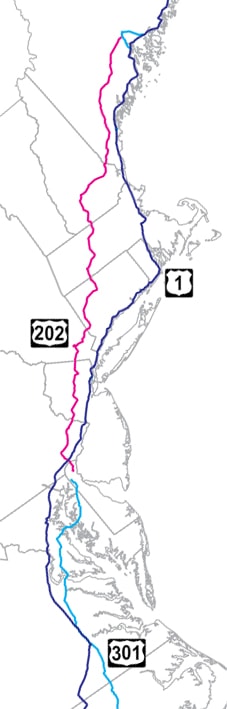
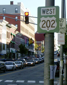
In the opinon of US Ends .com, the entire route should be signed north-south. And, as a matter of fact, consider this: the north terminus of US 301 is only 12 miles away from the south end of US 202 near New Castle (and historically the two routes actually shared a common terminus). So what would be really cool is if the US 301 designation overlapped with DE 1/US 13 northward for 12 miles, and then replaced US 202 in its entirety, with signage all along the way being changed to north-south:
|
|
|
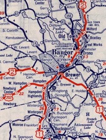
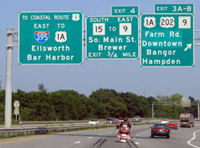
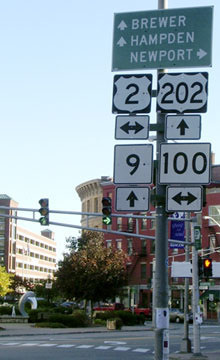
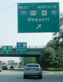
Anyway, all of that explains why the "north" end of US 202 in Bangor is actually signed as its "east" end. Some smaller-scale maps seem to indicate that US 202 terminates at I-395's interchange 2. However, the official route log from Maine DoT indicates that US 202 actually ends at its junction with US 1A... in other words, it overlaps with I-395 for one mile to the east, and then ends at exit 3. These photos were taken from I-395 (eastbound and westbound, respectively):
|
Buchanan/Nitzman, June 2005
|
Kaiser, July 2006
|
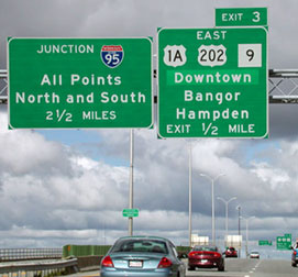
Directing US 202 traffic to exit there is absurd, especially for westbound travelers. The sign bridge visible in the distance is shown close-up in the following interactive image. This interchange marks the east beginning of US 202... so in other words, it goes only one way from here, and that is straight ahead on I-395!
|
|
|
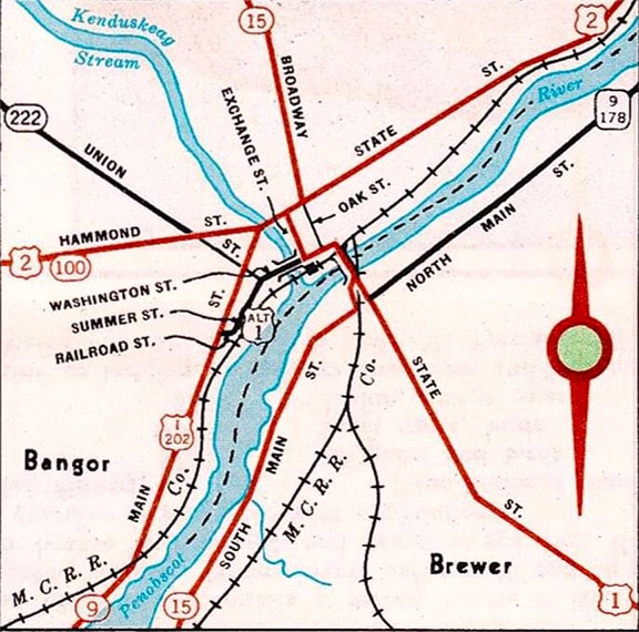
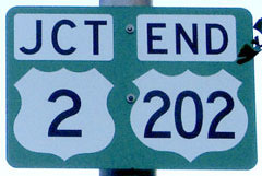
When a driver exits there today, expecting to follow US 202, they will be perplexed, because beyond there that route is no longer referenced. But historically US 202 traffic was directed north on Main Street, ending at Hammond Street, where it junctioned its parent route (US 2):
|
c. 1950, Maine DOT
|
|
Reportedly US 202 was officially truncated out of downtown in the late 1980s, but at least as late as 2007 US 202 was still signed all the way to its original endpoint at US 2 (although the signs appeared to be city property, not Maine DoT signs). These photos were taken looking north on Main:
|
Buchanan/Nitzman, June 2005
|
Sanderson, Oct. 2004
|
|
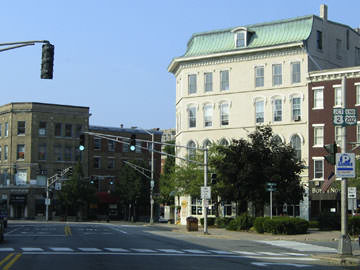
US 202 originally ended at the traffic signal in the distance, which carries US 2; the sign at that intersection is enlarged here:
|
Sanderson, Oct. 2004
|
That sign was a bit underinformative: it referred to eastbound US 2, via State Street. Westbound is to the left via Hammond Street, but it was not mentioned because traffic heading north on Main may not turn that direction. To the right, State is one-way road over a bridge; so westbound US 2 must leave State, turning to the north on Harlow Street, then loop around back south via Central Street (a movement that was not well-signed). Thus westbound US 2 traffic actually approaches this intersection heading south:
|
Sanderson, Oct. 2004
|
|
That was a strange sign too: traffic there is already on westbound US 2, which continues by taking a right on Hammond. To go left on State would be to go the opposite direction (eastbound) on US 2. At any rate, the historic beginning of US 202 was straight ahead on Main. Next is the original beginning as seen from eastbound Hammond:
|
Sanderson, Oct. 2004
|
|
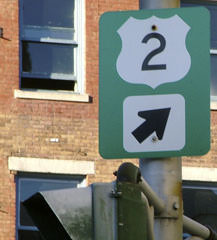
State is straight ahead, but formerly drivers making that right turn onto Main would immediately see the first westbound US 202 confirming marker...
|
Sanderson, Oct. 2004
|
...even though, according to MDoT, they were not actually on US 202 yet. Continuing ahead, US 202 traffic is instructed to use I-395 westbound...
|
Buchanan/Nitzman, June 2005
|
|
...and that is technically the east beginning of US 202. Let us follow it all the way to Delaware.
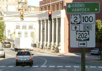
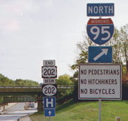
For several years now (and possibly since 1970), as one approaches Wilmington from the north on US 202, there has been an "End" sign at I-95 (interchange 8)... |
Nitzman/Field, Oct. 2001
|
Nitzman/Field, Oct. 2001
|
Nitzman, Dec. 2016
|
...but that is not the south end of US 202. Historically US 202 continued straight ahead, ending at various junctions in Wilmington or New Castle. Then from 1970-1984 that actually was the terminus of US 202. Today it is DE state hwy. 202 that begins straight ahead on the Concord Pike. But instead of an "End US 202" sign, there should be a sign routing US 202 traffic to the right on southbound I-95 (that on-ramp is just behind the camera; the "North I-95" sign refers to the cloverleaf ahead, on the far side of the overpass). US 202 is actually routed further south with I-95 about five miles. At exit 5 traffic is directed south on Basin Road; the designation ends just outside New Castle, at its junction with US 13-40, which the state highway map labels "Basin Corner":

Nitzman, Dec. 2004
|
Karners, Dec. 2016
|
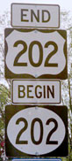
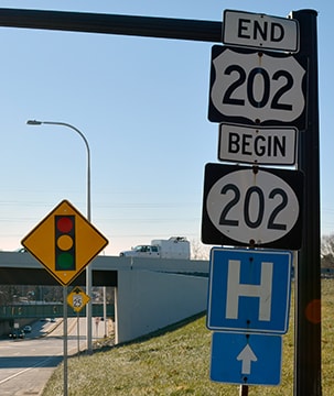
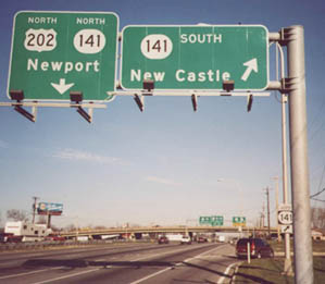
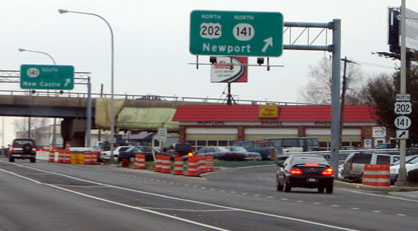
That was looking south on Basin Road (US 202) at the Dupont Highway (US 13-40). These shots were taken heading north out of downtown New Castle on Basin Road (DE hwy. 141) at its interchange with Dupont. This is the point where the US 202 designation begins; DE 141 is overlapped with it a couple miles straight ahead, to the I-95 interchange:
Nitzman, 2000
|
Nitzman, Aug. 2004
|
Karners, Dec. 2016
|
|
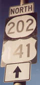
The sign assembly just barely visible on the overpass is shown close-up here:
|
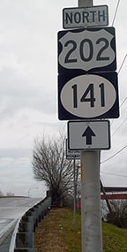
That was supposed to be the first US 202 sign at its south beginning. But in 2000 the shield types were reversed: a state highway blank was used for US 202, and a US highway blank was used for DE 141. By 2016 that assembly had been changed to reflect the correct designations. And the signage shown here was done correctly:
|
Nitzman, 2000
|
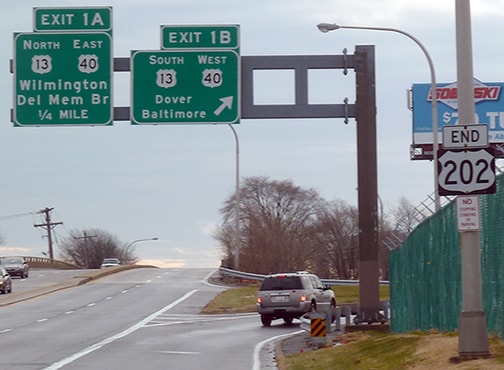
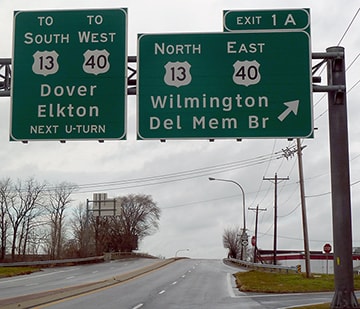
That was taken from Dupont Hwy, heading north on US 13/east on US 40. The overpass in the distance is the same one shown in the photos above; it marks the south terminus of US 202. The signage in the distance is shown close-up in these photos:
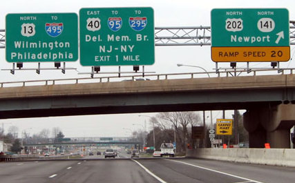
Nitzman/Field, Mar. 2004
|
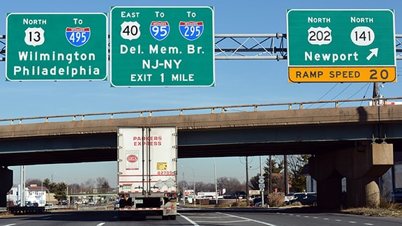
Nitzman, Dec. 2016
|
|
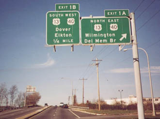
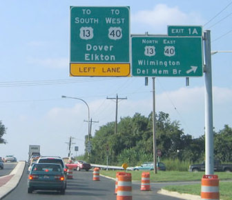
Next is a view of the south beginning of US 202, as seen from the opposite direction (southbound US 13/westbound US 40):
|
Nitzman/Field, Mar. 2004
|
Research and/or photo credits: Eric Bryant; Carter Buchanan; Andy Field; Cameron Kaiser; Karin and Martin Karner; Alex Nitzman; Dale Sanderson; Michael Summa
Page originally created 2000;
last updated Mar. 12, 2023.
last updated Mar. 12, 2023.
