End of US highway 209 |
 |
|
1926-1934
|
1934-1935
|
1935-present
|
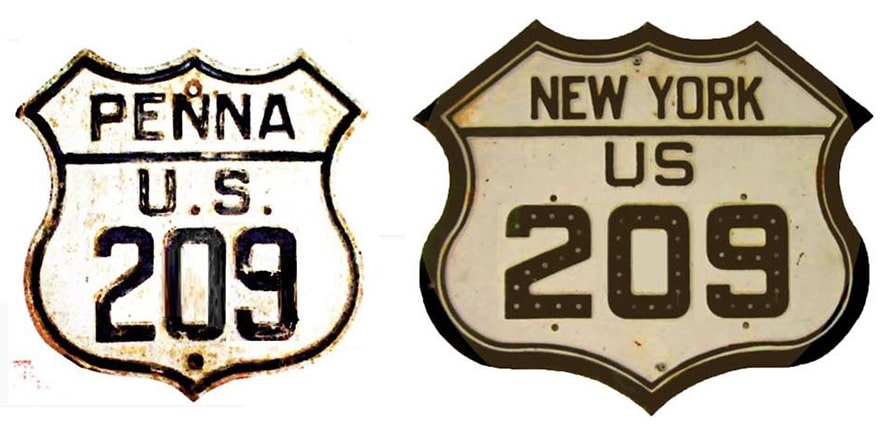
Summa
|
Mileage: in 1989 AASHTO listed a figure of 235 miles for US 209... however, that included the mileage of US 209's associated business route. According to the state subtotals on AASHTO's 1989 spreadsheet, mainline US 209's actual end-to-end total at the time was 217 miles. That is reasonably close to our own 2020 measurement, which yielded 211.3 miles (reroutings and realignments likely explain the difference).
|
|
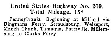
US 209 was among the original 1926 routes; this excerpt is from AASHO's April 1927 route log:
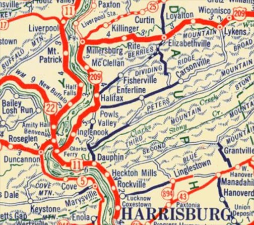
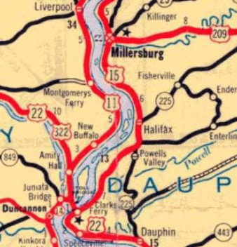
At the time its south end was at Clarks Ferry (which was across the Susquehanna River from Duncannon, but today is really nothing more than a highway junction):
|
c. 1930, PennDoT
|
|
Today PA hwy. 147 heads south from Milton along the east bank of the Susquehanna -- through Northumberland, Sunbury, Millersburg, and Halifax -- ending at its junction with US 22-322:
|
Sanderson, Nov. 2000
|
|
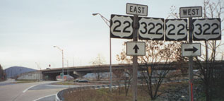
Straight ahead is Harrisburg, while right (west) across the Clarks Ferry Bridge leads to Lewistown and State College. That is the original south end of US 209 (although there was no grade separation here until 1986). This photo was taken from the opposite direction: north from Harrisburg on westbound US 22-322:
|

Sanderson, Nov. 2000
|
|
Those routes go left across the bridge and up the Juniata River valley. PA 147 begins there by continuing north along the Susquehanna. That was the original south beginning of US 209.
In 1935, US 15 was extended north from Harrisburg along what is now PA 147. So the south end of US 209 was truncated to its junction with US 15 in Millersburg: |
c. 1940, PennDoT
|
|
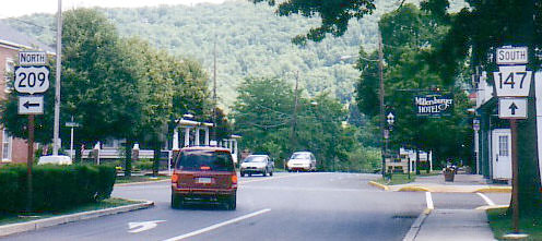
Five years later, US 15 was rerouted to follow the west bank of the Susquehanna (as it does yet today), but rather than re-extending US 209 back down to Clarks Ferry (so that it would again end at a junction with another US route), US 209 was left dangling (so to speak) at its existing terminus, where it remains to this day. That makes it a member in a small group of inland US highways which do not end at a junction with another US route. This photo was from northbound PA hwy. 147, which is on Market Street in town. US 209 begins to the right, on Union Street:
|
Sanderson, Nov. 2000
|

Ilyes, 2004
|
|
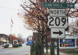
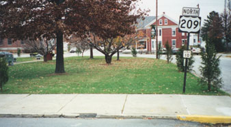
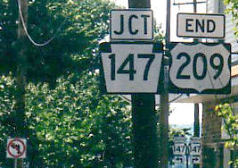
Here is approach signage from the opposite direction:
|
Ilyes, 2004
|
|
Travelers taking that left will be on the road visible at far right in this next photo. Union (US 209) does not have a standard "T" intersection with Market (PA 147). Instead, there is a one-way semi-circle or "half-rotary". Drivers curve past the side of the brick building in the background, and then take another right, heading straight out behind the trees:
|
Sanderson, Nov. 2000
|
|
These photos were taken from the opposite direction: approaching the half-rotary on Union. The "End" sign was posted just shy of the true end of southbound US 209. Drivers must go right here to reach Market (or PA 147, which runs behind the gazebo), but there was no "End" sign at that intersection:
|
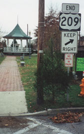
Sanderson, Nov. 2000
|
Ilyes, June 2002
|
|
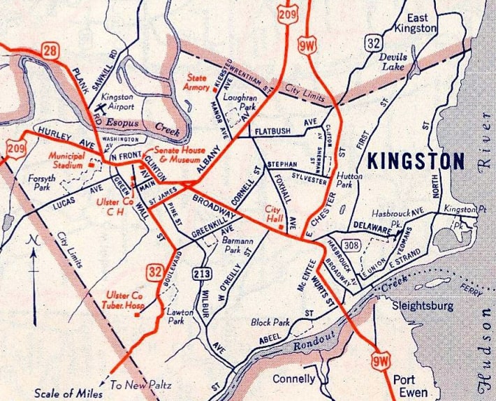
To the north, US 209 originally ended in Milford. But already by 1934 the north end of US 209 had been extended to Kingston. At the time, US 9W traffic was directed through the central part of the city, via Ulster Avenue, Albany Avenue, and Broadway. US 209 went through the Stockade District (the original town), then made its way over to Albany, where it ended at Broadway:
|
Mortell, Oct. 2006
|
|
Northbound US 9W was to the left on Albany, and southbound was to the right on Broadway. But it was not long before US 9W was changed to follow Chester Street, which bypassed the more congested part of the city and shaved off about a mile. So at that time, in order to maintain a connection with US 9W, the US 209 designation had to be extended along the former 9W. This could have been accomplished using the southbound connection (Broadway), but instead the northbound connection was used (Albany and Ulster). That arrangement was illustrated on this map:
|
c. 1949, General Drafting
|
|
This image looks south on US 9W, which continues to the left (despite being mis-signed as NY 9W). To the right on Ulster was the original US 9W, but only for a few years, and then it became the north beginning of US 209:
|
Google Maps Street View, Jul. 2018
|
|
This next photo is looking the opposite direction (north on Ulster), approaching the historic north end of US 209:
|
Google Maps Street View, Sep. 2019
|
|
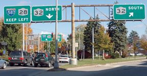
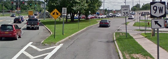
Sometime around 1960, US 209 traffic was routed onto a newer highway that bypasses the city to the west and north, ending at a different junction with US 9W. This photo shows the twin "End" signs heading east on northbound US 209:
|

Field/Nitzman, Aug. 2007
|
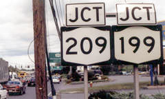
The mainline itself continues ahead as NY hwy. 199. That goes east across the Hudson River and connects with US 9 in the Rhinebeck-Red Hook area... which makes one wonder why the US 209 designation does not extend a bit further ahead, in order to junction its parent route. As it turns out, NYSDOT tried to do that in the 1960s... as a matter of fact, they asked AASHO for permission to replace all of NY 199 with US 209, such that its terminus would have been at its junction with US 44 near Millerton. But AASHO denied their request.
|
This series shows the signage for the north beginning of US 209 as seen from northbound US 9W. Approaching the junction, there was a sign error:
|
Nasiatka, Sep. 2003
|
|
That should be a US 209 shield, not NY 209. The next two signs have it correct:
|

Kerr, July 2001
|
Nasiatka, Sep. 2003
|
|
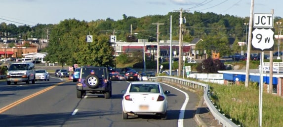
Heading the opposite direction (south on US 9W) the north beginning of US 209 is signposted thus:
|
Deane, Nov. 2014
|
|
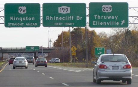
Drivers who make that turn onto US 209 will soon see the first southbound sign:
|
Field/Nitzman, Aug. 2007
|
Research and/or photo credits: Valerie Deane; Nathan Edgars; Marc Fannin; Andy Field; Jason Ilyes; Doug Kerr; J.P. Nasiatka; Alex Nitzman; Dale Sanderson; Michael Summa
Page originally created 2000;
last updated Dec. 10, 2023.
last updated Dec. 10, 2023.
