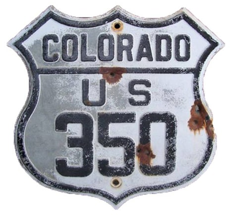
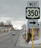
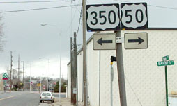
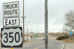
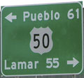
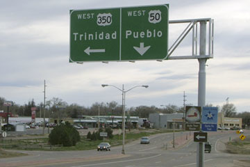
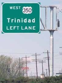
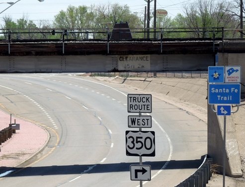
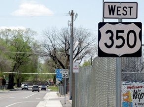
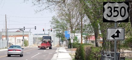
End of US highway 350 |
|
1995-present
|
Mileage: in 1989 AASHTO listed a figure of 80 miles for US 350... but at the time, the route still ended in Trinidad. Since then US 350 has been truncated to a junction outside of town, and our own 2020 measurement yielded 72.8 miles.
|
US 350 was an original 1926 route; its west end has always been at or near Trinidad. This excerpt is from AASHO's Apr. 1927 route log:
|
|
It is somewhat remarkable that US 350 has survived all this time, considering that it is less than 100 miles long, and it has always been an intra-state highway:
|
However, that is not to imply it is an unimportant route: its entire length parallels a segment of the Mountain Branch of the historic Santa Fe Trail. The town of La Junta is located on a southernmost bend of the Arkansas River, so it marked the spot where southwestbound travelers left the river and began following Timpas Creek upstream towards Trinidad, Raton Pass, and ultimately Santa Fe.
|
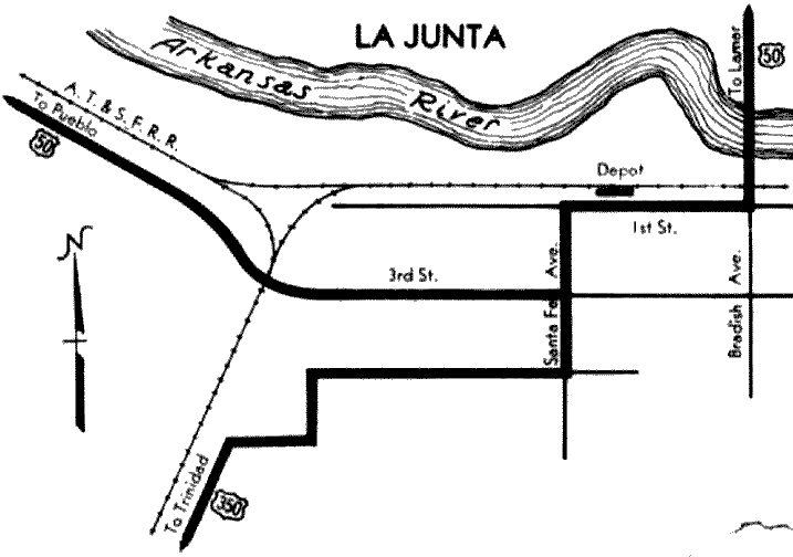
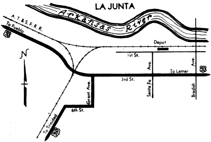
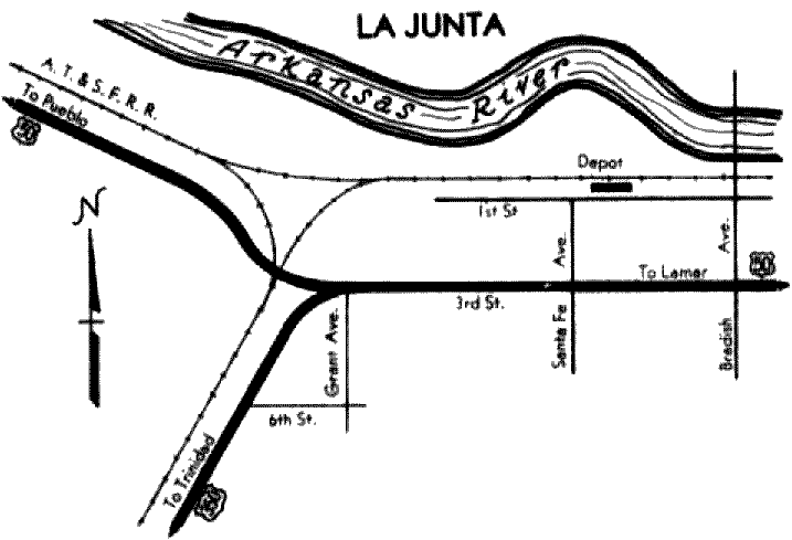
It was for the same reason later on, when the rail lines were built, that La Junta was the site of a split in branches of the Atchison, Topeka, and Santa Fe Railroad. And still later, when many of the highways across the Plains were built along the same corridors as the railroads, La Junta became the highway hub of southeastern Colorado: this is where US 350 splits off from its parent route, US 50. The exact location of this junction has changed several times over the years. In a nod to its strategic location, Colorado actually included an inset of La Junta on its official state highway maps during the early 1930s... and each one showed a different routing for US 350! The inset was removed after 1934, but US 350's east terminus has changed at least two more times since then. Let us begin with the earliest inset:
|
Lots of interesting things there. First -- while it may be no surprise that US 50 came in from the west and continued straight on 3rd Street (instead of swinging up to the current bypass on 1st) -- that map also illustrates how US 50 historically crossed to the north bank of the Arkansas River. That map is a bit generalized: northbound Bradish actually led to a diagonal bridge over the river. This diagonal continued into North La Junta (the alignment is still visible today) and connected with Main Street. From there, US 50 followed what is now CO hwy. 194 eastward to Las Animas.
|
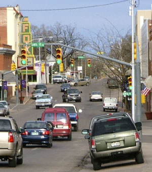
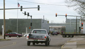
As for US 350, notice that it moved away from the railroad via a series of stair-steps, and also that it ended downtown (rather than on the west side of town). The roads that comprised the stair-steps are not labeled on that map, but it is reasonably certain that US 350 traffic was directed east on 6th (not 5th), then north on Grant Avenue, and east on 5th. One more turn on Santa Fe led to 350's terminus at its junction with US 50. This is consistent with the routing of many highways during that era, which were commonly signed to a courthouse, city hall, and/or central business district. This shot was looking north on Santa Fe at 3rd:
|
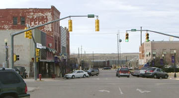
That was a former east end of US 350. Westbound US 50 was to the left, and eastbound went straight ahead for two blocks before continuing to the right on 1st. Next is the perspective looking east on 3rd. Originally eastbound US 50 turned left at the light, while to the right was the east beginning of US 350:
|
|
It was the following year that US 50 was changed to its modern corridor along the south bank of the Arkansas, so it followed 3rd all the way through town. Also, it appears CDoT decided it was not cost-effective to maintain nearly a mile of both 3rd and 5th: parallel roads only two blocks apart. Starting in 1932, the rationale seems to have been: get US 350 traffic to a junction with US 50 as soon as possible. So US 350 was simply extended two blocks north on Grant to a new terminus:
|
The pickup, heading north on Grant, was at an historic north end of US 350 (as well as what is now the current endpoint, so additional photos are posted below). Within two years, US 350's route had been changed again -- US 350 now stayed next to the railroad, skirting the west side of Potter Park, so its terminus moved still further west:
|
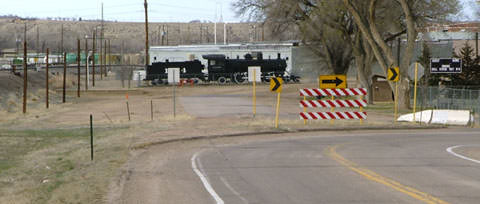
This photo was taken looking northeast on US 350. Today traffic is directed to the east (right) on 5th. But historically US 350 continued straight ahead (along what is now called Potter Drive), to a junction with US 50 that was situated right in the vicinity of this old locomotive (which has since been moved):
|
|
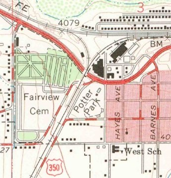
CDoT stopped printing La Junta detail maps after 1934, but it appears that US 350 traffic remained on Potter Drive until sometime in the 1960s, based on the following: US 50's railroad underpass was rebuilt in 1961, and that was probably so US 50 could be expanded to four lanes. US 50 was changed to its modern bypass on 1st Street in 1963. This map is from a few years after that; by this time, US 50 had been four-laned, and it had been switched to the 1st Street bypass. Although this map indicates that Potter Drive still had a junction with US 50, it also suggests that US 350 traffic was no longer using Potter Dr, but instead was being directed east on 5th, then north on Barnes Avenue. Why Barnes, you might ask, rather than just going back to Grant? The original plan set indicates that they were considering building a grade separation at the US 50-350 junction (and that would not have been possible if US 350 used Grant):
|
|
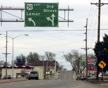
US 350 remained on Barnes until 2012; following is a series of shots from that timeframe. This one was taken looking east on US 50 at 3rd:
|
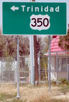
The maps above show that US 50 traffic for many years was directed straight ahead down 3rd... so it is a bit surprising that travelers on eastbound US 50 who wanted US 350 were not directed to simply continue straight on 3rd: Barnes was only two blocks ahead. But instead, unsuspecting drivers followed the curve to the left, where they soon saw this sign:
|
|
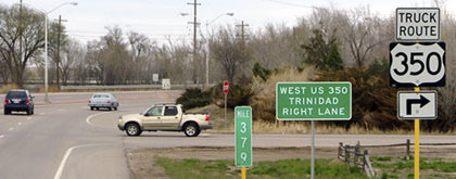
That is where Barnes intersects modern US 50 -- the pickup was at the east end of US 350. (And remember the locomotive shown in a photo above? By 2013 that had been moved to the hill just behind the pickup.) The "Truck Route" banner (which is also shown in more photos below) seems kind of strange: "Truck Route" implies that is something other than mainline US 350. However, that was not the case -- that was the one and only US 350. (And now that US 350 has been re-routed, it is still signed as "Truck Route".) Presumably it meant, "this is the only approved route for trucks to head out of town via 350". Anyway, travelers who turned there would soon come to the intersection of 3rd and Barnes...
|
|
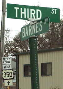
...but they would have driven four blocks to get to that point (compared to only two blocks if they had simply gone straight on 3rd). Travelers who had done that would have seen this signage at that intersection (eastbound on 3rd at Barnes):
|
Perhaps the reason why there was no sign pointing to the left is that most traffic heading that direction had just exited US 50 anyway. Signage looking the opposite direction (west on 3rd) was kind of interesting: the sign made it look like US 50 was on Barnes, and US 350 only went left:
|
|
The reason for that was: while eastbound US 50 can exit onto eastbound 3rd (coming towards the camera), westbound 3rd is denied access to US 50 (if one continued straight from there, they would intersect US 50 two blocks ahead). So the intent of this sign was to let drivers know that, if they wanted US 50, they needed to take a right there. It would have been more accurate if it read "TO US 50"; if one did turn right from there (north onto Barnes), they encountered a sign indicating that they were actually on US 350 (not US 50):
|
|
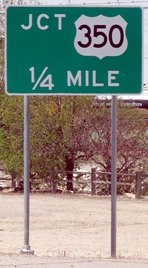
In 2012, US 350 was changed such that it followed Grant again (instead of Barnes) to its current endpoint in La Junta. In other words, US 350's terminus was re-established in the same location where it ended for a brief time during the 1930s. Heading west on US 50, there were several references to US 350:
|
This was posted just before the left-turn lane to Barnes Avenue, which had carried US 350 traffic for the previous 50 years:
|
|
Those are followed by a sign in the median, and then one on the right shoulder. A left turn there puts travelers on Grant Avenue, which also carried US 350 traffic for a year or two during the 1930s:
|
By contrast, eastbound US 50 had perhaps not quite enough junction signs for US 350. This photo shows the last one. The right-turn lane on the far side of the underpass is visible; there should probably be one more sign posted there...
|
|
This photo was taken heading the opposite direction (north on Grant). It shows the final two blocks of US 350, as well as a sign...
|
...although it is unclear for whom that was intended, since US 350 traffic comes from the left. Ahead, there was no "End 350" assembly, but its endpoint has returned to a place it no doubt remembers from the early 1930s:
|
Research and/or photo credits: Jeff Morrison; Matt Salek; Dale Sanderson; Michael Summa
Page originally created 2002;
last updated Dec. 21, 2021.
last updated Dec. 21, 2021.
