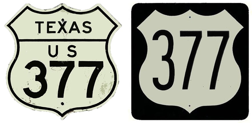
End of US highway 377 |
 |
|
1930-1931
|
1931-1951
|
1951-1968
|
1968-1988
|
1988-present
|
Summa
|
Mileage: in 1989 AASHTO listed a figure of 461 miles for US 377... but that assumed an endpoint in Madill. As of 2020, the signposted length of US 377 was 601.4 miles (which includes 124.7 "unauthorized" miles in Oklahoma; more below).
|
c. 1936, TXDoT
|
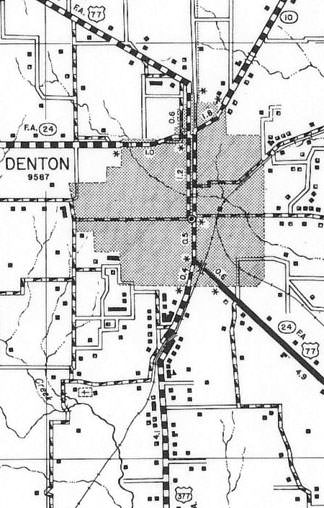
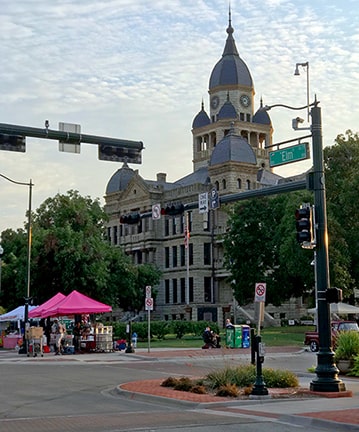
US 377 was commissioned in 1930; at the time its north end was in Denton. Originally it came into town on Locust Street, and junctioned with US 77 approximately where Eagle Drive is today. But US 377 probably did not end there; it almost certainly was overlapped north with US 77 along Locust, ending at the courthouse:
Sanderson, Sep. 2019
|
|
That was looking north on Locust at Hickory Street. There at the courthouse square, US 77 turned left for one block before heading north again on Elm Street. So within a few more years, after US 377 had been upgraded to its current viaduct under the railroad and came into town on Fort Worth Drive, it continued up Elm, ending at the jog in US 77 (one block to the left):
|
c. 1961, TXDoT
|
Sanderson, Sep. 2019
|
|
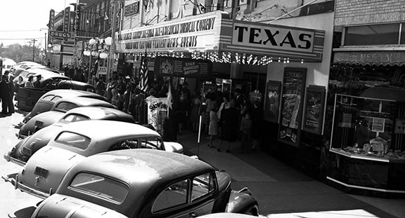
This 1942 image was taken looking the opposite direction (south on Elm, approaching Hickory):
|
c. 1942 (linked to source)
|
In the distance, a barely-legible highway signpost stated that US 77 and TX 24 were to the left on Hickory, while straight ahead was the beginning of US 377:
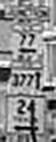
(detail)
|
|
Still later, starting in the 1950s, US 377 may have been extended north a couple blocks on Elm, ending at McKinney Street:
Sanderson, Sep. 2019
|
This photo was taken during that timeframe, but I believe this assembly was located at the historic terminus (south on Elm at Hickory). Note this was also during a brief period during which mainline US 77 traffic was directed around the city via I-35, while the original route of US 77 was signed as Business 77:
c. 1970s (linked to source)
|
|
The original south end of US 377 was at its junction with US 81 in Fort Worth. It is unclear when one-ways were introduced in FtW, but today historic US 81 is split into the one-way couplet of Commerce and Houston Streets, and old 377 splits into the Belknap/Weatherford couplet. Here is a view from what was likely the historic south terminus of US 377:
|
Brooks, May 2004
|
That was heading west on Belknap, looking at Commerce and the Tarrant County Courthouse. A right turn there was north on US 81, or a left turn on the far side of the courthouse (on Houston) would have been southbound US 81...
|
|
...but it was only one year later that the south end was extended to Stephenville. It is possible that the 377 designation could have ended at its junction with US 281 on the east edge of town, but it seems more likely that the two routes would have been overlapped to the junction with US 67 downtown:
|

c. 1936, TX DoT
|
|
This photo was looking west on Washington Street; US 377 was likely signed to this intersection at Graham Street. Southbound US 281 turned left, joining eastbound US 67. Westbound 67 was straight ahead. Note that -- thanks to a couple recent bypasses -- none of the mainline US routes are directed through this intersection anymore, although Washington is Business 377:
Taylor, Aug. 2004
|
Here, we are looking the opposite direction (east on Washington). This was formerly northbound US 67 (which came to this point and turned right on Graham). Northbound US 281 came from the right and continued straight ahead. Also straight ahead was the south beginning of US 377:
Sanderson, Aug. 2013
|
|
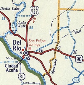
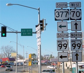
That lasted about 20 years. Then in 1951 the US 377 designation was extended further south, to its current terminus in Del Rio:
c. 1956, Gousha
|
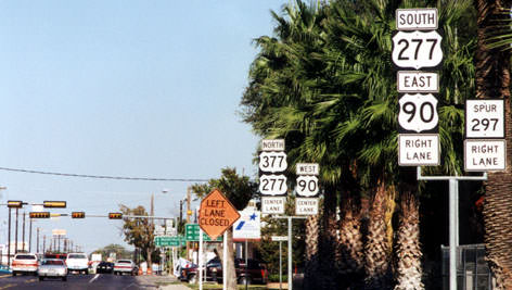
This shot was taken heading south on Veterans Boulevard (renamed from "Avenue F"); it was the last southbound US 377 sign:
Sanderson, Aug. 2013
|
|
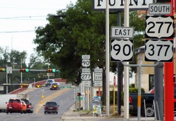
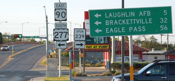
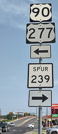
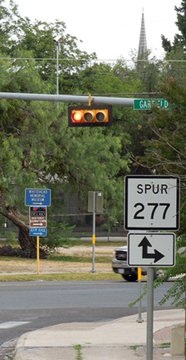
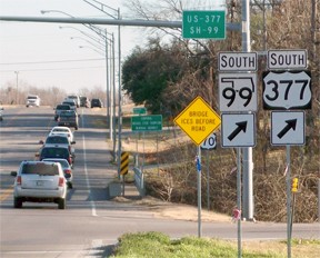
At that point, the designation is overlapped with US 90 and US 277. The yellow traffic signal in the distance was where US 377 ends; these photos show signage at the intersection:
Sanderson, Aug. 2013
|
Turner, Jun. 2023
|
|
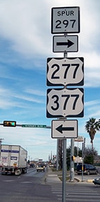
Eastbound US 90 and southbound US 277 are directed left at the intersection (Gibbs Street), but 377 ends there. Straight ahead is a viaduct over some railyards; today that is designated TX Spur 297. But when US 277 was first extended south of Del Rio (also in about 1951), it did not turn left there with US 90. Instead, it continued ahead over the viaduct to Garfield Street. Here is how that intersection was signed:
|
Sanderson, Aug. 2013
|
|
There mainline US 277 turned left (east towards Eagle Pass), whereas Spur US 277 turned right (southwest) to the Mexico border crossing. Garfield is still Spur US 277, despite the signage there (the real TX Spur 277 is in Coupland, way over near Austin). All of this may be relevant because, since the US 277 designation made it to that point until about 1985, it is possible that US 377 was historically signed to that junction as well. This photo was looking east on Garfield:
|
Sanderson, Aug. 2013
|
|
That assembly was a little strange, too: to the left is Spur 297. And there was no mention there of US 377, US 277, or Spur 277. Anyway, it is possible that US 377 once began to the left there. We will now continue that direction and return to the current terminus of US 377; this photo was taken across the viaduct, at the other end of Spur 297:
|
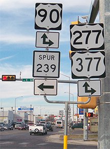
Karners, Dec. 2014 (unchanged as of 2023)
|
|
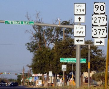
There was no assembly there in 2013. Several of the signposts at that intersection were replaced in 2014, and they were not entirely accurate. The one shown above made it look like 90, 277, and 377 all went both straight and right, but US 377 actually begins straight ahead. In the background was the first northbound confirming marker for 377:
|

Taylor, 2000
|
Karners, Dec. 2014 (unchanged as of 2023)
|
|
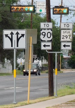
These photos were taken from eastbound Gibbs (TX Spur 239). Lots of information to convey here, so multiple sign trees were used. The south beginning of US 377 is to the left:
Taylor, 2000
|
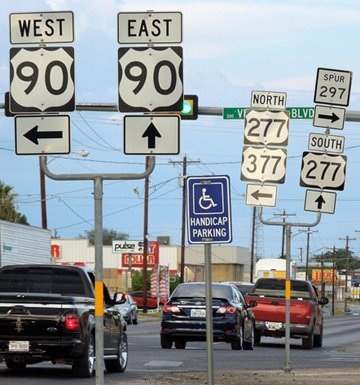
Sanderson, Aug. 2013
|
Karners, Dec. 2014 (unchanged as of 2023)
|
|
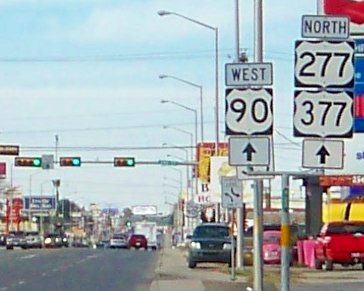
This shot was from the opposite direction (west on Gibbs). This is westbound US 90 and northbound US 277, each of which continue to the right. Also to the right is the south beginning of US 377:
|
Sanderson, Aug. 2013 (unchanged as of 2023)
|
|
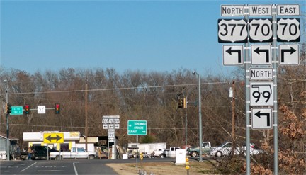
In 1968, AASHO approved an extension to US 377 north from Denton. Upon crossing into Oklahoma, it was routed along OK 99 to Madill... at least according to commercial maps. But OKDoT's official state highway maps for the next couple decades did not show a US 377 marker north of the Red River, suggesting that they may not have signed the route in their state (it's a long and somewhat mystifying story which is explained in more detail on this page). Originally OK 99 came into Madill via 5th Avenue, then east on Lilley Boulevard and out of town via Main Street. But by the time US 377 was added to OK 99, a bypass had been built along the south edge of town, so if US 377 was signed in Oklahoma during those years, it would have ended where that bypass junctions with US 70:
|
Karners, Jan. 2012
|
|
Today US 377 continues to the left, but it once ended there. These photos were taken from the perspective of US 70, looking both north and south (respectively) on First Street. Formerly US 377 began to the south:
|
Karners, Jan. 2012
|
Karners, Jan. 2012
|
|
In 1988 OK DoT extended the US 377 designation further north, to its present terminus at Stroud...
|

c. 1991, OK DoT
|
...however, signage there made it difficult to know exactly where. This photo was looking east on historic US 66/modern OK 66 (3rd Street):
|
McMahon, Dec. 2002
|
|
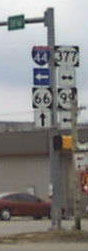
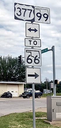
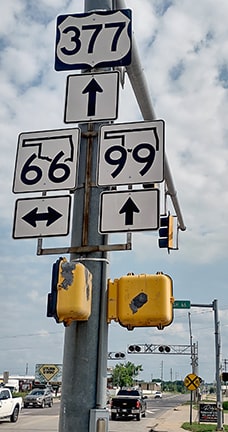
There, one would get the impression that the US 377 designation must continue to the left about a half-mile to the I-44 interchange. The same thing was indicated for drivers heading north on US 377/OK hwy. 99 (8th Avenue):
|
McMahon, Dec. 2002
|
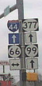
As you can see, in 2002 sign errors were in abundance at this intersection, but that was cleared up when OKDoT replaced the old "circle" state highway signs with the new "hatchet" state highway signs. Here is a more recent photo of the assembly for northbound traffic at that same intersection (and this is also the last northbound US 377 marker):
|
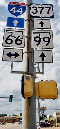
Turner, Jun. 2023
|
|
Based on OK DoT route logs, US 377 does indeed end at I-44. Funny thing is, though: north of OK 66 was absolutely no mention of US 377. Even the signage on I-44 mentioned only OK 99 (although by 2010 a US 377 shield had been added for the benefit of drivers on I-44):
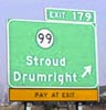
Stuve, Mar. 2003
|
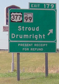
Morrison, Aug. 2010
Now, signage for traffic exiting the Turner Turnpike (I-44) gives the impression that US 377 runs both ways (rather than beginning to the right)...
|
Turner, Jun. 2023
|
|
...and while I suppose technically that is correct (since the I-44 overpass is a few hundred feet to the left), nevertheless I think it is misleading to indicate US 377 extends that direction (to the north). Drivers turning to the right (south) encounter the first southbound sign at the junction with OK 66:
|

McMahon, Dec. 2002
|
Turner, Jun. 2023
|
According to AASHTO, the north end of US 377 is still in Madill, because the extension north to Stroud was done without their approval. That was quite an unprecedented move, but it was the end result of a nearly-four-decade battle between Oklahoma and AASHO (AASHTO after 1973). The story is explained in more detail here.
|
Research and/or photo credits: Robert Brooks; Karin and Martin Karner; Brian Kosich; Jeremy Lance; Martin McMahon; Jeff Morrison; Steven Nelson; Dale Sanderson; Eric Stuve; Michael Summa; Stephen Taylor; Charles Turner
Page originally created 2000;
last updated Dec. 7, 2023.
last updated Dec. 7, 2023.
