End of US highway 18 |
 |
|
1926-1951
|
1951-1967
|
1967-present
|
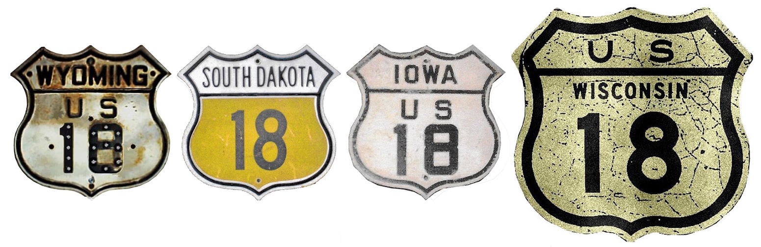
Summa
|
Mileage: in 1989 AASHTO listed a figure of 1033 miles for US 18. That closely matches our own 2020 measurement, which yielded 1034.6 miles.
|
|
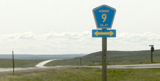
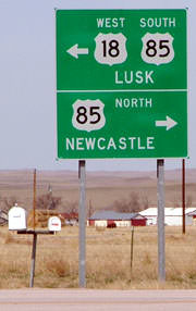
From its 1926 inception until 1967, the west end of US 18 was at its junction with US 85 in Wyoming. There has never been much of a settlement there, but like many highway intersections in Wyoming, this one has a name: Mule Creek Junction. The interesting thing about this junction is that it has moved:
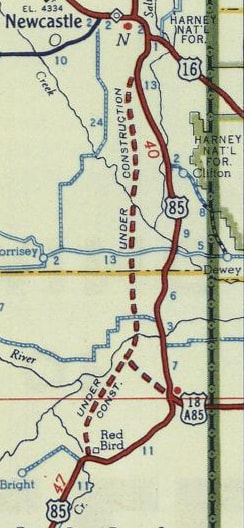
c. 1951, Gousha
|
|
|
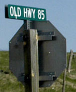
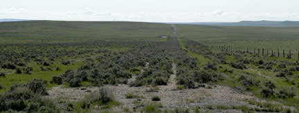
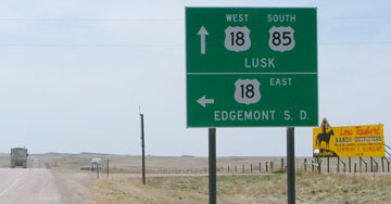
Today's US 85 south of Newcastle was opened to traffic in 1951. Because of this, it was necessary to extend US 18 west a few miles, so presumably that is also when the highway was changed to its current alignment. This photo was from westbound US 18, at the "new" Mule Creek Jct:
|
Sanderson, Mar. 2004 (essentially the same as of 2020)
|
US 18 now extends further west via US 85, but that sign is at what was once the west end of US 18.
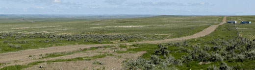
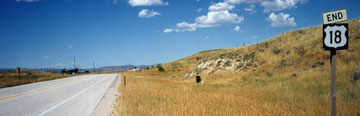
Here is the historic west beginning as seen from northbound US 85... |
Sanderson, Mar. 2004 (essentially the same as of 2020)
|
|
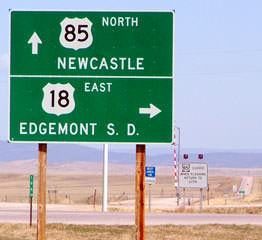
...and next is a view from the opposite direction:
|
Sanderson, Mar. 2004
|
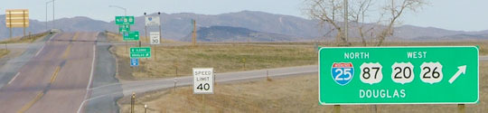
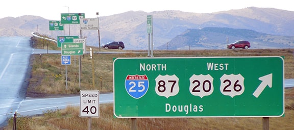
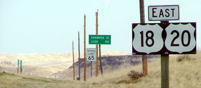
In 1967, the designation was extended straight ahead from there along existing US routes down to Lusk, and then over to I-25. These photos were looking west on US 18-20; just over the hillcrest is I-25's interchange 126:
Sanderson, Aug. 1999
|
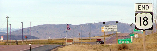
Sanderson, Mar. 2004 (unchanged as of 2015)
|
Sanderson, Oct. 2021
|
|
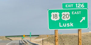
The actual interchange is visible in the distance; here are some closer views:
Sanderson, Mar. 2004
|
Sanderson, Oct. 2021
|
|
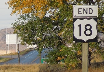
US 18 ends there, but US 20 continues west via I-25. Here is the beginning of US 18 as seen from northbound I-25...
|
Sanderson, Mar. 2004 (unchanged as of 2015)
|
...and below is the first eastbound sign assembly:
|
Sanderson, Mar. 2004
|
The east end of US 18 has always been in Milwaukee, but its exact location there has changed at least five times (maps and more info about historic endpoints can be found on the Milwaukee page). The current terminus is somewhat unusual in that it is not at a junction with another highway. US 18 winds up on Michigan Street in downtown Milwaukee, and the designation ends where it intersects Lincoln Memorial Drive along the shore of Lake Michigan. Historically the last eastbound trailblazer was between Jackson and Van Buren streets, but (perhaps due to ongoing construction projects) it has since been removed. As of 2021 the last US 18 sign was on southbound Broadway, directing traffic east on Michigan.
|
Here are a few shots of the different "End" assemblies that have been posted in recent years on Michigan at Lincoln. The first two show an assembly on the west side of Lincoln, which existed until sometime between 2011 and 2014. The third shot shows an assembly on the east side of Lincoln that was posted around 2020:
|
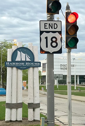
Sanderson, Jun. 2022
|


|
In 2005 there was no signage from either direction on Lincoln; the sign bridge shown here in the distance was installed between then and 2008, but it appears this intersection has still not achieved its permanent configuration:
|
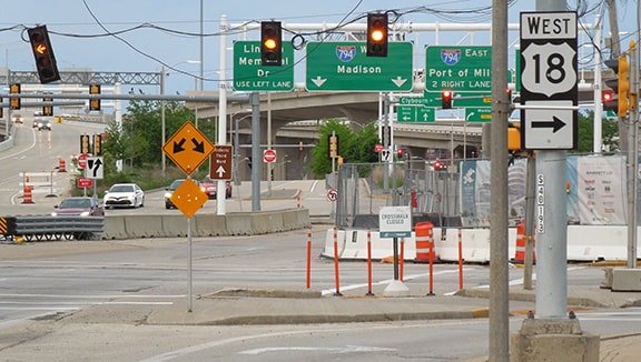
Sanderson, Jun. 2022
|
|
Traffic heading the opposite direction (north on Lincoln) has also had an on-again, off-again situation in terms of whether or not there are posted references to the east beginning of US 18:
|
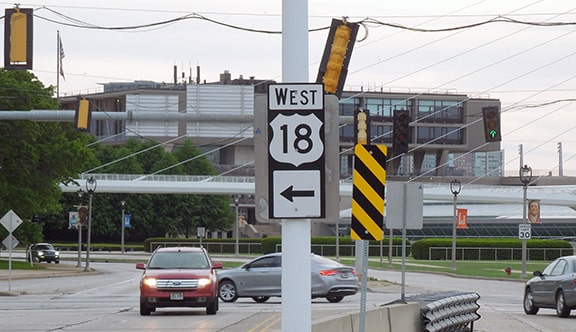
Sanderson, Jun. 2022
|
|
Heading left on Michigan, the first westbound US 18 marker was posted in a couple blocks (just before Cass Street). The sign was removed sometime between 2011 and 2014, but then replaced sometime around 2020:
|
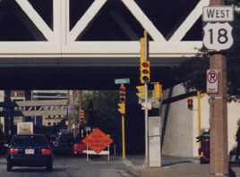
Mortell, 1997
|
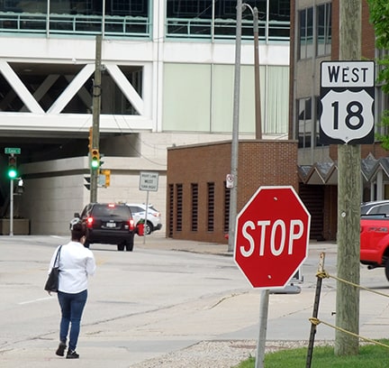
Sanderson, Jun. 2022
|
Research and/or photo credits: Chris Geelhart; Tom Grier; Jeff Morrison; Robert Mortell; Dale Sanderson; Michael Summa
Page originally created 1998;
last updated Jun. 8, 2022.
last updated Jun. 8, 2022.
