End of US highway 113 |
 |
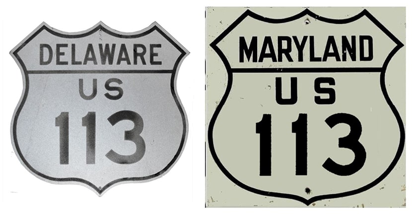
Summa
|
|
Mileage: in 1989 AASHTO listed a figure of 102 miles for US 113... however, that included the mileage of US 113's associated alternate route. According to the state subtotals on AASHTO's 1989 spreadsheet, mainline US 113's actual end-to-end total was 92 miles... but at the time, US 113 still ended in Dover. Since then it has been truncated to Milford, and our own 2020 measurement yielded 74.5 miles.
|
US 113 originally functioned as an alternate route for US 13 through the Delmarva Peninsula:
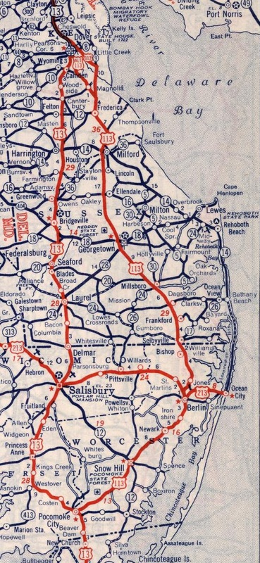
c. 1940, Rand McNally
|
Ever since the advent of US highways in 1926, the south end of US 113 has been in Pocomoke City. Traffic originally came into Pocomoke from the northeast via what is now called Old Snow Hill Road and Linden Avenue. This image was taken looking north on Market Street, which is Business 13 today, but which historically carried mainline US 13:
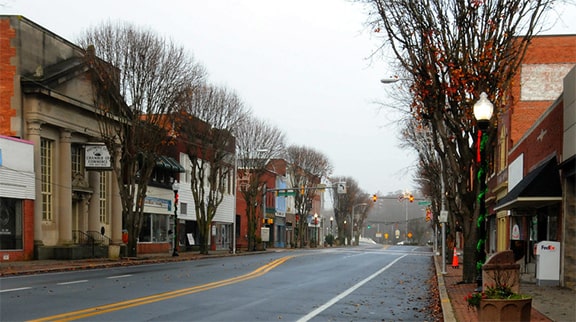
Johns, Dec. 2012 (linked to original)
It is uncertain which road US 113 traffic used to connect to Market, but it likely would have been Clarke Avenue, in which case the south beginning of US 113 was to the right at the traffic signal ahead. But already by the mid-1930s US 113 had been moved to what is now called "Bypass Road", which in turn connected with the northernmost segment of Old Virginia Road. US 13 remained on Market until around 1960, so for about 25 years, the south terminus of US 113 was a little further south and west of its current endpoint:
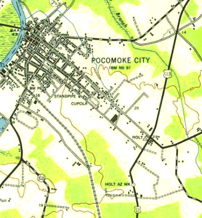
USGS, c. 1943 and 1968
|
|
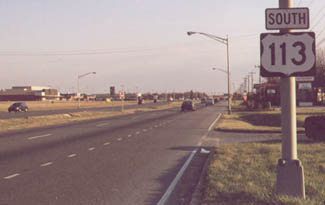
These shots show the current south beginning of US 113 (Worcester Highway) as seen from northbound US 13 (Ocean Highway):
|
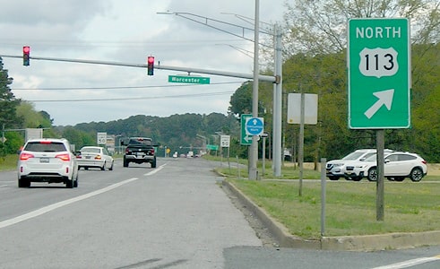
Morrison, Apr. 2023
|
|
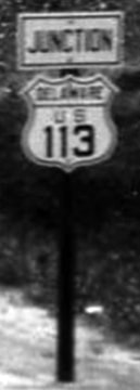
This sign is posted where US 113 currently ends at its junction with US 13...
|
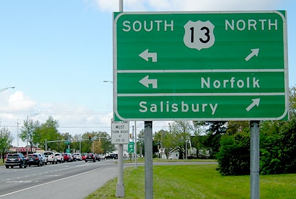
Morrison, Apr. 2023
|
|
...however, historically US 113 continued straight ahead on Old Virginia, ending at Market:
|
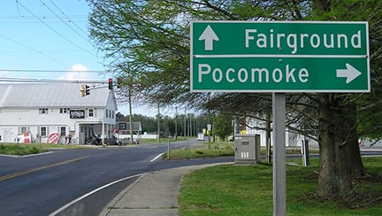
Morrison, Apr. 2023
|
|
Today, historic US 13 is designated as Business 13, and it is signed with green US route shields. This shot was looking southbound on that route; for roughly 25 years the south beginning of US 113 was to the left on Old Virginia:
|
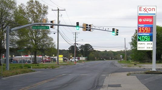
Morrison, Apr. 2023
|
|
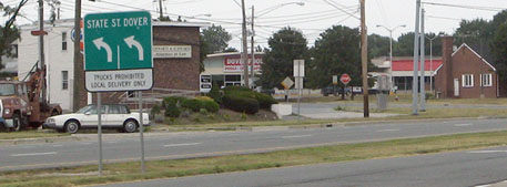
For nearly 80 years, the north end of US 113 was in Dover. Originally US 13 followed State Street through downtown. South of there, US 13 veered onto Governors Avenue and more or less joined its current alignment. But if a driver were to continue south on State, they would have been on the north beginning of US 113. This photo was looking south on US 13, or Dupont Highway:
|

Field/Nitzman, Aug. 2007
|
|
Originally US 13 came in from the right on State, and continued straight ahead. To the left on State was the north beginning of US 113. This next photo was taken looking roughly the same direction in 1924 (note the reference to "State Highway No. 3"), but it is likely that sign was still in existence two years later when the US route system was established:
|
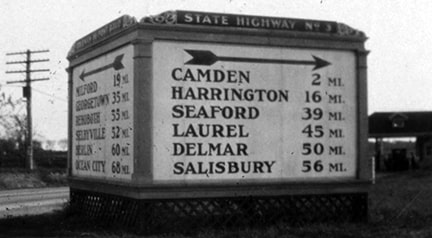
Nov. 1924, Delaware Public Archives (linked to source)
|
|
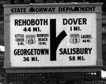
On the right side are mileages to several towns along US 13. Same thing on the left, except the towns are on (or near) US 113, from Milford to Ocean City.
Here, we are back to a modern photo, looking northbound on US 13: |
Field/Nitzman, Aug. 2007
|
|
US 13 continued to the left on State, but to the right on State is where US 113 originally began:
|

Field/Nitzman, Aug. 2007
|
|
In 1929 Governors Av. was extended north so that it could function as a bypass for State. Some maps indicate that US 13 traffic might have been moved to Governors at that time. If so, then US 113 might have been extended north on State, through downtown, ending where Governors comes back in. This image was looking north on Governors; US 13 would have continued north by curving slightly to the left. It is possible that traffic coming in from the right on State was at the north end of US 113:
|
AARoads, Dec. 2016
|
|
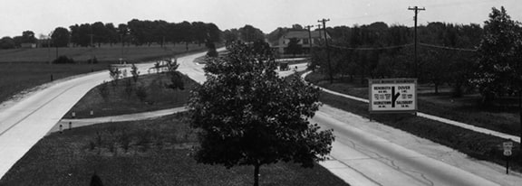
But that would have lasted only until 1935 anyway, because at that time the northern segment of the DuPont Highway was completed, so US 113 traffic was directed onto it. This next photo shows how that junction looked when it was brand new. The view was northbound from the perspective of traffic at the north terminus of US 113, which ended here at this curve in US 13 (the street blade at far right says "Leipsic Rd"):
|
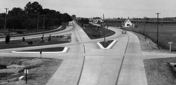
c. 1935, Delaware Public Archives (linked to source)
|
|
This photo was taken the same day, but looking the opposite direction: south on US 13 (DuPont), which curves to the right to become State Street. Straight ahead on DuPont was the north beginning of US 113:
|
c. 1935, Delaware Public Archives (linked to source)
|
|
The signs on the right side of the photo are enlarged here:
|
(detail)
|
(detail)
|
|
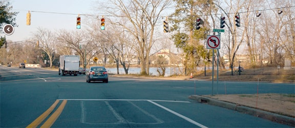
Next is a modern photo of that same junction, looking at the north end of State St. This was US 13, which continued by curving left on DuPont. Traffic coming in from the right on DuPont was once at the north end of US 113:
|
AARoads, Dec. 2016
|
|
But in 1951, when the southern segment of DuPont was completed, that allowed US 13 traffic to bypass the downtown area as well. So US 13 continued south on DuPont, and US 113 was truncated to the point where Bay Road splits off. These photos were from southbound US 13, at the former north beginning of US 113; this is Bay Road to the left:
|
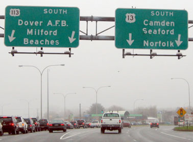
Nitzman, Apr. 2004
|
Field/Nitzman, Aug. 2007
|
|
The backside of that sign bridge is visible in this photo (although this sign is no longer there):
Nitzman, Apr. 2004
|
This shot shows the first US 113 shield as one headed south from its former north beginning in Dover:
Nitzman, 2000
|
|
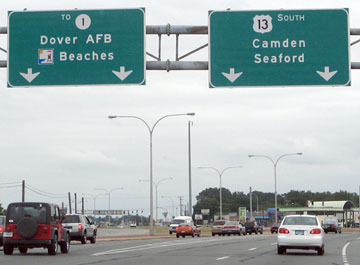
In 2003 DelDoT successfully applied to have the US 113 designation truncated to Milford, in order to eliminate the US 113/DE 1 concurrency. These photos were taken from southbound DE 1:
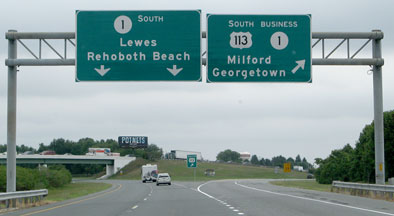
Field/Nitzman, Aug. 2007
|
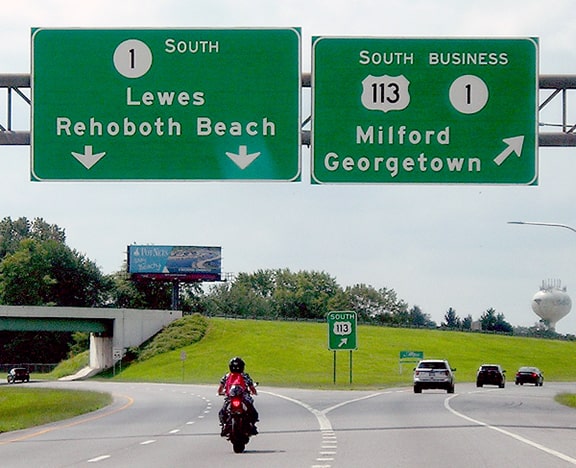
Morrison, Aug. 2021
|
|
To the right is now the official north beginning of US 113. The sign in the gore points to the right and says "SOUTH US 113", and across from there was a "Begin" assembly (until sometime after 2013), shown close-up here:
|

Field/Nitzman, Aug. 2007
|
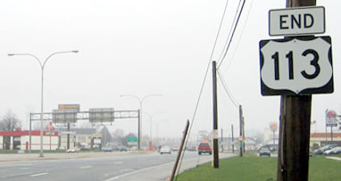
Heading the opposite direction, this photo shows the last northbound US 113 marker:
|
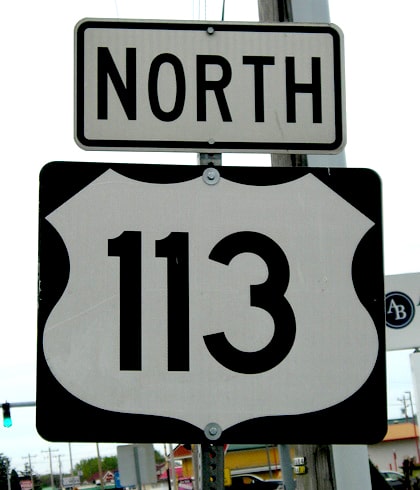
Morrison, Apr. 2023
|
Research and/or photo credits: AARoads.com, Nathan Edgars; Andy Field; William Johns; Jeff Morrison; JP Nasiatka; Alex Nitzman; Dale Sanderson; Michael Summa
Page originally created 2000;
last updated Dec. 8, 2023.
last updated Dec. 8, 2023.
