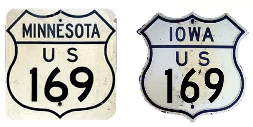
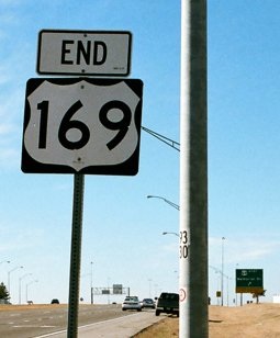
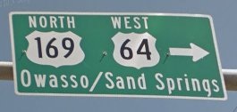
End of US highway 169 |
|
1930-1934
|
1934-1935
|
1935-1944
|
|
1944-1958
|
1958-1965
|
1965-present
|
|
Mileage: in 1989 AASHTO listed a figure of 971 miles for US 169... however, that included the mileage of US 169's associated business routes. According to the state subtotals on AASHTO's 1989 spreadsheet, mainline US 169's actual end-to-end total at the time was 966 miles. That closely matches our own 2020 measurement, which yielded 966.7 miles.
|
|
|
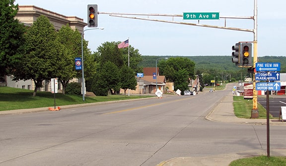
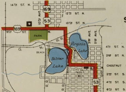
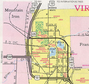
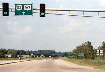
When US 169 was first commissioned in 1930, its south end was in Kansas City. The original north end of US 169 was at International Falls. From Virginia MN, the 169 designation went north along what is now US 53, all the way to the Canada border. In 1934, when US 53 was extended north of Superior WI through Duluth and Virginia to I-Falls, the north end of US 169 was truncated at Virginia. At the time, US 169 came east from Parkville (now incorporated by Mountain Iron) into Virginia, via what is now CR 102/9th Street North. It junctioned US 53 at 9th Avenue. This image was looking east on 9th St N; straight ahead was southbound US 53, while northbound was to the left on 9th Av, so US 169 ended here:
|
|
1934 was also the first map to show State Trunk Highway 169 signed along a previously-unmarked road running northeast from US 53 at Virginia, through Franklin and Florenton to Peyla (near Tower). In other words, the number of this new trunk highway was obviously based on US 169, and apparently its mileposts have always been numbered as if the route were an extension of US 169.
But the map from the following year (1935) showed that TH 169 had been rerouted to its current corridor. In other words, traffic no longer went through Franklin, but instead connected to US 53 about four miles north of Virginia (at what I refer to as "Ely Junction", pronounced EE-lee). So now, in order to maintain route continuity between US 169 and TH 169, it became desirable to add the 169 designation to the four-mile segment of US 53 north of Virginia. But was it considered US 169 or TH 169? |
|
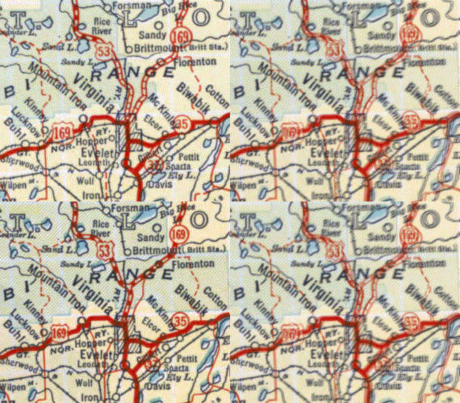
I have not seen a map from that timeframe detailed enough to show the designations along that four-mile stretch. But the earliest state highway map to include a Virginia inset was 1946. It showed 9th Av north of Virginia as US 53 and US 169. Same with the '47 and '48 maps:
|
So was US 169 really signed (or technically re-signed) back up as far as Ely Jct? There were no insets on the 1949 map. But they were included again in 1950, and every Virginia inset from then on showed that it was TH 169 north of town, along with US 53. This remained the case all the way up to the early 1990s, which was when MNDoT stopped printing a Virginia inset:
|
|
So in 1950, were the US 169 signs removed north of Virginia, and replaced with TH 169 signs? That is possible... and if so, then the north endpoint of US 169 reverted to the intersection described above. But it is also possible that MNDoT continued to sign the four-mile segment up to Ely Jct. as US 169 (more on that later).
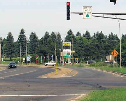
In about 1965, US 53 traffic was redirected to use the bypass around the west side of Virginia. Old US 53 through town was renumbered as an extension of TH 135. So at that time, the north terminus of US 169 was shortened by 3/4ths of a mile to the new US 53, at what is now the intersection with CR 102/9th St N. This image was looking east on CR 102: |
Originally US 169 continued ahead to old US 53, but after that US 53 bypass was built, that intersection marked the north end of US 169. But that situation lasted only a few years, because in 1971 the US 169 expressway was completed west of Virginia, and thus the modern highway configuration in the area was established. So the north end of US 169 was changed to its current junction with US 53.
|
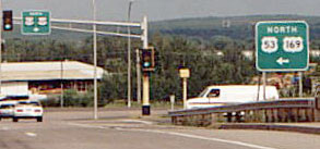
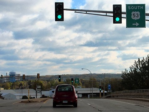
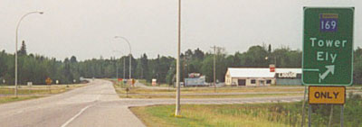
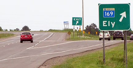
Presumably AASHO (and later AASHTO) always considered the aforementioned endpoints to be correct. However, despite the fact that MNDoT maps after 1949 marked the Virginia-Ely Jct. segment as TH 169, there is reason to believe that they actually signed that stretch as US 169. That was certainly the case as late as 2000 (as shown in several photos below). It was not until about 2005 that MNDoT removed the US 169 signs north of Virginia.
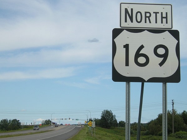
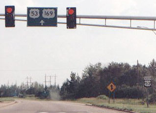
This photo shows the last northbound US 169 sign, which is posted in full view of its endpoint at the traffic signal just ahead, at its junction with US 53:
|
|
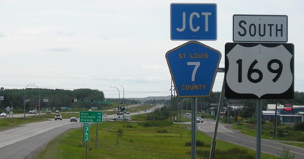
That was where MN 169 merged with southbound US 53; historically the US 169 signs began at Ely Jct. Another US 169 sign formerly was posted heading south at CR 102, where during the late '60s the route technically began to the right:
|
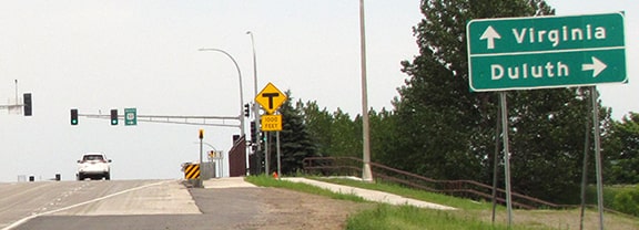
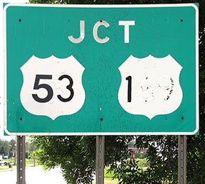
So to summarize: since 1934, the north end of US 169 has officially been at its junction with US 53 in Virginia. But for at least part (and possibly all) of the next 70-year period, the signed endpoint of US 169 was four miles north of Virginia. Here is another old sign that indicated US 169, posted for traffic heading west on 9th St approaching the US 53 bypass:
|
|
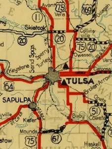
In 1935 the US 169 designation was extended into Oklahoma. Since then, the south end of the route has been at several different locations in and around Tulsa. Although some of what is presented here is guesswork and conjecture, most of it is based on historic OK DoT maps and/or OK DoT route logs. US 169 was not shown on the 1935 map from OK DoT. It first shows up on 1936 map, but it appears to end at US 75 in Collinsville:
|
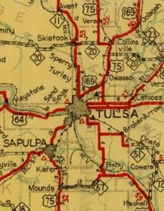
The Tulsa inset on the 1936 edition does not show US 169 either. However, OK DoT's legal description of US 169 states that it was commissioned in June 1935 to run from Tulsa to the Kansas line. So, despite that map, US 169 never ended in Collinsville. Maybe the reason it was not shown going to Tulsa on that map is because its new routing through Mohawk Park was under construction. That segment opened in May 1937, and it was shown on that year's map:
|
|
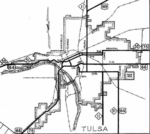
US 169 was also marked on the Tulsa inset map, coming into town on Mohawk Boulevard and then Peoria Avenue:
|
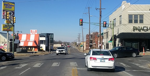
Initially US 169 ended at 2nd Street, where it junctioned US 75. But within a couple years it had been extended a mile further south, in order to connect with US 66 and US 64 as well (as shown on that map). This image was taken looking north on Peoria:
The two black cars (at left and right) were on 15th, which historically carried US 64 traffic. Straight ahead on Peoria was the south beginning of US 169.
|
|
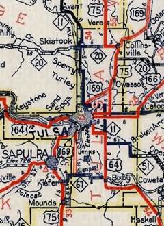
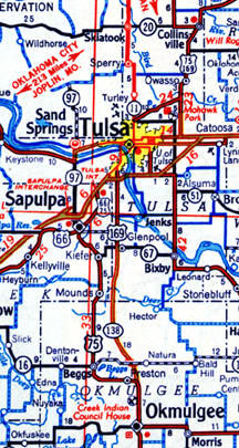
The next year (1940), OK DoT maps apparently stopped including city insets, but the main maps through 1943 indicate that US 169 continued to end in Tulsa. However, in May of that year, US 169 was extended west on 15th Street; then south on Boston Avenue; then across the Arkansas River on the 21st Street Bridge (which becomes 23rd in West Tulsa) -- that routing is shown on the map above. From there, US 169 was signed southward along Union Avenue (and later the "Okmulgee Beeline", which is now known as the "Okmulgee Expressway" -- it is the route that US 75 follows today). The 1944 map was the first to show this. I have seen that map only in black-and-white, but the full-color map from the next year was very instructive in determining exactly where US 169 ended:
|
According to the legend for that map, US routes are shown in red, and state routes are blue. So US 169 is shown ending at OK hwy. 67 in Glenpool, rather than being signed westward to a terminus at US 75 in Kiefer (the "hollow" red line indicates that the road was not yet paved). That was confirmed in the legal description, which specifies US 169 was extended to "Jct. SH 67 near Glenpool". But note that, while today's OK 67 runs along 151st Street, that was not the case until about 1972. Prior to that, OK 67 ran along 141st Street, so that was where US 169 ended.
|
|
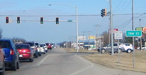
These photos show what that junction looked like then and now: they were both taken looking northbound on Union Av/Okmulgee Beeline at 141st, and straight ahead was the south beginning of US 169:
|
In this modern image, note that the Okmulgee is now a 4-lane expressway:
|
|
As illustrated on that map, US 75 was still using the road currently designated Alternate US 75, through Keifer and Beggs. OKDoT continued to extend the Beeline further southward, and by 1957 or '58 it connected with US 75 at Preston. At that time they sought AASHO permission to extend the US 169 designation southward with US 75 through Henryetta and Okmulgee all the way to Calvin, and then through Ada to Madill. (During that time OKDoT was determined to have a US route serving Ada; they had actually been trying to accomplish that since 1952, when they began proposing to extend US 177 and/or US 377). The US 169 proposal was not approved in 1957, nor in the following year when they made the same request. Some OKDoT documents provide additional insight on what was happening during that timeframe:
|
|
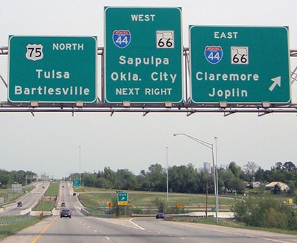
On the other hand: I have never seen any map showing a US 169 marker south of Glenpool. Not even OKDoT's maps. So what was the story with this hesitating extension that was retracted just five years later? I can think of two possibilities: OKDoT may have been reconsidering the extension to Ada due to the cost of upgrading the road to compliance. Also, by this time the Mingo Valley Expressway was under construction in Tulsa, and OKDoT wanted to apply the US 169 designation to that. It was built from the north, southward, and by 1964 it was complete down to its interchange with Skelly Drive (I-44), so traffic on both US 75 and US 169 was rerouted to follow the Mingo and I-44. In 1965 OKDoT put US 75 traffic on the Okmulgee, and the following year they truncated the US 169 designation to its junction with the Okmulgee (US 75). This image was taken looking north on US 75; for a time the south beginning of US 169 was to the right with eastbound I-44:
|
In 1978, US 169 was truncated again, such that it ended on the Mingo at its interchange with I-44. This was probably done because the next segment of the Mingo was about to open, and OK DoT had decided to use the US 169 designation for the Mingo. That happened in 1981, when the Mingo was completed down to the Broken Arrow Expwy, and US 169 was extended to that interchange. In 1987 the Mingo and US 169 were extended to the 71st Street interchange. By 1991 the Creek Turnpike was complete between Okmulgee and Memorial Drive (US 64), but the Mingo still went only as far as 71st until the following year: in 1992 the Creek Tpk was connected with the Mingo, and that is when the US 169 designation was extended to its current terminus at Memorial (Oklahoma made that official with AASHTO in 1994).
|
Since the Mingo bypasses downtown Tulsa to the east, US 169 no longer serves the central part of the city. (Apparently the name "Mingo Valley Expressway" is disappearing from local usage: the road is now signed as "Pearl Harbor Memorial Highway", but most Tulsans refer to it simply as "169"). In the southeast part of town, the freeway (now completed) curves west and becomes the Creek Turnpike. That is a toll road west of the Memorial Drive interchange (where eastbound US 64 exits), so perhaps that is why officials decided to terminate the US 169 designation at that point:
|
In the background is the exit sign for US 64, shown in more detail below. Ahead the turnpike becomes a tollway; the yellow sign says "Last Free Exit":
|
|
This series of photos was taken from the eastbound Creek Turnpike; the first one was approaching the Memorial exit. Eastbound US 64 is directed south on Memorial. Straight ahead is westbound 64, but that was not really acknowledged along the mainline. Also straight ahead is the south beginning of US 169:
|
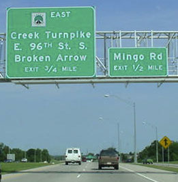
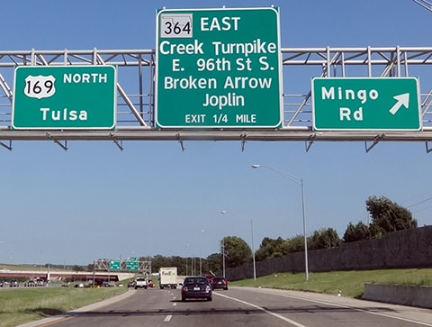
In the next photo, note the Creek Turnpike logo -- those were replaced with OK 364 signs in about 2014 (as shown on the last photo on this page):
|
Research and/or photo credits: Jody Aho; David Backlin; Chuck Bell; Robert Brooks; Monte Castleman; Warren Drewes; Nathan Edgars; Jeremy Lance; Patrick Lilja; Jeff Morrison; Ken Klauburg; Jeremy Lance; Jeff Morrison; Ben Prusia; Dale Sanderson; Eric Stuve; Michael Summa
Page originally created 2001;
last updated Feb. 7, 2024.
last updated Feb. 7, 2024.
