End of US highway 25 |
 |
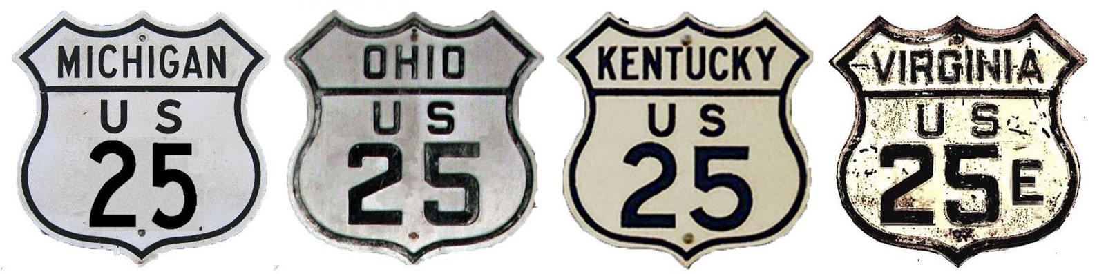
Summa
|
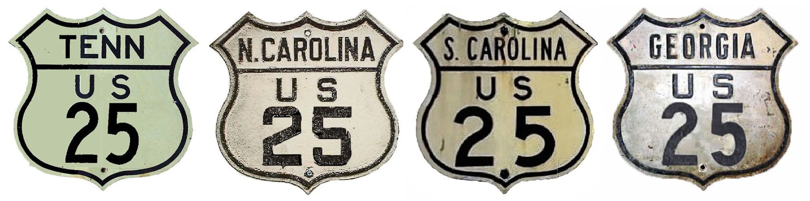
Summa
|
|
1926-1929
|
1929-1933
|
1933-1936
|
|
1936-1967
|
1967-present
|
Mileage: historically, when it went to Michigan, US 25 was 1115.8 miles long.
|
In 1989 AASHTO listed a figure of 903 miles for US 25... however, that included the mileage of US 25's associated business/bypass/alternate routes, and it also included the mileage of both US 25E and US 25W through Kentucky and Tennessee. According to the state subtotals on AASHTO's 1989 spreadsheet, mainline US 25's actual end-to-end total at the time was 750 miles (using US 25W) or 718 miles (via US 25E). Our own 2020 measurement yielded 708.3 miles (using US 25E, or 744 miles via US 25W).
|
Originally US 25 roughly followed what is now I-75 through Cincinnati, and north through Dayton, Lima, Toledo, and Detroit. From there it went to Port Huron MI via a road which today is signed with several different state and county highway numbers:
|
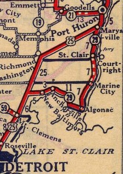
c. 1927, Rand McNally
|
|
This photo was taken on Military Street facing north towards Water Street (Lapeer Road):
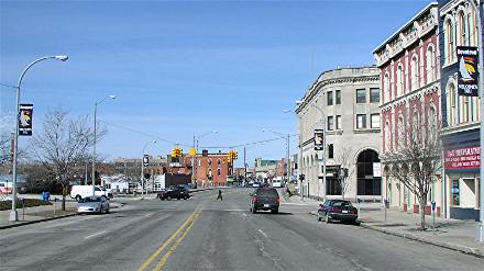
Hargraves, 2005
|
That was probably where M-21 ended, which would have been a logical point to terminate US 25. In 1933, the US 25 designation was extended northward about 85 miles to Port Austin:
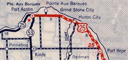
c. 1939, Rand McNally
|
|
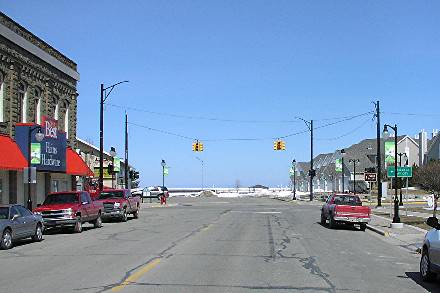
This shot is facing west on Spring Street at the meeting point with Lake Street:
Hargraves, 2005
US 25 most likely would have followed Port Au Barques Road into town, where it changed to Spring Street. Later on, US 25 was rerouted south, coming in on Grindstone Road to the south of Port Austin. That is the arrangement depicted on the 1970 USGS topo:
|
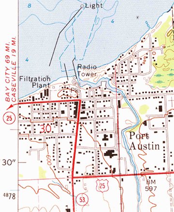
c. 1970, USGS
|
|
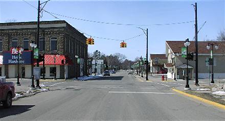
Although it was not made clear on that particular map, historic photos and historic Michigan route logs confirm the fact that US 25 and M-53 both extended north from their junction, with all three designations (US 25, M-25, and M-53) ending at the same intersection at the center of town. This picture was taken on Lake Street, looking north onto the intersection with Spring:
|
Hargraves, 2005
|
At first US 25 may have come in from the right on Spring, ending at the traffic signal. Later US 25 was rerouted to come in on Lake, ending there at Spring.
|
US 25 was an original 1926 route; at the time it ran down to North Augusta SC, ending unceremoniously at the Georgia stateline for a few years. But Georgia picked up the route in 1929, extending the south end of US 25 to its junction with US 80 just west of Statesboro (USGS maps label this junction "Hopeulikit"). This shot was looking northwest along US 25-80:
|
Karners, Apr. 2014
|
Today the highway curves to the right, and at the light in the distance, US 80 splits off by making a left turn. The road goes behind the trees in the center of the photo, and then re-emerges in the upper left corner. But in the '30s, US 80 followed the alignment visible along the left side of the photo, and right here is where the south beginning of US 25 split off to the right.
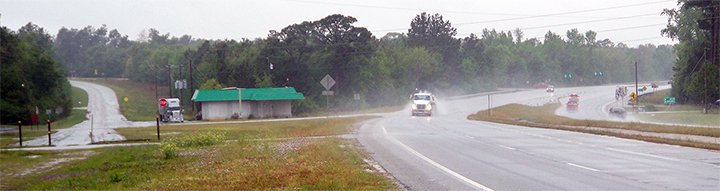
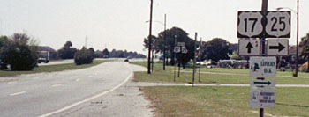
In 1936 the south end of US 25 was extended out of Statesboro along its current corridor, ending in Brunswick GA. It comes into Brunswick having been co-signed with US 341 for about 40 miles, from Jesup. At first, US 25 ended north of downtown (at Dock Junction, the same place where US 341 had ended since 1928), where those routes junctioned US 17 (more info on the Brunswick page).
In 1936 the south end of US 25 was extended out of Statesboro along its current corridor, ending in Brunswick GA. It comes into Brunswick having been co-signed with US 341 for about 40 miles, from Jesup. At first, US 25 ended north of downtown (at Dock Junction, the same place where US 341 had ended since 1928), where those routes junctioned US 17 (more info on the Brunswick page).
|
After US 17 was rerouted to use the Sidney Lanier Bridge in 1956, US 25 and US 341 were extended into town along the former US 17. Traffic was originally directed through Brunswick on Newcastle Street, but today bypasses the downtown area via Bay Street. US 25 splits off onto Gloucester Street, and its last southbound trailblazer is just past Norwich Street:
|
Karners, Jan. 2017
|
Meanwhile, US 341 continues about a mile further south, then heads east on Fourth Avenue. Both routes end at their junctions with US 17, or Glynn Avenue. This photo was from eastbound Gloucester at Glynn:
|
Osbaldeston, Mar. 2002
|
|
There was some construction at that intersection in 2003, and some re-signing as well; here is how that same view looked in 2004:
|

Nitzman, July 2004
|
Nitzman, July 2004
|
Nitzman, July 2004
|
|
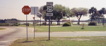
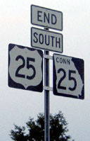
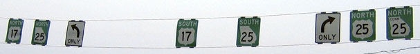
US 25 is now co-signed with GA "Connector 25", while US 17 is overlapped with mainline GA 25... all of which served to make signage a bit more confusing. More recently, most of those signs have been removed, including (unfortunately) the "End" assembly:
|
Nitzman, Jan. 2014
|
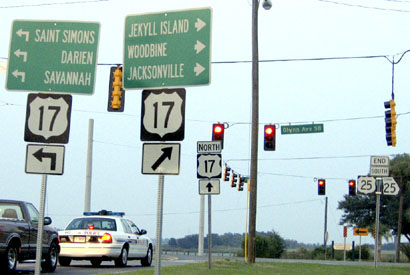
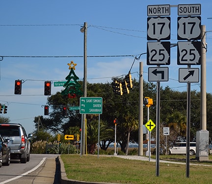
The signage shown here is posted on northbound Glynn (US 17), at the south beginning of US 25:
Karners, Jan. 2017
|
The signs on the spanwire in the distance are shown close-up below...
Nitzman, July 2004
...and here is signage for traffic heading the opposite direction, on southbound Glynn:
|
Osbaldeston, Mar. 2002 (gone as of 2016)
|
Nitzman, July 2004
|
|
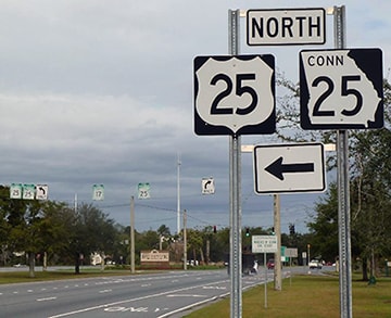
Turning to the west on Gloucester, the first northbound US 25 marker was posted at the intersection with Norwich. (Historically, US 25 traffic was directed to the right, and the east beginning of US 84 was straight ahead):
|

Karners, Jan. 2017
|
|
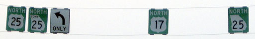
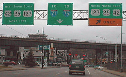
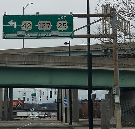
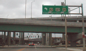
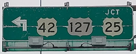
In 1967 the US 25 designation was eliminated in Michigan and Ohio. Signs may not have been removed until about 1974, but since then the north end of US 25 is in Covington KY (although there is a minor dispute about that; see below). We will begin by heading west on KY hwy. 8 (4th Street) in Covington. Note that US 25 is still signed northbound from this point:
|
Moraseski/De Cesari, Nov. 2001 (still there as of 2019)
|
|
That right turn puts drivers onto the Clay Wade Bailey Bridge over the Ohio River. More than halfway across the river, the bridge enters Ohio. At that point on the bridge was formerly the last northbound US 25 sign:
|
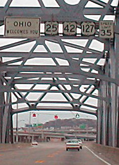
Moraseski/De Cesari, Nov. 2001
|
Head, Mar. 2019
|
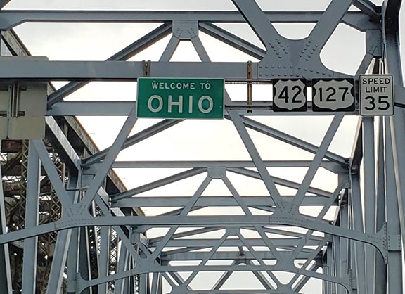
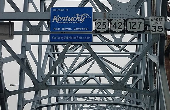
(Note the backside of the sign visible at far left; that is a "Welcome to Kentucky" sign, the frontside of which we will see in a photo below.) All of those signs were replaced around 2008... except for the US 25 shield. H.B. noted that the specs of those signs suggest that they were installed by Ohio DoT, which does not consider US 25 to exist in their state. Neither does AASHTO, which lists Covington as the north endpoint of the route. The dispute arises because of a technicality: Kentucky maintains the entire bridge, including about 140 feet that are inside the boundary of Ohio. As a result, KYTC's internal description of US 25 has the designation extending to the end of the section they maintain (which is in Cincinnati city limits). However, this is most likely an error, because Kentucky does not have the authority to define a route outside of their borders. There is no question that they maintain the bridge a short distance into Ohio, but the bridge is designated US 25 only as far as the Ohio line.
|
Head, Mar. 2019
|
That was heading south over the Ohio River, and (unlike its counterpart), a US 25 sign is still there. (Visible at far left in this next photo is the backside of the "Welcome to Ohio" sign, pictured above):
|
Head, Mar. 2019
|
Research and/or photo credits: Chris Bessert; Shawn De Cesari; Nathan Edgars; H.B. Elkins; Paul DiGianfrancesco; Don Hargraves; Mike Head; Karin and Martin Karner; Dan Moraseski; Jeremy Moses; Alex Nitzman; Greg Osbaldeston; Dale Sanderson; Michael Summa
Page originally created 2000;
last updated Dec. 15, 2023.
last updated Dec. 15, 2023.
