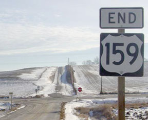
End of US highway 159 |
 |
|
1935-1942
|
1942-1957
|
1957-1974
|
1974-present
|
Summa
|
Mileage: in 1989 AASHTO listed a figure of 85 miles for US 159. That closely matches our own 2020 measurement, which yielded 84.9 miles.
|
|
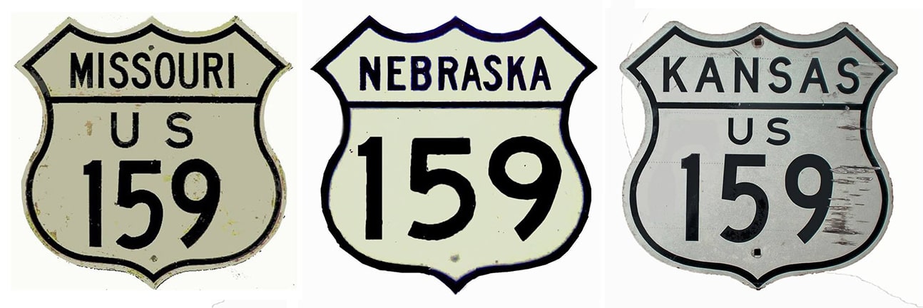
Claim to fame: US 159 is the shortest US route that serves more than two states.
However, at the time US 159 was commissioned in 1935, it was only 25 miles long, and entirely in one state. It replaced part of the route that had formerly been designated US 73W: |
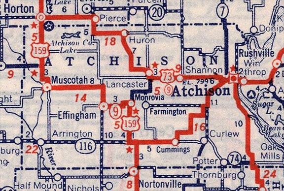
c. 1940, Rand McNally
|
|
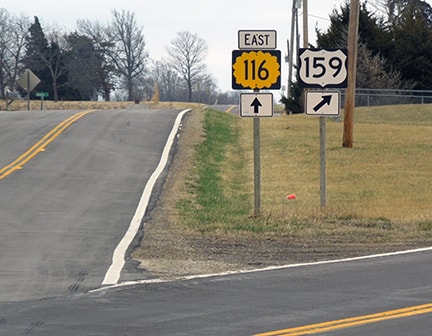
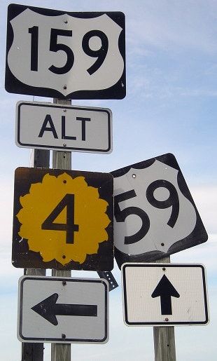
At the time US 59's diagonal between Nortonville and Cummings had not yet been built. Instead, traffic went north from Nortonville on today's US 159, and then east on K-116. The opposite direction (west on K-116) was where US 159 began. This image was looking east on US 159/K-116. Today the two routes split here, with K-116 continuing due east to Cummings, while US 159 curves due south, reaching Nortonville in about three miles. This curve may not have been here in the 1940s; if not then the original junction would have been the 4-way intersection with Hamilton Road (ahead just over the hillcrest). Until about 1957, US 159 ended here. Straight ahead was northbound US 59, while southbound was to the right:
|
Sanderson, Mar. 2018
|
|
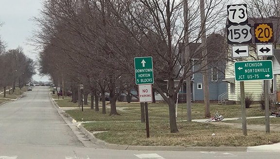
US 159's original northern terminus was at US 73 in Horton. This photo was looking south on Central Avenue. Today Central carries US 73-159, which both turn east (left) on 15th Street for one block before US 159 resumes southward again via 1st Avenue East. However, it seems likely that today's US 159 along 1st is a more recent realignment; during the 1940s US 159 probably began straight ahead on Central (which joins the current alignment of US 159 in about one mile):
|
Sanderson, Mar. 2018
|
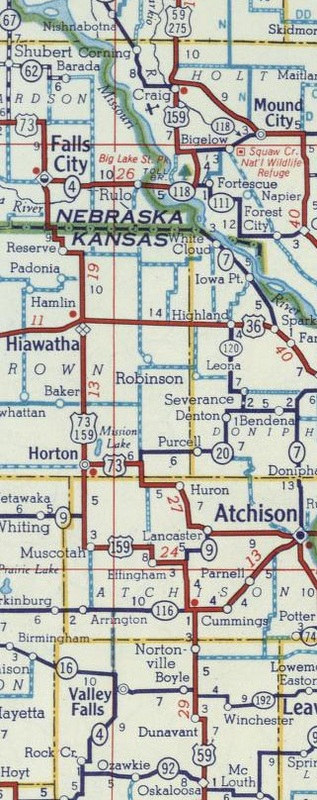
In 1942 US 159 was extended north with US 73 for 29 miles, through Hiawatha KS to Falls City NE (which remains the case today). From there the route heads east, crosses the Missouri River, and enters the state of the same name. But just shy of Fortescue, US 159 formerly went north on what is now MO hwy. 111, and its terminus was at US 59 in Craig. US 159 was conceived as a shortcut for drivers on US 59 who wanted to bypass St. Joseph and Atchison, as it would shave 15 miles off the existing route of US 59. In fact, it was for that reason that Nebraska and Kansas initially wanted to reroute US 59, but Missouri objected because that would have removed St. Joseph from the route. So then KS and NE proposed designating their route Alternate US 59, but MO did not agree to that either. So the US 159 designation was a compromise of sorts:
c. 1956, Gousha
|
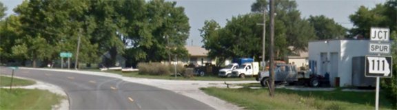
Even after that extension, US 159 was still only 82 miles long, and over one-third of its length was concurrent with US 73. So it seems like US 59 Alternate would have been a more apt designation. However, US 159 gained a distinction: it is the shortest US route that serves three states. Here we are looking south on US 59:
Google Maps Street View, Aug. 2013
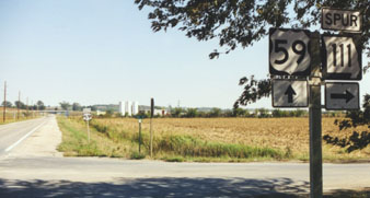
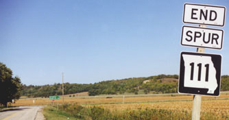
The green sign in the middleground is at US 59 (it runs east-west at this point; northbound is to the left). I-29 is in the distance, at the foot of the bluffs in the background. Mainline MO 111 splits off to the left about a half-mile behind the camera; the segment that continues due north from there is designated "Spur 111". Assuming that bypass was built before 1974, that is where US 159 ended.
|
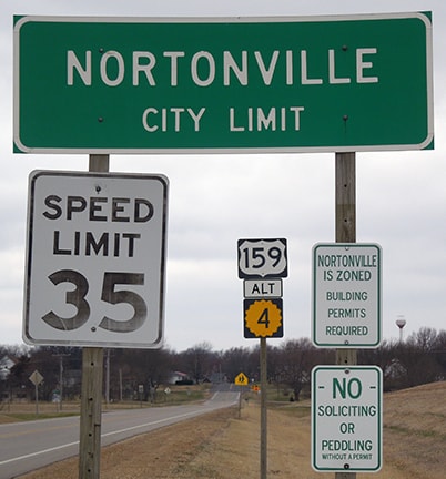
It was about 1957 when US 59 was rerouted to its current diagonal path between Nortonville and Cummings, so the south end of US 159 had to be extended down former US 59 in order to junction with the new US 59 in Nortonville. However, today's US 59 south of Nortonville was not yet built. At the time, US 59 came into town from the south on Osage Avenue, then turned east on 206th Road, then north again on current US 59. So US 159 ended on Osage at 206th for about two decades.
|
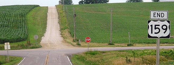
Modern US 59 (along the east edge of Nortonville) opened in 1979, and Walnut Street was extended east to the new bypass. So US 159 was extended south on Osage and then east on Walnut Street. This photo shows the last southbound US 159:
|
Sanderson, Mar. 2018
|
|
That was posted just shy of US 159's terminus, where the route ends at its junction with US 59. The sign assembly visible in the background is shown close-up here:
|
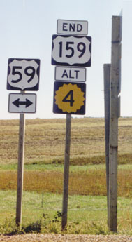
Sanderson, Oct. 2002
|
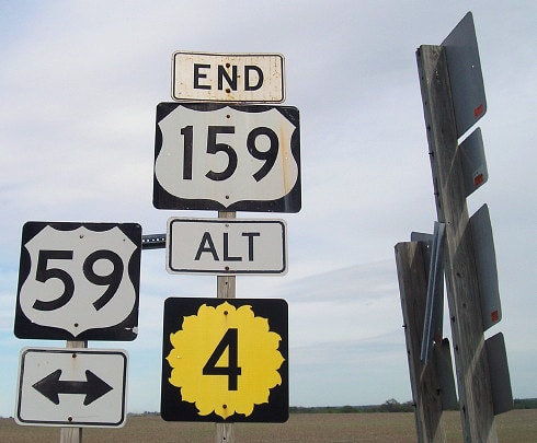
Morrison, Apr. 2017
|
|
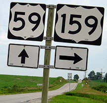
That was looking east at the spot where Walnut ends at US 59. The town of Nortonville is about a half-mile behind the camera. These perspectives were from northbound US 59, at the south beginning of US 159:
Sanderson, Oct. 2002
|
Morrison, Apr. 2017
|
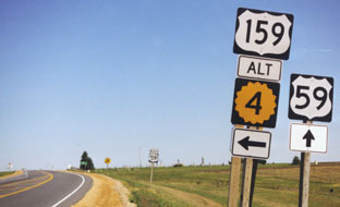
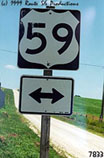
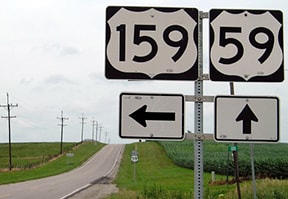
Drivers turning left there immediately encounter the first northbound US 159 trailblazer:
Sanderson, Mar. 2018
|
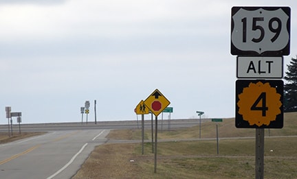
In 1974 the north end of US 159 was changed to its present configuration: now it continues eastward past Fortescue, meets I-29 at interchange 79, and ends at US 59 about three miles east of there (in other words, US 159 ends about nine miles southeast of Mound City). These photos were looking east at the north end of US 159; US 59 is the crossroad:
Prusia, Jan. 2003
|
Kennedy, 1999
|
Morrison, June 2014
|
|
Heading south on US 59 between Oregon and Mound City, this photo shows the signage one sees at the north beginning of US 159...
|

Sanderson, Oct. 2002
|
Morrison, June 2014
|
|
...and this shot was taken looking the opposite direction:
|
Morrison, June 2014
|
If a traveler turns to the west, will immediately encounter the first confirming sign for southbound US 159:
|

Sanderson, Oct. 2002
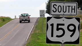
Morrison, June 2014
The interchange with I-29 is about three miles ahead.
|
Because US 159's northern terminus was moved to this new location, the route has lost its functionality as a shortcut between its endpoints on US 59. Actually, the most efficient route between Mound City and Nortonville involves I-29 and I-229 now. If one were to avoid the interstates and stay on US 59 the whole way, the distance would increase by nine miles. But if instead one were to use US 159 the whole way, the distance would increase by an additional seven miles (for a total of 16). So very few travelers would have a reason to drive US 159 from end to end anymore, and as a result the route has only very localized importance. And unfortunately, one can no longer even enjoy a drive over the beautiful original Rulo Bridge: it was demolished in 2014, after its non-descript replacement opened to traffic in 2013.
Research and/or photo credits: Nathan Edgars; Richie Kennedy; Jeff Morrison; Ben Prusia; Dale Sanderson; Michael Summa
Page originally created 2000;
last updated Jan. 27, 2024.
last updated Jan. 27, 2024.
