Historic US highway endpoints in Charleston, SC
|
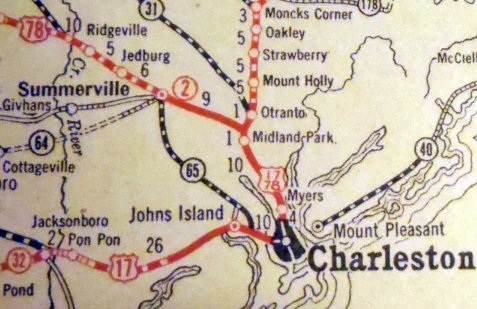
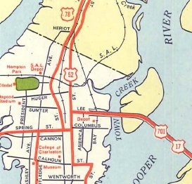
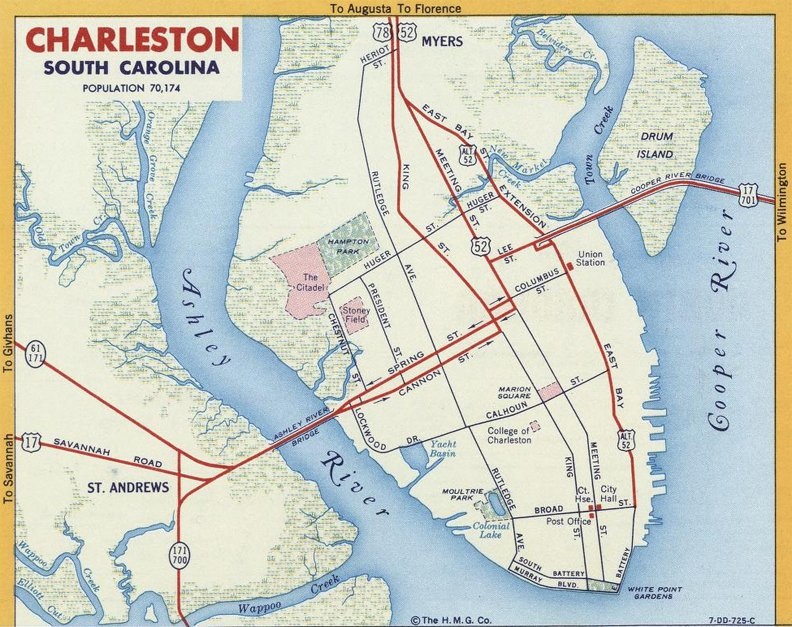
When the US routes were first commissioned in 1927, two of them served Charleston. US 17 came in from the south on Spring Street, and then left the city via King Street. Originally it ran along what is now US 52, from Charleston all the way up to Florence. US 78 came in from the northwest, joining US 17 near Goose Creek:
|
|
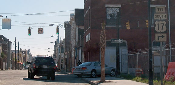
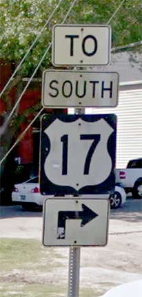
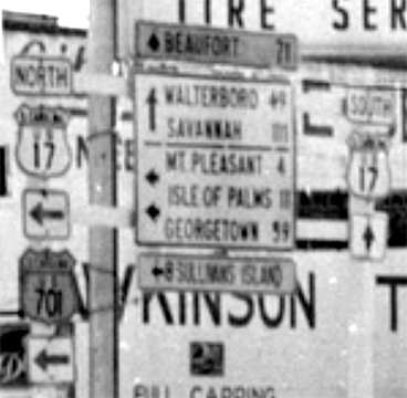
The two routes were overlapped down King, with US 78 presumably ending where US 17 turned from King onto Spring. Highways were rerouted away from that intersection decades ago, but interestingly up until about 2018 some signage still existed there:
|
|
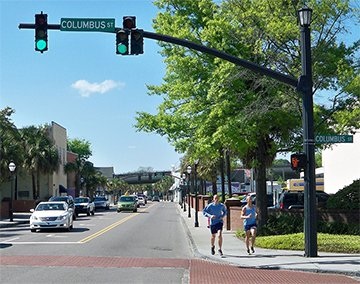
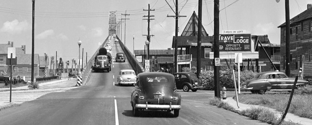
That was looking south on King. Historically, that was the perspective of a driver heading eastbound on US 78 (which ended here), and southbound on the original US 17 (which continued to the right on Spring). In 1929 the original Cooper River Bridge opened to traffic (officially the John P. Grace Memorial Bridge). Three years later the US 701 designation was commissioned, with its south end in Charleston. Traffic came in from the north via the bridge, which aligned with Lee Street. At Meeting Street, US 701 was directed south, then west again on Columbus Street. US 701 ended at King, where it junctioned US 17-78. In the photo above, that intersection is one block behind the camera, so if one were to turn around (looking north on King), they would see a view similar to this:
|
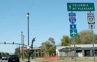
Historically, that was US 17-78, and to the right on Columbus was the south beginning of US 701. A few years later, in 1935, US 17 was rerouted in South Carolina, generally along its current route. At that time, US 17 traffic turned right here, joining with US 701 all the way up to Georgetown. Also, possibly the US 78 designation was truncated by one block, such that it began straight ahead. And finally, the former route of US 17 was replaced with a southern extension of the US 52 designation. So straight ahead was also the southeast beginning of US 52, meaning three routes probably shared a terminus at that intersection.
|
This remained the case until 1947, when some additional changes were made. First, US 17 no longer jogged along King and Columbus; instead traffic stayed on Spring to Meeting, then turned north to Lee. So if US 78 had previously been truncated to Columbus, at that time it would have been extended back to its original endpoint at Spring:
|
|
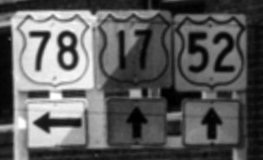
Also, US 52 traffic was directed to follow Meeting instead of King. So its endpoint was on Meeting at Lee, where it junctioned with US 17-701. Also at that time, it appears that US 701 was truncated to that same junction. This photo shows signage that was posted during that timeframe:
|
|
That was for the benefit of drivers heading southbound on Meeting. US 52 ended there; straight ahead on Meeting was southbound US 17. Northbound was to the left on Lee, as was the south beginning of US 701. Here is a modern photo taken looking the opposite direction (north on Meeting):
|
That was northbound US 17, which continued to the right on Lee and over the Cooper River. Starting in 1947, that also would have been the beginning of US 701, while straight ahead was the southeast beginning of US 52.
|
|
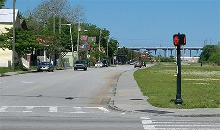
Turning that direction, here is the view to the east on Lee. Historically US 17 came from the right, and then turned here, continuing straight ahead on Lee (the grassy open area at right is there because later that was the location of the supports for the approaches to the old Cooper River bridges, the Grace and the Pearman). Also straight ahead was the south beginning of US 701 after 1947, and to the left was the beginning of US 52:
|
The flyover in the distance is the "New Cooper River bridge", officially the Ravenel Bridge, which opened in 2005 and carries modern US 17. But historically, the approach to the bridge was straight ahead on Lee:
|
|
One of the supports for the old Cooper River Bridge still stands at the intersection of Lee and East Bay Street.
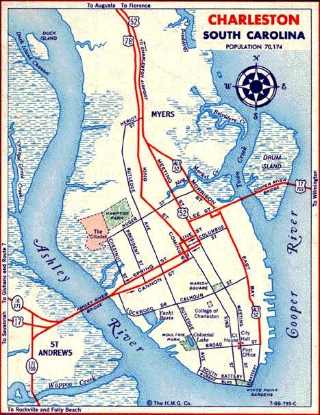
In about 1952, US 17 was split into one-ways through the city. Spring was changed to southbound US 17 only. Cannon Street became its northbound counterpart; at first traffic jogged up to Meeting via King and Columbus... |
|
...but it was not long before northbound traffic instead began using Coming Street and Line Street to jog over to Meeting:
|
During this time, all endpoints remained the same: US 78 on King at Spring, US 52 and US 701 at Meeting and Lee. Here is a photo taken during that timeframe:
That was looking east on Line, which carried northbound US 17. US 78 technically went right on King for another block or two, but essentially began to the left. A block ahead was the beginning of US 52, which began by turning left on Meeting.
|
|
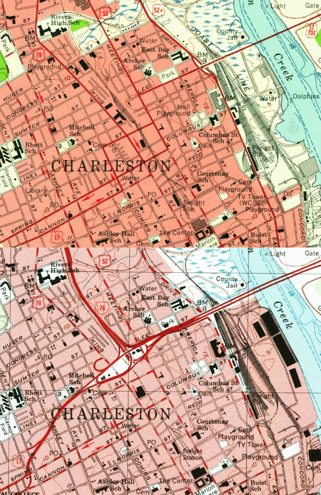
Then in about 1968, US 17 was rerouted to follow the then-new "Crosstown Expressway" (now called Septima Clark Parkway). The animated map below switches between two images, one showing the original surface routing of US 17, and the other showing the arrangement after the Parkway was built:
|
That illustrates how US 17 was changed to tie in more directly with the Cooper River bridges, and how the turns in the old route were eliminated. Officially, US 701 continued to end on Lee at Meeting, but probably when the elevated bridge approaches were built, US 701 was no longer signed very well, and this remained the case up until 1992, when its overlap with US 17 between Charleston and Georgetown was eliminated. Also with the US 17 reroute, there was no longer a need for US 78 to go all the way down to Spring, so that designation was truncated a couple blocks, to Line (which was the first surface street south of the US 17 overpasses). The US 52 designation was extended a couple blocks, also ending at Line. In 2005, US 17 was rerouted to follow the "New Cooper River Bridge" (officially the Ravenel Bridge), but the endpoints of US 52 and US 78 did not change, and they remain the same today (for more, please use the links below).
...even though both routes continue ahead for another five miles. That was looking south on Rivers Avenue, just southeast of the Cosgrove Road intersection. About a half-mile ahead, the two routes split and continue down opposite sides of a railroad (with US 52 on Meeting, and US 78 on King), but there is no directional signage there. About three miles ahead, maps indicate "Spur US 52" splits off Meeting on Morrison Drive (that becomes East Bay Street and goes all the way downtown), but it has not been signed anywhere since at least 1975.
Research and/or photo credits: Justin Cozart; David Dawson; Alex Nitzman; Mike Roberson; Dale Sanderson
Page originally created 2000;
last updated May 12, 2023.
last updated May 12, 2023.
