Headwaters Hill, Colorado
|
Headwaters Hill is a mountain in central Colorado. It is geographically significant, because its summit sheds water into three divergent river basins that reach sea-level at three separate places in two different oceans. In other words, Headwaters Hill forms a major triple divide: a special kind of hydrological apex. (There are only five places in the continental US that can make this claim -- one of the others is Three Waters Mountain.)
|
Elevation: 11,862 feet above sea-level
Geographic coordinates: 38.34763 -106.25296 |
|
This mountain was unnamed until July 12, 2001, when the topynym "Headwaters Hill" was accepted and made official by the U.S. Board on Geographic Names. The placename "Headwaters Hill" is now included in the Geographic Names Information System database, and as a result its label is being included on an increasing variety of maps. The first published maps to show Headwaters Hill were printed works, both copyright 2006:
|

Benchmark, Colorado Road and Recreation Atlas, first edition
|

National Geographic, La Garita / Cochetopa Hills Trails Illustrated Map
|
|
The corresponding USGS topo map quads were last updated in 2001, but unfortunately the name "Headwaters Hill" was not approved quite soon enough to be included in that revision. (That link will display a default map, where a crosshair in the center of the screen marks the summit of Headwaters. Go to the layer menu to display the USGS topo map.)
In 2007 a geocache was placed on Headwaters Hill, in recognition of its interesting geography. Google Maps has labeled Headwaters Hill since 2008; here is the default view: |
|
|
Here is another Google map that I customized in order to better illustrate the location of Headwaters Hill and how to get there. If Google Maps is working properly, you should see a shaded-relief map with a yellow pin in the center, marking the location of Headwaters Hill. The three faces of the mountain are highlighted in order to differentiate the three watersheds that are common to its summit. The lines represent trails that provide access to Headwaters Hill. On this embedded version of the map, it is possible to pan, zoom, and so forth, but the full version of the map is more functional:
|
|
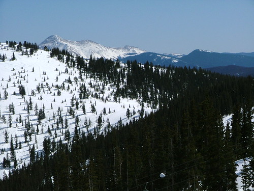
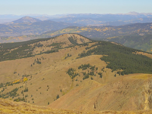
Here are a couple photos showing Headwaters Hill from a distance:
If you would like a good, solid overview of Headwaters Hill -- the geography, the history of the naming effort, the people involved, and so forth -- then please read what is probably the best and most-comprehensive single article ever written on the topic. It is called "Playing the Name Game", by Ed Quillen, and it was published in Colorado Central Magazine in September 2001, shortly after Headwaters Hill had been officially named. (In case that link ever becomes non-functional, I have saved the text here.)
Research and/or photo credits: Dale Sanderson
Page originally created 1998;
last updated Nov. 30, 2020.
last updated Nov. 30, 2020.
