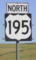
End of US highway 195 |
 |
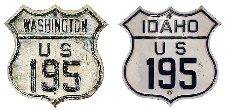
Summa
|
1926-1948?
|
1948?-1969
|
1969-present
|
|
Mileage: in 1989 AASHTO listed a figure of 95 miles for US 195. That closely matches our own 2020 measurement, which yielded 93.7 miles. Historically, when it went to Sandpoint, US 195 was 171.7 miles long.
|
|
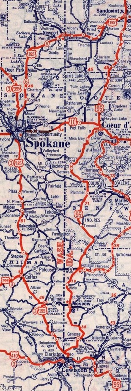
c. 1939, Rand McNally
|
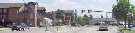
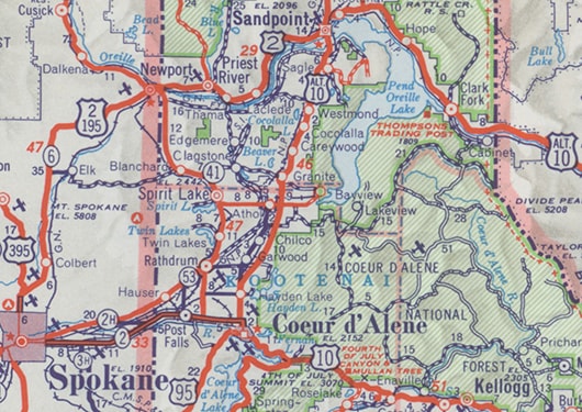
When US 195 was originally commissioned, it essentially functioned as an alternate route for US 95. Whereas US 95 remained on the Idaho side of the line, US 195 primarily served towns in western Washington. Today the south end of US 195 is about seven miles north of Lewiston, but during those early years, the designation was signed all the way into Lewiston proper. On its north end, US 195 junctioned US 95 in Sandpoint. At the time, US 2 went only as far west as Bonners Ferry. So historically US 195 continued north from Spokane (along what is now US 2). In Sandpoint, US 95 came in on 1st Avenue, then west on Cedar Street, then north via 5th Avenue. This shot was taken looking west on Cedar at the 4th Avenue intersection. Ahead, US 95 continues to the right on 5th; to the left was once the north beginning of US 195. As US 2 does today, US 195 turned west on Pine Street, then southwest on Dover Highway:

Elbert, July 2008
One might well wonder: if the shot above is from the perspective of someone already on US 95, then why is US 95 signed both directions on 5th? It is because the arterials encircling downtown Sandpoint have been converted to one-ways, essentially forming a giant rotary. Eastbound US 2 traffic coming in from Priest River can no longer make a left turn on 5th. Instead, drivers have to continue east on Pine, then join US 95 by heading north on 1st, then west on Cedar, then north on 5th (which adds up to an extra eight blocks of travel).
|
|
This shot was looking south on 5th, or southbound US 95, which originally turned left on Cedar, while straight ahead was the north beginning of US 195:
|
Elbert, July 2008
|
|
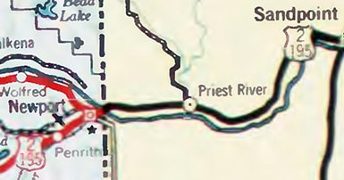
In 1948, US 2 was extended west from Bonners Ferry by joining US 95 south to Sandpoint, then US 195 south and west all the way to Spokane (where the two routes split). In other words, the northernmost 76 miles of US 195 were overlapped with US 2. Washington was comfortable with that arrangement, and their DoT maps reflected that:
|
c. 1950, WSDoT
|
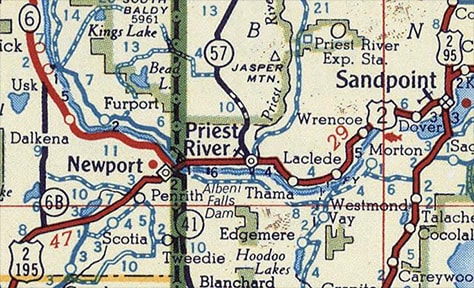
However, Idaho DoT maps from the same timeframe have the highways labeled a little differently. Notice that US 195 was not marked in Idaho at all:
c. 1950, ID DoT
|
That may have been because it was not in Idaho's interest to inform travelers about an alternate route that would take them out of Idaho. Many historic maps suggest that once US 2 was extended west of Sandpoint, Idaho signed the road only as US 2, and they removed the US 195 signs:
c. 1956, Gousha
|
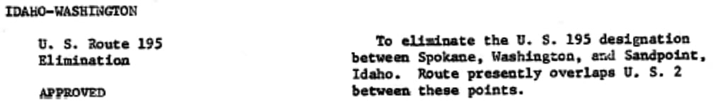
So it appears that the de facto north end of US 195 was at the stateline in Newport, possibly for as long as two decades. WSDoT eventually decided that it was pointless to overlap US 195 north of Spokane, so in 1969 they petitioned AASHO to have the designation truncated to that city. But as a matter of procedure, Idaho was required to make the same request, because AASHO had never formally truncated the route to Newport. Below, the agenda item from the actual meeting minutes is shown:
|
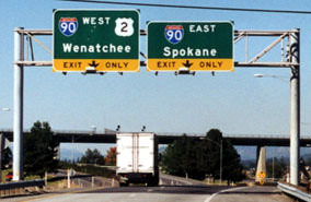
In Spokane, US 195 was originally routed along Inland Empire Way. However, by the time the designation was truncated to Spokane, traffic had been rerouted along the newer four-lane that US 195 still uses today. US 2 had been rerouted off Sunset Boulevard, too, so the only place where US 195 has ever ended in Spokane is the interchange where it still ends today: I-90's exit 279:
|
Taylor, 2000
|
|
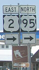
These shots show the exit from I-90 onto the north beginning of US 195, both eastbound and westbound, respectively:
|
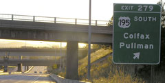
Elbert, July 2005
|
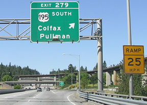
Elbert, July 2008
|
|
The viaduct visible at right is for a railroad. If a driver takes that exit, they will soon see the first southbound reassurance marker:
|
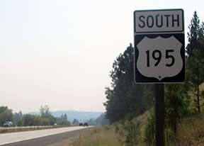
Dienhart, Aug. 2018 (unchanged since 2005)
|
It was probably during this same timeframe when Idaho truncated the US 195 designation to its current terminus at the southern edge of the Palouse, just shy of where the prairie gives way to the Lewis-Clark Valley.
|
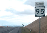
The signs in this series of photos are along northbound US 95, at the exit that marks the beginning of US 195 (traffic exits right, but it then crosses under US 95):
|

Elbert, July 2005
|
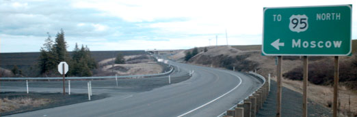
The point where the routes actually split is visible in the background; this shot was taken there:
|

Elbert, July 2005
|
|
In the gore, there was another little reminder that people heading for Spokane need to exit there:
|

Elbert, July 2005
|
In the distance, the US 95 and US 195 confirming markers are visible; the one on the left is shown close-up here:
|
Elbert, July 2005
|
|
Heading the opposite direction (south on US 195), just before the terminus, travelers come to the historic junction shown here. Originally southbound US 95 came in from the left and then continued straight ahead, overlapped with US 195 into Lewiston:
|
Sanderson, Mar. 2001
|
|
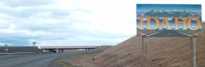
Today the US 195 designation still extends straight ahead, but only as far as its junction with modern US 95, in the vicinity of the overpass visible in the background. A bit further ahead, drivers cross the Idaho line...
|
Sanderson, Mar. 2001
|
Straight ahead is "the Grade" descending about seven miles into Lewiston.
|
Research and/or photo credits: Mark Bozanich; Paul Dienhart; Chris Elbert; Dale Sanderson; Michael Summa; Stephen Taylor
Page originally created 1999;
last updated Nov. 26, 2021.
last updated Nov. 26, 2021.
