US highway 6 endpoint in Bishop, CA
|
1964-present
|
 |
|
In 1964, when the US 6 designation was truncated to Bishop, the west "end" of the route technically became the point where it crosses the CA/NV line, because (most) signage on the remaining segment in California was changed to north/south. Today most US 6 signs in CA have been changed back to east/west, but a few exceptions remain. This photo shows the last westbound US 6 marker...
|
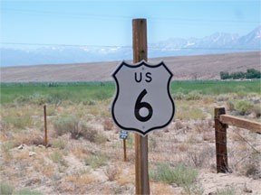
Karners, Aug. 2010
|
|
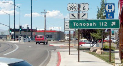
Sure, it is possible that the missing tab said "South". But the marker directly across the road from there (for traffic heading the opposite direction) said "East". This next shot was taken approaching the west (or south) end of US 6, at its upcoming junction with US 395:
|
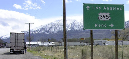
Elbert, Mar. 2005
|
|
A right turn there does not put one directly on mainline US 395 -- that is actually Wye Road, which connects with 395 after about a tenth-mile. But if one continues straight, then just ahead is a sign marking the end of US 6:
|
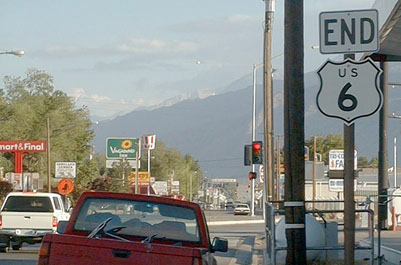
Ehrenburg, 2002
|
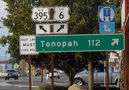
Elbert, Mar. 2005
|
Sanderson, Oct. 2023
|
|
The view there is south on Main Street, just north of where US 395 comes in from the right and continues straight ahead. Looming in the background is the Sierra Nevada (Mt. Whitney, the highest point in the 48 states, is in that range).
|
|
|
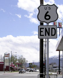
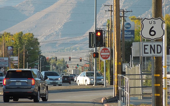
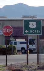
Just ahead, as drivers are waiting for the stoplight at US 395, the sign shown here is posted across the road at the physical terminus of US 6:
Karners, Aug. 2010
|
Sanderson, Oct. 2023
|
|
Until 1964, the US 6 designation continued to the left, overlapped with US 395. Today US 395 heads south from Reno and Carson City NV, and provides access to California's Mono Lake and Yosemite National Park. From there, it continues south and east; by the time it reaches Bishop, it is aligned due east. In town, the road makes a broad curve to southbound Main (to the right of the gas station shown in this photo...
|
Field/Nitzman, Nov. 2008
|
|
...but traffic heading for eastbound US 6 (marked "North" on that sign) is directed to continue due east on Wye Road (left of the gas station). After about a tenth-mile, there is a stop sign at Main, and traffic is directed to make another left turn:
|
Field/Nitzman, Nov. 2008
|
|
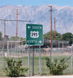
These next photos were from the perspective of a driver northbound on 395 at the west beginning of US 6. In the first image, notice the signs in the background that were formerly posted there; they are shown close-up in the second photo:
|

Summa, 1983
|

Summa, 1983
|
|
Those were in reference to mountain passes ahead on each route (Deadmans Pass on 395, and Montgomery Pass on US 6, just across the Nevada line).
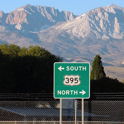
Hansens, July 2004
|
Sanderson, Oct. 2023
|
|
If one were to follow the US 6 fork there, the traveler would have soon seen the sign shown here:
|
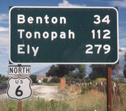
Ballard
|
|
Note the "North" tab. That mileage sign has since been replaced...
|
Field/Nitzman, Nov. 2008
|
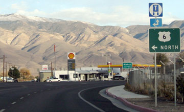
...and the US 6 confirming assembly is no longer there. But one does not have to drive much farther before encountering the really cool sign shown below:
|
Schlichtman, 2003
|
Sanderson, Oct. 2023
|
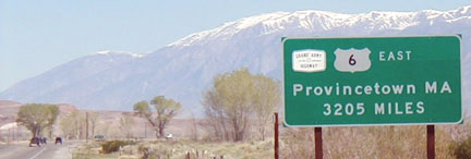
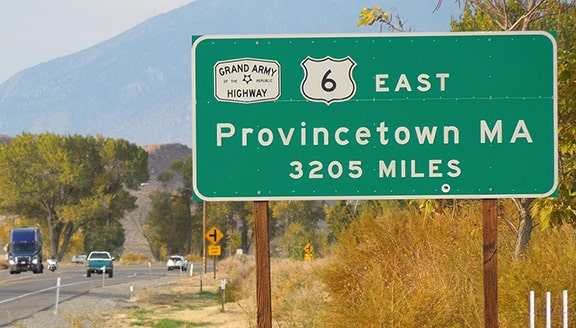
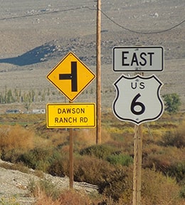
There US 6 is described as going "East" (instead of "North"). Note also the use of a 3-digit shield, which is particularly strange for a 1-digit route (it's not quite as elongated on the newer version of the sign, which was posted sometime between 2010 and 2018). On the left side is a "Grand Army of the Republic Highway" marker, and those are the White Mountains in the background. Just ahead, US 6 turns east for about two miles, then resumes due north again. That stretch of road is where the first standard reassurance marker was posted:
Field/Nitzman, Nov. 2008
|
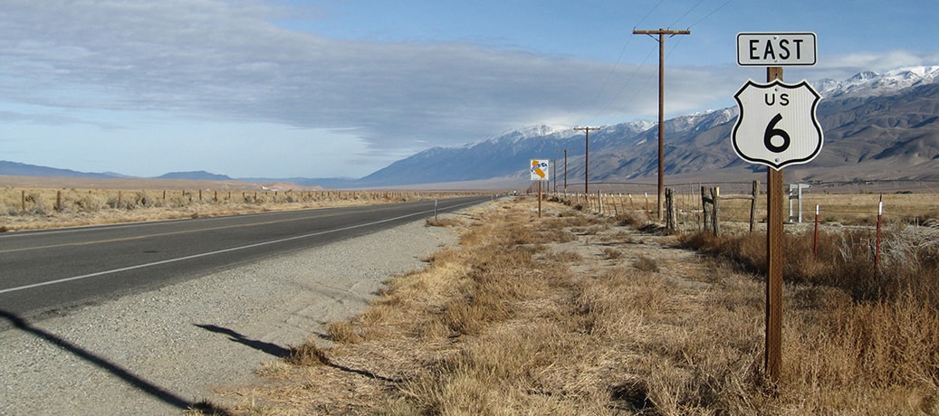
The White Mountains are again prominent in that striking shot -- in the distance one can see the northern edge of that range. US 6 runs along the base of those mountains, which explains why the road actually runs not only north, but also slightly west before finally turning eastward into Nevada. And thus can be seen the dilemma Caltrans has faced in terms of which direction to use in signing their segment of US 6. That sign was also missing as of 2010 -- now the first reassurance sign is at mile marker 23 (across from the sign shown in the first photo on this page):
|
Sanderson, Oct. 2023
|
As a matter of fact, that is now the only reassurance marker along the entire California segment of US 6. Onward to Provincetown: 3200 miles.
Research and/or photo credits: Mike Ballard; Rick Ehrenberg; Chris Elbert; Andy Field; the Hansens; Karin and Martin Karner; Alex Nitzman; Dale Sanderson; Paul Schlichtman; Michael Summa
Page originally created 1998;
last updated Oct. 24, 2023.
last updated Oct. 24, 2023.
