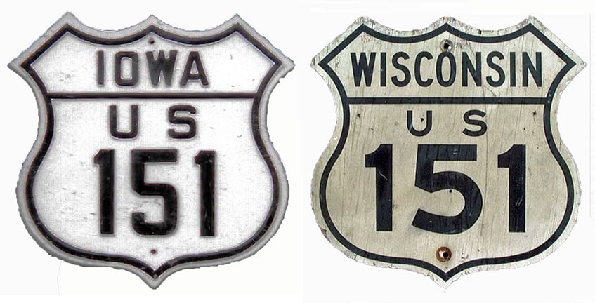
End of US highway 151 |
 |
|
1926-1934
|
1934-1937
|
1937-1986
|
1986-present
|
Summa
|
Mileage: in 1989 AASHTO listed a figure of 309 miles for US 151... but that was assuming a south terminus at Cedar Rapids. Since then US 151 has been extended to the Amanas, and our own 2020 measurement yielded 327.1 miles.
|
|
US 151 was an original 1926 highway, but at the time it was an intra-state route, running only between Madison and Fond du Lac:
|
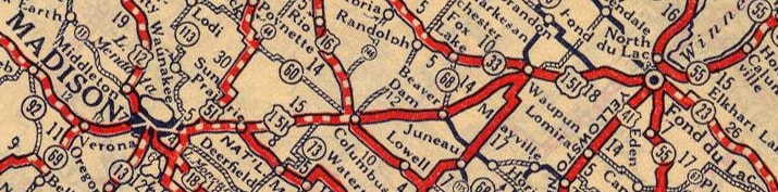
c. 1927, Rand McNally
|
|
This photo was in Madison, looking southwest on Washington Avenue (southbound US 151). Today US 151 traffic is directed to bypass the Capitol area by turning left on Blair Street, but historically that route continued straight ahead all the way to the Capitol Square:
|
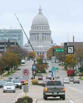
Sanderson, Oct. 2006
|
On the opposite side of the Capitol, US 151 originally continued west via State Street, Gilman Street, and University Avenue...
|
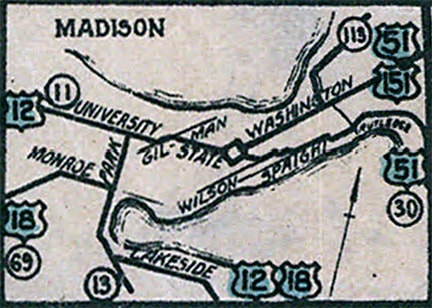
c. 1927, Wisconsin DoT
|
...but already by the following issue, US 151 was shown using Washington, Bassett Street, and University:
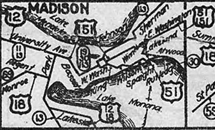
c. 1928, Wisconsin DoT
|
|
Both maps show US 151 ending on University at Park Street, where it junctioned US 12 (and later US 14). This location is on the UW campus:
|
|
|
At the time, US 151 went only as far as Fond Du Lac. It came in on Military Road and Western Avenue, ending at its junction with US 41 (Main Street):
|
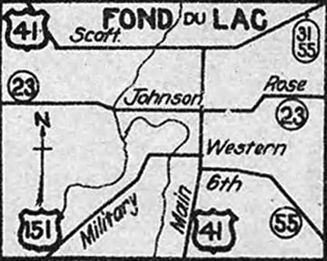
c. 1928, Wisconsin DoT
|
|
This photo was looking north on Main; the original north beginning of US 151 was to the left on Western:
|
Sanderson, Aug. 2005
|
Here is modern signage looking east on Western, at the former north end of US 151:
|
Sanderson, Aug. 2005
|
|
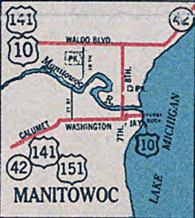
In 1934, US 151 was extended northeast out of Fond du Lac to Manitowoc, where the designation still ends today:
|
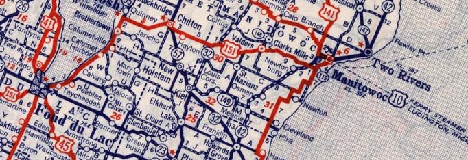
c. 1939, Rand McNally
|
|
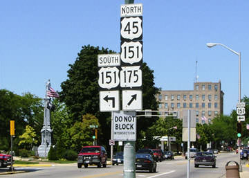
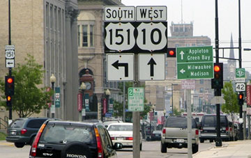
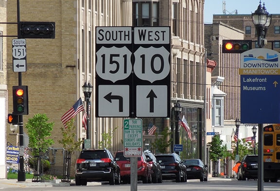
The route comes into town via Calumet Avenue, and until late 2022 US 151 continued where that road becomes Washington Street approaching downtown. The last US 151 trailblazer was posted at 11th Street:
|
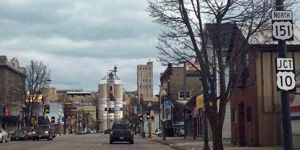
Johnson, Apr. 2016 (unchanged as of Jun. 2022)
|
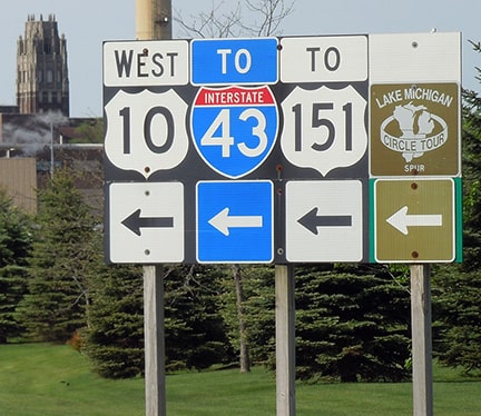
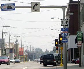
US 151 junction with eastbound US 10 at 10th Street (which is one-way running southbound), and then there was an "End" assembly posted just past 9th Street:

Sanderson, Aug. 2005 (replaced in 2015)
|
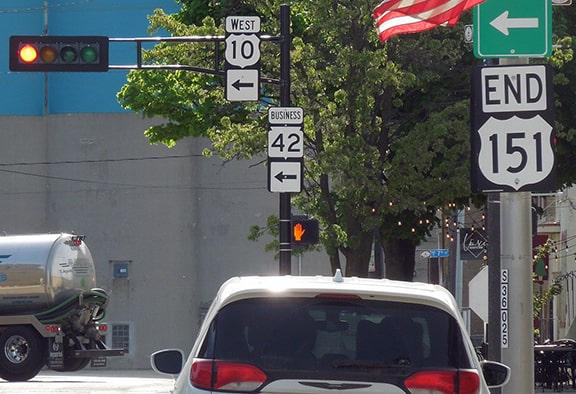
Sanderson, Jun. 2022
|
|
Visible in the distance is the signage at 8th Street, which at the time served as westbound US 10 -- that is the intersection that marked the actual endpoint of US 151. One block behind the camera, eastbound US 10 ran to the right. After a few blocks that route turned east (ahead) on Madison Street, and then angled north (left) to the Lake Michigan car ferry dock (which happens to be situated directly behind the Anheuser-Busch malting facility visible in the background of the photos above). But historically, westbound US 10 was to the left on 8th, while eastbound went straight ahead on Washington. Right at the big Budweiser silos, the route jogged north one block on 7th, and then resumed eastward on Jay Street, directly to the ferry dock:
|
c. 1939, Wisconsin DoT
|
|
It is unclear whether US 151 was ever overlapped with US 10 to the ferry dock. That map gives no reason to think so, although as of mid-2022 US 10 was meticulously co-signed as "TO US 151" all the way from the ferry landing to the actual beginning of US 151:
Sanderson, Jun. 2022
|
A few months after that photo, that sign was significantly changed:
Johnson, Oct. 2022
More on that below, but US 10 traffic is now directed to go north to Quay Street, and US 151 is no longer referenced at all...
|
|
...but until Sep. 2022, US 10 was directed south from the ferry, then west on Madison Street, then north on 8th. The signage shown here was for the benefit of drivers on that route:
Sanderson, Aug. 2005 (replaced in 2015)
|
Sanderson, Jun. 2022
|
|
Those were looking north on 8th; the north beginning of US 151 was to the left on Washington. These next photos show the opposite direction (south on 10th, or east on US 10):
|
Sanderson, Aug. 2005
Later a both-ways arrow was added to the US 151 sign, even though to the left that designation ended after only two blocks:
|
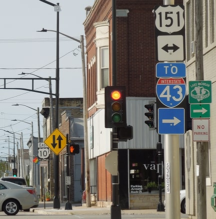
Sanderson, Jun. 2022
|
|
If a traveler were to take that right turn, they would soon see the first southbound confirming marker...
|
Sanderson, Aug. 2005
|
Sanderson, Jun. 2022
|
|
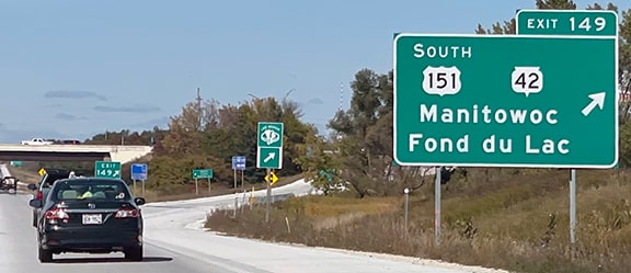
...however, just a few months after I took those photos, the US 151 designation was truncated such that it no longer goes all the way into downtown Manitowoc. The City wanted to move US 10 traffic off 8th and 10th streets, but they didn't want to give up State maintenance on those two bridges over the Manitowoc River. So some changes were made to the routings of not only US 10 but also WI 42, which was brought back through the downtown area (despite bypassing it in 1956). Much of the rerouted WI 42 was along US 151, and as a result the US 151 designation was truncated to its interchange with I-43 on the west edge of the city:
|
Johnson, Oct. 2022
|
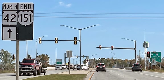
Straight ahead, former US 151/Business 42 now carries the mainline WI 42 designation. Heading the opposite direction (west on Calumet), signs indicate that US 151 begins straight ahead:
Johnson, Oct. 2022
|
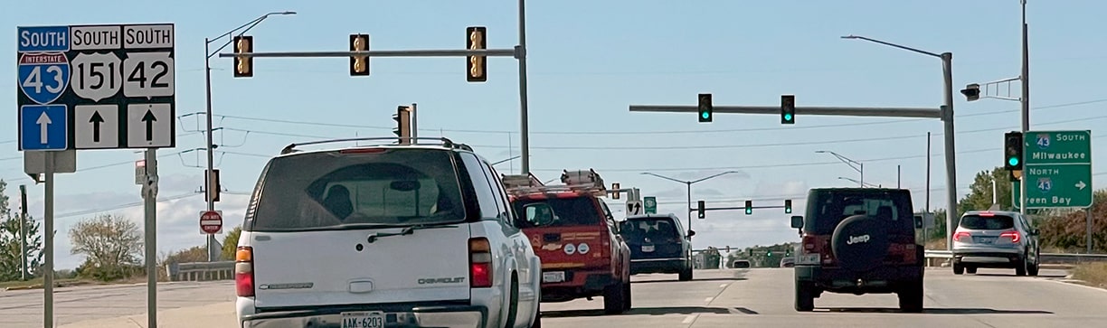
Heading north on I-43, the "Business" modifier was removed from the WI 42 marker on the sign shown below, and a "South" modifier was added to US 151, indicating that US 151 no longer heads to the right (or "north") into Manitowoc, but only to the left now, away from the city...
Johnson, Oct. 2022
|
...however, at the time of these photos, signage on the offramp itself had not yet been changed, as it still reflected the historic designations:
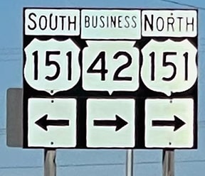
Johnson, Oct. 2022
|
|
Now, back to the other end of US 151: in 1938 it was extended southwest to Cedar Rapids:
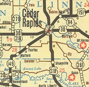
c. 1938, IA DoT
|
Initially the route ended on 1st Avenue West at 1st Street Southwest:
Morrison, Mar. 2007
|
|
But US 30 was soon rerouted, so US 151 then ended at the intersection of Williams Boulevard (Business US 151 today) and 16th Avenue SW (US 30-218):
|
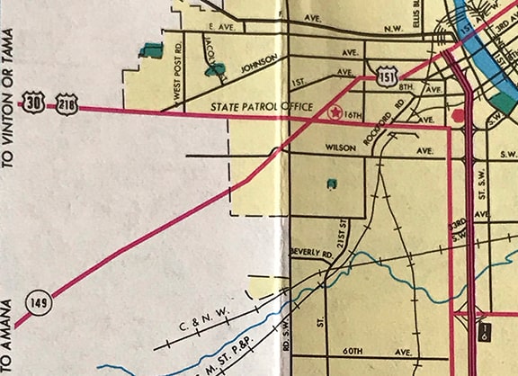
c. 1976, Iowa DOT
|
|
This photo shows the intersection where US 151 ended, looking southwestward along Williams Blvd. toward 16th Av SW:
|
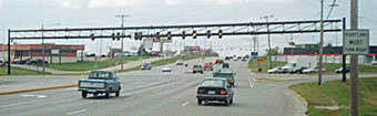
Hancock, 2001
|
|
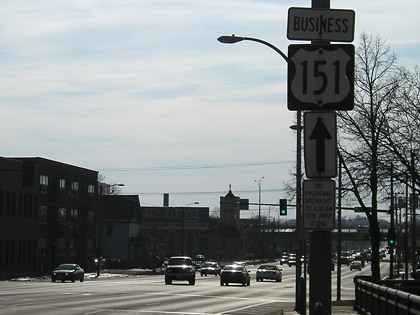
After the US 30 bypass opened in 1981, US 151 was extended southwestward to the interchange with the new US 30. This photo looks southwestward toward US 30-218. Today this interchange marks the end of Business US 151, which replaced mainline US 151 through Cedar Rapids and Marion upon its 1989 rerouting via Bertram:
|
Hancock, 2001
|
|
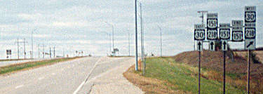
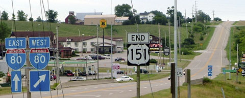
In 1986, US 151 was extended southwest out of Cedar Rapids: along former IA hwy. 149, past the Amana Colonies, to its south end at interchange 225 on I-80. (Twice that year Iowa tried to get AASHTO to approve the extension, but for some reason they denied it. It was not approved by AASHTO until 1996.) Here is the exit to the south beginning, as viewed from eastbound I-80:
|
Sanderson, June 2001
|
|
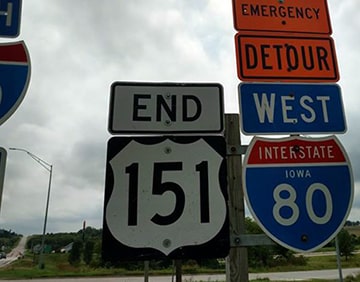
At the end of that offramp, traffic is directed to US 151 thus (to the right the road is designated County Hwy. W21):
|
Sanderson, Aug. 2005
|
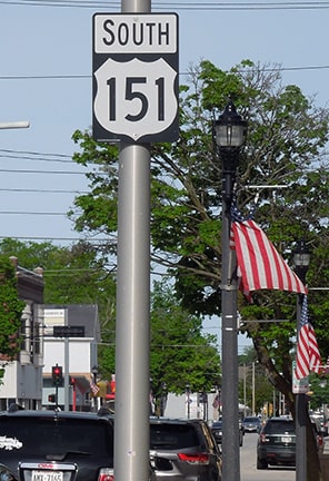
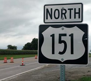
Approaching that interchange from the south on W21, the south beginning of US 151 is marked like this:
|
Sanderson, Aug. 2005
|
|
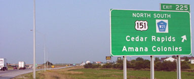
Not far ahead is the first confirming marker. The junction with US 6 (which provides access to the main Amana Colonies) is about six miles ahead. But this commercial area situated right at the freeway interchange is marked on some maps as "Little Amana":
|

Nitzman, Mar. 2016 (unchanged since at least 2005)
|
Handler, Sep. 2018
|
|
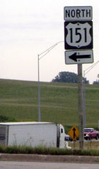
Here, we are heading the opposite direction. This is the last southbound marker, along with some classic Iowa scenery:
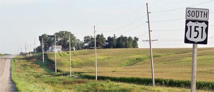
Karners, Aug. 2010
|
Not far ahead is the I-80 interchange and Little Amana, part of which is visible in this shot, looking south at the I-80 overpass:
Sanderson, Aug. 2005
|
Handler, Sep. 2018
|
Research and/or photo credits: Nathan Edgars; Jon Enslin; Jason Hancock; Mark Handler; Peter Johnson; Karin and Martin Karner; Bruce Kasprzyk; Jeff Morrison; Alex Nitzman; Dale Sanderson; James Schecter; Michael Summa
Page originally created 2000;
last updated Oct. 6, 2022.
last updated Oct. 6, 2022.
