End of US highway 45 |
 |
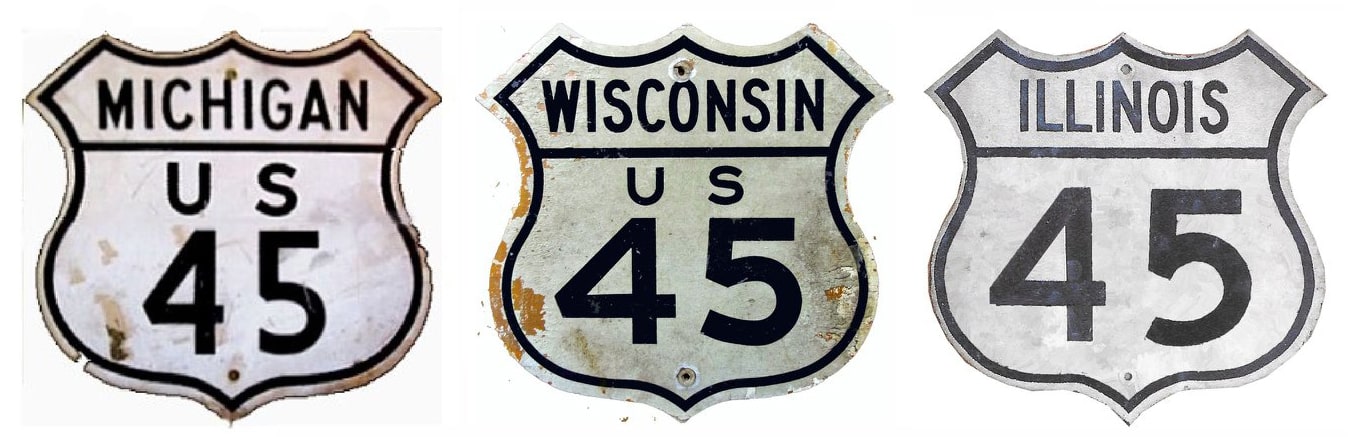
Summa
|
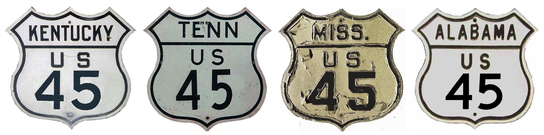
Summa
|
|
|
|
Mileage: in 1989 AASHTO listed a figure of 1435 miles for US 45... however, that included the mileage of US 45's associated business/bypass/alternate routes, plus it included the mileage of both US 45E and US 45W. According to the state subtotals on AASHTO's 1989 spreadsheet, mainline US 45's actual end-to-end total at the time was 1297 miles. That closely matches our own 2020 measurement, which yielded 1297.9 miles. Historically, when US 45 went further into Mobile, it was 1298.8 miles long.
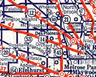
US 45 was an original 1926 route, although its north end was in the Chicago area at the time. Historic maps suggest that the original endpoint was always intended to be in Des Plaines, but the route was not fully open to traffic that far north until about 1930. The 1931 map showed US 45 pretty much along its current path through Chicagoland: north on Mannheim Road to Lee Street in Des Plaines. This map was from 1932, in anticipation of the Worlds Fair in Chicago the following year:
|
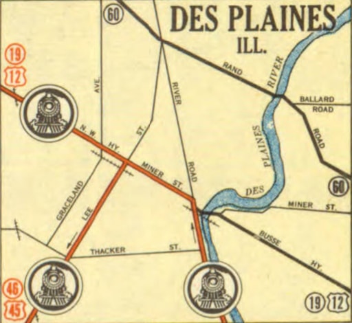
c. 1932
|
|
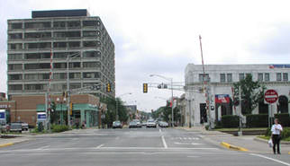
US 45 ended at Northwest Highway, which at the time carried US 12 traffic. This photo shows the scene:
|
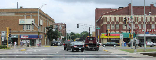
Hargraves, Aug. 2002
|
|
That was looking north on Lee at Northwest Hwy (which is now US 14). Here we are looking the opposite direction (south on Lee from Northwest Hwy) at an historic north beginning of US 45:
|
Hargraves, Aug. 2002
|
c. 1935, IL DoT
|
|
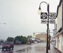
The 1935 official Illinois map was the last to show the Des Plaines endpoint; the previous year AASHO extended the US 45 designation north to its present terminus in Ontonagon, on Lake Superior in the upper peninsula of Michigan. This shot shows the last northbound sign...
|
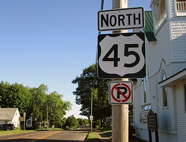
Dienhart, Aug. 2020
|
|
...although formerly there was another US 45 sign further ahead. This was looking northwest on River Street, between Tin Street and Copper Street:
|
Mortell, Aug. 2011
|
|
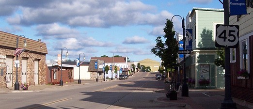
The large building in the background is also visible in these next photos, taken about four blocks ahead:
|
Osbaldeston, June 2001
|
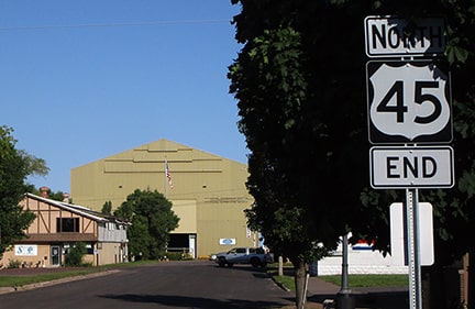
Dienhart, Aug. 2020
|
The shore of Lake Superior is just on the opposite side of that building. Historically, M-64 began to the left on Ontonagon, so that junction was an appropriate place for US 45 to end. In between the time when those two photos were taken, there was a several-year period during which there was no "End" assembly for US 45.
|
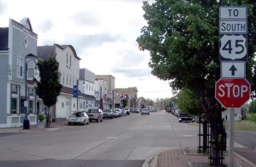
Now M-64's bridge over the Ontonagon River no longer exists; instead that highway connects with US 45 to the south of the downtown area (about a mile behind the camera). But US 45 does not end at that junction; it still continues to the same terminus in the downtown area. But the endpoint is signposted kind of strangely now, since there is no longer a highway junction here. As travelers head north on River, they encounter a sign that says "To South US 45". If the driver keeps following those signs, they end up driving in a loop formed by Chippewa, Michigan, and Lake streets; and finally back the opposite direction on River:
|
Mortell, Aug. 2011
|
|
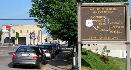
M-64 used to begin to the right on Ontonagon; US 45 still begins straight ahead. A half-block in that direction, there is a great sign:
|
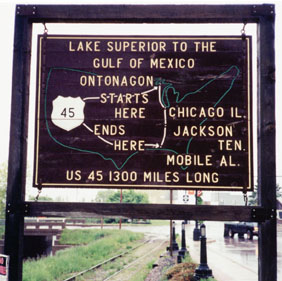
Osbaldeston, June 2001
|
|
When the Google Street View car went through town in 2008, its photos showed the sign frame, but the sign itself was gone. Fortunately by 2011 a new and improved sign had been installed:
|
Morrison, July 2013
|
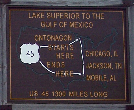
Mortell, Aug. 2011
|
It originally said "Golf of Mexico", but then the top part of the "O" was rubbed out in order to look more like a "U". However, the outline of the U.S. is more accurate now, and overall I think the sign is a bit more aesthetically pleasing. Like the old sign, it inspires wonder -- all of the long US routes should have something like this at their endpoints.
|
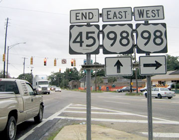
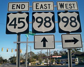
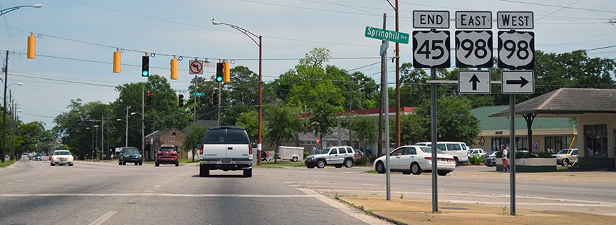
The south end of US 45 has always been in Mobile, although the endpoint has changed a bit (more info on the Mobile page). Probably in about 1980 the south end was truncated to its current terminus on Spring Hill Avenue (US 98) at the Y-intersection with St. Stephens Road:
|
Nitzman, 2004
|
|
To the right is the modern south beginning of US 45. The yellow sign behind the US 45 marker is right about where the first northbound confirming marker is posted:
|
Nitzman, 2002
|

Nitzman, 2004
|
|
It is unfortunate that the replacement signs in this area do not comply with the standard design for the US route shield. These next shots were looking at the south end of US 45 on St. Stephens at Spring Hill:
|
Nitzman, 2004
|
Karners, Jan. 2010
|
Nitzman, May 2016
Research and/or photo credits: Paul Dienhart; Adam Froehlig; Don Hargraves; Karin and Martin Karner; Richard Montgomery; Jeff Morrison; Robert Mortell; Alex Nitzman; Greg Osbaldeston; Dale Sanderson; Michael Summa
Page originally created 1999;
last updated Dec. 16, 2023.
last updated Dec. 16, 2023.
