End of US highway 2 (western segment)
 |
Summa
|
Summa
|
|
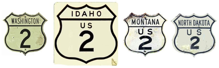
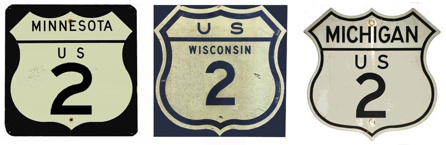
1926-1948
|
1948-1983
|
1983-present
|
Mileage: US 2(e) and US 2(w) are separated by 650-some miles through Canada, plus (since 1984) another 50-some miles through Michigan's Upper Peninsula. In other words, they are two different routes (even though they are designated with the same number). For that reason, when calculating the total length of "US 2", one must specify which segment; adding the two segments together produces a meaningless total. But that is exactly what AASHTO did in 1989, when they listed a figure of 2643 miles for US 2... not only did that figure include both segments of US 2, it also included the mileage of US 2's associated business/bypass/alternate routes. According to the state subtotals on AASHTO's 1989 spreadsheet, the actual end-to-end total of mainline US 2(w) at the time was 2119 miles. That closely matches our own 2020 measurement, which yielded 2114.9 miles (reroutings and realignments likely explain the difference). That makes US 2(w) a formidable route on its own, even without the help of its sibling. Its midpoint is near Culbertson MT. At its maximum historical extent (before it was truncated to St. Ignace), US 2(w) was 2168.2 miles in total length. At that time, its midway point was between Williston ND and the Montana border.
|
An original 1926 route, the western segment of US 2 formerly continued north from St. Ignace, roughly along today's I-75, to the Canada border at Sault Ste. Marie:
|
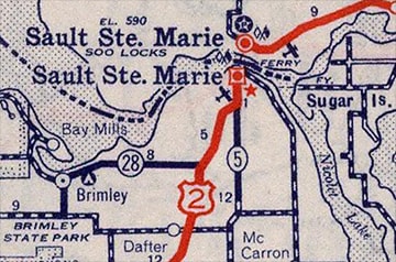
c. 1939, Rand McNally
|
|
Today I-75 skirts the west side of town, but Business Spur I-75 connects with Mackinac Trail / Ashmun Street, which historically carried US 2. At Portage Avenue traffic was directed east, as shown on this historic map:
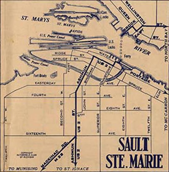
c. 1933, Michigan DoT
|
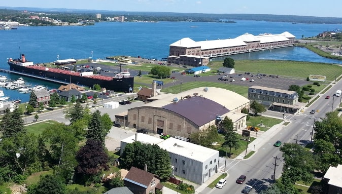
Today the area around US 2's original terminus has changed quite a bit, and from ground level it is hard to get a feel for how things were, but one can get a great overview of the area from the nearby Tower of History, as seen here:
Elliott, Aug. 2016
The view is to the east; the road at lower right is Portage. Just past the ice arena (with the curved roof) is Johnston Street, where US 2 turned left. The next block is Water Street; right where the ore ship is docked (actually a museum now), US 2 turned right into what is now a parking area. Historically that was where people could catch the ferry that went to Sault Ste. Marie Ontario, so that is where the US 2 designation ended.
|
|
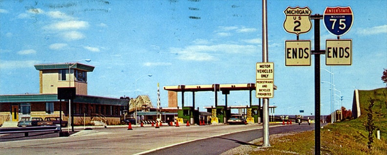
When I-75 was opened to traffic in 1962, US 2 traffic was rerouted onto the interstate, and then its east terminus was where I-75 enters Canada. Here is a scan from an old postcard, showing the "End" signage that was formerly posted there:
|
|
|
This more recent photo still shows an "End I-75" assembly, but it illustrates how the customs facilities have been expanded, and also more clearly shows the bridges across the St. Marys River and into Canada:
|
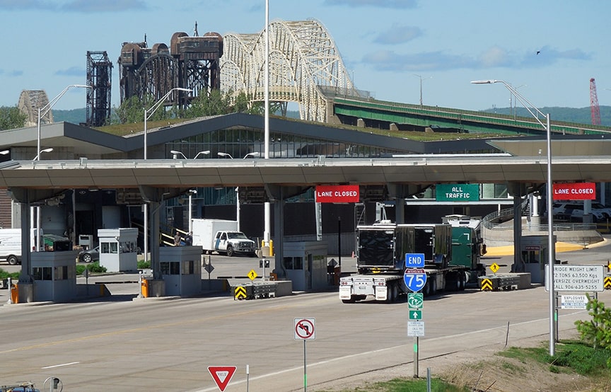
Sanderson, Jun. 2022
|
|
This photo was taken looking the opposite direction, southbound at the beginning of US 2 (and I-75), after the border checkpoint but before the tollgates:
|
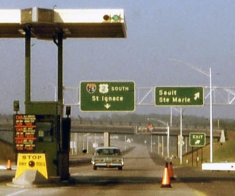
Lindsay, Jul. 1963
|
|
At their Oct. 1983 meeting, AASHTO approved the truncation of the east end of the US 2 to its current terminus in St. Ignace.
Originally US 2 went only as far west as Bonners Ferry ID. There is some question as to the original route of US 2 between Bonners and Moyie Springs, and therefore the location of its junction with US 95 as well...
|
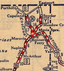
c. 1927, Rand McNally
|
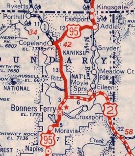
c. 1927, Rand McNally
|
|
...but the answer may not be relevant to the endpoint of US 2, because according to this Boundary County census map, US 2 did not end at its junction with US 95, but instead overlapped with it into Bonners Ferry:
|
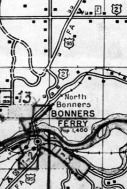
c. 1937
|
|
At the time, US 95 used Main Street all the way through town. So it is possible that the US 2 designation ended on Main near the courthouse, but that is only speculation.
In 1948 the west end of US 2 was extended to Everett WA. That was right about the time that US 99 was re-routed such that it used Broadway through most of town (instead of Rucker), so US 2 would have begun there: |
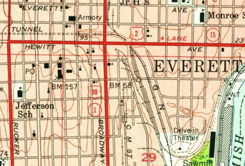
c. 1953, USGS
|
|
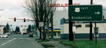
Here is modern signage posted on northbound Broadway at Hewitt Avenue:
|
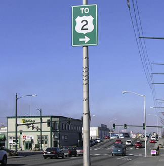
Elbert, Feb. 2005
|
|
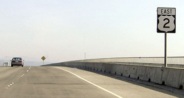
Everett's original west beginning of US 2 was to the right. But after I-5 was built and US 99 was decommissioned, US 2's western terminus became a little less well-defined. Heading westbound, there is no "End" sign, but this photo shows the last US 2 sign on the road:
|
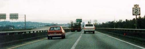
Wiley, 2000
|
|
Going that direction, WSDoT makes it look like US 2 ends at its junction with I-5:
|
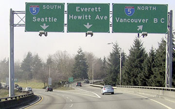
Elbert, Feb. 2005
|
|
However, the US 2 designation officially continues ahead via the roadway signed "Everett", a bit past the southbound I-5 onramp. This winds up on California Street, and US 2 ends at its junction with Maple Street (which is designated as WA hwy. 529). That intersection is shown here:
|
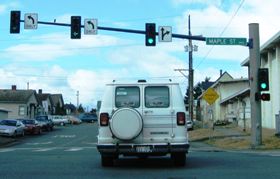
Field/Nitzman, Aug. 2006
|
|
The sign ahead says "Residential Street - Speed Limit 25". Eastbound US 2 uses Hewitt, which is one block to the south (left). So if a driver turns left from there, they will see the sign shown in this next photo:
|
Wiley, 2000
|
|
That was on southbound Maple at Hewitt. The overhead sign is still there, as is the one just visible at far left; here are some close-ups:
|
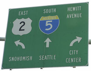
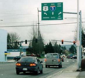
Elbert, Feb. 2005
|

Elbert, Feb. 2005
|
|
These next photos were taken looking the opposite direction (north on Maple at Hewitt):
|
Wiley, 2000
|

Elbert, Feb. 2005
|
|
When a driver turns that direction, the view under the I-5 overpass used to look like this:
|

SRweb
|
|
Note how Hewitt used to head due east to an elevated portion which joined US 2 traffic coming from I-5. That is no longer the case:
|

Elbert, Feb. 2005 (same as of 2019)
|
|
Hewitt is now just a surface road ahead. US 2 traffic is directed to turn left (as the red car in the middleground is doing). That merges with I-5 traffic and then curves back to join the US 2 bridge over the Snohomish River (visible in the distance). The first eastbound confirming marker is posted on that bridge:
|
Elbert, Feb. 2005
|
Research and/or photo credits: Mark Bozanich, Chris Elbert; William Elliott; Andy Field; Jim Lindsay; Alex Nitzman; Mike Roberson; Dale Sanderson; Michael Summa; Gary Voshol; Mike Wiley
Page originally created 2000;
last updated Dec. 11, 2023.
last updated Dec. 11, 2023.
