Historic US highway endpoints in Louisville, KY
|
1926-1955(?)
|
 |
|
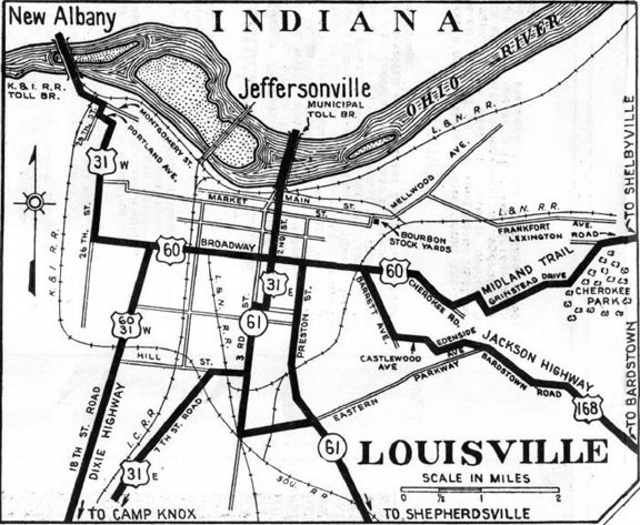
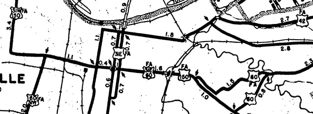
US 168 was an original 1926 route, and its west endpoint was in Louisville. This map showed US 168 coming in on Barret Avenue. It had a junction with US 60 at Broadway...
|
c. 1930, Kentucky State Highway Commission
|
|
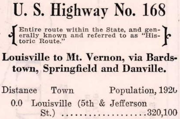
...but during the early years, routes were often overlapped to a more centrally-located junction. This 1928 photo shows that traffic heading east on Broadway from 2nd Street (US 31) was reassured with two US route shields. Unfortunately the numbers themselves were not visible, but nevertheless that gives further support to the idea that US 60 and 168 were overlapped between 2nd and Barret. This route log (from the 1929 official state highway map) suggests that the route actually terminated at 5th and Jefferson. In one sense that is plausible (considering that the courthouse is located there), but on the other hand it is odd that inset maps from that timeframe illustrated neither 5th nor Jefferson:
|
c. 1929, Kentucky State Highway Commission
|
|
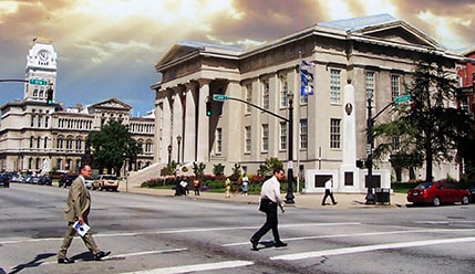
With very little to go on, my conclusion at this point is that US 168 may have ended at the courthouse during the 1920s. This photo was taken looking to the west on Jefferson, with 5th being the crossroad. In the foreground is the courthouse, and City Hall is visible in the next block:
|
Onasill, 2009 (linked to original)
|
|
However, in 1930 the west end of US 42 was extended to Louisville, and this photo (from the same year) shows both a US 42 and a US 168 shield at the intersection of 2nd Street and Market Street:
|
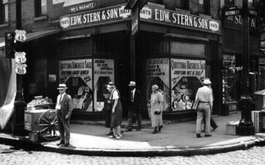
c. 1932, linked to source
|
|
At the time neither US 60 nor US 31E followed the same routings they do today, so it would have made sense for US 42 to end right downtown at its junction with US 31 (specifically on Main Street at 2nd Street). And according to the preceding photo (since Market is the eastbound counterpart to Main) US 168 probably ended there as well. This shot was looking west on Main at 2nd:
|
Sanderson, July 2007
|
|
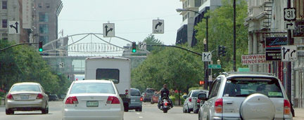
These photos were both taken looking north on 2nd:
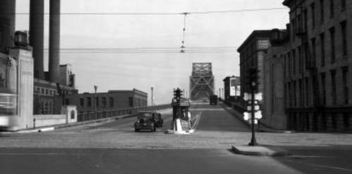
c. 1945 (linked to source)
|
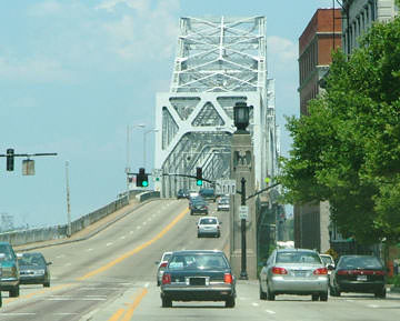
Sanderson, July 2007
|
|
Ahead is the US 31 bridge over the Ohio River into Jeffersonville IN. To the right on Main (or Market) was the historic beginning of US 42 after 1932. That was probably also a terminus of US 168, but only until 1934, when that designation was replaced by US 150.
Some later maps, such as the one shown here, suggest that US 42 may have been extended west to 22nd Street, in order to junction US 31W... |
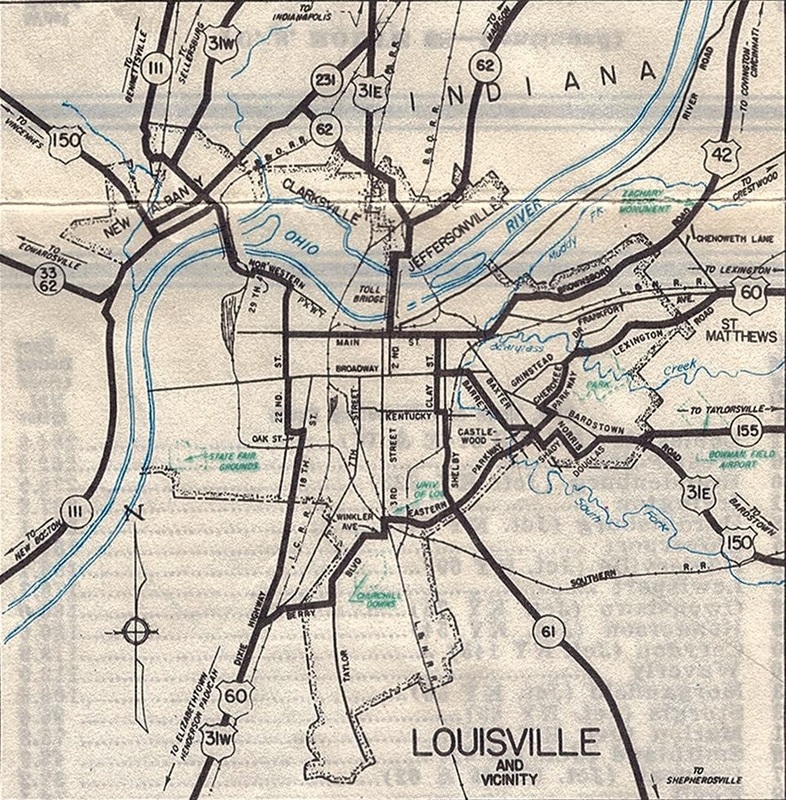
c. 1939, KYDoT
|
|
...but the Jefferson County map from the same timeframe does not show that:
|
c. 1937, KYDoT
|
So US 42 probably ended at 2nd until sometime in the 1950s. Subsequent Louisville endpoints are shown on the main US 42 page.
Research and/or photo credits: Bill Onasill; Mike Roberson; Dale Sanderson
Page originally created 2005;
last updated Feb. 21, 2021.
last updated Feb. 21, 2021.
