End of historic US highway 168 |
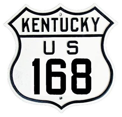
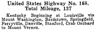
1926-1934
- East: Mt. Vernon, KY
- West: Louisville, KY
US 168 was an original 1926 route, with its east terminus in Mt. Vernon. The west endpoint was in Louisville. This map showed US 168 coming in on Barret Avenue. It could have ended at Broadway, at its junction with US 60. But, especially during the early years, routes were often signed to a more centrally-located junction. And this 1928 photo shows that traffic heading east on Broadway from 2nd Street (US 31) was reassured with two US route shields. Unfortunately the numbers themselves were not visible, but nevertheless this gives further support to the idea that US 60 and 168 were overlapped between 2nd and Barret:
|
This interactive image is looking south on 2nd, which at the time was US 31. The cross street is Broadway, which today is US 150, but back then it was US 60. To the left on Broadway was not only eastbound US 60, but probably also the west beginning of US 168:
|
About a mile in that direction is the junction with Barrett; eastbound Broadway is on the left side of this image. To the right is Barrett, a diagonal. That was either the west beginning of US 168, or else this intersection was where US 168 split off from US 60:
|
US 168 lasted only about seven years: in 1934, US 150 was extended eastward, and it subsumed the entirety of what had been US 168.
Research and/or photo credits: Mike Roberson; Dale Sanderson
Page originally created 2005;
last updated Dec. 30, 2018.