End of US highway 11 |
 |
|
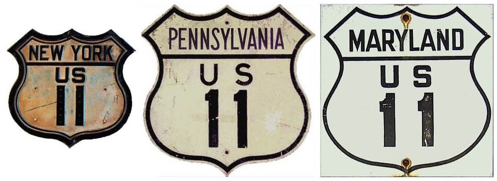
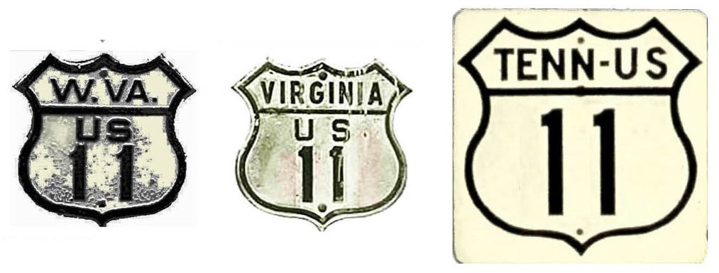
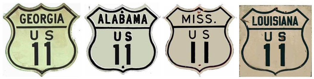
1926-1936
|
1936-1951
|
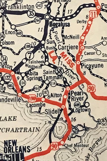
1951-present
|
Summa
|
Summa
|
Summa
|
|
Mileage: in 1989 AASHTO listed a figure of 1780 miles for US 11... however, that included the mileage of US 11's associated business/bypass/alternate routes, and it included the mileage of both US 11E and 11W in Tennessee. According to the state subtotals on AASHTO's 1989 spreadsheet, mainline US 11's actual end-to-end total at the time was 1645 miles (assuming US 11W; using US 11E would have increased that distance to 1654 miles). That is reasonably close to our own 2020 measurement (again assuming US 11W), which yielded 1655.8 miles (reroutings and realignments likely explain the difference; using US 11E instead would have been 1665.5 miles).
|
The north end of US 11 has always been in Rouses Point. Exactly where is open to debate; more info on the Rouses Point page.
The original south end of US 11 was a little ways south of Nicholson, just shy of the Louisiana state line. This was before US 90 had been rerouted to its present crossing of the Pearl River. West of Bay St. Louis, US 90 originally veered north, following what is now MS hwy. 607. Just before reaching Nicholson (near what is now I-59's interchange 1), US 90 took a left turn and crossed the Pearl River, went through the Louisiana town of the same name, and followed today's US 11 southwestward into New Orleans... |
c. 1927, Rand McNally
|
c. 1934, Gallup
|
|
...but if -- instead of making the left turn at that junction -- a driver went straight ahead (towards Nicholson and Picayune), they would have been on the south beginning of US 11. This interactive image was taken looking north on MS 607:
|
That was westbound US 90, which continued to the left (on a road that is now vacated). Straight ahead was the original south beginning of US 11. This photo is looking the opposite direction:
|
That was the south end of US 11 - straight ahead was eastbound US 90, and westbound was to the right. Some older maps label that historic wye-junction "Santa Rosa" (one example is at the bottom of this page). Not much to see there anymore: the south half of the wye has been vacated, and if any of the old highway's surface
remained, it has since been covered with sand.
remained, it has since been covered with sand.
|
In 1936, US 90 was rerouted to cross the Pearl River at Pearlington, so US 11 was extended southwest from Santa Rosa on the former US 90. Initially US 11-190 used the former US 90 (today's LA 433) south of Slidell to connect with US 90...
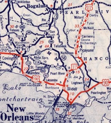
c. 1939, Rand McNally
|
...but in about 1939, the bridge tolls were removed, so US 11 took the more direct route across Lake Pontchartrain, and the former US 11-90 south of Slidell became simply US 190:
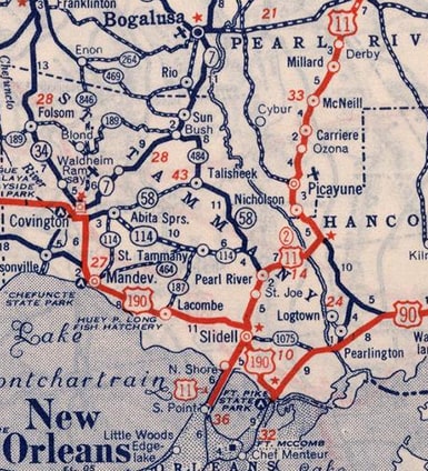
c. 1940, Rand McNally
|
|
During those years, US 11's endpoint was in New Orleans (photos and more info on that page)...
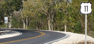
...but not long after that (in 1951), US 11 was truncated to its current terminus, at its junction with US 90 in the Bayou Sauvage National Wildlife Refuge (although this is still within New Orleans city limits):
|
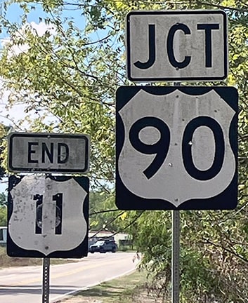
Miller, Sep. 2023
|
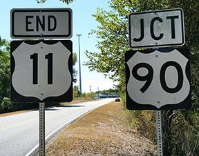
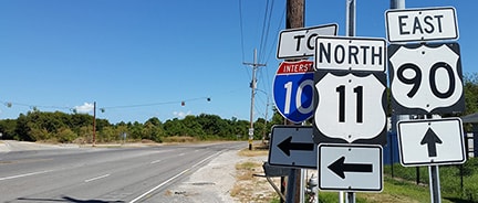
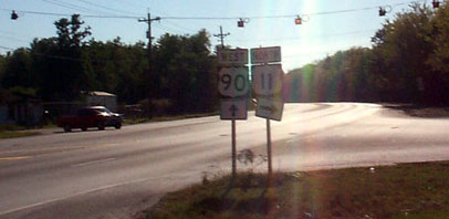
Those signs have been knocked around by hurricanes a few times, and the "90" shield was replaced with a larger version. The intersection just ahead is known to locals as "Powers Junction", which was the name of a no-longer-extant truck stop established by the Powers family in 1955. These next photos show the sign assembly a driver would see heading east on US 90, as they approach the left-hand turn onto the south beginning of US 11:

Nitzman, Dec. 2007 (replaced by 2009)
|
Nitzman, Oct. 2016
|
Bourey, Nov. 2019
|
|
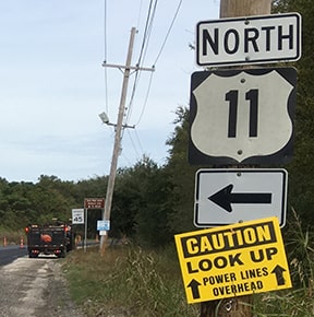
Historically, travelers taking that turn to the left would immediately see the first northbound marker, but this has been gone for a long time now:
|
Nitzman, Dec. 2007 (gone as of 2013)
|
|
These next shots were taken from westbound US 90. This first sign may have been damaged by Hurricane Katrina in 2005; at any rate, it was replaced in 2009:
|
Nitzman, 1999
|

Karner, Jun. 2013 (unchanged as of 2019)
|
|
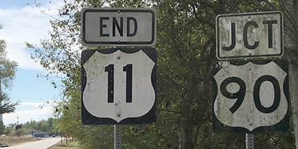
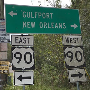
The sign in the background is for drivers at the south end of US 11; some close-ups are shown here:
|

Mortell, 1996
|

Karners, Dec. 2009
|
Bourey, Nov. 2019
|
|
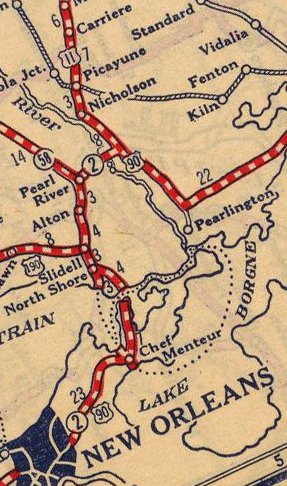
Incidentally, US 11 continued to cross the Pearl River on the old US 90 alignment up until about 1966 (which is when it was rerouted to cross into Louisiana via what is now the I-59 bridge). After US 11 traffic was redirected, the old bridge continued to function for local traffic until it was finally dismantled in the mid-1970s. But some maps continued to show US 11 on its old (and vacated) alignment. One example is shown here... a USGS map, dated 1984:
|
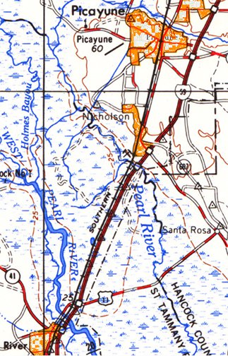
c. 1984, USGS 1:200k
|
Research and/or photo credits: George Bourey; Adam Froehlig; Karin and Martin Karner; Kevin Miller; Robert Mortell; Alex Nitzman; Dale Sanderson; Michael Summa
Page originally created 1999;
last updated Dec. 12, 2023.
last updated Dec. 12, 2023.
