US highway endpoints in Atlantic City, NJ
|
1927-present
|
 |
|
The east ends of both US 30 and US 40 have been in Atlantic City since the US routes were first commissioned in 1926. The US 322 designation was extended there ten years later. All three routes once shared a common terminus:
|
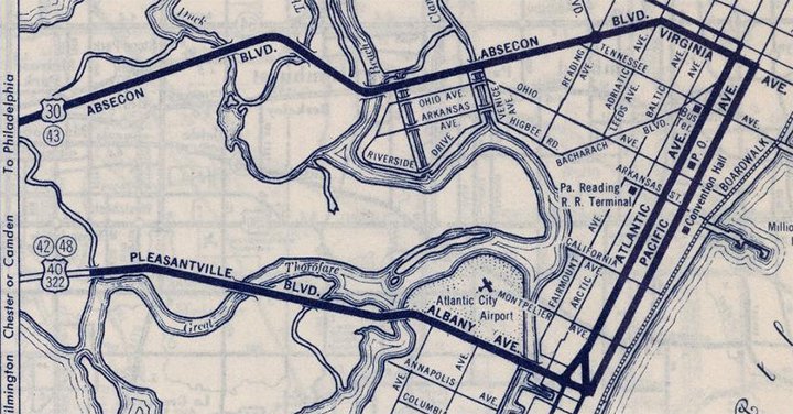
c. 1940, Rand McNally
|
|
Today US 30 ends on Absecon Boulevard at the five-way intersection of Virginia Avenue and Adriatic Avenue. But at one time the designation continued south on Virginia for about a half-mile. And, whereas today US 40 and US 322 end on Albany Avenue, those routes originally extended east along the Atlantic Avenue/Pacific Avenue couplet to Virginia Av, where they shared a common terminus with US 30. That was still the case at the time of this map:
|
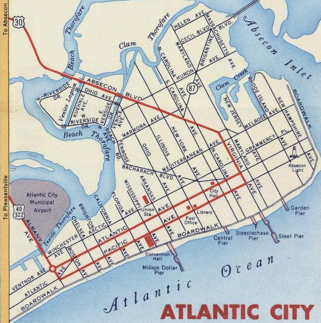
c. 1956, Gousha
|
|
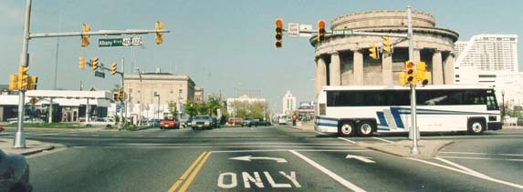
This photo was taken looking south on Virginia, or historic US 30; the east beginning of US 40 and US 322 was to the right on Atlantic:
|

Elbert, July 2006
|
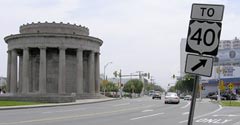
Apparently Atlantic was one-way southbound, so US 30 ended at the next block ahead: Pacific Avenue, which carried the easternmost segment of US 40-322. If the car shown above were to turn right and go about two miles, the road jogs slightly, its name changes to Ventnor Avenue, and it passes just to the north of the distinctive WWI Veterans Memorial (this is a fairly modern reconfiguration; as can be seen on the map above, there was formerly a traffic circle surrounding the Memorial).
|
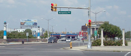
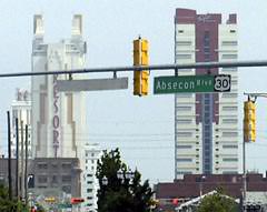
Just past that, Ventnor intersects Albany Boulevard (formerly Albany Avenue). There, a sign pointing to the right (west) on Albany is the current easternmost reference to US 40...
|
Elbert, July 2006
|
...and although US 322 also begins there, for some reason that highway is not represented on the sign assembly. And unfortunately, Chris reports that was the only standard signage at this intersection. The only other indication of the two US routes is on city street signs. But apparently this endpoint has been poorly-signed for decades: in his 1953 book U.S. 40: Cross Section of the United States of America (Riverside Press, Cambridge MA), George R. Stewart had this to say about the east terminus:
"In keeping with its utilitarian and non-ceremonial nature, U.S. 40 has no monument or even signpost to mark its beginning. It merely emerges from the streets of Atlantic City. This is unusual. Most federal highways come to a definitely and clearly marked terminus, but in Atlantic City the westbound motorist must merely, so to speak, pick up the trail by sighting a seemingly chance marker along the street.
As a practical starting point, we can take the traffic-circle surrounding the World War Memorial. From this point westward, for nearly three thousand miles, the route is posted continuously with the shield-shaped markers of the federal highway system. Here at the traffic circle U.S. 40 is only a quarter mile from the ocean, though actual view of it is cut off by the intervening Atlantic City board-walk."
As a practical starting point, we can take the traffic-circle surrounding the World War Memorial. From this point westward, for nearly three thousand miles, the route is posted continuously with the shield-shaped markers of the federal highway system. Here at the traffic circle U.S. 40 is only a quarter mile from the ocean, though actual view of it is cut off by the intervening Atlantic City board-walk."
|
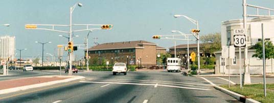
At some point (perhaps the 1980s), the US highway designations were removed from Atlantic/Pacific, and the routes were truncated to their current endpoints. This next photo was taken looking north along Albany from Atlantic:
|
Mortell, Aug. 2007
|
|
According to NJDoT documents, US 40-322 actually begins there at Atlantic (not Ventnor, which is the next block ahead; note the WWI Memorial in the distance). In other words: the Memorial may be the vernacular endpoint for US 40, but apparently it is not the actual endpoint. However, there is no route signage at the Albany/Atlantic intersection. One must travel a few blocks north of Ventnor before sighting the first confirming assembly:
|

Elbert, July 2006
|
The two routes are overlapped for about 12 miles west, to McKee City. The green sign in the distance informs the traveler of a connection to Camden and Philadelphia via the Atlantic City Expressway.
|
Heading the opposite direction, the east end of US 40-322 is completely unheralded, both at Ventor and one block ahead at Atlantic:
|
Elbert, July 2006
|

Elbert, July 2006
|
|
This photo was taken from eastbound Ventnor, where there are US route shields on the street signs:
|
Wiley, 2000
|

Elbert, July 2006
|
|
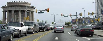
Moving on to US 30, this photo was looking east on Absecon Boulevard, which comes in diagonally to the rest of the street grid. The two cars coming towards the camera are westbound on Adriatic Avenue. Here drivers must veer either slightly right (to southbound Virginia Av) or slightly left (to continue on Absecon)...
|
Wiley, 2000
|
|
...but unfortunately that "End" sign was gone as of 2006. In fact, there are no longer any standard route shields posted at this intersection -- the only mention of US 30 is found on city street signs, an example of which is shown here, looking south on North Carolina:
|
Elbert, July 2006
|
Elbert, July 2006
|
|
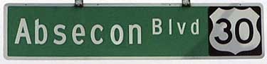
As of 2018, all Absecon Blvd street blades included a US 30 shield... even those along the two-block segment east of Virginia, which is actually not part of US 30. About two blocks west of Virginia is the first confirming assembly:
|
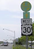
Elbert, July 2006
|
_at_Pennsylvania_Avenue_in_Atlantic_City,_Atlantic_County,_New_Jersey.jpg)
"Famartin", Sep. 2018
|
Research and/or photo credits: Chris Elbert; Robert Goodman; Robert Mortell; Dale Sanderson; Mike Wiley; "Famartin"
Page originally created 1999;
last updated Oct. 16, 2019.
last updated Oct. 16, 2019.
