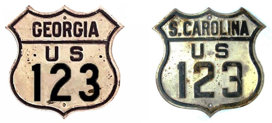
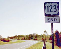
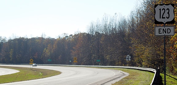
End of US highway 123 |
 |
Summa
|
|
Mileage: in 1989 AASHTO listed a figure of 90 miles for US 123... however, that included the mileage of US 123's associated business route. According to the state subtotals on AASHTO's 1989 spreadsheet, mainline US 123's actual end-to-end total was 87 miles... but at the time, US 123 still ended in Cornelia. Since then it has been truncated to Toccoa, and our own 2020 measurement yielded 74.2 miles.
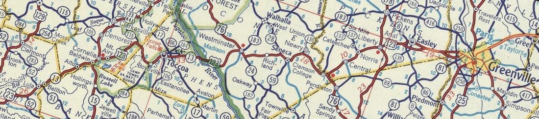
Prior to the current US 123, there was a historic US 123 in Kentucky. Interestingly, it too connected US 23 and US 25, just like today's US 123. The current designation was commissioned in 1946, and it has served essentially the same corridor ever since, running through a small region of northeast Georgia and upstate South Carolina:
Prior to the current US 123, there was a historic US 123 in Kentucky. Interestingly, it too connected US 23 and US 25, just like today's US 123. The current designation was commissioned in 1946, and it has served essentially the same corridor ever since, running through a small region of northeast Georgia and upstate South Carolina:
c. 1956, Gousha
|
In Greenville, US 123 originally came into town on Pendleton Street, and then angled north on Main Street (in other words, it followed the route which today is designated SC hwy. 124). At the time, US 25-29 followed modern SC 20, which comes in on Augusta Street, and then continues on Main by taking over where SC 124 ends. That is the same junction where US 123 originally ended, shown in this interactive image. US 25-29 came in from the right on Augusta, and continued straight ahead on Main:
|
|
|
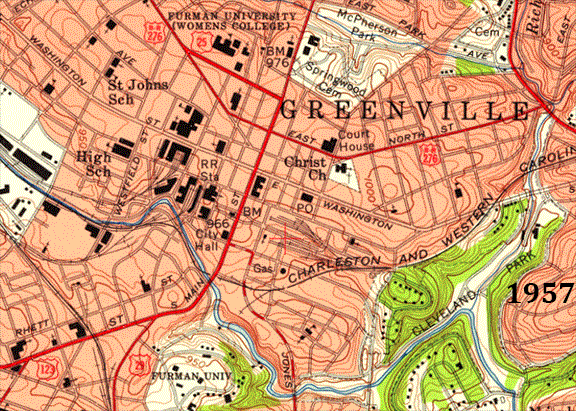
That endpoint was illustrated on this 1957 map, but it is clear that by the time of the 1976 map, Greenville had made some significant changes to the transportation infrastructure in the downtown area. One that impacted US 123's terminus was a four-lane road built to connect Academy Street and Church Street; it ran just north of Furman University and crossed the Reedy River at what is now Falls Park:
|
|
|
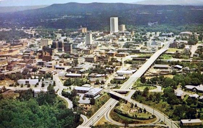
That road still existed at the time of this postcard, visible along the bottom of the photo. In 1961, US 123 traffic was directed onto this road. The long diagonal road is Church Street (which by then was carrying US 25-29 traffic). The US 123 designation ended at Church, at the junction marked by the triangle-shaped overpass and the looping access ramps:
|
date and attribution unknown
|
|
Although the Reedy River bridge has since been removed, most of the remainder of that historic segment of US 123 still exists as Falls Park Drive and Camperdown Way. The connection with Church was (and still is) a bit complex, involving Falls Street for drivers wanting southbound US 25-29, and Cleveland Street is used for traffic headed towards northbound US 25-29:
|
|
|
In 1972, US 123 traffic was directed to stay on Academy to its current terminus at North Street. Academy loops around the downtown area, so northbound US 123 is actually heading south at the point where it ends. These photos show the last northbound marker (which is just past Church) and the actual terminus a couple blocks ahead at North St:
|
Karner, May 2013
|
Karner, May 2013
|
|
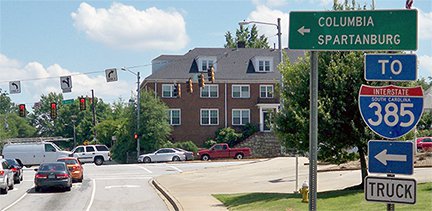
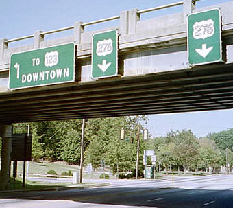
One could make the case that is not a very logical endpoint for US 123. It could be extended east (left) a couple blocks on (unmarked) I-385 Spur, so that it would end where I-385 begins, where there is also a junction with US 276:
|
Karner, May 2013
|
Ahead I-385 forms a bypass around the south and east part of town, down to Mauldin. US 276 traffic is directed onto the old highway, Laurens Road, which heads south through Mauldin to its own terminus at I-385.
|
|
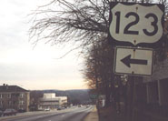
Heading the opposite direction, I-385 ends and dumps traffic onto westbound North St. There, drivers encountered a fairly old US 123 sign (gone now) and then another assembly marking the north beginning of US 123:
|
Turner, May 2023
|
The route begins by heading further north for a couple blocks to a junction with US 29 at Church, then west for a few more, and then back to the south, where US 123 has another intersection with North St. After that point it finally begins heading southwesterly out of town, towards Easley and Clemson.
|
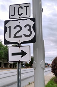
Heading the opposite direction on North was formerly a sign that directed US 123 traffic north onto Academy, but since at least 2011 that has been replaced with a "JCT" sign which does not indicate that US 123 traffic should turn left:
|
Nitzman, 2000 (gone as of 2013)
|
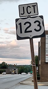
Turner, May 2023
|
|
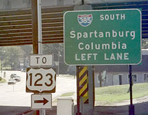
Historically from US 276, signs did a pretty thorough job of directing drivers to US 123, but when this old I-385 bridge was demolished for a replacement, these signs came down with it and were never replaced:
|
Nitzman, Oct. 2001
|
Nitzman, Oct. 2001
|
|
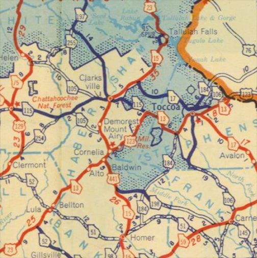
At its other end, US 123 was initially signed along what is now GA hwy. 13, and US 23 was still on its original alignment, which ran through the central business districts of Alto, Baldwin, Cornelia, and Demorest:
c. 1949, GA DoT
|
In 1952, the US 441 designation was placed over US 23 from Baldwin all the way up to Sylva NC (a distance of approx. 75 miles). So it is interesting that in recent years, when this original alignment was signposted as an historic route, it was marked as "Historic US 441", rather than "Historic US 23", even though the US 23 designation was there nearly 20 years earlier:
|
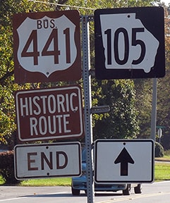
At any rate, US 23 ran through Cornelia along Main Street, and US 123 began on Wyly Street where it forks off from Main, as shown in these images:
|
|
Sanderson, Nov. 2017
|
|
Both images were looking north on Main; US 23 continued straight ahead, while to the right on Wyly was the south beginning of US 123.
In 1981, when the modern four-lane alignment of US 23 had first been built, US 123 was still running along today's GA 13. The designation was extended west a mile or two, so that it would connect to the new US 23. At that time, US 123 began at the Level Grove Road exit... |
Sanderson, Nov. 2017
|
|
...but that lasted only about ten years, until more of modern US 23 had been opened to traffic, and the routing of US 123 was changed as well. Now its south end is at a junction between Cornelia and Toccoa; here is the last southbound marker:
|
Sanderson, Nov. 2017
|
|
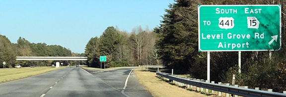
That was at the intersection with Rock Road. About two miles ahead, US 123 ends at its junction with US 23-441:
|
Patriarca, July 2003
|
Sanderson, Nov. 2017
|
|
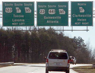
Right around that traffic signal would be an appropriate place for an "End" assembly, but where it is actually posted is easily visible to drivers on southbound US 23, right where traffic from US 123 merges in:
Field/Nitzman, Oct. 2001
|
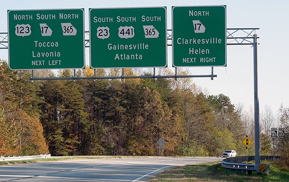
Sanderson, Nov. 2017
|
In these next photos we are looking north on US 23-441; the south beginning of US 123 exits to the right. One might find it curious that the sign says US 123 goes "northbound" (not "eastbound"). The highway is signed north/south along its entire length. Although US 123 runs essentially east/west, the route basically follows the foot of the Appalachians, and travel along that chain is often considered to be north/south, even in isolated places where it is actually more east/west. US 123 runs parallel to I-85, which is also numbered and signed as a north/south route:
Field/Nitzman, Oct. 2001
|
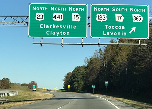
Sanderson, Nov. 2017
|
|
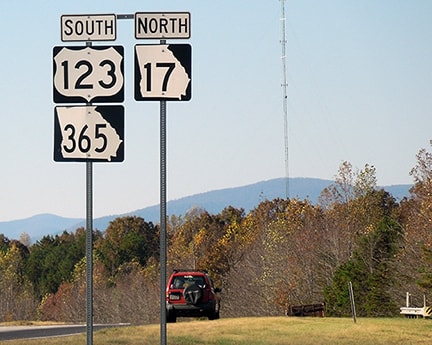
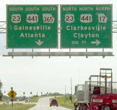
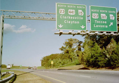
This shot was from the opposite direction (southbound US 23-441). The next exit leads to the south beginning of US 123, so it should have said "NORTH 123" (not "SOUTH")...
Elkins, Jan. 2008
|
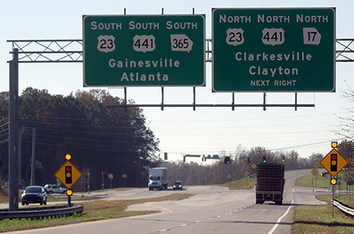
...and in addition to that, how was it possible that one could go two different directions on GA 365, and both ways were marked as "SOUTH"? Both mistakes were soon fixed:
Sanderson, Nov. 2017
|
Research and/or photo credits: H.B. Elkins; Andy Field; Martin Karner; Alex Nitzman; Chris Patriarca; Mike Roberson; Dale Sanderson; Michael Summa; Charles Turner
Page originally created 2000;
last updated May 31, 2023.
last updated May 31, 2023.
