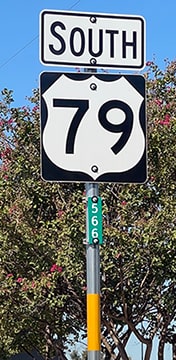
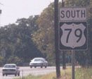
End of US highway 79 |
 |
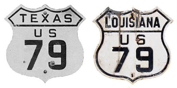
Summa
|
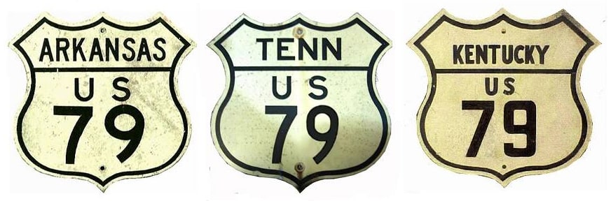
Summa
|
|
1934-1940
|
1940-1944
|
1944-1986
|
1986-present
|
|
Mileage: in 1989 AASHTO listed a figure of 878 miles for US 79... however, that included the mileage of US 79's associated business route. According to the state subtotals on AASHTO's 1989 spreadsheet, mainline US 79's actual end-to-end total at the time was 873 miles. That closely matches our own 2020 measurement, which yielded 870.5 miles.
|
Historically, when US 79 extended to Austin, the route was 889.3 miles long.
|
|
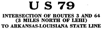
US 79 was not among the original 1926 routes; it was commissioned in 1934. Originally its north end was near West Memphis... but where, exactly? The 1936 issue of the official Arkansas highway map included a route log, and the title block for US 79 explicitly spelled out where the route began...
|
|
...but can that be trusted? It is questionable because that same year, AHTD printed a detailed map of Crittenden County that showed US 79 ending at US 70 in Lehi. So why the discrepancy? One theory is this: AHTD's 1935 issue included a route log for State Route 3, which did indeed begin at Cunningham Corner (three miles north of Lehi). The US 79 designation had replaced most of SR 3 (but not the northernmost three miles). So it is possible that a staffer made the erroneous assumption that the route log for SR 3 could be used for the new US 79, even though that was not entirely correct.
|
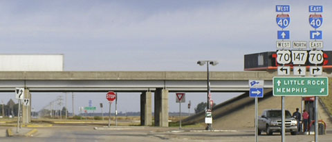
What is clear is that, at the time, US 79 was routed north on what is now SR 147. Most likely it ended in Lehi at its junction with US 70:
|
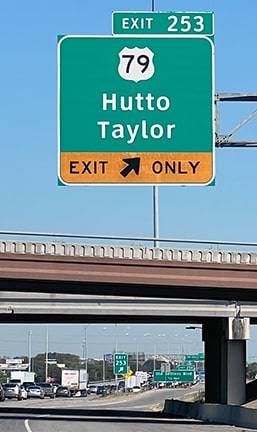
Taylor, Oct. 2004
|
|
The overpass is I-40; in this area US 70 doubles as the southside frontage road for the interstate. Around 1940 US 79 was extended east, on an overlap with US 70 to the Tennessee border (photos and more info on the West Memphis page).
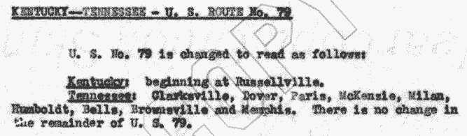
Tennessee did not pick up the route until 1944, which is when it was extended through that state and into Kentucky: |
c. 1945, KYDoT
|
AASHO meeting minutes, 1944
|
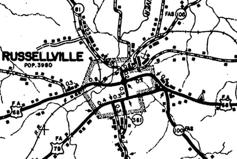
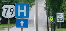
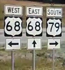
Since then the north end of US 79 has been in Russellville. This photo was taken looking east on 9th Street, or Business US 68:
|
Sanderson, July 2007
|
|
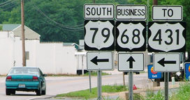
Formerly that was mainline US 68, but when the Russellville bypass was completed in 1998, it was re-signed as a business loop. To the right was the north beginning of US 79. The sign assembly in the background was for traffic at the north end of US 79; it is shown close-up in this photo:
|
Sanderson, July 2007
|
|
To the right is actually Business 68, but it meets mainline 68 about a half-mile in that direction.
This photo shows what was formerly the begin US 79 sign for westbound Business 68: |
Sanderson, July 2007
|
|
To the left on 9th was the north beginning of US 79. If a driver were to turn that way, this shot shows what was once the first US 79 sign heading south...
|
Sanderson, July 2007
|
|
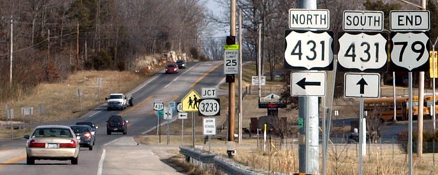
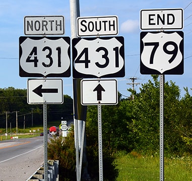
...but in 2007, the US 79 designation was truncated by about two miles. About one mile ahead, 9th picks up US 431 traffic. Then, in about another mile, US 431 departs 9th to the north on the bypass, and straight ahead on 9th is where US 79 began:
|

Elkins, June 2006
|
|
That photo was taken before the truncation took place. There was not really any reason to change that particular assembly, but the entire intersection was later re-signed without references to US 68. These photos were looking the opposite direction (northeast on 9th):
|
Sanderson, July 2007
|
|
At the time of that photo, signage still reflected US 79's historic extent, which continued ahead for another two miles. It is interesting that the bypass was signed as "Truck 79", because that route never rejoined mainline 79, and actually continued about three miles further than mainline US 79. This was the same scene a few years later:
Welborn, Jan. 2011
|
Buchanan/Nitzman, June 2017
|
|
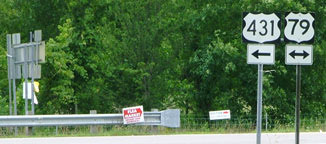
For a brief time in between those two photos, the road ahead was signed as "Formerly US 79". From 2007-2017, US 79 ended at that "elbow" in US 431. It was unfortunate that new US 79 shields had such an ugly shape. It was also unfortunate that US 79 ended at a 3dus route. But that was only temporary, in anticipation of extending the US 79 designation to the right along a then-unbuilt road.
|
Buchanan/Nitzman, June 2017
|
|
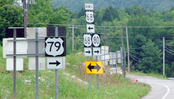
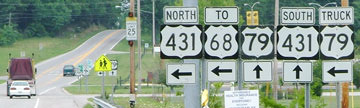
That was southbound US 431, which continued to the left. Historically US 79 went to the left as well, but from 2007-2017 it began to the right, and now both US 79 and US 431 continue straight ahead. After winding around the south Russellville bypass for 5.5 miles, one reaches a junction with US 68, and the north end of US 79:
|
Google Maps Street View, Jul. 2018
|
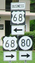
Approaching that intersection from downtown (east on Bowling Green Road, or Business 68), the north beginning of US 79 is at a turn in mainline US 68:
|
Google Maps Street View, Oct. 2018
|
|
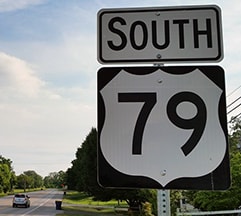
A driver turning to the right there will reach US 79's previous endpoint in 5.5 miles. However, if they were to simply head west via Bowling Green Rd and 9th St, they would reach the same intersection after only 2.7 miles. Obviously the purpose of the Russellville bypass is to keep truck traffic out of the central area, but under most circumstances those additional three miles would not provide any benefit for people driving smaller vehicles. Where the Bypass meets Clarksville Road, US 79 traffic is directed southwest, and the reassurance assembly there was once the first southbound confirming marker:
|
Sanderson, July 2007 (unchanged as of 2010)
|
Buchanan/Nitzman, June 2017
|
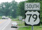
Given that Kentucky state highway 79 runs northeastward out of Russellville, along roughly the same direction-of-travel as US 79, one may wonder whether KY 79 was formerly a part of US 79. The answer is no. Prior to 1944, both of today's route 79s (heading both directions out of Russellville) were designated as KY 105. In 1944 US 79 replaced KY 105 from the Tennessee line to Russellville, but the road northeast out of town remained KY 105 for another two decades. In 1965 much of KY 105 was re-designated as KY 79. Obviously this was a nod to US 79, but that designation was never extended beyond Russellville, and I have not seen any evidence in AASHTO minutes indicating that KYDoT ever intended to do so.
|
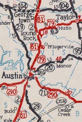
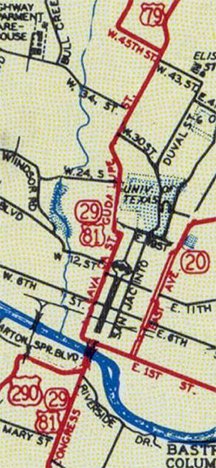
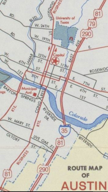
At its original south end, US 79 overlapped with US 81 about ten miles further south from its current terminus in Round Rock, ending in Austin:
c. 1936, TXDoT
|
Until about 1955, US 79-81 was routed along what is now Loop 275 through Austin: south on Lamar Boulevard and Guadalupe Street, then east on 1st Street (which today is also known as Cesar Chavez Street):
c. 1937, TXDoT
|
|
At Congress Avenue was a junction with US 290, where US 81 turned to cross the Colorado River and continue south, but the US 79 designation ended at that intersection:
|
Karners, Dec. 2014
|
|
That was looking east on Chavez -- US 79 ended there, but US 81 continued to the right on Congress. That direction was also westbound US 290, while eastbound was straight ahead.
This photo was taken looking north on Congress; about ten blocks in the distance, the gap in Congress is marked by the location of the Texas State Capitol: |
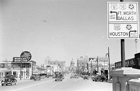
c. 1938 (attribution unknown)
|
|
Historically that was eastbound US 290 (which continued to the right on Chavez) and northbound US 81 (which continued to the left). To the left was also the south beginning of US 79. Here is a close-up of the sign:
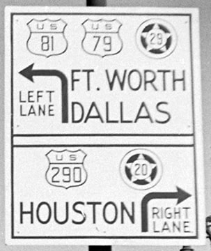
(detail)
In about 1955, US 79-81-290 were re-routed along East Avenue -- part of the "Interregional Highway" which would soon become I-35:
|
c. 1962, TXDoT
|
|
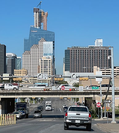
At 7th Street was an exit for Business 183-290 through downtown. The US 79 designation was truncated to that interchange:
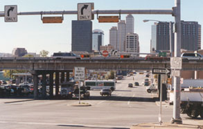
Taylor, Sep. 2000
|
Sanderson, Oct. 2022
|
|
Those were taken looking west on 7th at I-35 (which was built over the alignment of East Av). To the right was the south beginning of US 79, until sometime between 1979 and 1991 (depending which source is correct). Here is another view, this time looking south on the I-35 frontage road:
|
Karners, Dec. 2014
|
|
That was US 81-79-290 down to this point at 7th, but US 79 ended there. In roughly 1985, US 79 was truncated to its interchange with I-35 in Round Rock. We will begin with the view from northbound I-35:
|

Taylor, Sep. 2000
|
Sanderson, Oct. 2022
|
|
The US 79 offramp takes drivers to the frontage road shown here:
Taylor, Sep. 2000
|
Sanderson, Oct. 2022
|
|
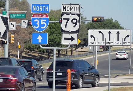
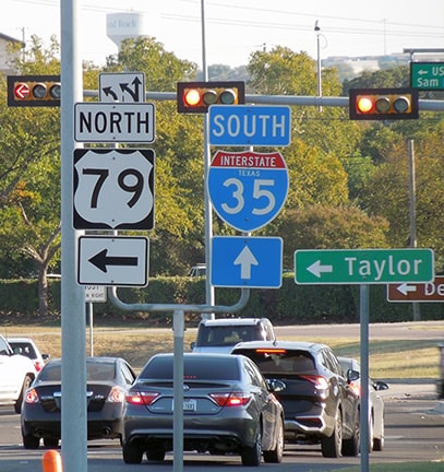
A turn there onto eastbound Palm Valley Boulevard also puts one on the south beginning of US 79. Drivers heading that direction soon see the first sign on northbound 79:
|
Sanderson, Oct. 2022
|
|
That was posted almost immediately (between I-35 and Mays Street, which carried US 81 traffic prior to the construction of I-35). But the first sign that includes a north tab was not posted for over two miles. That may be where the first sign was located in 2000:
|

Taylor, Sep. 2000
|
Continuing south from there (which is actually west), one passes Mays, and just beyond there one more trailblazer has been posted (it was within view of US 79's terminus, but my photo illustrating that was not very good, thanks to an overgrown tree):
|
Sanderson, Oct. 2022
|
|
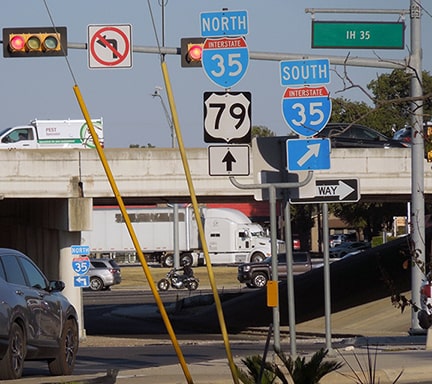
About a quarter-mile further is the interchange with I-35. That is shown in the photos that follow, marking the southern end of US 79:

Taylor, Sep. 2000
|
Sanderson, Oct. 2022
|
|
These next shots were taken from southbound I-35:

Cozart/Nitzman, Oct. 2007
|
Ivy/Nitzman, Aug. 2019
|
|
As a driver exits to the frontage road, these are the signs at the beginning of US 79:
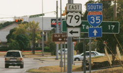
Taylor, Sep. 2000
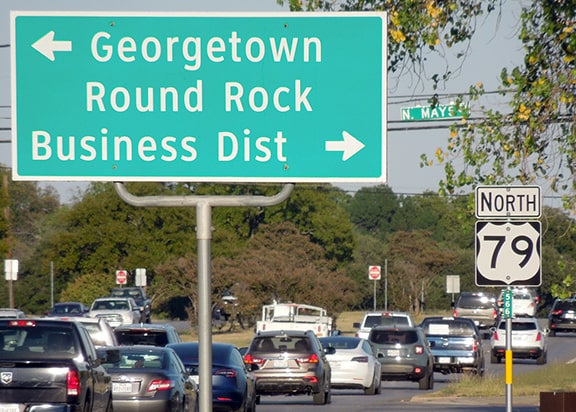
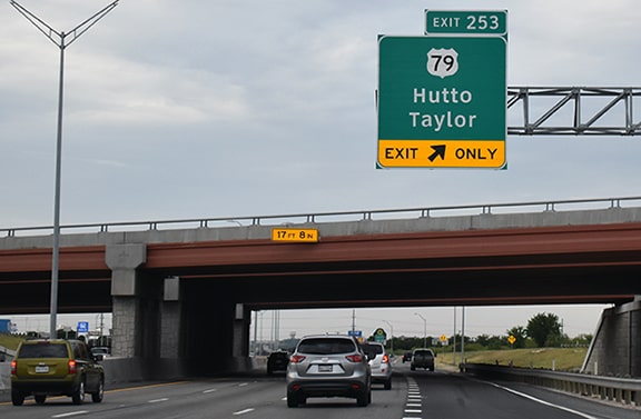
The partially-obscured green sign indicated that the town of Taylor is 17 miles to the left. It is interesting that the tab said "East" on US 79. Palm Valley certainly does run east-west, but US 79 is a north-south route, and that has since been corrected on a more recent assembly:
|
Sanderson, Oct. 2022
|
|
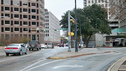
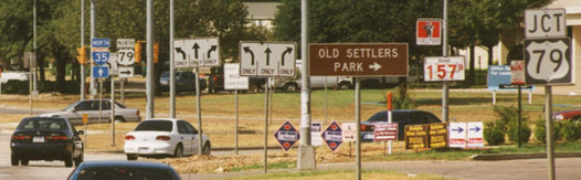
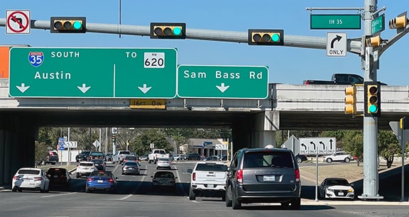
One more image from Round Rock: this was taken looking east on Sam Bass Road at the I-35 interchange. US 79 begins straight ahead on Palm Valley:
|
Sanderson, Oct. 2022
|
Research and/or photo credits: Carter Buchanan; Justin Cozart; H.B. Elkins; Brent Ivy; Karin and Martin Karner; Alex Nitzman; Mike Roberson; Dale Sanderson; Michael Summa; Steven Taylor; Johnnie Welborn, Jr.
Page originally created 2000;
last updated Dec. 17, 2023.
last updated Dec. 17, 2023.
