US highway endpoints in Virginia Beach and Hampton Roads
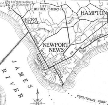
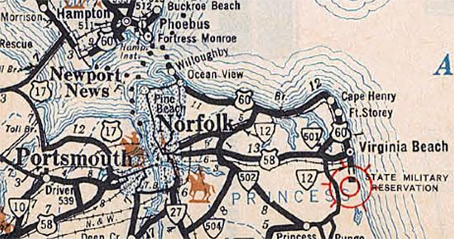
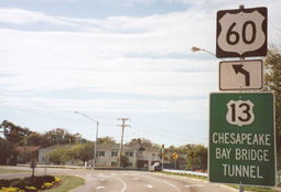
During its first couple years, US 60 ended in Newport News, at the landing of a ferry to Norfolk. These maps from that timeframe show US 17-60 coming in on Virginia Avenue (now Warwick Blvd), east on 25th Street, and south again on Jefferson Avenue to the ferry dock:
|
As can be seen in this interactive image, today Jefferson ends a little shy of the old ferry dock, which was straight ahead a couple hundred more feet (through what is now private property):
|
|
|
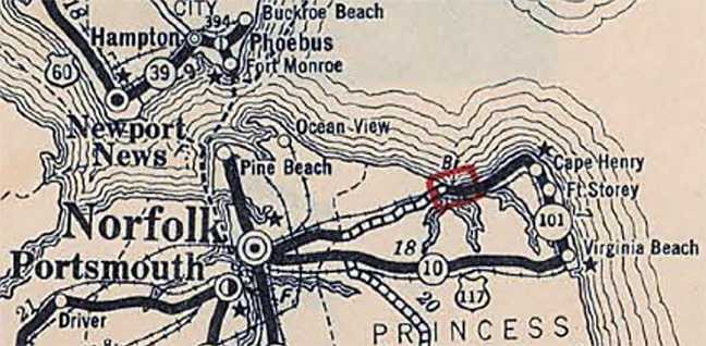
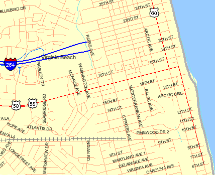
US 60 ended there, but on the map above, the ferry line (and US 17) are shown connecting with what is now Admiral Taussig Boulevard in the Naval Base at Norfolk, then south on Maryland Avenue/Hampton Boulevard into downtown, where a connection could be made with US 117[i]. US 117 ran east from Norfolk to Virginia Beach. Traffic was directed to the oceanfront via 17th Street (or Virginia Beach Boulevard), ending at Atlantic Avenue (which at the time was VA hwy. 501):
|
|
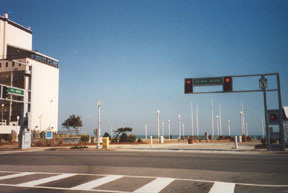
US 60 still shared a common endpoint with US 117, but now it approached that intersection from the north via Atlantic Av. Here the view is looking south on Atlantic:
|
|
|
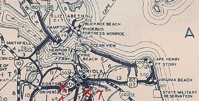
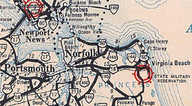
For a brief time, that was the east end of US 60, and the east beginning of US 117 was to the right on 17th. In 1932, US 58 absorbed what had been US 117, so then it was US 58 that began to the right. (That remained the case until 1956; for the rest of US 58's story, please see the main US 58 page.) Also, the designation south of that terminus point was briefly changed to VA 12...
|
|
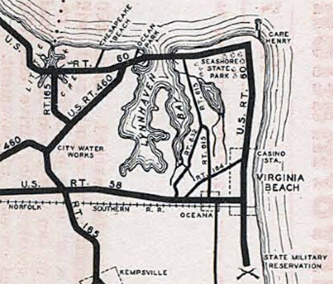
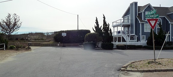
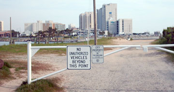
(Note that also showed a terminus of US 460; that is covered on the US 460 page.) At the time it was Atlantic Avenue (not Pacific Avenue) that had a bridge across Rudee Inlet. So US 60 continued along South Atlantic, ending just past Lockheed Avenue at the original entrance to Camp Pendleton:
|
|
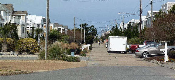
That was looking south on Atlantic; presumably the original entrance to Camp Pendleton was straight ahead (although today the entrance is one block inland, at the south end of Vanderbilt Avenue). This is now a residential area, and although that particular intersection has been repaved with asphalt, the road behind the camera is still concrete, indicating an old surface that dates back to the time this road carried highway traffic. Here is a view looking that direction (north):
|
US 60 formerly continued ahead, connecting with Atlantic Av on the other side, crossing Rudee Inlet via a bridge that no longer exists. This first bridge was considerably closer to the shoreline than today's bridge, and apparently there were issues keeping it open to traffic... which is not surprising, considering the risk of impact from beach erosion. Commonwealth Transportation Board (CTB) minutes from 1938 and 1941 include references to "...the situation at Rudee Inlet..." and discussions about "...a seawall to sustain the road..." Whatever solutions were tried, apparently they were not successful: aerial photos and maps from multiple sources (e.g. USGS, Princess Anne County, City of VA Beach) indicate that this first bridge was already gone by 1937.
|
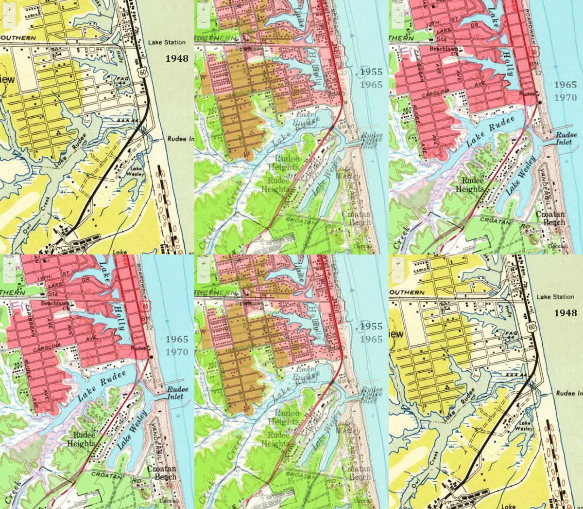
Instead of continuing to span Rudee Inlet at that particular location, the replacement bridge was built further inland, sometime around 1938. Traffic could then go south on Atlantic (using what is now the northbound section of the loop) only as far as 2nd Street, where the road then veered sharply westward to cross this second bridge, which aligned with what is now General Booth Boulevard at today's intersection with Harbour Point Road and Rudee Point Road (if all this is difficult to visualize, try this interactive map with all of these bridges superimposed). This bridge was gone no later than 1955 (although a short segment of the old bridge approach still exists at the north end of Southside Road). Based on the dates of construction, I believe this second bridge was a quick fix, intended to immediately alleviate the problems with the first bridge, before a more permanent third bridge was opened the mid-1940s. This bridge also lined up with General Booth to the south of the inlet, but to the north it aligned with what is now the southbound section of the Atlantic loop (which curves broadly until it joins the straight segment of Atlantic at about 5th Street). This third bridge -- and the second bridge as well -- were both depicted on the 1948 USGS map:
|
The road shown at lower right is South Atlantic Av, which carried US 60 to Camp Pendleton until the first bridge was abandoned around 1940. In other words, US 60 initially ran along the shoreline, to the east of Lake Wesley. But since then, it appears that all subsequent bridges have carried traffic to the west side of Lake Wesley. If the first bridge no longer existed, then obviously US 60 could not have been routed along S. Atlantic. So then where did it end?
|
It seems logical that US 60 traffic would have been directed to use the new bridge, terminating at a different entrance to Camp Pendleton. And indeed some of the maps above seem to suggest that. However, there is no evidence in VDoT route logs to support that theory. The replacement bridges carried various secondary route designations, but it appears that none of them ever carried US 60. So I can only conclude that US 60 must have ended where Atlantic ends, on the north side of Rudee Inlet:
|
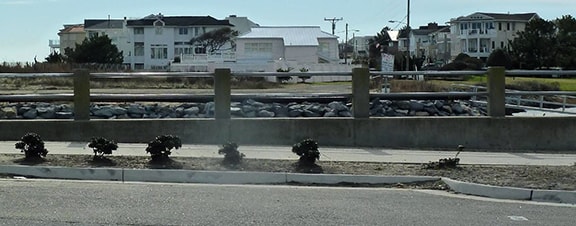
No bridge today -- only a fishing pier -- but the historic connection to South Atlantic is visible across the channel: it essentially followed the fenceline along the right side of the house in the foreground. It should be noted that this would have been the de facto terminus of US 60, but not the official terminus. Maps produced by VDoT continued to show US 60 using the first bridge for another 20 years or so, and VDoT did not address the failed bridge in their US 60 route description until 1961. Here is an excerpt from page 24 of the CTB meeting minutes from September of that year:
"...the portion of US Route 60 at Rudee Inlet, between the face of the north and south walls of the abutments, a distance of 200 feet, being no longer necessary for uses as a highway, be abandoned altogether as a public road... and that the remaining portion of Route 60 beginning at the south abutment and extending south to the present end of maintenance, a distance of 0.763 mile, be transferred from the Primary System to the Secondary System of Highways..."
In other words, the first bridge was removed from the highway system; the US 60 designation was officially truncated to the location where it had actually ended for the previous 20 years (on the north side of Rudee Inlet); and the former stretch of US 60 south of Rudee (along S. Atlantic Av.) became a secondary route.
So when looking solely at VDoT records, one can easily get the impression that the first bridge existed until 1961, and that US 60 ran all the way down S. Atlantic until that time. However, based on other sources, I believe this would be an incorrect assumption. So the first question is: if the bridge was gone by 1940 or so, then why did VDoT maps continue to show it for another 20 years? I suspect the answer was: because maps produced by VDoT were based on VDoT route descriptions, and therefore were not always updated to reflect actual conditions in the field. That in turn leads to another question: why doesn't VDoT do a better job of keeping its route descriptions current? That one is harder to answer. Perhaps part of the reason is because, in Virginia, non-interstate maintenance and signage within the jurisdiction of independent cities is the responsibility of the cities themselves (not VDoT). For the City of VA Beach, this took effect in 1963, because that is when the City merged with Princess Anne County. So it may not be entirely a coincidence that 1963 is the last time VDoT updated their route description for the VA Beach segment of US 60. Page 6 of the CTB minutes from October of that year clearly defined the routings of both US 60...
"Beginning at Rudee Inlet; thence northerly along Atlantic Avenue, westerly along 17th Street, northerly along Pacific Avenue and Atlantic Avenue, and westerly along Shore Drive to the W.C.L. of Virginia Beach..."
...and Business 60:
"Beginning at its intersection with U. S. Route 60 at 17th Street; thence northerly along Atlantic Avenue to its intersection with Pacific Avenue (U.S. Route 60)..."
Since then, over a half-century has passed, and not surprisingly, during the intervening years, the City of VA Beach has made some changes to the route of US 60. Perhaps most notably: by 1970 US 60 traffic did not use Atlantic at all, but instead was directed to stay on Pacific all the way down to Rudee Inlet. It has been reported that initially an "End US 60" sign was posted on Pacific near Rudee, but if true, then apparently it did not last long, based on this report from Shayne, who was stationed in Virginia in the mid-1970s:
|
"The major intersections in VA Beach were well-marked. Eastbound US 60 split into mainline US 60 (Pacific Av) and Business US 60 (Atlantic Av). This division was well-marked, using the then-typical small Virginia cut-out US shields on wooden posts. Both routes were marked with reassurance shields south to Laskin Road (where US 58 ended) and continuing down to VA Beach Blvd, which was marked "Business US 58". No "End" signs anywhere, but the proper directional signs were posted for US 58 and US 60 and their respective business routes."
By the 1980s, Business 60 was no longer marked at all. But VDoT has not made any changes to the route descriptions for either US 60 or Business 60. In fact, as of 2016, VDoT's online data still shows US 60 coming down Pacific, jogging over one block on 17th, and then resuming south on Atlantic: |
So, what's the problem? Why isn't VDoT's data more current? Is it because independent cities are supposed to report to VDoT any changes they make to highway routes, but VA Beach has not done so? Is it because VDoT does not consider it a high priority to keep data for independent cities accurate? Are there other reasons? I don't have the answers, but I do know that there are several instances (not just in VA Beach) where discrepancies exist between VDoT's route logs and highway signage posted in the field. However, the problem is compounded in VA Beach, because the City has almost completely failed in its responsibility to keep its highway routes clearly signed.
|
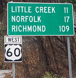
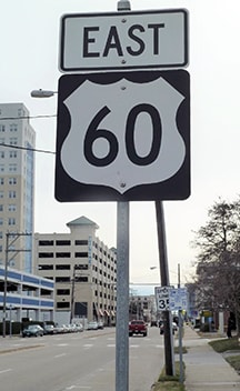
Mike reports that signage was already bad as of 1991, and that was certainly the case at the time of my 1999 visit. I first went out US 58 (Laskin Road), and then down to Business US 58 (VA Beach Blvd), looking for signs, but not immediately seeing any references to either US 60 or US 58, business or mainline. Then I headed north, looking for the first sign that would tell me I was on US 60. Not a thing until all the way up at Ft. Story, five miles north of its terminus:
|
|
That is where Atlantic curves and becomes Shore Drive. (If one were to turn right at the intersection ahead, which is one of the entrances to Ft. Story, the road re-aligns with old Atlantic Av, which was the pre-1940 alignment of US 60). Also at that intersection is a "Mile 0" marker. That -- coupled with the fact that there was no reference to US 60 in downtown VA Beach -- made me wonder whether the US 60 designation had been truncated to Ft. Story. But Stephen explained that was just a mile marker for the newer bypass segment of US 60 (other bypasses in the area also have "Mile 0" markers posted at their east beginning). As of 2017, even that sign was gone, but less than a half-mile ahead, this one had been posted:
|
|
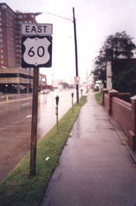
So the first confirming marker was nearly six miles away from US 60's point of beginning. Turning around and heading back south from there, for at least two decades the only US 60 sign going that direction is the one shown here. This is on Pacific, just past 36th Street; it was replaced sometime prior to 2015:
|
Not far behind that sign, Atlantic becomes Pacific. If one wants to continue south on Atlantic, they must make a left turn at about the 4100 block. That is the north beginning of Business 60 (or at least it was), but there were no signs to that effect. Further south, there were no signs for US 58 at Laskin, or Business US 58 at 17th, nor any indication that US 60 traffic should turn on 17th in order to resume southward along Atlantic.
|
|
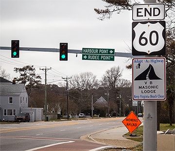
Does US 60 still jog between Pacific and Atlantic? VDoT information indicates that it does. But VDoT does not have much jurisdiction here, since they have offloaded responsibility for signage and maintenance to the City of VA Beach. And clearly VA Beach considers US 60 to continue straight on Pacific, because in about July 2004 they posted a new "End US 60" assembly on the south side of the Rudee Inlet bridge:
|
|
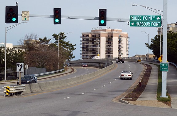
But decades before that "End" sign was posted, locals have not considered US 60 to jog over to Atlantic. Rather, they think of it as continuing the rest of the way down Pacific. The Rudee Inlet bridge is the landmark where Pacific ends, and US 60 ends, and General Booth Blvd begins. Or, to look at it from the opposite direction (north on General Booth), the Rudee Inlet bridge is where US 60 begins:
|
So this is a case in which an independent city has made changes to a highway route within its jurisdiction. Since this change has never been reflected in CTB minutes or in VDoT records, it appears that either VA Beach did not report the change to the state, or else the state agencies have not bothered to update their info. Whatever the reasons for the discrepancy, another resulting complication is that VDoT has never petitioned AASHTO to approve this change in the route of US 60. Virginia's unusual relationship between its DOT and its independent cities has resulted in a situation fraught with problems, including unreliable route logs and unacceptably dismal route signage within several cities.
Research and/or photo credits: Adam Froehlig; Robert James; Karin and Martin Karner; Jeff Morrison; Alex Nitzman; Stephen Platt; Mike Roberson; Dale Sanderson; Shayne Stephens
Page originally created 1999;
last updated Jan. 11, 2024.
last updated Jan. 11, 2024.
