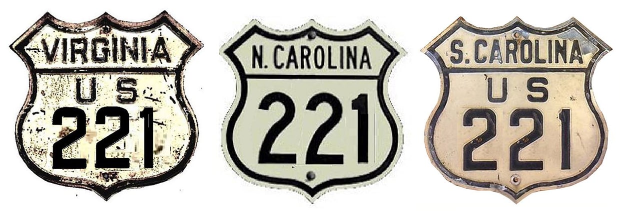
End of US highway 221 |
 |
Summa
|

Summa
|
|
1930-1931
|
1931-1953
|
1953-1971
|
1971-present
|
|
Mileage: in 1989 AASHTO listed a figure of 770 miles for US 221... however, that included the mileage of US 221's associated business/bypass/alternate routes. According to the state subtotals on AASHTO's 1989 spreadsheet, mainline US 221's actual end-to-end total at the time was 734 miles. That closely matches our own 2020 measurement, which yielded 728.9 miles (reroutings and realignments likely explain the difference).
|
|
|
US 221 was commissioned in 1930 to branch off its parent route (US 21) at Twin Oaks. This photo was looking south on US 21-221, but originally this was only southbound US 21, which continued to the left, and to the right was the north beginning of US 221. At far right the assembly for northbound US 221 traffic is visible -- drivers coming from that direction are at the historic north end of US 221:
|

Elkins
|
|
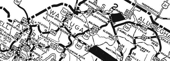
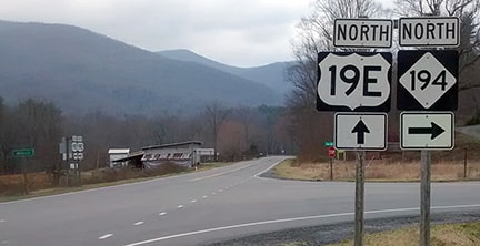
From Twin Oaks, US 221 went down to US 19E at Ingalls:
|
c. 1930, NC DoT
|
|
South of Crossnore, US 221 was originally routed along present NC hwy 194. Today's south end of NC 194 is the historic south end of US 221. This image was taken looking north on US 19E; the south beginning of US 221 was to the right on what is now NC 194:
|
Younce, 2018
|
|
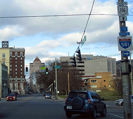
Just one year later, in 1931, both the north and south ends were extended outside North Carolina. To the north, US 221 went up to Roanoke. It came in on Elm Avenue (as it does to this day), but it continued east of Franklin Road, ending at Jefferson Street, which carried US 311. The shot below was looking north on Jefferson:
|
Sweeney, Jan. 2020
|
|
The crossroad is Elm, so to the left was the original north beginning of US 221. But that was the case for only about two years. In 1934, US 221 was changed to the route that it still follows today, bypassing this segment of Elm. Instead, US 221 used Franklin (three blocks ahead), but still ended at Jefferson. This photo was taken back when that was still the arrangement, looking north on Jefferson (although by this time US 311 had long since been subsumed by a southward extension of US 220):
|
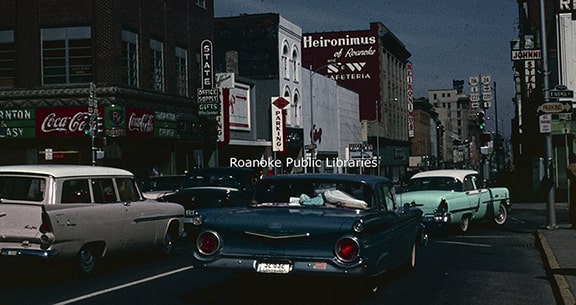
Roanoke Public Libraries, Apr. 1963
|
This next shot shows modern signage facing west at that intersection; straight ahead on Franklin was the beginning of US 221, which continued to terminate at this same junction for about 40 years altogether:
|

Google Maps Street View, Apr. 2012
|
|
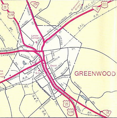
Also in 1931, US 221 was extended south to Greenwood. This image is looking west on Cambridge Avenue at a sharply-angled intersection. US 221 ended here; to the right on Calhoun Avenue was northbound US 25-178, while southbound was to the left on Hampton Avenue:
|
|
|
That was the arrangement until about 1947, when US 221 was likely changed to go south on Main Street (along the east side of a no-longer-extant railroad), then west on Maxwell, crossing the railroad and immediately ending at US 25-178:
|
c. 1952, SC DoT
|
|
This image was taken looking south on Main at Maxwell, during the timeframe when US 221 ended here (note the US 25-178 shields at far right):
|
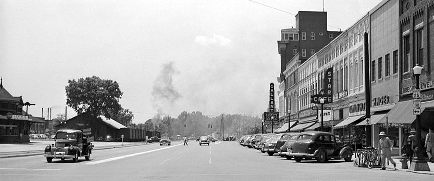
c. 1949, SCDoT (linked to full version)
|
Summa, 1978
|
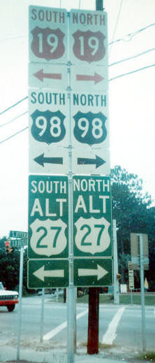
In 1953 the south end of US 221 was extended to its present terminus in Perry. These photos were taken looking south on Jefferson Street. The preceding one was taken back when Florida was still using colored US shields, while the following ones are more recent:
|

|
Ahead is Puckett Road; the crossroad is Byron Butler Parkway, which carries US 19-98-27 Alt. Because of the acute angle at this intersection, the sign indicating a left turn to the south beginning of US 221 is also visible at left; that is shown in more detail here:
|
Cozart/Nitzman, Nov. 2006
|
Nasiatka / Nitzman, Jul. 2022
|
|
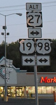
Signage heading the opposite direction (north on US 19-98-27 Alt) looks like this:
|

Karners, Jan. 2010
|
That shows mainline US 221 begins to the right, but Truck 221 begins straight ahead (because through trucks are not allowed on the first few miles of the main route). Drivers taking that right turn soon see the first northbound sign:
|
Karners, Jan. 2010
|
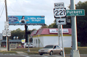
It is possible that the south beginning of US 221 was formerly about a mile ahead, at Hampton Springs Avenue, which is the main east-west highway through town, and which probably carried US 19 and 98 (as well as US 27) before Byron Butler was built.
|
|
The north end of US 221 was extended to its present terminus in 1971. Presumably this was prompted when US 460 between Lynchburg and Bedford was re-routed onto a new expressway. The old route was too long to re-sign as "Business 460", so instead the 221 designation was overlapped with 460 from Roanoke to Bedford, and then extended to Lynchburg along old US 460. This photo was taken heading north on US 29 (Lynchburg Expressway); it shows signage at the exit to the north beginning of US 221:
|
Nitzman, May 2005
|
|
That exit leads to Kemper Street. Heading north on US 221 (which is actually south on Kemper), this is the last northbound trailblazer:
|
Prince, July 2003
|
|
Not far ahead, we reach the end of the route, which at the time of these photos was posted with a fairly-recent "End" sign...
|
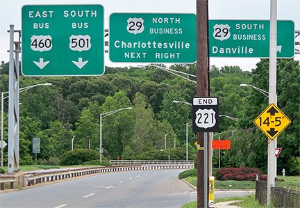
Karners, May 2013
|
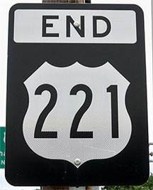
Karners, May 2013
|
|
...although shortly after that the sign bridge shown in the background was removed:
|
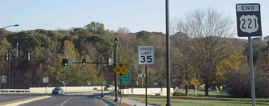
Sweeney, Nov. 2019
|
|
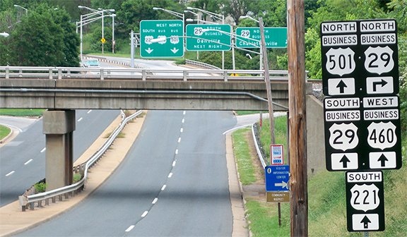
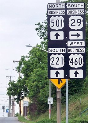
Heading the opposite direction (north on Kemper), US 221 is referenced just before the interchange, and then on the far side is the first signage posted on the mainline:
|
|
|
Research and/or photo credits: Justin Cozart; H.B. Elkins; Karin and Martin Karner; J.P. Nasiatka; Alex Nitzman; Adam Prince; Mike Roberson; Dale Sanderson; Michael Summa; Collin Sweeney; Morgan Younce
Page originally created 2002;
last updated Nov. 29, 2023.
last updated Nov. 29, 2023.
