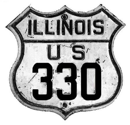
End of historic US highway 330 |
 |
|
1926-1934
|
1934-1937
|
1937-1938
|
1938-1941
|
1941-1942
|
|
|
|
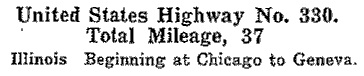
US 330 was among the original 1926 routes; this excerpt is from AASHO's April 1927 route log:
|
|
|
For the first seven years, US 330's east end was in downtown Chicago. During that time, its east terminus was first in Geneva, and then in West Dundee (both endpoints are discussed in detail on the Fox River Valley page).
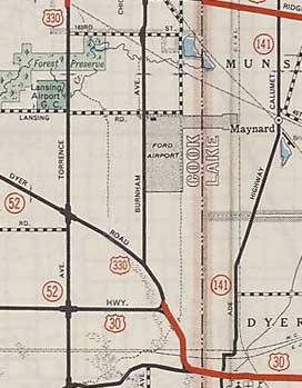
In about 1933, Roosevelt was extended further east through Chicago, so the US 330 designation was extended along with it, and then quite a ways to the south, where it ended at US 30 in what is now Lynwood. A detailed map shows that, initially, US 330 used a small segment of Glenwood-Dyer Road between US 30 and Torrence Avenue: |
c. 1934
|
|
This photo was looking north on westbound US 30/Lincoln Hwy, which continues to the left. IL hwy. 83 begins straight ahead on Glenwood-Dyer, and that was the former beginning of US 330. Glenwood-Dyer curves to the northwest and meets Torrence after about a mile:
|
Hargraves, June 2002
|
|
This shot was taken from the opposite direction. IL 83 ends here, as did historic US 330...
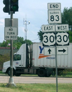
Morrison, July 2017
...but that lasted for only a few years.
|
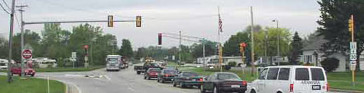
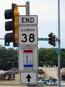
In about 1937, US 330 traffic was redirected to simply stay on Torrence for the remaining distance down to US 30. This image was looking south on Torrence, in what is now Sauk Village. Until its decommissioning in 1942, US 330 ended at the traffic signal ahead, at its junction with US 30:
Morrison, July 2017
|
|
Around 1937 was also the time when US 30 to the west of Chicagoland began to resemble its current route. Instead of going north all the way to Geneva before turning west, US 30 was changed to head west from Aurora (as it does today). So the US 330 designation was removed from the segment between Geneva and West Dundee, and instead extended west from Geneva along the former route of US 30 (which is IL 38 today). Initially US 30 turned north to meet its original routing at Elburn. So for one year US 330 ended at the "new" 30 in Elburn. Illinois' 1937 map was the only one illustrating that change:
|

c. 1937, IL DoT
|
|
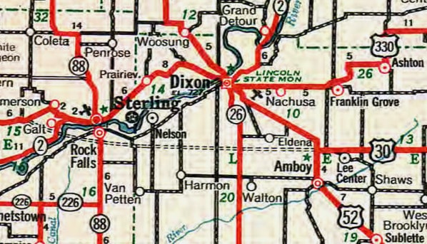
The following year the "new" US 30 was complete as far west as Amboy; from there it went northwest with US 52 to Dixon, where it connected with its original alignment. So the west end of US 330 was extended west again, this time to its new junction with US 30 in Dixon:
|
c. 1939, IL DoT
|
|
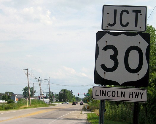
US 330 came into Dixon on today's IL 38, ending at US 52 (which carried US 30 traffic for a few years):
|
Sanderson, Aug. 2005
|
Morrison, Aug. 2016
|
|
Downtown is a few blocks ahead. Here is a shot from the opposite direction: this was eastbound US 30, which continued to the right. The west beginning of US 330 was straight ahead:
|

Sanderson, Aug. 2005
|
|
Next is a photo from the perspective of historic westbound US 30, which continued to the left, while US 330 began to the right:
|

Sanderson, Aug. 2005
|
|
By 1941, US 30 was extended further west along its current path, which goes through Rock Falls, bypassing Dixon and Sterling. Illinois' 1941 map was the only issue that illustrated that change:
|

c. 1941, IL DoT
|
|
So the US 330 designation was extended west along former US 30 through Dixon and Sterling, ending just west of Sterling near Galt. This photo was looking east on US 30:
|
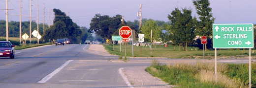
Sanderson, Aug. 2005
|
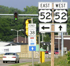
Until recently, a left turn there put drivers on the west beginning of IL hwy. 2. But in the early 1940s, that was the west beginning of US 330. However, that lasted only a year or two, until the US 330 designation was decommissioned, and instead re-signed as Alternate US 30.
Research and/or photo credits: Neil Bratney; Robert Droz; Don Hargraves; Jeff Morrison; Morton Raff; Matt Salek; Dale Sanderson; Michael Summa
Page originally created 2002;
last updated Dec. 4, 2023.
last updated Dec. 4, 2023.
