End of US highway 43 |
 |
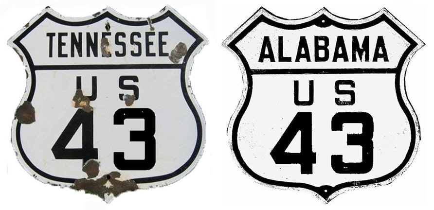
Summa
|
1934-2001
|
2001-present
|
|
Mileage: in 1989 AASHTO listed a figure of 410 miles for US 43. That closely matches our own 2020 measurement, which yielded 409.5 miles. Historically, when it went to Mobile, US 43 was 413.2 miles long.
|
|
|
US 43 was commissioned in 1934 to run north all the way to Hopkinsville KY. But initially Tennessee did not signpost the route, so some maps showed its north terminus was at the stateline near Greenhill AL:
|
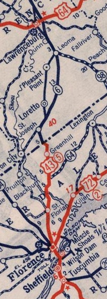
c. 1940, Rand McNally
|
It is unclear why Tennessee did not pick up the US 43 designation immediately, but by 1939 the north end of the route had been extended to Columbia:
|
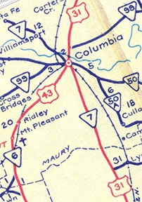
c. 1951, TNDoT
|
|
Originally US 31 came into town from the south via Main Street, then crossed the river via the bridge that connects 5th Street and 1st Avenue, then followed Riverside Drive northward. Meanwhile, US 43 followed what is now TN hwy. 243 through downtown Mt. Pleasant (Main Street) and north to Columbia, where it becomes Trotwood Avenue. At 7th Street (now TN 99 and poorly-signed Business 412), traffic was routed east, and the US 43 designation ended where it met US 31 at Main, right at the courthouse square:
|
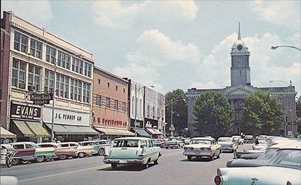
attribution unknown (from old postcard)
|
|
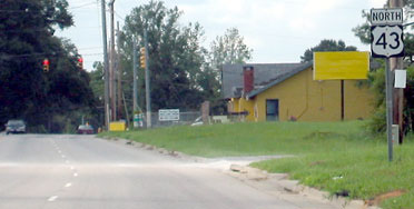
That was looking west on 7th, US 43's original north terminus: northbound US 31 was to the left on Main, and southbound to the right. The highways through town have changed a lot since then. At some point around 1957, US 31 was changed to follow its current routing, which bypasses Riverside, and it now follows Garden Street through downtown (instead of Main). So for a few decades US 43 was still routed into downtown, but it ended at Garden. This photo was taken looking west on 7th from Garden:
|
Nelson, July 2006
|
That was actually Business 412, and at one time that was the north beginning of US 43. At some point, modern US 43 was built along the opposite (north) side of the railroad between Mt. Pleasant and Columbia. That intersects 7th (actually the Hampshire Pike at that point) about four miles west of Trotwood, but US 43 was probably still signed east on Hampshire/7th to its endpoint at Garden.
|
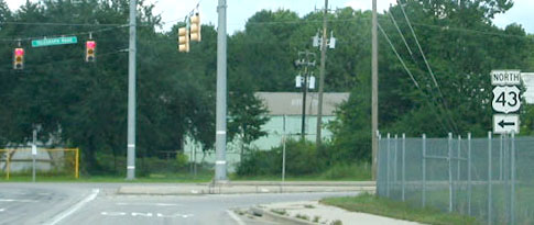
Around 1992, the US 43 designation was moved off 7th, and instead traffic is now routed along the bypass that skirts the west and north side of the city (co-signed with US 412). US 43 still ends at its junction with US 31, but its modern terminus is about 2 miles north of its historic endpoints downtown. This photo is looking east on the bypass: US 43 ends here...
|

Nelson, 2003
|
|
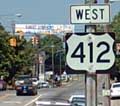
...but US 412 continues ahead another 7 miles or so, to its own terminus at I-65's interchange 46. To the right is not only southbound US 31 but also westbound Business 412 through downtown. Approaching this intersection from that direction, the beginning of US 43 is marked thus:
|

Eisenberg, Dec. 2009
|
|
That was from northbound US 31. This next photo shows the perspective from westbound US 412:
|
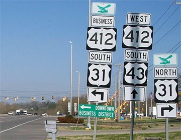
Mortell, Mar. 2010
|
|
US 43 begins at the traffic signal, and just beyond that is the first southbound marker:
|
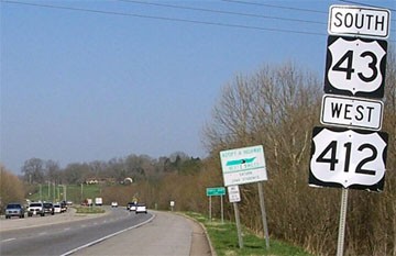
Mortell, Mar. 2010
|
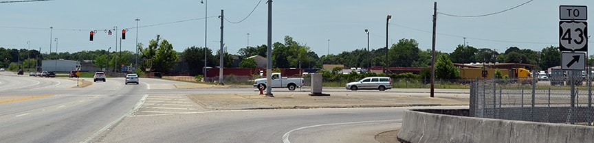
Originally, and for the next several decades, the south terminus of US 43 was in downtown Mobile. But in late 2001, just about all of the US 43 signage downtown was either removed, or else changed to read "TO US 43". The designation now ends a few miles to the north: on Telegraph Road at its connector to Bay Bridge Road, or US 90/Truck US 98 (this is actually within Prichard city limits). These first photos were taken heading east on Bay Bridge...

Nitzman, 2002
|
Nitzman, May 2016
|
...and here is a shot from the opposite direction:
Nitzman, May 2016
|
There is no direct access to Telegraph, so US 43 traffic is now directed north onto a short connecting road, which curves around to the east and connects with Telegraph:
|
Cozart/Nitzman, 2003 (gone as of 2006)
|
|
Today US 43 begins to the left, but historically it continued southbound to the right. Telegraph no longer crosses the railyards that direction, and the road dead-ends near the state docks. Drivers heading north on Telegraph see the following signage:
|

Cozart/Nitzman, 2003 (replaced as of 2016, but essentially the same)
|
|
That was looking north on Telegraph, at the sign directing Bay Bridge traffic onto the connector. Just ahead was the first standalone marker...
|
Cozart/Nitzman, 2003 (replaced as of 2016)
|
|
...although that was gone by 2017; now the first marker is on the far side of the traffic signal visible in the distance.
Heading the opposite direction, these photos were taken along the southernmost stretch of US 43: |
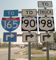
Nitzman, 2002 (replaced as of 2016; no longer any reference to US 90)
|
|
Part of Bay Bridge is visible in the background; these photos were taken just before one passes underneath:
|

Cozart/Nitzman, Nov. 2006
|
Nitzman, May 2016
|
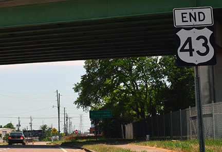
For decades, US 43 continued ahead a few more miles. When the designation was initially truncated to this point, there was not an "End" sign, but ALDoT posted one later.
Research and/or photo credits: Justin Cozart; Andrew Eisenberg; Marc Fannin; Adam Froehlig; Robert Mortell; Steven Nelson; Alex Nitzman; Dale Sanderson; Michael Summa
Page originally created 1999;
last updated Dec. 16, 2023.
last updated Dec. 16, 2023.
