End of US highway 290 |
 |
|
Mileage: in 1989 AASHTO listed a figure of 588 miles for US 290... but at the time, US 290 still ended in West Texas. Since then it has been truncated to the Hill Country, and our own 2020 measurement yielded 265.5 miles.
|
|
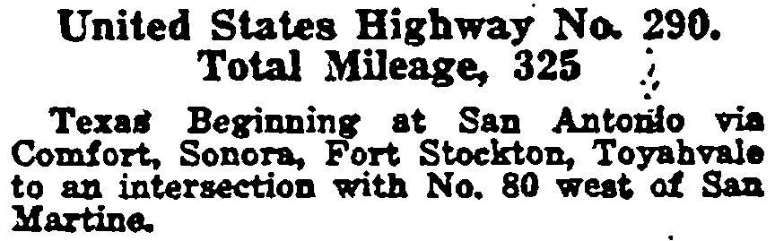
The preceding excerpt was from AASHO's Apr. 1927 route log.
|
|
Since 1992, none of the route that was originally designated US 290 still carries that number. Instead, the west end of US 290 is where the current route has a junction with the original route. At first US 290 essentially followed what is now the I-10 corridor, running from US 90 in San Antonio to what was then US 80, way out in far west Texas:
|

c. 1935, TX DoT
|
Maps typically do not label that junction, but historically it was referred to as "Davis Mountain Station" or "Davis Mountain Junction". Route logs often referred to the junction that marked the west terminus of US 290 as "east of Kent" or "west of San Martine", but those reference points are not well-known either (and besides: San Martine Spring, which serves as the boundary point common to Culberson, Reeves, and Jeff Davis counties, is actually west of the junction, not east)...
|
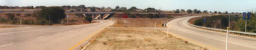
...so there is no simple toponym that can be used to identify this junction. Today it is perhaps best described as west of Balmorhea, where I-20 ends at I-10:
|
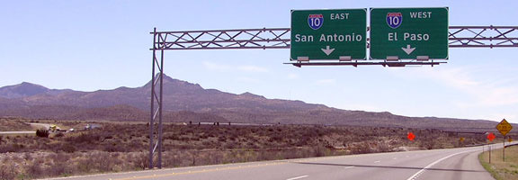
Elbert, Mar. 2007 (unchanged as of Dec. 2011)
|
|
Gomez Peak (northernmost of the Davis Mountains) is visible in the background. Historically westbound US 80 followed the general path of today's I-20 to that spot, and then along I-10 west from there. US 290 began there and followed (for the most part) modern I-10 to San Antonio (traffic from which is visible at far left). Virtually all traces of the old roadways are gone now, and it appears the actual junction was completely erased when that interchange was built. But here is a great postcard that shows the historic junction:
|
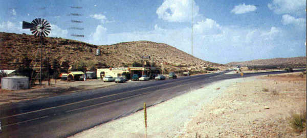
c. 1960 (linked to source)
|
|
That was looking east on US 80, which continued straight ahead. US 290 began on the road curving off to the right, which led to its east terminus in San Antonio. This photo shows roughly the same perspective, post interstate construction:
|
Royston (since replaced with Clearview version)
|
|
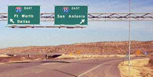
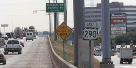
After those freeways were complete through there in the 1960s or 1970s, US 290 was overlapped eastward with I-10 until 1992. By early 2007, the signs pictured above had been replaced with Clearview versions. This photo was taken from westbound I-10, and it has since been changed again -- it is now exit 187, and the control city is Dallas:
|

Elbert, Mar. 2007
|
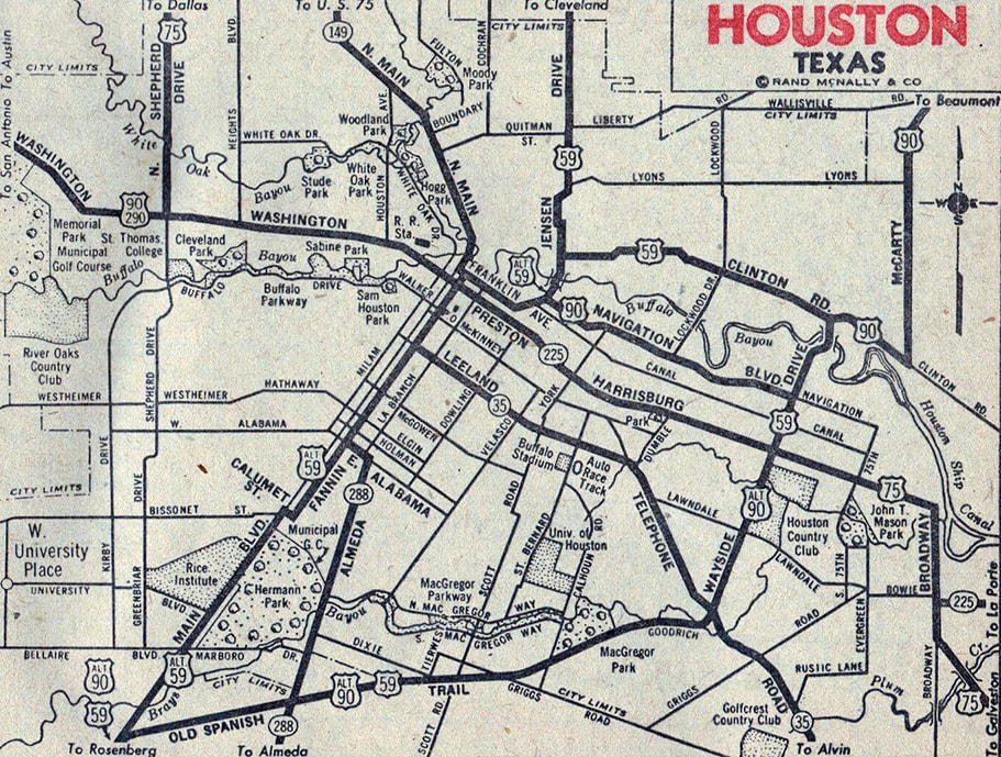
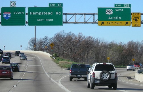
In 1934, the US 290 designation was removed from the segment between San Antonio and a point near Segovia. Instead, it was rerouted more easterly from Segovia, along its current corridor through Fredericksburg and Austin, to a new east terminus in Houston. Today, most of the Northwest Freeway sits on top of US 290's original alignment. But near the interchange with the Sam Houston Tollway, it veers off slightly to the north. East from there, US 290 traffic was formerly routed along Hempstead Highway and Hempstead Road. Originally US 90 followed what is now US 90A, not Katy Road, so US 290 traffic was directed further east along Washington Avenue, which turns into Preston Street downtown:
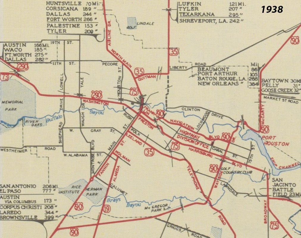
c. 1938, TX DoT
|
The designation ended at Fannin Street, where US 290 junctioned not only its parent route (US 90), but also US 75. This intersection was right at the original Harris County courthouse. This image was looking southeast on Preston; US 290 ended here. To the right on Fannin was westbound US 90; straight ahead was southbound US 75; and to the left was east 90/north 75:
|
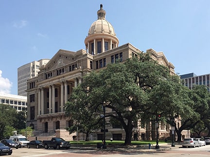
Telwink, Sep. 2014 (linked to original)
|
|
Around 1943 a few changes affected highway routes in Houston. First, US 75 was removed from its original Main Street/Airline Drive routing, and was instead shifted to follow Shepherd Drive down to Washington. At that point, US 75 turned east along what had been US 290, so the US 290 designation was truncated to that intersection. This photo was looking west on Washington:
|
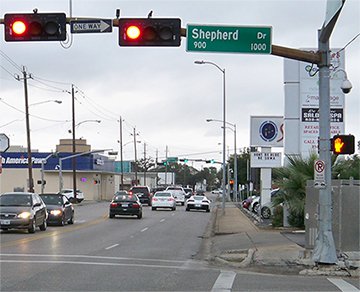
Karners, Dec. 2014
|
|
That was the perspective of a driver on northbound US 75, who would have been directed to turn right there on Shepherd, while straight ahead was the east beginning of US 290.
Another change was that US 90 was redirected to follow Washington out of town (instead of its original routing along Fannin and Main, which was redesignated as US 90A). For awhile US 290 and US 90 were overlapped east to Shepherd: |
c. 1947, Gousha
|
|
But after a few years (around 1950), that overlap with US 90 was eliminated, so US 290 did not begin until the point where it split off from US 90:
|
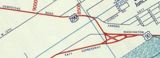
c. 1956, Gousha
|
|
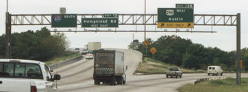
This photo was looking west on Washington. US 90 continued to the left on Katy, while US 290 began to the right on Hempstead:
|

Nelson, Aug. 2007
|
|
This photo was looking southeast on Hempstead, essentially where US 290 ended -- the curve to the right leads to Katy Road (historic westbound US 90), while straight ahead curves eastbound to Washington (eastbound old US 90):
|
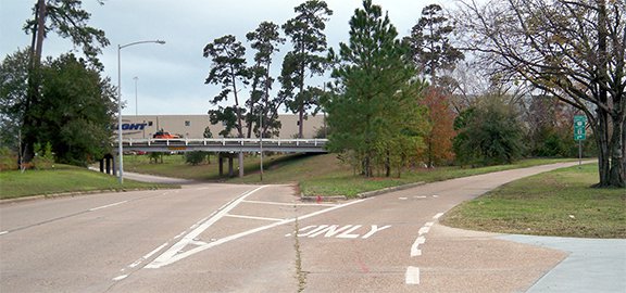
Karners, Dec. 2014
|
|
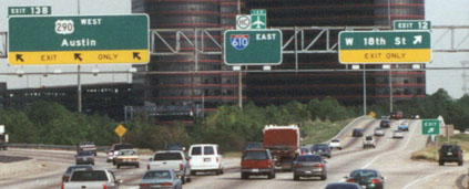
Starting in about the 1970s, US 290 traffic was routed onto a multi-lane expressway, known locally as the Northwest Freeway. Where that highway ends at its interchange with I-610, the US 290 designation also ends. This photo shows the last eastbound 290 shield...
|
Taylor, 2000 (essentially unchanged as of 2014)
|
|
...although the frontage road visible on the right has additional US 290 signage ahead at on-ramps. These shots show the signage at the actual east terminus of US 290:
|
Taylor, 2000
|
Ivy/Nitzman, Aug. 2019
|
|
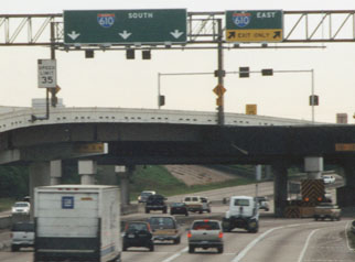
With some exceptions, this freeway marks the spot where signage on the 610 loop changes from east/west to north/south. These photos show the beginning of US 290 from I-610 (northbound and westbound, respectively):
|
Taylor, 2000
|
Taylor, 2000
|
|
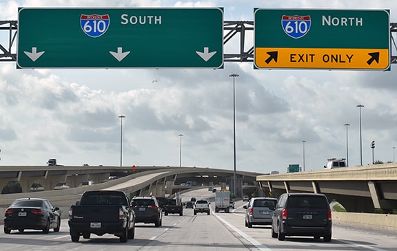
By 2005 those signs had been replaced with Clearview versions, but the verbiage is basically identical; here is an example:
|
Morrison, May 2012
|
|
In 1992, the last remaining segment of original US 290 -- that between Segovia and Davis Mtn. Jct. -- was decommissioned. Until then, that entire segment had been overlapped with I-10 (with a few exceptions). Now the west end of US 290 is at least ten miles from anyplace, at I-10's interchange 477, but we will refer to it as "near Harper", since that is the westernmost community along US 290's route. These photos were taken over 15 miles west of there; this one shows the last westbound trailblazer...
|
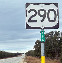
Karners, Dec. 2014
|
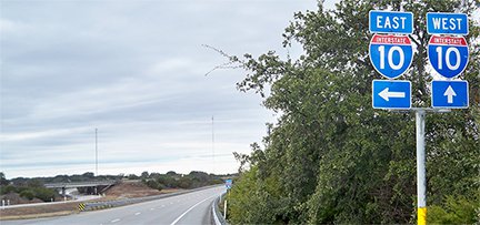
...and after a few more miles, one reaches the west end of US 290:
Taylor, Dec. 2000
|
|
Curving to the right is the on-ramp to westbound I-10. Access to eastbound I-10 is via another underpass, off the left side of this photo. From eastbound I-10, US 290 traffic exits, curves back under I-10 via the underpass visible here, and comes in towards the camera:
|
Karners, Dec. 2014
|
|
No "End" sign was posted; only a traveler's options at I-10. This photo shows the beginning of US 290 as seen from eastbound I-10:
|
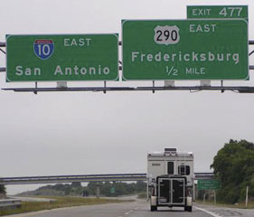
Teresco, May 2004
|
|
Hidden behind the RV in that photo is this sign, at the offramp:
|

Nitzman, Jan. 2006
|
For drivers taking that exit, here is the first eastbound confirming marker:
|

Karners, Dec. 2014
|
Research and/or photo credits: Chris Elbert; Marc Fannin; Karin and Martin Karner; Jeff Morrison; Steven Nelson; Alex Nitzman; Jeff Royston; Dale Sanderson; Michael Summa; Stephen Taylor; Ben Telwink
Page originally created 2000;
last updated Apr. 30, 2024.
last updated Apr. 30, 2024.
