Historic US highway endpoints in Baltimore, MD
|
1934-1960
|
 |
|
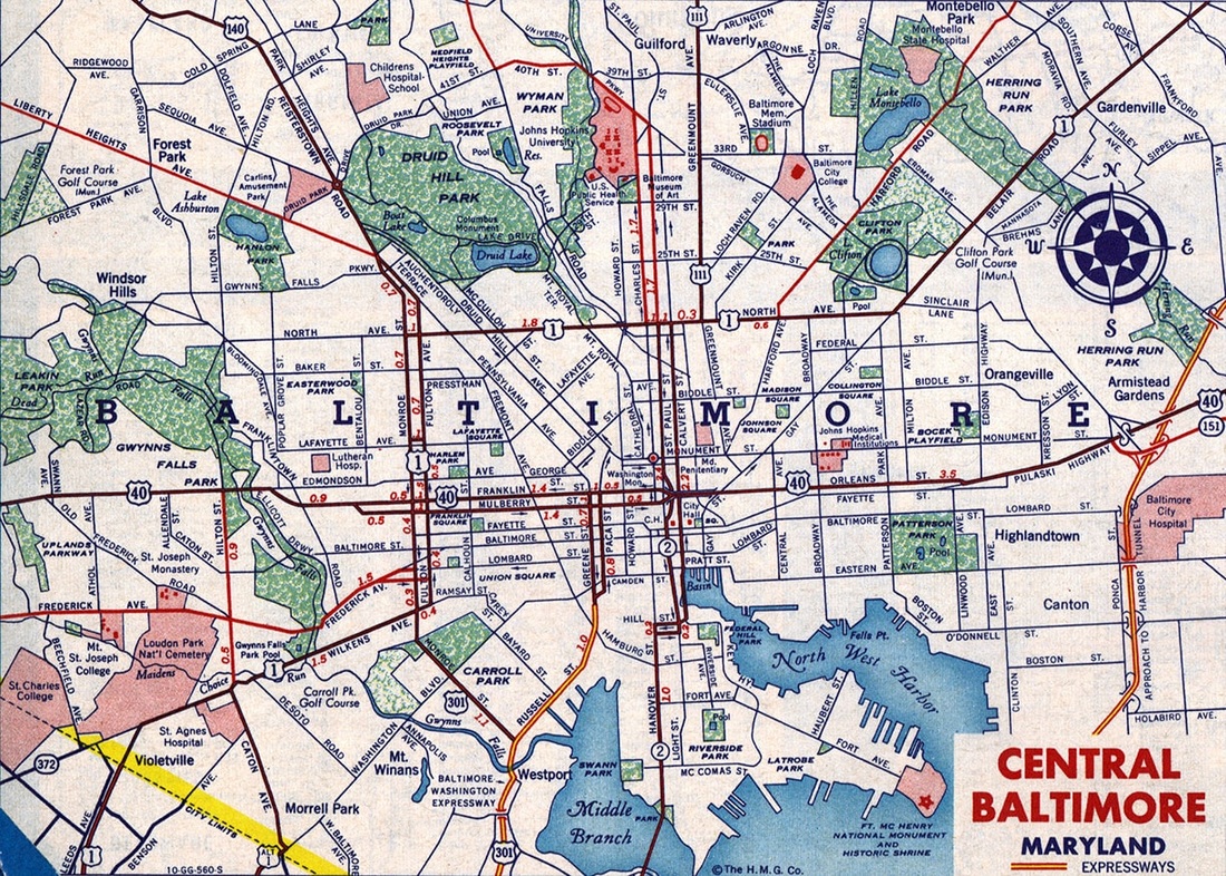
When the US routes were originally commissioned in 1926, US 1 and US 40 both went through Baltimore, and they still do. US 111 and US 140 ended in Baltimore, and that remained the case up until the time those routes were decommissioned (in 1963 and 1977, respectively). Later revisions to the US route system extended a couple other routes into downtown Baltimore: US 29 (from 1934-1955), and US 301 (from 1941-1960). This page focuses on the endpoints of those routes. This first map (1940) showed US 29 coming in with US 40 on Frederick Avenue:
|
c. 1940, Rand McNally
|
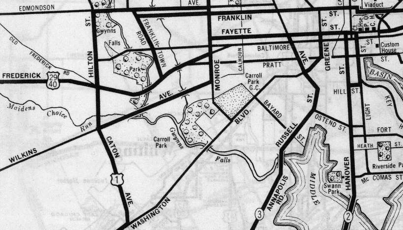
That suggests that US 29 could have ended on Frederick at Monroe Street (where it junctioned US 1). However, that was probably not the case, based on another map which will be discussed below. Also note Maryland highway 3, coming in from the south via Annapolis Road, and possibly ending on Greene Street at Fayette Street (US 29-40). The very next year (1941), US 301 was extended north via what had been MD 3, so US 301's original Baltimore endpoint could have been at the same intersection.
|
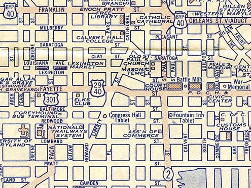
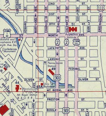
Today (and probably since about 1955), Greene is the southbound counterpart to Paca Street, and this next map (1947) showed US 301 traffic on Paca (more on that below). This map also illustrated the termini of US 111 and US 140, both coming in from the north and ending at their junctions with US 1 (North Av):
|
c. 1947, Rand McNally
|
|
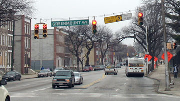
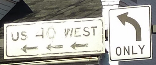
This photo was looking north on Greenmount Avenue at North Avenue. The view is hardly recognizable, because nearly every building shown here has since been torn down. Along the far left edge, a US 111 marker with a right arrow is barely large enough to be legible:
|

c. 1955 (linked to source)
|
|
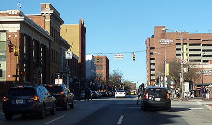
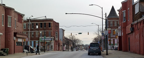
The modern photo below was looking the opposite direction (south on Greenmount) at North Av, at the historic south end of US 111:

Karners, Jan. 2017
|
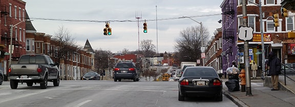
Below, we are looking east on North Av at Greenmount; until 1963, US 111 began to the left:
Nitzman, Jan. 2008
|
|
Next, we are looking the opposite direction on North. At upper right, the guide sign for MD hwy. 45 is visible -- that was the designation that replaced US 111. The mast arm shown in that photo probably dated back to at least the 1960s, and therefore it likely once supported "US 111 (right)" signage:
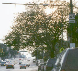
Nasiatka, Aug. 2003
|
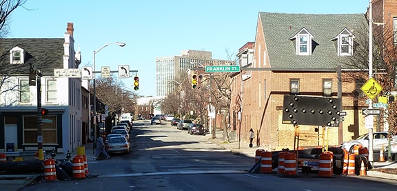
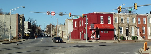
Continuing that direction (west on North Av, or southbound on US 1) about two miles, historically US 140 began to the right on Penn. So it just missed connecting with its parent (US 40) by a couple miles. This photo was taken looking northwest on Penn. US 1 ran across the photo on North, and straight ahead was the original beginning of US 140:
Karners, Jan. 2017
|
|
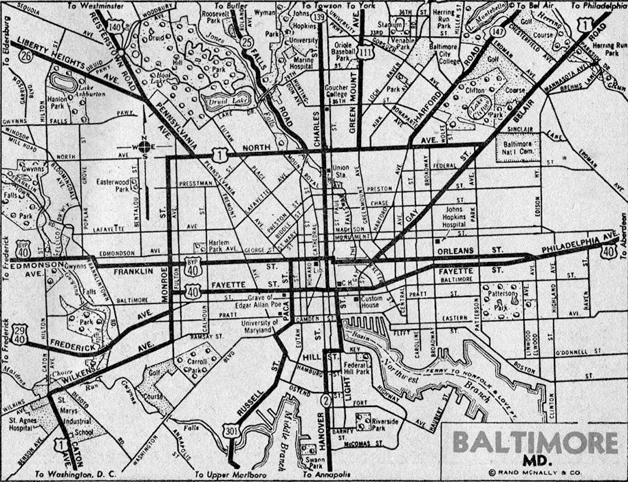
That 1947 map above also showed the US 301 designation extending a few blocks north of Fayette (US 40), instead ending at Franklin Street (US 40 Bypass). That same arrangement was shown on the 1944 and 1953 USGS topo maps. However, this 1954 map showed US 301 ending on Paca at Fayette (not Franklin):
|
c. 1954, Rand McNally
|
|
These next photos were taken from northbound Paca. This one shows the intersection with Fayette, which may have been the north end of US 301 for a brief time:
|
Karners, Dec. 2016
|
|
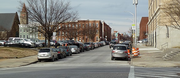
About six blocks straight ahead is the junction with Franklin, another place where US 301 ended historically:
Karners, Dec. 2016
|
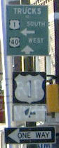
Interestingly, the mast arm at left still hosts a reference to US 40; it is shown close-up here:
Karners, Dec. 2016
|
|
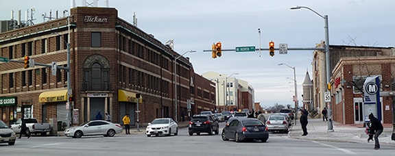
Another item of note on that 1954 map above is the US 29 shield on Fayette; the designation probably ended a few blocks west of there, at the courthouse. And since that map was published only about one year before US 29 was rerouted away from the downtown area, it seems likely that US 29's Baltimore endpoint was always at the courthouse:
|
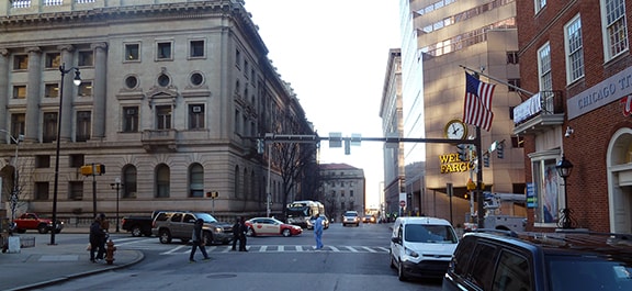
Karners, Dec. 2016
|
|
Today Fayette carries westbound traffic only, but historically it ran both directions, and US 29 ended at the intersection shown there: St. Paul Street, which was (and still is) designated MD hwy. 2.
This 1956 map showed US 29 no longer serving Baltimore, and it also showed a significant change in the route of US 301. The old route was labeled as "US 301 Alternate". The mainline was instead shown concurrent with MD hwy. 2, which went right through downtown using the one-way couplet of Calvert Street (northbound) and St. Paul Street/Light Street (southbound). And just to the east of that couplet was another route, designated "Commercial US 301": |
c. 1956, Gousha
|
|
Mainline US 301 was shown ending on Calvert at North Avenue (US 1)...
|
Karners, Jan. 2017
|
...and it began one block west of there, on St. Paul. But within three years, by the time of this 1959 map, it appears things had changed yet again:
|
c. 1959, Gousha
|
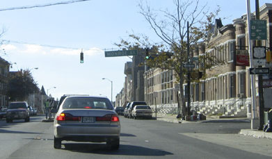
There, US 301 was shown coming in on its old MD 3 corridor again. However, it is unclear what (if any) designation was applied to Russell Street and the Paca/Greene couplet. Instead, US 301 was shown heading northwest on Monroe, ending at Wilkens Avenue (US 1):
|
Karners, Dec. 2016
|
|
That was the last map to show US 301's north end in Baltimore; the 1960 issue showed that traffic was instead directed to cross the Chesapeake Bay Bridge, avoiding Baltimore altogether (as it does yet today). US 111 continued to end at the same location for a few more years, until it was decommissioned in 1963. US 140 continued to exist for another twenty years or so, but its endpoint changed slightly. Fulton Avenue and Monroe Street had become a one-way pair, and US 140 traffic was directed to use those roads to junction North Av:
|
Karners, Jan. 2017
|
|
That was looking north on Fulton at North Av. Despite the lack of an arrow with the US 1 sign, the designation turns right at that intersection, and until 1980 the east beginning of US 140 was straight ahead.
Southbound US 1 uses Monroe (which is one block to the left); this photo was looking south on Monroe at North Av, at the historic east end of US 140. Northbound US 1 was to the left on North Av, and southbound was straight ahead: |
Karners, Jan. 2017
|
|
One more: here is a view from westbound North Av. The east beginning of US 140 was to the right, one block behind the camera. Traffic coming in from the right was once at the east end of US 140:
|
Nitzman, Oct. 2004
|
(detail)
|
Research and/or photo credits: Karin and Martin Karner; J.P. Nasiatka; Alex Nitzman; Mike Roberson; Dale Sanderson
Page originally created 2002;
last updated Aug. 31, 2019.
last updated Aug. 31, 2019.
