US highway endpoints in the Penn-York Valley
|
Waverly NY and South Waverly PA
1927-present |
 |
|
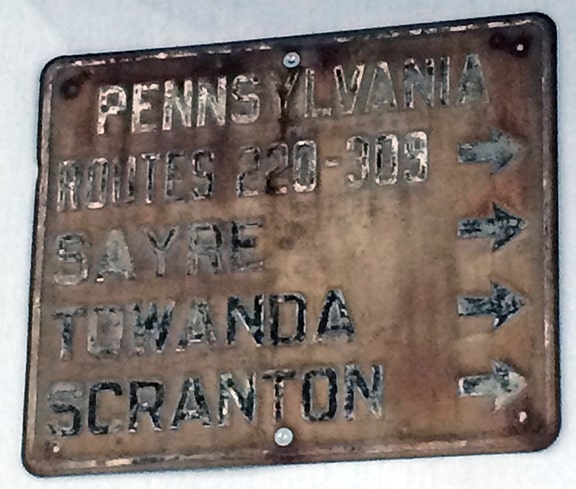
The north end of US 220 has always been in the Waverly area, but the exact location of its terminus has moved over the years. Originally there was no US 220 bypass around Athens and Sayre PA. Instead, US 220 followed what is now PA 199 through those towns (except for the segment right up near the state line). And after 1930, the US 309 designation was twinned with US 220:
|
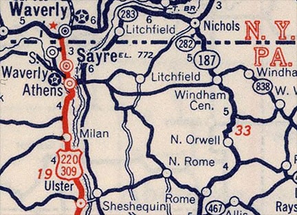
c. 1940, Rand McNally
|
New York did not wish to extend the US 220 or US 309 designation into their state, so all of AASHO's route logs through 1955 indicated that those two designations ended at the PA/NY state line. The earliest maps I have seen (USGS 1942 and '48) show that Pennsylvania Avenue in Waverly NY formerly extended south from Broad Street, crossed the railroad, and connected with Pennsylvania Av in South Waverly PA. So officially US 220-309 began on Penn at the state line, a place that no longer exists (although aerial photos show that a short stub of historic Penn still exists off Erie Street in Waverly). From there, 220-309 traffic turned east on a road that no longer exists (because of the Southern Tier Expressway, or "STE"), and then south again on Keystone Avenue, following what is now PA hwy. 199 through Sayre and Athens.
|
A few years after those maps, a 1951 letter from AASHO to Pennsylvania stated that neither US 220 nor US 309 had ever entered New York. That was true as far as AASHO knew, but the reality is that New York (or at least the town of Waverly) had been posting US 220 signs that directed travelers southward from the original NY hwy. 17 (which ran along Chemung Street at the time). This is confirmed by photos and maps from that timeframe. The earliest one I have seen, from 1950, is shown here:
|
c. 1950s, courtesy of Farr
|
|
That was taken looking northeast on Pennsylvania at Chemung. The backside of a single shield is visible (not two shields), suggesting that only US 220 was signposted in New York (not US 309).
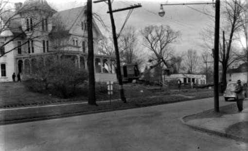
Another example of that was shown in this next photo, which was taken looking south on Penn, just south of Broad. The workers were dismantling the bridge that went over the railroad. A US 220 sign directs traffic east to the replacement bridge: |
c. 1954, courtesy of Farr
|
|
We know from the 1954 and '57 USGS maps that the replacement bridge was an extension of Spaulding Street in Waverly, which went over the railroad and connected with Keystone in South Waverly:
|
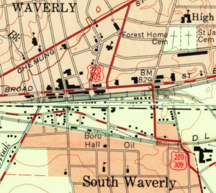
c. 1957, USGS
|
|
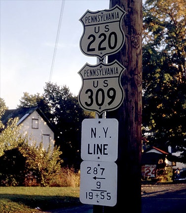
USGS maps were field-checked, so it is interesting that both US 220 and US 309 were labeled along Penn Av north of the state line. That suggests there were signs on the New York side not only for US 220, but also for US 309. The following photo shows what may have been one of those signs. This was posted on southbound NY 34, pointing west on Chemung towards Penn Av:
|
courtesy of Farr
|
|
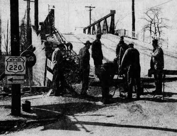
During his 1961 visit to Waverly, Jim Lindsay reported seeing that sign (or one similar to it). He did not see any actual US route shields on the New York side; he photographed the first southbound shields, which were posted on Spaulding right at the Pennsylvania line (this is another location that no longer exists, again because of the STE):
|
Lindsay, 1961 (linked to source)
|
|
US 309 was truncated out of Waverly in 1963. Today's US 220 bypass around Athens and Sayre was built in 1973; at that time the location of its north terminus changed. Though the route continued to end at its junction with old NY hwy 17, its terminus was about a half-mile west of its previous location at Penn and Chemung:
|

NYSDoT
|
The NY 17 freeway (or STE, which is now also I-86) wiped out some of the older segments of route 220-309. Red indicates NYSDOT maintenance; orange indicates PENNDOT maintenance; and brown indicates county maintenance...
|
|
...so at the time of that map, US 220 in New York was still not state-maintained, which explains why it did not show up in state records. Nevertheless, an "End" sign was posted in New York:
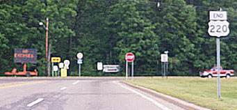
Nitzman, 2000
|
Sep. 2015, Google Maps Street View
|
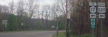
That was just north of 220's interchange with I-86 / NY 17 / Southern Tier Expressway; US 309 never ended there. These photos were taken from westbound Chemung; US 220 began to the left:

Nitzman, 1994
|
Kerr, Apr. 2002
|
Bourey, Oct. 2019
|
|
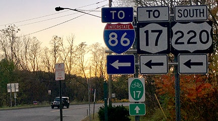
At the time of that last photo, the sign assembly for eastbound traffic was essentially identical, but within a couple years the only designation referenced was US 220:
|
Nitzman, Aug. 2021
|
|
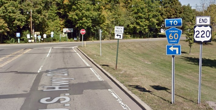
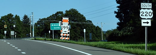
When the NY 17C designation was removed from Chemung, it made sense for the US 220 designation to be cut back to the STE. NYSDoT finally formalized this with AASHTO in 2017, although US 220 signage on Chemung had still not been removed as of 2023. But officially US 220 now ends in South Waverly, just shy of the New York line. This photo shows exit signage from the STE:
|
Morrison, Aug. 2021
|
|
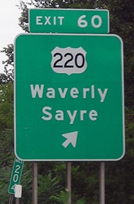
For years prior to that, the 500-foot segment of US 220 that continued north from the STE was (understandably) not acknowledged from the off-ramps; both of these images are from Google Street View, Sep. 2015:
|

(westbound)
|
(eastbound)
|
Turning south from that interchange, drivers immediately encounter the first southbound US 220 confirming marker:
Farr, Jan. 2019
|
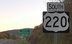
Bourey, Oct. 2019
|
|
Heading the opposite direction, this photo shows the last northbound US 220 marker:
|
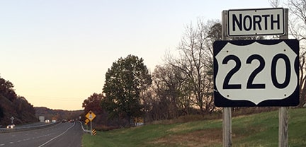
Bourey, Oct. 2019
|
Research and/or photo credits: George Bourey; Bryan Farr; Doug Kerr; Jim Lindsay; Jeff Morrison; Alex Nitzman; Nathan Perry; Dale Sanderson
Page originally created 1999;
last updated Feb. 28, 2024.
last updated Feb. 28, 2024.
