US highway endpoints in Ocean City, MD
1927-present
US 213 was among the original 1926 routes, and its south terminus was in Ocean City:
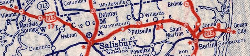
c. 1939, Rand McNally
|
US 213 followed what is now MD hwy. 707 (or Old Bridge Road) through West Ocean City. This photo was taken looking east along that road:
|
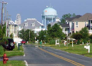
Sanderson, June 2009
|
|
Originally that road continued straight ahead (through the newer houses that now occupy its former right-of-way) and spanned the narrowest crossing of the Sinepuxent Bay to Fenwick Island (the barrier island upon which Ocean City is built). This old postcard showed the old bridge, as well as its landing in Ocean City:
|
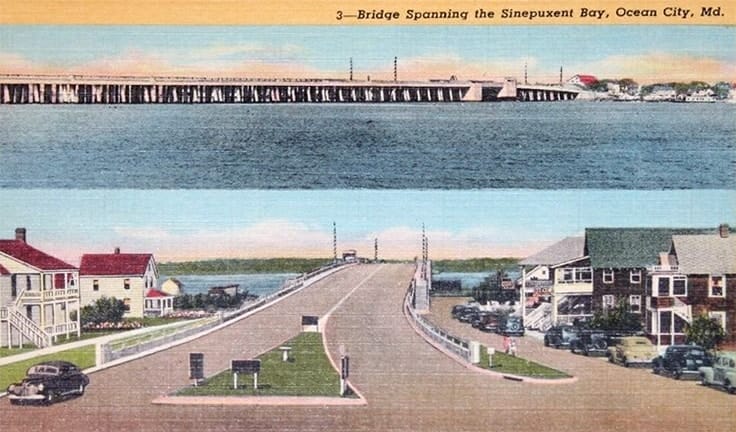
date and attribution unknown
|
|
That bridge came into town aligned with Worcester Street, so US 213 originally ended on Worcester at the couplet of Philadelphia and Baltimore avenues, or MD hwy. 528. Note the water tower in the distance; that is situated right at the intersection of Worcester and Philadelphia:
|
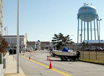
Dukes
|
|
That is on Fenwick Island (in Ocean City proper), looking east on Worcester. US 213 ended just ahead, at the Philadelphia/Baltimore couplet. The bend in the road is where the original bridge approach (behind the camera) curves to align with the orientation of the city street grid. In fact, if one follows the alignment of the bridge approach straight across the bay, it lines up perfectly with Old Bridge Rd in West Ocean City. Today Worcester dead-ends at the bay, and there is a small fishing platform where the bridge landing was once located:
|
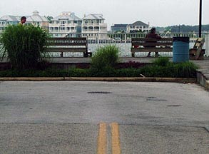
Sanderson, June 2009
|
|
By the time of my visit in 2009, I did not observe any remnants of the old bridge. Looking straight across the Bay, one can see the same houses visible in the first photo above. In 1944 that bridge was replaced by the current Harry W. Kelly Memorial Bridge. The western approach is now known as "Ocean Gateway", but the bridge actually comes into Ocean City aligned with North Division Street (which is about five blocks north of Worcester). So then the south end of US 213 was where the current bridge comes in. Here is where it reaches Philadelphia Av, which is one-way to the right...
|
Sanderson, June 2009
|
|
...and the next block is Baltimore, which is one-way northbound:
|
Sanderson, June 2009
|
That is the historic south end of US 213. Also right around that time, the ferry dock on Maryland's western shore was moved to Sandy Point. But the US 50 designation continued to end in Annapolis until 1948. At that time, US 50 was extended east from Annapolis across Chesapeake Bay (although the Bay Bridge wasn't opened to traffic until 1952, so during the first four years of this extension, US 50 used the Sandy Point-Matapeake ferry). At Wye Mills US 50 replaced the US 213 designation from there to Ocean City. So what had been the south end of US 213 for four years became the east end of US 50, and that remains the case to this day. Just ahead from the photo above is the famous Ocean City Boardwalk, then a wide sandy beach, and beyond that the Atlantic Ocean... a pretty cool place for a transcontinental highway to end.
|
This photo was taken from from the opposite direction (from Baltimore, looking west on North Division):
|

Schroeder, Aug. 2007
|
|
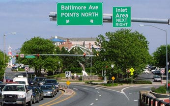
Those cars are at the east end of US 50. The next block ahead is Philadelphia (southbound MD 528). And beyond that, barely visible in the distance, is the bridge over the Sinepuxent Bay. But North Division is one-way eastbound, so that is not the east beginning of US 50. Instead, signage along Baltimore directs US 50 traffic to follow any of a number of streets to get to Philadelphia:
|
Sanderson, June 2009
|
|
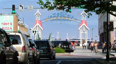
Once a driver is heading south on Philadelphia, approach signage for the beginning of US 50 looks like this...
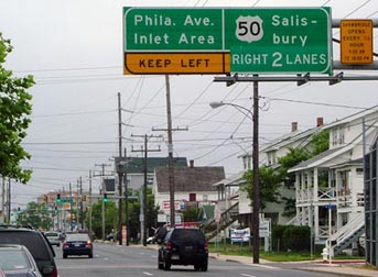
Sanderson, June 2009
|
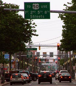
...and the next photo shows the assembly ahead from there, at the actual intersection:
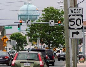
Sanderson, June 2009
|
That turn marks the east beginning of US 50 (and also the final terminus of US 213). For reference, the watertower in the distance is the same one pictured in the other photos on this page, so the original beginning of US 213 was ahead a few blocks. After making that right turn, the first westbound confirming sign is posted on the bridge...
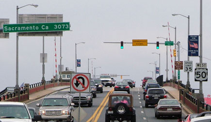
Sanderson, June 2009
|
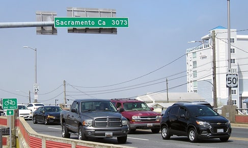
Morrison, Apr. 2023
|
...as is the famous "Sacramento: 3073 miles" sign, visible at upper left. Photos of its counterpart in California appear on the main US 50 page.
Research and/or photo credits: Corey Dukes; Nathan Edgars; Adam Froehlig; Jeff Morrison; Dale Sanderson; Jeff Schroeder
Page originally created 2000;
last updated Aug. 17, 2023.
last updated Aug. 17, 2023.
