End of US highway 62 |
 |
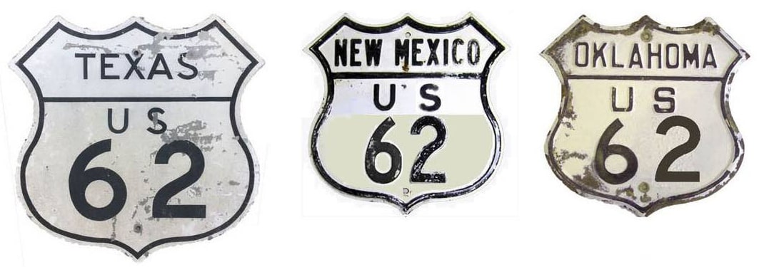
Summa
|
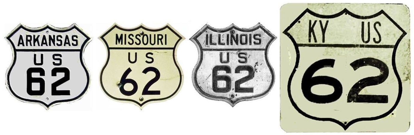
Summa
|
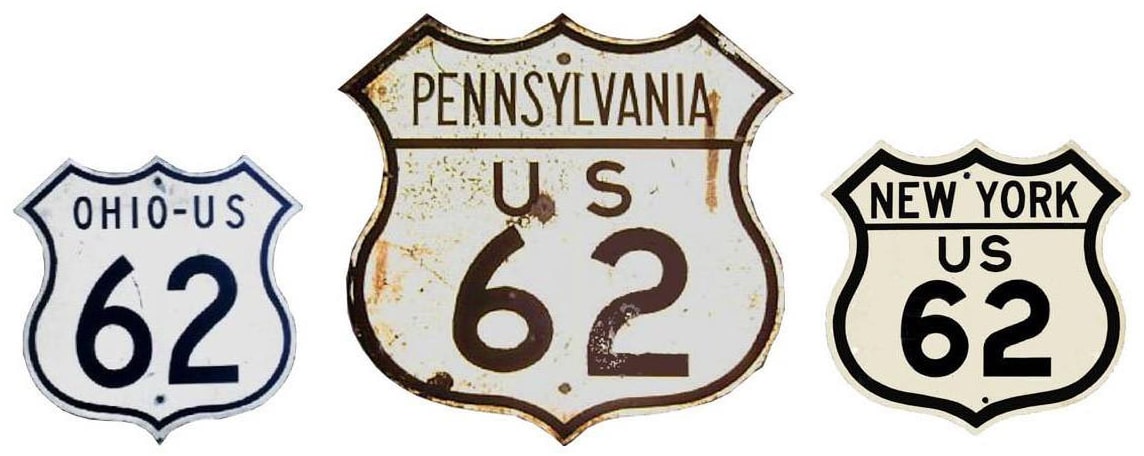
Summa
|
|
Mileage: in 1989 AASHTO listed a figure of 2271 miles for US 62... however, that included the mileage of US 62's associated business routes. According to the state subtotals on AASHTO's 1989 spreadsheet, mainline US 62's actual end-to-end total at the time was 2248 miles. That closely matches our own 2020 measurement, which yielded 2246.9 miles. That puts the midway point of US 62 in Salem, Arkansas.
Claims to fame: US 62 is the longest "parent" route that never had any "branch" routes numbered after it. Also, despite the fact that US 62 is an east-west route, it connects Canadian and Mexican border crossings... although there are some nuances to that. US 62 does have an east-west number, and although it is a diagonal route, its overall bearing is east-west. US 62 is signed east-west from El Paso all the way through Ohio... except the segment south of Carlsbad NM to the Texas line is signed north-south. And, more to the point: the route through the entirety of Pennsylvania and New York is also signed north-south. Nevertheless, US 62 is the only even-numbered US route running between Canada and Mexico.
Claims to fame: US 62 is the longest "parent" route that never had any "branch" routes numbered after it. Also, despite the fact that US 62 is an east-west route, it connects Canadian and Mexican border crossings... although there are some nuances to that. US 62 does have an east-west number, and although it is a diagonal route, its overall bearing is east-west. US 62 is signed east-west from El Paso all the way through Ohio... except the segment south of Carlsbad NM to the Texas line is signed north-south. And, more to the point: the route through the entirety of Pennsylvania and New York is also signed north-south. Nevertheless, US 62 is the only even-numbered US route running between Canada and Mexico.
|
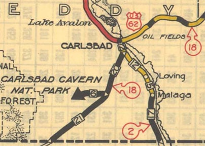
US 62 was commissioned in 1930. At first it went only as far east as Maysville. At the time, the west end of US 62 was in Carlsbad -- an odd terminus, considering that there was no north-south US route serving town back then:
|
c. 1931, NMDoT
|
|
Maybe the road south and west to El Paso was not yet in good enough condition to include in the system. At any rate, this photo was looking south on Canal Street:
|

Elbert, Mar. 2007 (still there as of 2010)
|
|
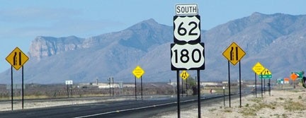
That's really, um... creative, the way they overlapped those signs. To the left on Greene Street may have been the original west beginning of US 62. Curiously, from this point to the Texas state line, New Mexico signs US 62-180 as a north-south route. This shot was taken right at the Texas line...
|
Sanderson, Mar. 2010
|
|
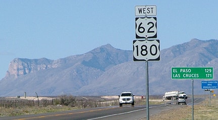
...but the entire route between there and Carlsbad is consistently signed as north-south. And just ahead, Texas immediately changes signage back to east-west:
|
Sanderson, Mar. 2010
|
|
(Incidentally, the mountain just to the left of the signpost is Guadalupe Peak, which is the highest elevation in Texas. Just left of there, the mountain with the rock cliff is El Capitan; that is all part of Guadalupe Mountains National Park.) This shot is back in Carlsbad, from the opposite direction (north on Canal):
|

Elbert, Mar. 2007 (both still there as of 2010)
|
|
Old signs juxtaposed with new signs -- this is where the north-south signs change back to east-west. If nothing else, the upcoming intersection is the modern equivalent of the historic junction. Today eastbound US 62-180 continues to the right. US 285 did not come through Carlsbad until 1936, but before that, this segment was NM hwy. 2. So in the early 1930s, the west beginning of US 62 may have been to the right... that is, assuming highway traffic was always routed down Canal Street. But it may have originally used Main Street, in which case US 62 would have begun two blocks to the right. If a driver turns that way, they see this assembly:
|
Elbert, Mar. 2007
|
|
The actual beginning of US 62 may have been at Main (the stoplight in the distance). Turning around, this sign is on westbound Greene at Canal:
|
Elbert, Mar. 2007
|
|
That may have been the original west end of US 62. Now, it continues west (along with US 180) by turning left, joining with southbound US 285 for about two miles. Here are some examples of how NMDoT signs that concurrency:
|
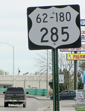
Elbert, Mar. 2007 (still there as of 2010)
|
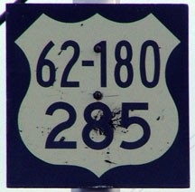
Sanderson, Mar. 2010
|
Just one year later, both ends of US 62 were extended, to the same destinations that the highway still serves today. In Texas, the west terminus of US 62 has shifted around a bit over the years; photos and more info on the El Paso page.
The east end of US 62 is at the Ohio line at Sharon PA; despite the east-west bearing implied by its even number, the highway actually runs north-south in Pennsylvania and New York, and is signposted that way. So the Niagara Falls terminus of US 62 is actually its north end (more info on that page).
Research and/or photo credits: Chris Elbert; Dale Sanderson; Michael Summa
Page originally created 2000;
last updated Dec. 17, 2023.
last updated Dec. 17, 2023.
