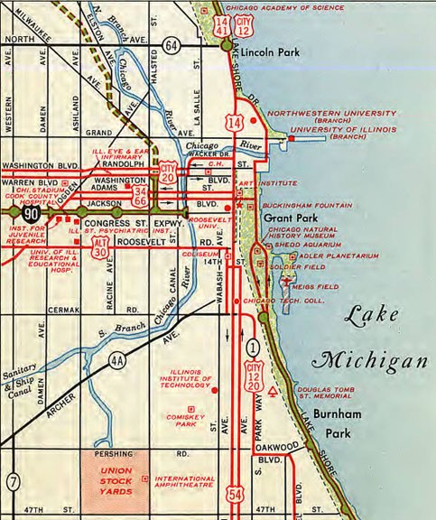
Some historic US highway endpoints in Chicago, IL
|
1927-1978
|
 |
|
If everyday Americans were asked whether they could name a specific location where a US highway begins or ends, few people would be able to come up with any answer, but out of all 1300+ current and historic endpoints, likely one of the most common responses would be "the intersection of Jackson and Michigan in Chicago".
|

Morrison, Jun. 2011
|
|
Anyone who is somewhat familiar with historic US 66 has probably heard that the route ended there, and many people have seen the "End" sign posted on Jackson Boulevard at its intersection with Michigan Avenue:
|
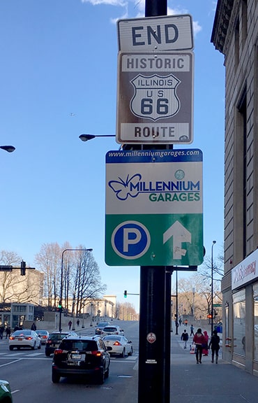
Fearer, Apr. 2019
|
|
Some related but less-commonly-known facts:
|
c. 1934
|
|
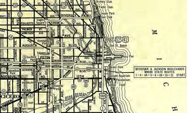
But already for years prior to that, the Jackson/Michigan intersection had been known as the "route center" of Chicago. In other words, highway route mileages were measured from this intersection, so it had always made sense for highway traffic to be routed to this intersection. This is evidenced by the note at far right on that map.
US 32 was another highway that was among the original 1926 routes. It came into Chicago on Ogden Avenue, and met US 66 at Harlem Avenue. From that intersection, these two routes were overlapped along Ogden: |
c. 1931
|
Another original route was US 330 (also visible on the map above). It came into Chicago on Roosevelt Road, but that was not a through road at the time (because a rail station was in its right-of-way). So US 330 traffic was directed north (perhaps on Austin Boulevard?) to Jackson, and then continued east again. At the intersection with Ogden, it picked up US 66-32, and the three routes were overlapped along Jackson to a common terminus at Michigan: the one pictured at the top of this page.
|
But this triple endpoint lasted only for a few years. In 1931, some improvements to Ogden were complete, so US 32 was changed to continue on that road. Ogden formerly extended further northeast than it does today, ending at Clark Street in Lincoln Park. But Clark was not a highway, so US 32 extended just a bit northwest on Clark, then due north on Lincoln Park West. Then either west on Fullerton Parkway and north on Lakeview Avenue, or else it cut across the southwest side of North Pond to get to Lakeview. Lakeview becomes Sheridan Road, and that carried US 32 up to its endpoint at Lake Shore Drive (US 41). Road configurations in that area have changed quite a bit since the 1920s and '30s, but this image shows the endpoint as it appears today, looking south on Lake Shore:
|
Nitzman, Jun. 2022
|
|
There, Lake Shore curves to the left, but at right another road is visible heading off into the distance: that is Inner Lake Shore, which becomes Sheridan in a couple blocks, so that represents the east beginning of US 32... and later, US 34 (more on that below).
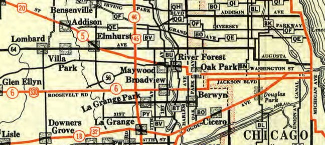
Another change took place in 1933, when US 330 was rerouted such that it stayed on Roosevelt (these changes are visible on the 1934 map above). Also in 1934, US 34 replaced the Chicago segment of US 32. For the next few years, US 34 continued to follow Ogden all the way through town (as US 32 had done during its final years):
|
c. 1935
|
It was not until 1938 that the US 34 designation was changed, such that it remained twinned with US 66, following Jackson all the way to its terminus...
|
|
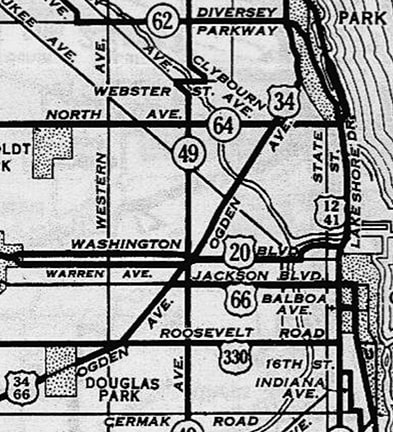
...however, that was the same year when the Link Bridge over the Chicago River opened to traffic, and US 41 traffic was routed through the Loop via Lake Shore Drive (instead of via Michigan). So US 66 was extended about a quarter-mile west from Michigan, such that its new terminus was on Jackson at Lake Shore. Thus US 34 never ended at Michigan; rather, its endpoint was at Lake Shore for about 32 years. A sign formerly at that intersection confirmed the terminus of both US 66 and US 34:
|
c. 1956, attribution unknown
|
|
That photo was looking east where Jackson ends at Lake Shore, and Chicago Harbor on Lake Michigan is visible in the background. That was US 34's terminus until 1970 (when it was truncated back to its present endpoint at Harlem Avenue). Then for an additional six years that remained the east terminus of US 66 (for a total of almost 40 years), until 1976, when the route was decommissioned in Illinois.
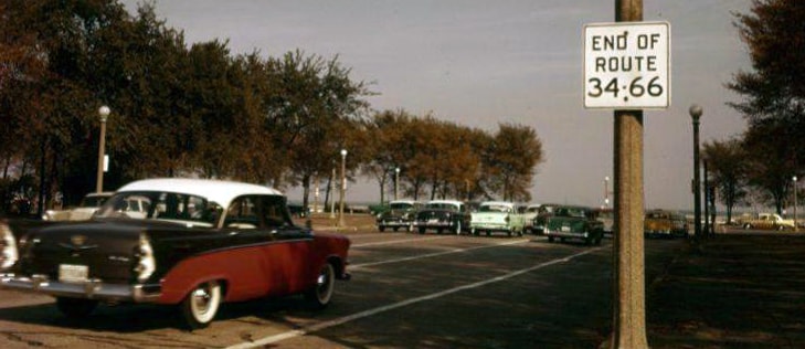
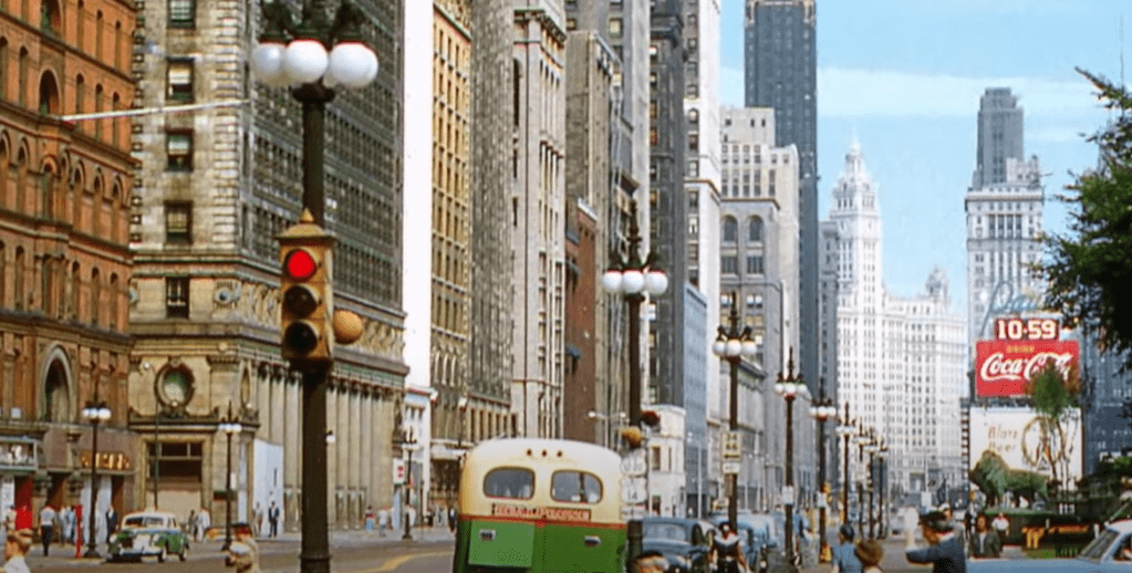
This modern image, looking the opposite direction, shows the view from what was historically the east beginning of US 66 and US 34: |
|
|
Lake Shore runs across the foreground; that is Jackson cutting through part of Grant Park and then entering Chicago's Loop in the distance. The Sears Tower was not there to dominate the skyline until US 34 was already gone, and it was there only for the final four years of US 66's existence in Chicago. This view is more representative of what drivers saw during most of the timeframe when US 34-66 began here...
|
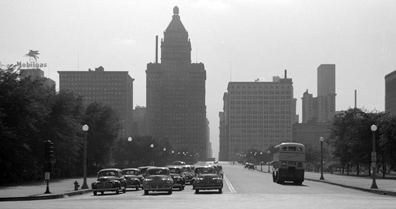
Vachon, 1941 (linked to source)
|
|
...and visible at lower right were the first westbound shields for US 34 and US 66.
A newspaper photographer captured the moment when the US 66 signs were removed in early 1977: |
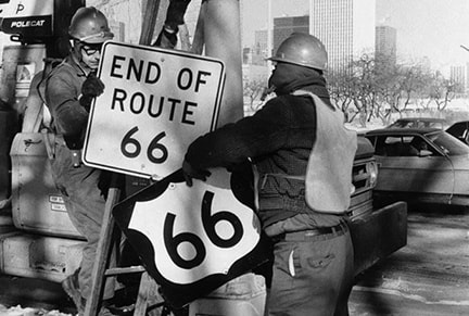
Jan. 1977, Chicago Sun-Times
|
|
For a few years after 1938, no US routes were on Michigan. But this changed in 1942, when the US 54 designation was extended to Chicago. It came in from the south on Michigan, and continued all the way up to its junction with Lake Shore. There was a 15-year gap during which the Jackson/Michigan intersection did not mark the endpoint of any US routes. This changed in 1953: at that time, US 14 was extended southward along Lake Shore with US 41. But at Michigan, US 14 separated from Lake Shore and US 41, and instead continued down Michigan. Presumably it ended at Jackson (where it junctioned with US 66-34), and presumably US 54 was truncated to the same intersection... at least, that is how it appears on maps from that timeframe:
|
c. 1959
|
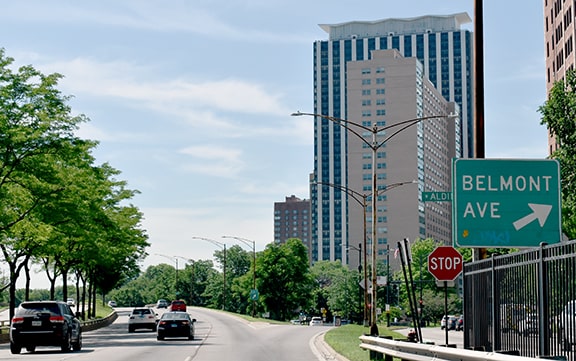
In other words, north on Michigan from Jackson was the beginning of US 14, while south on Michigan was the beginning of US 54. This remained the case for about 20 years... even after 1955, which is when Jackson became one-way eastbound, and Adams Street became its westbound counterpart. The following image was taken during that timeframe, looking north on Michigan:
c. 1954, linked to source
|
The traffic signal in the foreground was at Jackson, so that marked the east end of US 54 and the east beginning of US 14. Mounted on the next light pole was the first US 14 confirming marker (as well as a US 12-20 shield). And the light pole beyond that indicated that US 34-66 continued to the left on Adams. Adams is not a through road east of Michigan. So, from Lake Shore, westbound US 34-66 was routed west on Jackson to Michigan, then north for one block to Adams (the scene visible in that photo), then west again. This shot was taken looking west along the beginning of Adams, essentially from the front steps of the Art Institute:
|
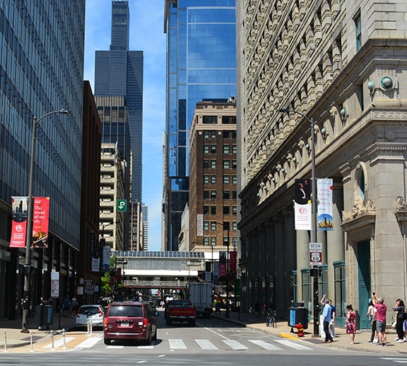
Nitzman, Jun. 2022
|
At lower right a group of Route 66 fans are gathered around and photographing a "Begin historic US 66" sign, shown close-up below:
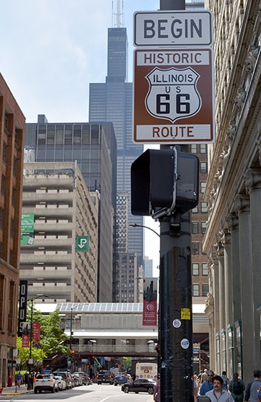
Nitzman, Jun. 2022
|
About halfway up that block and on the opposite side of Adams, a duplicate sign is posted:
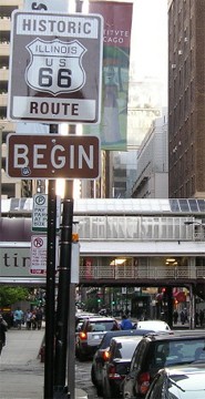
Morrison, Jun. 2011
|
That has since been replaced, and the "Begin" tab has become unreadable from all the stickers:
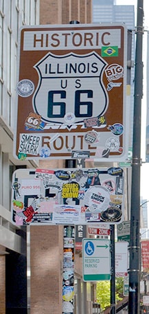
Nitzman, Jun. 2022
|
|
US 66 never actually began at Adams and Michigan, but that does not detract from how well historic US 66 is signed throughout Chicagoland. US 54 was decommissioned out of Chicago in 1972. US 14 continued to end at Jackson until 1978, when it was truncated to its current terminus on Broadway at Foster.
In this next image, the view is south on Michigan, approaching Jackson. For a time, this was the final segment of US 14, and US 54 began straight ahead. And for a brief period before that, US 66, 32, and 330 all began to the right on Jackson: |
|
|
Since 1978, the only US route still serving downtown Chicago is US 41. While Michigan no longer carries any signed highways, it remains one of the signature streets of Chicago. And while the center of Chicago's address system lies at the intersection of State and Madison Streets, the Jackson/Michigan intersection remains a good candidate for the "vernacular center" of Chicago. This image is looking north on Michigan. To the left is Jackson, the intersection that has marked the endpoint of five different US routes (and a sixth highway passed through):
|
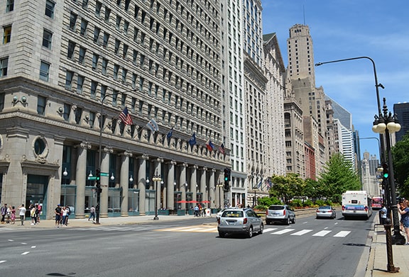
Nitzman, Jun. 2022
|
Research and/or photo credits: Neil Bratney; Tom Fearer; Scott Maness; Jeff Morrison; Alex Nitzman; Mike Roberson; Dale Sanderson; John Vachon
Page originally created 1999;
last updated Jul. 24, 2022.
last updated Jul. 24, 2022.
