End of US highway 89 (south segment)
|
(not to be confused with the separate northern segment of US 89)
|
 |
Summa
|
|
|
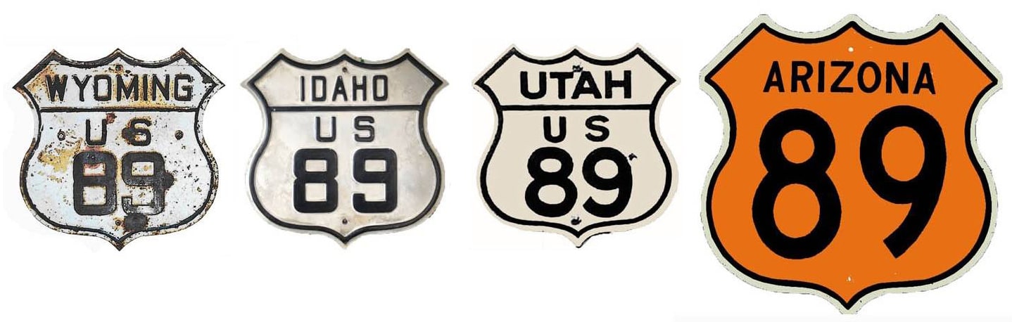
1926-1935
|
1935-1992
|
1992-present
|
Mileage: in 1989 AASHTO listed a figure of 1257 miles for the south segment of US 89... however, that included the mileage of US 89's associated alternate routes. According to the state subtotals on AASHTO's 1989 spreadsheet, the actual end-to-end total of mainline US 89[s] was 1084 miles... but at the time, US 89 still ended in Nogales. Since then it has been truncated to Flagstaff, and our own 2020 measurement yielded 839.3 miles. (US 89 does not exist within Yellowstone National Park, and although the route is implied to run through Yellowstone, the Park divides US 89 into two separate segments.)
|
US 89 was one of the inaugural 1926 routes; its original north end was in Spanish Fork. It is possible that this terminus would have occurred on 300 South Street at Main Street; this photo is looking south on Main:
|
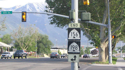
Stewart, June 2004
|
|
Loafer Mountain dominates the horizon in that direction. In 1927, this was likely southbound US 91 and eastbound US 50. US 50 would have continued to the left, and US 89 would have begun there, overlapped with it. Here we are looking west on 300 South:
|
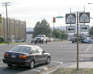
Stewart, June 2004
|
|
Possibly that was westbound US 50 (which continued to the right with US 91) and northbound US 89 (which ended there).
In 1935 the north segment of US 89 was commissioned. But US 89 does not exist within Yellowstone National Park, and although the route is implied to run through Yellowstone, the Park divides US 89 into two separate segments. Meanwhile, the south end of US 89 was at the Mexico border in Nogales AZ: |
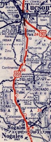
c. 1939, Rand McNally
|
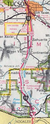
c. 1971, AZDoT
|
|
Obviously I-19 was around by the time of this photo, but Arizona had not yet decommissioned US 89 through here:
Summa, 1989
|
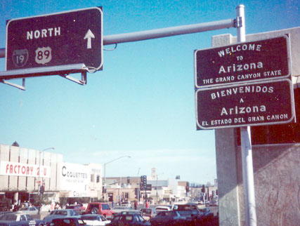
As of 2007, there was no longer any reference to US 89; this shot shows the first signage heading north from Mexico:

Faye and Sandy, 2007
|
|
Below is the signage that was at the south end of the route...
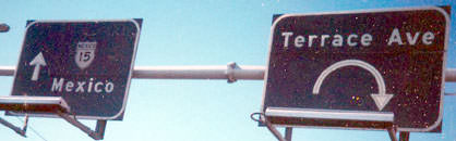
Summa, 1989
|
...and here is a more recent shot of the border crossing where US 89 actually ended:

Faye and Sandy, 2007
|
Here is a nice photo showing the south end of US 89 as it appeared in 1955, including what must have been at the time a brand-new green US 89 shield:
|
In 1992 US 89 was decommissioned through much of Arizona; since then the south end has been at Flagstaff.
|
Research and/or photo credits: Dale Sanderson; Faye and Sandy; Michael Stewart; Michael Summa
Page originally created 1999;
last updated Dec. 18, 2023.
last updated Dec. 18, 2023.
