End of US highway 191 |
 |
Summa
|
Summa
|
|
1926-1934
|
1934-1937
|
1937-1946
|
1946-1962
|
|
1962-1972
|
1972-1978
|
1978-1981
|
1981-present
|
Note: until 1981, US 191 was a single, continuous route. This page covers the history of US 191 prior to that time, but if you are looking for the current endpoints of US 191, please see the US 191[n] page and/or the US 191[s] page.
|
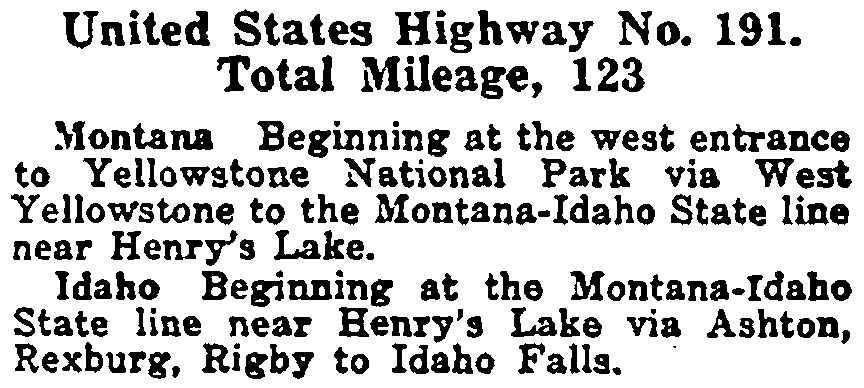
US 191 was an original 1926 route, but it ran only about 125 miles: from US 91 in Idaho Falls to West Yellowstone, as shown in AASHO's Apr. 1927 route log below:
|
|
At the time, US 191's parent route (US 91) ran from Montana to southern California. In a sense, the two routes have now switched places: today US 191 runs from Canada to Mexico, while US 91 has been shortened to only 167 miles in length. One would have to travel 1720.1 miles in order to drive US 191 from end-to-end. However -- because US routes are not designated within Yellowstone National Park -- technically US 191 has two segments: a north segment from Canada to West Yellowstone, and a southern segment from Yellowstone's south entrance through Arizona. In 1989 AASHTO listed a figure of 1226 miles for US 191... but at the time, US 191 still ended in Chambers. Since then US 191 has been extended to Douglas, and our own 2020 measurement yielded 1651.3 miles (not counting the implied mileage through Yellowstone).
|
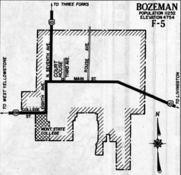
In 1934, the north end of US 191 was extended to junction US 10 in Bozeman:
c. 1951, MT DoT
|
|
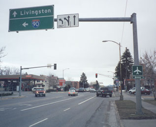
This photo was looking east on Main Street (US 191), approaching the intersection with 7th Avenue. This sign is a bit underinformative, because I-90 is straight ahead too (that is how one gets to Livingston):
|
Sanderson, Mar. 2000
|
|
Today, US 191 is routed straight through this intersection, to Main's interchange with I-90, which it then overlaps all the way to Big Timber. But historically US 191 ended there, at its junction with US 10 (which no longer exists in Montana; it is now signed as Business I-90 through Bozeman). The sign assembly in the distance makes that a little more clear; it is shown more closely in this photo:
|

Sanderson, Mar. 2000
|
|
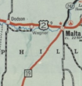
The north end of US 191 was extended to Malta in 1962:
|
c. 1962, MT DoT
|
c. 1963, MT DoT
|
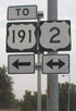
This photo shows the signage looking north on Central Avenue (US 191) at North 1st Street (US 2), where the US 191 designation formerly ended:
Wilson
|
|
By the time that photo was taken, US 191 had been extended north, co-signed to the left for a couple blocks with US 2, so the "TO" banner was a bit misleading. This next shot was looking south from US 2, at what was historically the north beginning of US 191:
|
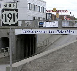
Elbert, July 2004
|
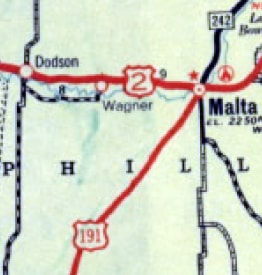
When US 191 was split into separate routes in 1981, the north end of US 191[n] was still in Malta. Then in 1997 US 191 was extended north from Malta to its current terminus at the Port of Morgan, on the Canada border. That endpoint is covered on the US 191[n] page.
|
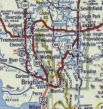
On its south end, US 191 was extended to Tremonton in 1937. This map suggests that the route followed what is now U-82, ending at US 30-S right in town (that would be Main Street, or today's U-102)...
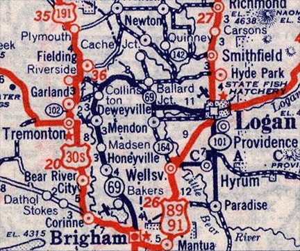
c. 1939, Rand McNally
|
...however, the road that bypasses Tremonton and Garland to the east (today's U-13) had already been defined as a state highway in 1935. So it seems likely that by 1937 US 191 traffic would have directed to follow that road, ending at US 30-S a mile east of downtown Tremonton. That was certainly the case by the time of this 1940 map:
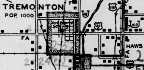
c. 1940, Census Enumeration District map
|
|
This photo was taken looking west on US 30-S (Main Street Tremonton, now U-102); the south beginning of US 191 was to the right on what is now U-13 (1600E):
c. 1938? (attribution unknown)
|
This photo was looking south on U-13 at what was formerly the south end of US 191. The crossroad is Main; downtown Tremonton is one mile to the right. US 30-S followed what is now Business 84; northbound was right on Main, southbound was straight ahead:
c. 1956, Gousha
|

|
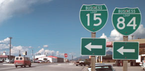
This photo was looking north on Brigham's Main Street, which today carries U-13 and Business I-15/84, but historically this was westbound US 30-S and northbound US 89-91. US 91 continued by turning right on 200 South (modern U-90), while US 30-S and 89 continued straight ahead. Also ahead was the south beginning of US 191:
|
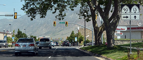
Nitzman, July 2016
|
|
The US 191 designation was cut back to Tremonton in 1962 (presumably because I-15 replaced its functionality between there and Brigham). This map was made during that timeframe:
|
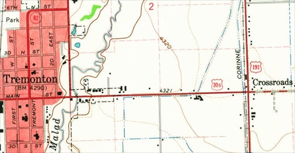
c. 1963, USGS
|
|
The terminus would have been the same as it was in the '30s and '40s (see above); this photo was looking east on Main (or southbound on historic US 30-S):
|
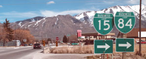
Sanderson, Mar. 2001
|
|
US 30-S traffic turned right at the intersection ahead, and left was the south beginning of US 191 (the Wellsville Mountains are visible in the background). This photo was looking north along former US 30-S, which continued to the left ahead:
|
Sanderson, Mar. 2001
|
Straight ahead is the former south beginning of US 191. In 1972, US 191 was shortened again, such that it ended at its original terminus (or at least near it -- more details on the Idaho Falls page). That lasted until 1978, when US 191 was cut back to West Yellowstone. Here is that agenda item from the minutes of AASHTO's meeting in October 1978:

That action was a preparatory move for a much bigger change. Prior to 1981, US 191 was a single, continuous route. But in June of that year, a big change was approved for US 191: the route was extended south to Chambers AZ via what had been US 187 through Wyoming. In order to get there, US 191 was assumed to follow an implied route through Yellowstone National Park. Here is that item from AASHTO's 1981 meeting minutes:
This represented a significant change from the original intention of US highway 191: it no longer ran along any of its original corridor between Idaho Falls and West Yellowstone. Now it skipped Idaho altogether, instead serving Wyoming and a completely different part of Utah. Also, since US routes do not exist in Yellowstone, this action created two separate, disconnected segments of US 191. The endpoints of those two segments are covered on the US 191[n] page and/or the US 191[s] page.
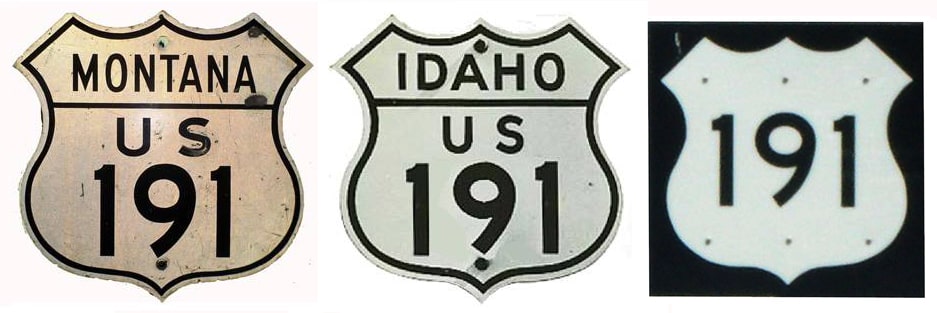
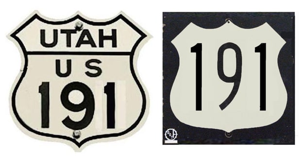
Research and/or photo credits: Chris Elbert; Julian Macdonald; Alex Nitzman; Dave Pence; Dale Sanderson; Thomas Silas; Michael Summa; Ed Wilson
Page originally created 1999;
last updated Dec. 10, 2023.
last updated Dec. 10, 2023.
